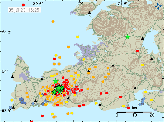
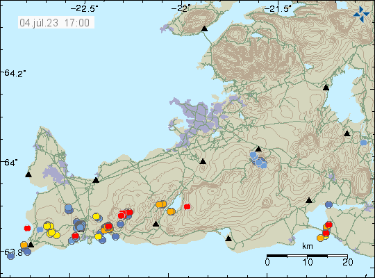
This is going to be a really short article. Because an eruption might be about to start. Difficult to be sure, but there’s a chance. Eruption has not started at the writing of this article.
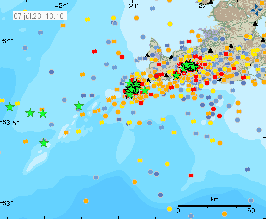
- Largest earthquake in the last 24 hours seems to be a magnitude Mw4,3. I no longer can keep up with all this earthquake activity.
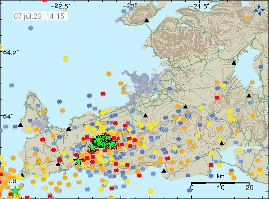
- Inflation in area close to Keilir has reached 200mm (20cm) in less than 48 hours when this started.
- Inflow of magma is estimated to be 88m3/s and that is a lot of magma moving and moving fast.
It is unclear where the eruption is going to happen. But there has been a drop in earthquake activity that strongly suggest that magma is close to finding a path to the surface. According to measurements, the magma is now less than 1 km away from the surface.