Minor earthquake cluster in Katla volcano caldera

There seems to be forming of minor earthquake clusters in Katla volcano caldera. But this has been following growing number earthquakes in Katla volcano caldera during past few weeks. This is most likely an signal of increased activity in next few weeks to months. But the increase does not have to been slowly up. It can be sudden as did happen in July 2011 in Katla volcano caldera when earthquake activity did increase suddenly and there was an small eruption without an warning.


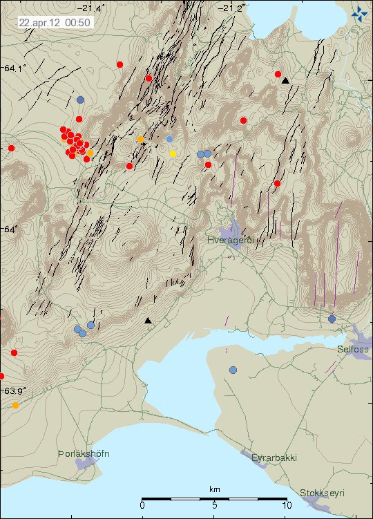
Current earthquake activity in Katla volcano. Note the small cluster of earthquakes close the area where an small eruption took place in the year 1999. Copyright of this image belongs to IMO.

There has been some small cluster of earthquakes taking place in Katla volcano caldera. I am not yet sure what that means at the moment. However this might be clues to minor dike intrusions into Katla volcano caldera. But without more data, it is impossible to be sure on this detail at current time.

Last night there was an change in harmonic tremor on two SIL stations around Katla volcano. But due to high wind noise I am unsure what was going on. But it is possible that this was an small dike intrusion taking place close to Goðabunga part of Katla volcano, or this was an minor glacier flood that was taking place under the glacier. At current time I have no good idea what was going on.


The harmonic tremor on Smjörgil SIL station. The signal is unclear due to high wind noise. Copyright of this picture belongs to IMO.


The harmonic tremor signal on the Goðabunga SIL station. Due to high wind the signal is unclear and hard to see. Copyright of this picture belongs to IMO.

It is hard to know for sure what happens next in Katla volcano. But important signs can be found in earthquake patterns. But it is also important not to overlay broad interpret the data in the favor of an eruption taking place. As it is impossible to know for sure when Katla volcano erupts, and then how big. All we might get is an new small eruption like in July 2011. As Katla volcano can also have small eruptions like big ones.

Old rift zone in Iceland

Here are two pictures of an old rift zone in Iceland. This rift zone was active until about 7 million years ago or so. This cliffs that I show here on this picture are from this old rift zone. It was volcanic long time ago. But not any more. This area however holds an good amount of unknown fissures and fault lines that might become active one day and create earthquakes in this area. But the years that I have been in this area I have never felt an earthquake. But I have recorded earthquake somewhere in this area. But it was an minor one. Less then ML1.5 in size. This area also used to be under ocean for several million years before it became dry land.


This is the old rift zone that was active until 7 million years ago. Click on the picture for full size. This picture is released under Creative Commons Licence. See the licence page for more details.

There is still an chance of this area to get new volcanoes in far future. Like did happen on Snæfellsnes. But this rift zone did pass trough there also. In this old rift zones there are several old volcanoes. I have covered them before on this blog. But that blog post can be found here.

More articles on this area

The Iceland Hotspot (academic.emporia.edu)
Iceland 2003 Keck Junior Research Project Geology of an Abandoned Oceanic Rift: The Skagi Area, North-Central Iceland (people.usd.edu)

Late website news for February 2012

I am sorry for this late website news for February 2012. But this delay has happened because there is not a lot to report on web site matters at the moment. Both January and February have been slow in terms of traffic on this website. This is mostly because nothing of interest has been happening in Iceland in few weeks.

Name change in January

This blog did go trough an second name change in January 2012. The reason for that name change was that I wanted to cover more areas of the world. Not just Iceland and Canary Islands. I do however have my focus points in my coverage. I mostly cover Iceland and Europe. Rest of the world comes last and I might not cover it in real time. So delayed reports of events that take place in the world might happen on this blog. Since information on what is happening in other place of the world might take an long time to reach me.

Going broke again

With less traffic it means less income from ads and all that. This also means that I am going broke when I start to rent again an apartment in Denmark and paying all those bills. On the bright side I am now debt free with the bank in terms of overdraft. So things are going to be bit easier on me then before in this terms (it is good not have to pay off any debt). But this is not going to be easy I believe. Besides ads, donations are the only other thing that helps me (I do get social welfare due to my disability, but I have a Aspergers syndrome). I am just happy when the ads pay for the hosting cost of this blog. But that cost is around 800 DKK every month. Most of the ads cover that cost, but nothing more in terms of extra money for me at the moment. But this depends on traffic, so high traffic months are better for me then low traffic months in terms of income. But this is all depenend of the whims of Iceland, Europe and other parts of the world in terms of what is happening.

Moving to Denmark

There is now an good chance that I move back to Denmark in April 2012. When exactly I do not know at this time. But there is an good chance that I get an apartment soon in Denmark. So all my life reading and high resolution data of earthquakes and other events is due to return after I have moved and connected back to the internet with ADSL connection. While I am moving there might be an brake in updates. But I am going to do my best on keeping this blogs updated properly if anything interesting happens in Iceland specially.

Blog post updated at 15:25 UTC on 22.02.2012. Fixed year error. Some part of me still thinks it is the year 2011.

Continued harmonic tremor in Katla volcano

The harmonic tremor that started yesterday in Katla volcano continues. It is however at less strength then yesterday. Often there are small earthquakes following it. They can be poorly observed on my Heklubyggð geophone. Few earthquakes have happened during this unrest. GPS data is unreliable, as it has not been updates since mid December 2011 (why that is I do not know). At current time it seems that this harmonic tremor is dropping down at the moment. It is impossible to know for sure if this is the end of this tremor in Katla volcano for the moment or not.


The tremor noise as seen on Slysaalda SIL station. Copyright of this picture belongs to IMO.


The harmonic tremor noise as seen on Skrokkalda SIL station. Copyright of this picture belongs to IMO.

There are now two possible reasons why this is happening. This might be an increase in hydro-thermal activity in north part of Katla volcano. Second reason might be that this is magma moving around inside Katla volcano at depth, then out visible effects on the surface. That is earthquakes have not happened following this event to any extent. There have only been two registered earthquakes so far. There location is both poor and depth poorly located. It has been my experience that following smaller event of this type there is generally an earthquake swarm in Katla volcano caldera. The time is is from from this type of event to take place until the earthquake swarm takes place differs a lot.

Last minor eruption that took place in Katla volcano was on 6. September 2011. My blog posts about it can be found here. It was believed at the time this was water. But today I now think this was an small eruption rather then water flooding under Mýrdalsjökull glacier.

Strong harmonic tremor pulse starting in Katla volcano
Most likely water creating harmonic tremors in Katla volcano (for the moment)

Both blog posts are from 6. September 2011.

Harmonic tremor pulse in Katla volcano

Today there was an harmonic tremor pulse in Katla volcano. I am not sure when this harmonic tremor pulse did start. But I am guessing around 15:22 UTC or maybe around 16:00 UTC. It seems that this harmonic tremor pulse was small, considering the activity in July 2011 in Katla volcano (an minor eruption). This harmonic tremor pulse seems to have happened in the north part of Katla volcano, outside the caldera from my best estimates but might well be inside it in the north part of it. But it hard to be sure on that detail. From what I can tell, this harmonic tremor pulse does not appear on my geophones clearly. But it might have appeared on Hekla geophone poorly. But it is hard to be sure on that due to wind noise. When this is written the harmonic tremor pulse appears to be dying down. But there is still an possibly that it might pick up again or an new one might start without warning. It is impossible to know for sure how long this is going to stop after this harmonic tremor pulse. This harmonic tremor pulse is due to dike intrusion in Katla volcano at depth, so earthquakes might not happen until it reaches shallower surface in the crust. If the dike intrusion gets that far to start with.


The possible location of the harmonic tremor marked by the poorly located earthquake in Katla volcano. Copyright of this image belongs to IMO (Iceland Met Office).


The harmonic tremor on the Slysaalda SIL station where it is the strongest. But that means it is closest to this SIL station. Copyright of this image belongs to IMO (Iceland Met Office).


The harmonic tremor pulse on Goðabunga SIL station. The harmonic tremor pulse is weaker here then on Slysaalda SIL station. Copyright of this image belongs to IMO (Iceland Met Office).


The harmonic tremor pulse on Skrokkalda SIL station. One of the SIL station that have the most distance from Katla volcano area where the tremor pulse is taking place. Copyright of this image belongs to IMO (Iceland Met Office).


The harmonic tremor pulse can clearly be seen on Lágu Hvolar SIL station. Copyright of this image belongs to IMO (Iceland Met Office).


The harmonic tremor on Smjörgil SIL station, it is located in the flanks of Eyjafjallajökull volcano. This SIL station is close to Goðabunga SIL station. Copyright of this image belongs to IMO (Iceland Met Office).

What happens next in Katla volcano is hard to know. It all comes down to wait and see what happens next in Katla volcano. Eruptions in Katla volcano in January – February time period are not common, but due happen at times. So this harmonic tremor pulse might be an advance warning of what is to come. But that is just speculation on my part. It is impossible to know for sure what happens in Katla volcano until it happens.

A ML3.3 earthquake in Tenerife volcano

Today at 13:28 UTC there was an ML3.3 earthquake in Tenerife volcano. The depth of this earthquake was at 31 km depth. But I do not know if this earthquake was felt, so far nothing suggests it. But this is was just an minor earthquake on the earthquake scale.


The location of this earthquake according to IGN. Copyright of this picture belongs to IGN.


The regional view of the earthquake from EMSC. Copyright of this picture belongs to EMSC.


The local view of this earthquake according to EMSC. Copyright of this picture belongs to EMSC.

It is normal for volcanoes to earthquakes at times, even when they are dormant. So I do not believe this earthquake means anything special for the Tenerife volcano. More details on this earthquakes can be found on EMSC web site here.

All quiet in Iceland volcanoes and earthquakes

Currently everything is quiet in Iceland. Most of this quietness is mostly due the winter storms that are passing over Iceland at the moment. When this changes I have no idea. But there are always several weeks during the year that are quiet in Iceland, both in activity in volcanoes and earthquakes.

This is the reason why I have not had so much to write about during the past few days and weeks. But it can’t be helped. Activity in the world also seems to be rather quiet, there are always earthquakes but most of them are small.

I also advice any tourist going to Iceland this time of year NOT to go up on volcanoes during the winter without experienced mountain travel guide. If you do that without an guide you are risking your own life, as the weather in Iceland is unforgiving and has killed people in matters of hours. The people in the news on Rúv got really, really lucky. The where just cold and where saved by rescue teams.

Icelandic News about people how got stuck on cliffs on Eyjafjallajökull volcano. Use Google Translate to understand.

Í sjálfheldu á Eyjafjallajökli (Rúv.is)

Earthquake swarm in Katla volcano, earthquake in Hekla volcano

Tonight at 21:13 UTC there was an earthquake with the size of ML1.2, it had the depth of 0.1 km. But that is about 100 meters. This is the second earthquake in Hekla volcano during that past three weeks (almost an month since last earthquake did happen in Hekla volcano). So far nothing more has happened. But that might change without warning.


The earthquake in Hekla volcano. It is the red dot in Hekla volcano. Copyright of this picture belongs to IMO.

Katla volcano

Today at 16:04 to 16:27 UTC there was an minor earthquake swarm in Katla volcano. The largest earthquake had the size of ML2.6, with the depth of 1.4 km. Like before this earthquake swarm was because of an dike intrusion into Katla volcano caldera. But this suggests that the unrest that started in Katla volcano in July 2011 is not over. But for the moment it continues at lower rate then before. But that might also change without warning at any time.


The earthquake swarm in Katla volcano. The earthquake in Hekla volcano can also be clearly seen on it. Copyright of this picture belongs to IMO.

It is impossible to know for sure what is going to happen next in both of this volcano. But it is clearly worth watching what is going on. The earthquake in Hekla volcano can clearly be seen on my Heklubyggð geophone, as it forms an clear spike on it, the web site can be found here. Same does the largest earthquake from Katla volcano earlier today.

Interesting earthquake activity in El Hierro volcano

Over the past two weeks there has been interesting earthquake activity in El Hierro volcano in Canary Islands. What is so interesting about this earthquakes is the fact they are getting more shallow every day or so. Currently the most shallow activity that has been taking place is around 6km depth. But this is an rise from about 12 km depth.

What this means in my opinion is that magma is most likely rising to the surface at the location where the earthquakes are currently taking place (dike intrusions). This did happen before the first eruption in Eyjafjallajökull volcano. So it is an important to keep an eye on this earthquakes and where they happen, as eruption might take place in nearby area of this earthquakes. As magma might, and most likely is going find an clear path to the surface soon. The last part of that before an eruption might happen with no noticeable earthquakes at all. They might well be just over ML2.0 in magnitude or smaller.


Earthquake activity in El Hierro volcano over the past 10 days. Copyright of this image belongs to ING.

It is impossible to know for sure when or if an eruption happens in this area. But I find that is most likely going to be the case given the current activity. When and where is impossible to know for sure at current time.

Earthquake with the size of ML4.2 in Switzerland on 11. February 2012

At 22:45 UTC in Switzerland and earthquake was felt, information from EMSC on this earthquake can be found here. The size of this earthquake was ML4.2 with the depth of 32 km. This was an tectonic earthquake, as Italy continues to push up into Europe plate. Earthquakes are frequent in this area, on both sides of the Alps. This is not the strongest earthquake that can happen in this area.


The locations of where the earthquake was felt and how strongly it was felt. Copyright of this picture belongs to EMSC-CSEM.

It is also important factor that most of the crust in this area is old, so it carries seismic waves better then young crust. This happens because older crust is more insulated with dirt and sediment that has been collected over time period of million of years.


Here is the regional view of where the earthquake took place. Copyright of this picture belongs to EMSC-CSEM.


Here is the local view of the earthquake. Due to how close it was to many small towns, it was well felt there. Copyright of this picture belongs to EMSC-CSEM.

From best to my knowledge, no aftershocks have taken place after this earthquake. But they might happen in several weeks to months time, if they do so to start with.