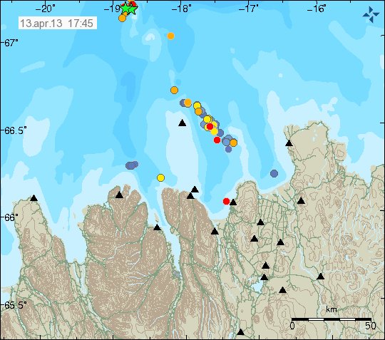
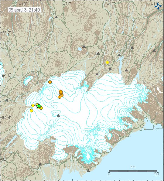
Yesterday (02.05.2013) at 06:08 UTC there was a earthquake swarm deep off the south coast of Iceland. This earthquake swarm was around 300 km south of Iceland. I do not know if there are any volcanoes in this area, at least nothing is documented. Depth of the ocean in this area is around 3 to 4 km, or more. Icelandic Meteorological Office did register two earthquakes from this area. The location is a good estimate at best. Since the SIL network has problems locating earthquakes this far out in the ocean.
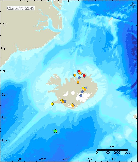
The green star marks the location of this earthquake swarm. Copyright of this picture belongs to Icelandic Meteorological Office.
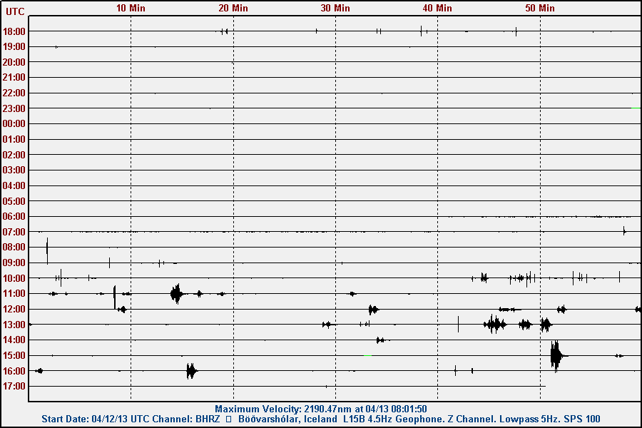
I did record this earthquakes on my geophone network. This earthquake activity was clearly seen on Skeiðflöt geophone stations, but also in Heklubyggð geophone stations. The data from my geophone network suggests that this earthquake had stronger magnitude then ML3.0 as it is registered with Icelandic Meteorological Office. Estimating magnitude of earthquake this far away from the SIL network is difficult at best, so its magnitude is at best too low. I do not know by how much it is.
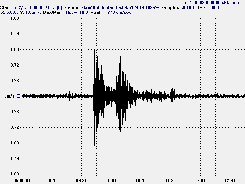
The earthquake as it did appear on Skeiðflöt geophone station. This image is released under Creative Commons licence. Please see licence page for more details.
It is possible that more earthquakes did take place in this location. The SIL network did record one (and my geophones too) at 03:56 UTC, that earthquake was smaller but at the same location. So this was most likely a earthquake swarm taking place in this location. I do not know if there are any volcanoes in this area, it might well be. If that is the case, it is unknown and undocumented as is and is going to be that for a while now.