Update on the 4-August-2022 on the eruption in Meradalir valley in Fagradalsfjall mountain

This is a short update on the eruption in Meradalir valley in Fagradalsfjall mountain. This article is written on 4-August-2022 at 15:17 UTC.

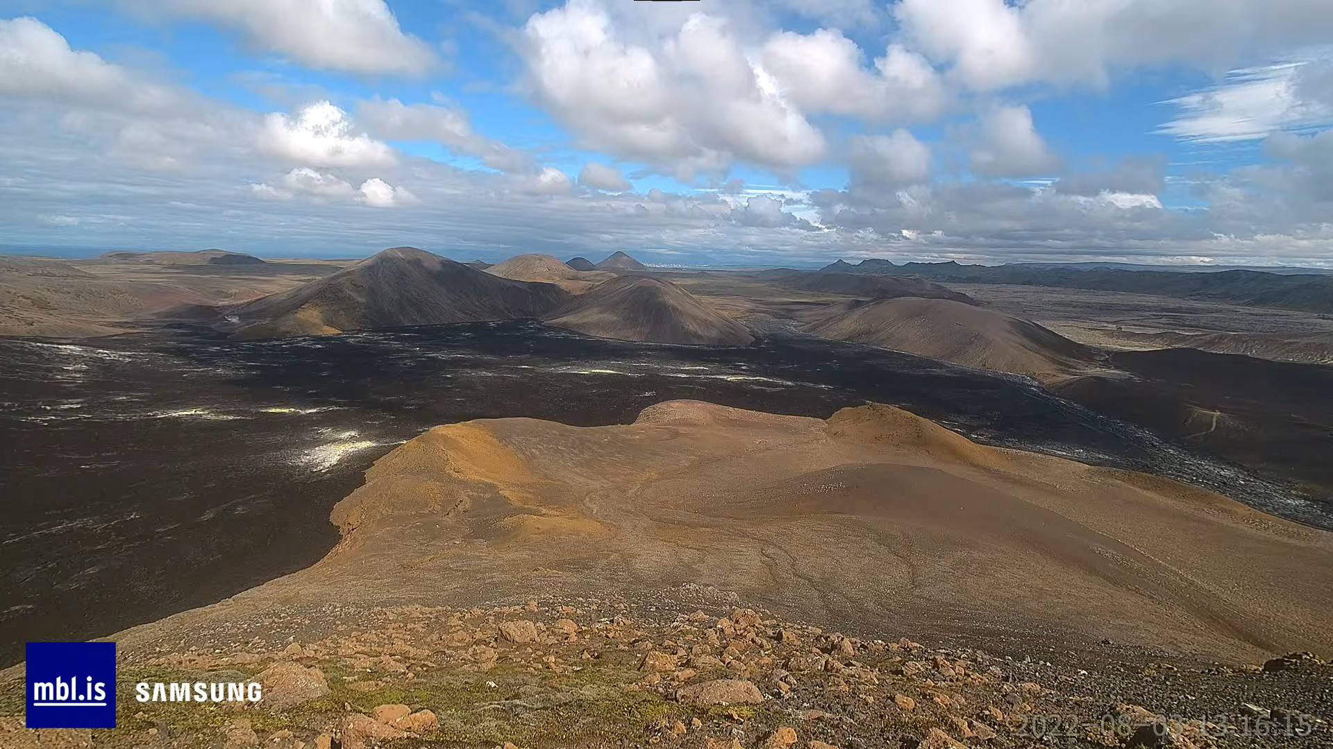
  • The eruption is stable for now. The fissure has closed up in part and now the eruption is only take the south part of the fissure and the centre.
  • Crater has not formed because of the lava lake that is at the south end of the fissure.
  • The amount of lava coming up is around 20 m3/sec  to 30 m3/sec at the moment. This amount might change without warning.
  • The valley were (Meradalir?) this eruption happens is getting full of lava and the bottom of the valley is now 800C hot lava pond, the valley might fill up after about one week of an eruption (according to the news) if the flow of lava remains the same. The lava has started flowing into other nearby smaller valleys (not sure if they have any names). If the eruption slows, the time it takes for the eruption goes from one week to three to four weeks until Meradalir valley is full of lava and starts to flow in the direction of roads and other infrastructure in the area.
  • The eruption fissure can started expanding in both direction if the current eruption vents can’t handle the flow of magma. It has been noted in the news that the north part of the fissure is on the move and that increases the risk of eruption in the north part of the fissure. The south part of the fissure is all under lava, both new and old so it is impossible to monitor that part of the fissure.
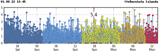
  • Harmonic tremor (middle band, 1 – 2Hz) continues to increase and that shows a increase in magma flow in the magma dyke. This suggests to me that a larger eruption is possibly on the way. When that might happen is impossible to know.
  • Largest earthquake in the last 24 hours had a magnitude of Mw3,4 at 09:26 UTC. Yesterday (03-August-2022) an earthquake with magnitude of Mw4,6 took pace at 05:42 UTC and a magnitude Mw4,2 took place at 12:00 UTC. This earthquake activity is interesting, since it continues after the eruption starts. Minor earthquakes also continue after the eruption starts.
  • There is more water is this magma, making it degas more when it erupts. There is also more dangerous SO2, CO, CO2 gas in this eruption because there is more lava erupting.

I’ll post next update when something new happens or by the latest of Friday (tomorrow). Since I plan on posting updates on this eruption every Friday unless something happens (eruption starts at new location and so on). The normal day to day changes are mostly just minor stuff.

Donation

Please remember to support my work with donations. That helps me greatly and stops me from being broke. Thanks for the support. 🙂

Update on the eruption in Meradalir valley/Fagradalsfjall mountain

This is a short update on Meradalir valley/Fagradalsfjall mountain eruption at 21:25 UTC on 3-August-2022.

Most of the fissure that started erupting at 13:16 UTC in Meradalir valley, just north of the old crater in Geldingadalir in Fagradalsfjalli mountain (Icelandic location names are long) is active after few hours of activity. Earthquake activity is now slowing or stopping almost completely as is the same thing that happened in 2021 after the Fagradalsfjall mountain / Geldingadalir valley eruption started.

The most northern part of the eruption fissure already seems to be shutting down. How fast that happens I don’t know, but there seems to be a crater started to form at the south end of the eruption fissure. At least for now. The news report at Rúv today noted that people where walking over a patch of land that was releasing gas and thermal camera showed the ground to be warmer than normally. This strongly suggests that an eruption might start at those location without warning. I don’t know exactly where those locations are, but they must be in the walking path, placing them south of the 2021 eruption crater.

Donations

Please remember to support my work with donations. August is going to be a broke month for me, since I am always broke because of my low income. Thanks for the support. 🙂

Eruption has started in Fagradalsfjall mountain

Today (03-August-2022) at around 13:30 UTC an eruption started in Fagradalsfjall mountain, just north of the eruption site that took place in March to September 2021. The fissure that is now erupting is growing both to south and north. That suggest that the power of the eruption is currently growing.

This is all the information I have at the moment. This eruption is clearly visible on the web cameras that mbl.is has on YouTube, along with web camera from Rúv.

I’ll post new information when I get them. I don’t know when that is going to be.

Donations

Please remember to support my work with donations. Thanks for the support. 🙂

Update 1

Based on this image from Morgunblaðið web camera. The eruption started at 13:16 UTC.

Image of an fresh lava field and a small cloud in the left corner coming from the ground were the eruption is starting. Clock on the image is 13:16 UTC
Image from Morgunblaðið web camera when the magma breaks the crust and starts the eruption. Copyright of this image belongs to Morgunblaðið/YouTube screenshot. – This image might be removed if requested.

Magnitude Mw3,7 earthquake in Grímsfjall volcano

Today (2-August-2022) at 14:24 UTC an earthquake with magnitude of Mw3,7 took place in Grímsfjall volcano. At the writing of this article there doesn’t seem to be any indicator that an eruption is about to start, but that might change without warning.

Green star in Grímsfjall volcano in Vatnajökull glacier in east Iceland. The volcano is located in about middle of the glacier
Earthquake activity in Grímsfjall volcano. Copyright of this image belongs to Icelandic Met Office.

There were few other smaller earthquakes following and before the largest earthquake. This earthquake activity is slightly unusual since normally Grímsfjall volcano doesn’t have any earthquake activity unless an eruption is about to start. If this earthquake activity continues is impossible to know.

Update on earthquake activity in Fagradalsfjall mountain area on 2-August-2022

This is a short article because the situation changes constantly.

This was not a night where many people in Reykjavík got a good night sleep. A magnitude Mw5,0 earthquake took place at 02:27 UTC and was felt in Reykjavík, few seconds earlier a magnitude Mw4,7 earthquake took place. Earlier three earthquakes with magnitudes of Mw4,3 to Mw4,5 had taken place, this was just around midnight and was also felt in Reykjavík. Over 10 000 earthquakes have been recorded since Saturday when this all started. The earthquake activity during the night was at the western end of Kleifarvatn lake and was for that reason felt clearly in Reykjavík. Minor damage was reported with the earthquake around midnight. Other reports of damage have not been reported so far.

Heavy green stars on Reykjanes peninsula, all over and closest to Reykjavík at Kleifarvatn lake
Heavy earthquake activity on Reykjanes peninsula. Copyright of this image belongs to Icelandic Met Office.

The strong earthquakes during the night where fault earthquakes, that happen because of the inflation that is now taking place north of Fagradalsfjall mountain. GPS data has also been showing a interesting patter. There is now a deflation taking place in Gónhóll and the crater, while that area also seems to be on the move north (?). The 24 GPS data can be viewed here and 8 hours GPS data can be viewed here.

This earthquake activity is going to continue until an eruption starts. When that happens is impossible to know. More stronger earthquakes can be expected in next few hours and days on Reykjanes peninsula.

Donations

Please remember to support my work. That stops me from being broke and I don’t need many donations to stop being broke. Thanks for the support. 🙂

Update on 1-August-2022 on the earthquake swarm in Fagradalsfjall mountain

This is a short update on the earthquake swarm in Fagradalsfjall mountain and nearby area. This is written on 1-August-2022 at 13:47 UTC.

The situation on Reykjanes peninsula is always updating so information in this article can be in part or in whole get obsolete quickly. Largest earthquake during the night had a magnitude of Mw4,7. This might not be the largest earthquake today, since larger earthquakes are always a possibility.

A lot of green stars on Reykjanes peninsula along with red dots that show the heavy earthquake activity that is now happening there
Strong earthquake activity on Reykjanes peninsula. Copyright of this image belongs to Icelandic Met Office.
Time trace of the strong earthquake activity in the last 48 hours. Dark blue dots, blue dots, yellow dots with a magnitude 5,4 earthquake line in it, orange dots and red dots show all the earthquakes. This earthquake activity is really dense
Time trace of the earthquake activity in the last 48 hours. Copyright of this image belongs to Icelandic Met Office.

GPS data have started to show a large displacement over the last 48 hours. The 24 hour GPS displacement can be found here and 8 hour GPS displacement data can be found here (find Reykjanes peninsula). This shows that magma is pushing its way though the crust at fast speed, but has not yet broken up trough the crust. When that happens is impossible to know, but this might not be a long wait based on the speed the magma is going. Current depth of the magma is around 2 to 4 km.