On Saturday 25-September-2021 an earthquake swarm started close to Keilir mountain, at the writing of this article this earthquake swarm is ongoing.
Earthquake swarm on the Reykjanes peninsula. Copyright of this image belongs to Icelandic Met Office.
The eruption in Fagradalsfjall mountain has been having its longest quiet period since 19-March-2021 and at the writing of this article that is ongoing situation.
This earthquake activity suggest that the eruption time period in this part of the Reykjanes peninsula is not over, even if nothing is happening at the moment.
Yesterday (15-September-2021) around 11:10 UTC a large lava cave just south of the crater in Geldingadalir had a roof collapse in a small area or a lava breakup in the surface. This resulted in the lava flow down Geldingadalir into Nátthagi. The flow covered Geldingadalir in less than 20 minutes. After that it did reach the barrier that stops it from going into Nátthagakriki, if that happens both walking path A and B are going to get closed forever or having to be redrawn from their current locations. Lava down that path also allows the lava flow to go in the direction of Grindavík town and nearby roads.
The lava flow yesterday did go down into Nátthagi but didn’t get far into there compared with the older lava it was flowing on top of. This sudden lava flow did put people in danger and shows that the lava field is full of dangerous caves that can collapse or burst open at any time without any warning. The lava flow that started yesterday is ongoing best to my knowledge. But the view has been limited due to fog and bad weather in Fagradalsfjall mountain this evening.
One or two idiots where seen walking on the crater rim yesterday and I think this are the same people that Icelandic coast guard had to transport from Gónhóll since they where unable to get back because of the new lava flow that had happened when they where there.
The crater is now ~334 meters above sea level high. Currently the crater is now growing in height but that can change without warning.
Pictures of this new lava flow are on social media. I can’t use them because of copyright but if searched they can be found and viewed. There are also some amount of videos of this lava flow on YouTube.
This is a late and short update on the eruption in Fagradalsfjall mountain on 12-September-2021. Fagradalsfjall mountain is part of Krýsuvík-Trölladyngja volcano system.
Yesterday (11-September-2021) at around 05:00 the harmonic tremor on SIL stations around Fagradalsfjall mountain started to show an increase in harmonic tremor after a break of 8 days. It took few hours for the magma to reach the crater and lava was visible in the crater around 12:00 UTC.
Increasing harmonic tremor at 00:38 UTC on Fagradalsfjall mountain SIL station. Copyright of this image belongs to Icelandic Met Office.
There have been possible new vents been opening up yesterday and today in the lava field. Icelandic Met Office says that this is a lava flow under the old colder lava and is now breaking up and looking like new vents. I don’t know yet if this is accurate, but it is my early assessment that this are new vents and are going to build new crater, at least there is a possibly of crater building if the new vents stay active long enough.
If this are new craters as I suspect, then they are going to change the lava flow quickly and increase the output of the lava flow from what it was. It might soon start to flow down into Nátthagi and other locations that are nearby.
It is a big question if the cycle eruption with no activity for hours has stopped for now. If this has turned back into an eruption that goes in 24 hours a day, that is going to allow the lava field to reach a lot more distance then before.
Because if Askja volcano quick inflation, that is now currently at 7 cm, Department of Civil Protection and Emergency Management has declared uncertain level and yellow alert for flight.
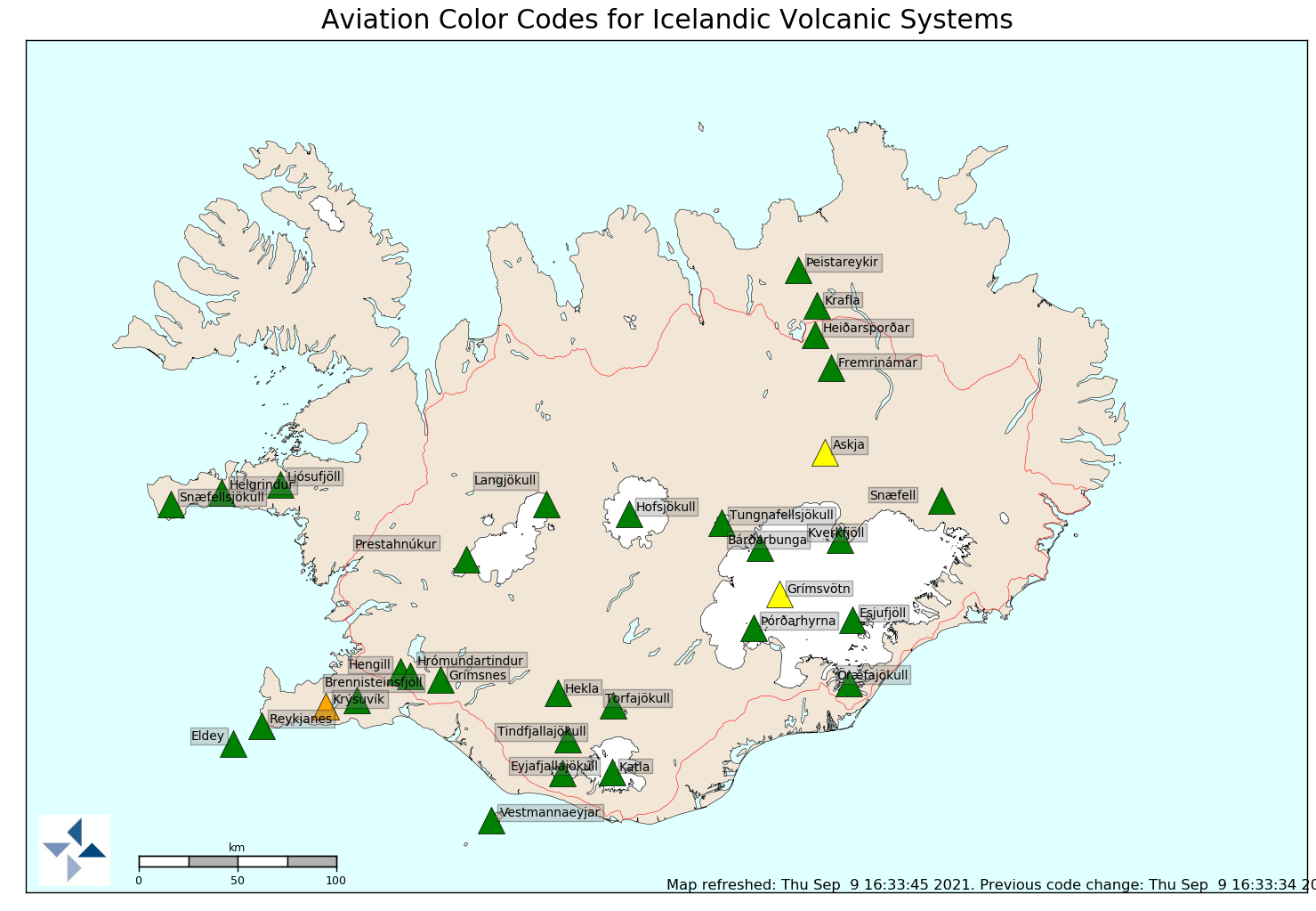
Current status of volcanoes in Iceland as of 9-September-2021. Copyright of this image belongs to Icelandic Met Office.
Inflation is quick in Askja volcano and is now at 7 cm. When or if that is going to result in an eruption is impossible to know. Current Askja volcano is what remains of a mountain that blew up in an large eruption in the year 1875 century. Most eruptions are just lava flows, unless they happen to start in a water, then explosive activity happens while water remains.
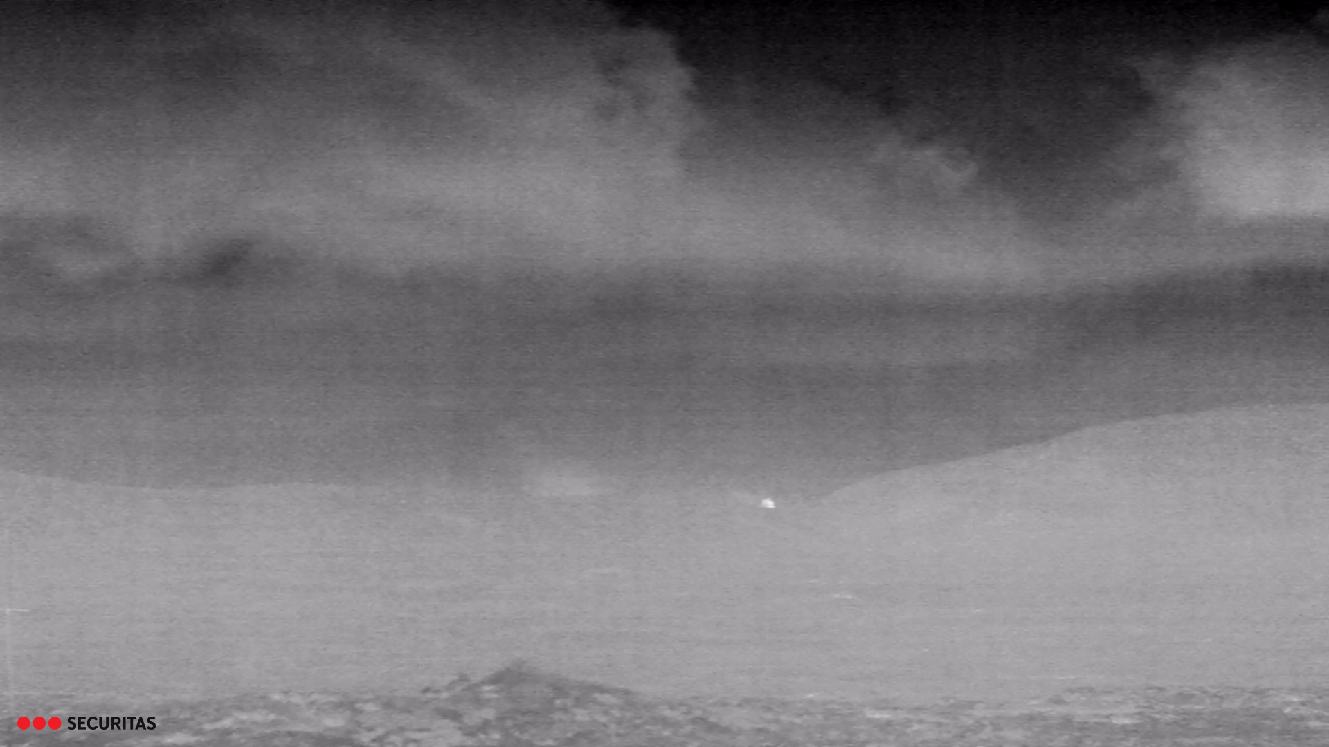
This is unconfirmed so there might be number of other reasons why this is being observed. This also might be wrong reporting but based on web cameras that might not be the case. There has been some visual view of this on web cameras. Here are two pictures that I was able to screen grab from two of those cameras.
There is a heat source in this image. Where it is located is currently unclear. Copyright of this image belongs to Míla and Securitas.
The light on the right of this image might be the an unconfirmed eruption. Copyright of this image belongs to Míla.
It is unclear what is going on and this might all be wrong. But I am also seeing this new light source on the web camera from mbl.is on YouTube as it peaks a little from behind the large crater in Fagradalsfjall mountain. That crater is not active at the moment.
I don’t know when confirmation is going to appear. If this is an eruption. If this is not an eruption, then there is going to be a confirmation of that too. I’ll post update here is I learn anything more in the next few hours.
Update03:07 UTC7-September-2021
The light on the second picture (on the right) is a human made light. I think it is the lighthouse. What is appearing on the thermal camera has not been identified.
Update 13:36 UTC 7-September-2021
This is wrong reporting that happened here. Nothing happened and what was seen on the thermal camera is most likely the heat from the crater. This type of wrong information happens every once in a while. Currently the main crater remains inactive and sulphur colours have started to appear on him from the sulphur outgassing that is now happening.
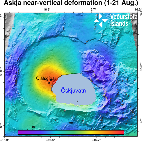
Icelandic Met Office published the news today that Askja volcano has started to inflate. This inflation started in August 2021 and has been measured at 5 cm a month. The inflation is happening just outside the Askja lake in area known as Ólafsgígar (Ólaf craters).
Inflation in Askja volcano. Copyright of this image belongs to Icelandic Met Office.
It is impossible to know if this is going to result in any eruption. This inflation however seems to have resulted in earthquake activity in Askja volcano. Most of the earthquakes so far have been minor in magnitude.
Inflation in Askja volcano. Copyright of this image belongs to Icelandic Met Office.
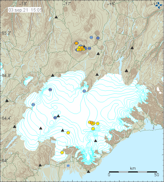
Today (3-September-2021) an small earthquake swarm took place in Esjufjöll volcano. This is the first earthquake activity in a while and suggest that there might be about to start more earthquake activity in Öræfajökull volcano. Since activity in Esjufjöll volcano seems to result in activity in Öræfajökull volcano. How that works and why is unknown.
Earthquake activity in Esjufjöll volcano. Copyright of this image belongs to Icelandic Met Office.
Last eruption in Esjufjöll volcano may have happened in the year 1927 but that remains unconfirmed. If that eruption happened, it only lasted for 4 to 5 days at most. This area is covered with a glacier, so any eruption there is going to result in a glacier flood.
Donations
Please remember to support my work with donations. Currently I am broke in September and that’s not good. Thanks for the support. 🙂