Strong earthquake activity in Fagradalsfjall volcano

This article is short because the situation is always changing. Article is written at 07-March-2021 at 23:10 UTC.

At 00:22 UTC and until around 00:42 UTC an harmonic tremor was detected in Fagradalsfjall volcano. While this harmonic tremor only lasted for 20 minutes it started an earthquake swarm around 01:00 UTC that lasted until around 04:00 and the largest earthquake in that swarm had a magnitude of Mw5,0 to Mw5,2 (USGS/EMSC) at 02:01 UTC. Every day from 2500 to 3000 or more earthquakes are being recorded. Since 24-February-2021 over 24000 earthquakes have been recorded in this earthquake swarm. There is a massive inflation happening from Fagradalsfjall volcano and that is what is causing the earthquakes west and east of the dyke location between Fagradalsfjall mountain and Keilir mountain. Resulting in large earthquakes like the Mw5,0. Many of the earthquakes are happening close to the town of Grindavík and people there can’t sleep due to earthquake activity and the ongoing earthquake activity that is now happening at every minute.
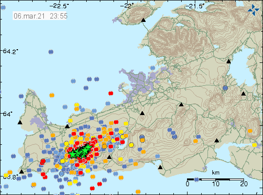
Heavy earthquake activity on Reykjanes peninsula. Total of 68 green stars on the map and over 2600 other earthquakes of smaller magnitude are shown on the map at different age
Heavy earthquake activity in Fagradalsfjall volcano. Copyright of this image belongs to Icelandic Met Office.

It is now possible to check the inflation by viewing this GPS data website. Another website with GPS data can be found here and its is called Crustal Deformation.

More strong earthquakes are expected. If anything major happens I’ll post update soon as possible.

Web cameras directly streaming

Beint vefstreymi af skjálftasvæðinu – Efstaleiti
Beint vefstreymi af skjálftasvæðinu – Vogastapi (Rúv.is)
Keilir í beinni (mbl.is)
Óróasvæðið í beinni útsendingu (Vísir.is)
Live from Iceland
Keilir og skjálftasvæðið (YouTube)
Road camera 1
Road camera 2 (night vision/infrared)


Update 8-March-2021

A news article has been published showing the road damage from the recent earthquake activity. This is close to the HS Orka energy plant on Reykjanes peninsula.

Mal­bik sprungið við HS Orku í Grinda­vík (mbl.is, Icelandic, Pictures)

Article updated at 01:31 UTC.
Article updated at 04:36 UTC. Fixed web camera link that was broken (YouTube)
Article updated at 16:58 UTC on 8-March-2021. Fixed Rúv web camera link.

Update on Fagradalsfjall volcano activity on 7-March-2021 at 00:21 UTC

This is a short update on activity in Fagradalsfjall volcano. This is mostly on the activity on 6-March-2021.

Overview of current activity

  • Earthquake activity is mostly limited to small earthquakes.
  • Risk of eruption has not been reduced with current change in activity.
  • The magma dyke is at the shallowest on 2 km but it has an average depth of 5 km to 8 km depth.
  • Most of earthquake activity is closest to Fagradalsfjall mountain (north end?). The dyke is situated between Fagradalsfjall mountain and Keilir mountain.
  • Fagradalsfjall volcano has not erupted in last 12000 years.
  • There has not been any magma activity observed in Krýsuvík volcano and Reykjanes volcano (Svartsengi volcano?). All earthquake activity in those volcanoes are due to crust stress changes due to inflation from Fagradalsfjall volcano.


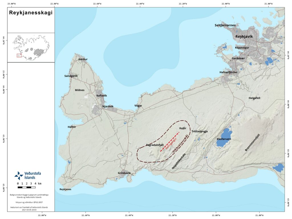
Dotted line showing the Fagradalsfjall volcano
The area of activity according to Icelandic Met Office. This might also be the Fagradalsfjall volcano. Copyright of this image belongs to Icelandic Met Office.

There remains a high risk of a strong earthquake with magnitude between Mw6,0 to Mw6,5 because of crustal stress changes that are connected to all the inflation that is now taking place in Fagradalsfjall volcano.

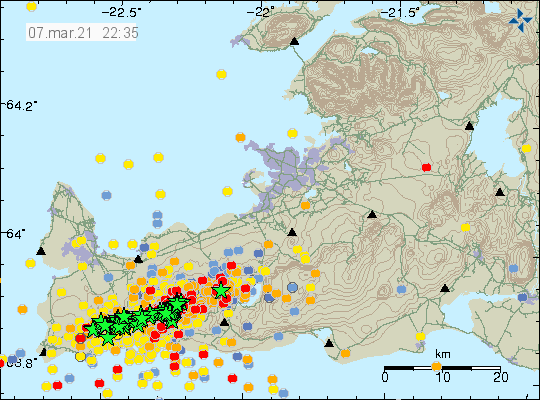
Dense earthquake activity in Fagradalsfjall volcano with many green stars showing earthquakes with magnitudes above Mw3,0 and many new red dots showing new smaller earthquakes
Dense earthquake activity in Fagradalsfjall volcano. Copyright of this image belongs to Icelandic Met Office.

Harmonic tremor has not been detected again since Wednesday but that might change without warning.

Current web cameras of Keilir mountain and possible eruption area

Beint vefstreymi af skjálftasvæðinu – Efstaleiti (Rúv.is)
Beint vefstreymi af skjálftasvæðinu – Vogastapi (Rúv.is)
Keilir í beinni (mbl.is)
Óróasvæðið í beinni útsendingu (Vísir.is)
Live from Iceland
Keilir og skjálftasvæðið (YouTube)
Road camera 1
Road camera 2 (night vision/infrared)

If anything major happens I’ll write a new article soon as I possibly can do so.