This is going to be a short article since I don’t have a time to write a long one.
The glacier flood from Skaftárkatlar cauldrons is mostly over. There continues to be a lot of water in rivers that were flooded, with the flood peak being at 2200 m³/s (uncorrected). Some damage has taken place on roads and few bridges, with one major bridge almost collapsing from the river eating into the river banks. A graph showing this glacier flood in realation to older glacier flood from the eastern skaftárkatlar cauldron can be found here (Icelandic news). The glacier water that did flood into a lava field (that erupted from Laki) is still on its way and is going to reappear in few days as clean water, a lot of clean water that might create problem in nearby rivers and nearby roads if any exist. I don’t know the layout of roads and such in this part of Iceland so I don’t release what type of damage might happen. Image of the largest damaged bridge can be found here (Icelandic news), there is a video in this news.
Bárðarbunga volcano
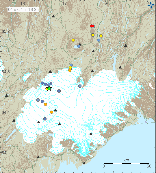
There has been a slight increase in earthquake activity in Bárðarbunga volcano this week. A magnitude 3,1 earthquake took place along with little increase in smaller earthquakes. There have also been clusters of small earthquakes been appearing in east and in south (both east and west) part of the volcano. This activity suggest that new magma is flowing into the magma chamber at depth and the pressure has increased. Maybe not to eruption levels at the moment, but that moment is getting closer as the time passes.

Earthquake activity in Bárðarbunga volcano. Copyright of this image belongs to Iceland Met Office.
North Langjökull volcano (Hveravellir)
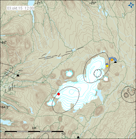
Earlier this week an earthquake swarm took place close to Hveravellir (volcano). This earthquake swarm was not large and the largest earthquake only had the magnitude of 2,5 (or around that number. I was working when this happened and I did not have chance to check or save the data). Earthquake activity in this area has been increasing slowly for the past 10 years. It is unclear why that is happening.

The earthquake activity in Hveravellir volcano. Copyright of this image belongs to Iceland Met Office.
Western Fracture Zone
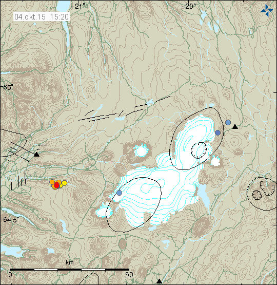
There has been for the past few days earthquake activity in WFZ. This earthquake activity appears to be taking place in a extinct volcano in this area. I don’t think that this volcano is named and I don’t know the name of the mountains at the location were the earthquake activity is taking place.

The earthquake activity in WFZ today (04-October-2015). Copyright of this image belongs to Iceland Met Office.
I do expect the earthquake activity to continue in this area for next few days. Due to how rare earthquakes are in this area there is a risk of sharp and strong activity. It might also last for a long period of time, up to weeks or months at the longest.
Donations
Please remember to support my work with donations. At the moment I’m trying to collect as much money as I can before I move back to Denmark. I am also trying to save up for a cheap new laptop so that I can write when I am traveling, in the case anything happens in Iceland. It is going to cost me 40.000,00 ISK (~280€/315USD). Currently I’m doing full workday until the end of October (when not in school). To clarify, the work is hard and they only pay legal minimal wages and overtime pay (1 – 3 hours each day).
Thanks for the support.
