It has been a bit busy day earthquake wise in Iceland. But there has been more activity today then in past few weeks in Iceland. But it has been really quiet for a long time now in Iceland. But let’s start with the largest earthquake of the day.
Kolbeinsey Ridge
Today at 11:11 UTC there was an earthquake with the magnitude of ML3.65. This earthquake was not felt since it was more then 100 km away from nearest human population in Iceland. The earthquake took place on Kolbeinsey Ridge. It last erupted in the year 1755. No known eruption is known in this area since then. My geophone network did record this earthquake properly. The signal was strongest at my Hvammstangi geophone station. But it was also recorded on my Heklubyggð geophone station. On other geophone stations. The signal was too weak to be properly detected by my geophone.
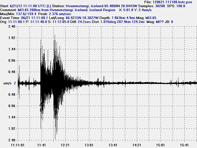
The ML3.65 magnitude earthquake as it was recorded on my Hvammstangi geophone. This image is released under Creative Commons licence. Please see the CC Licence page for more details.
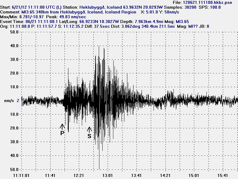
The ML3.65 magnitude earthquake as it was recorded on my Heklubyggð geophone. It is filtered at 1Hz. This image is released under Creative Commons licence. Please see the CC Licence page for more details.
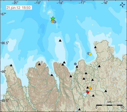
The location of the earthquake. Copyright of this picture belongs to Iceland Meteorological Office.
Hveravellir geothermal area
There is an earthquake swarm ongoing (or it might be over. I have no good way to know that currently) at Hveravellir geothermal area. I only know there is an earthquake swarm there because of the tremor recording on Hveravellir geothermal area. But only two earthquakes have been large enough to appear on earthquake map on IMO web page.
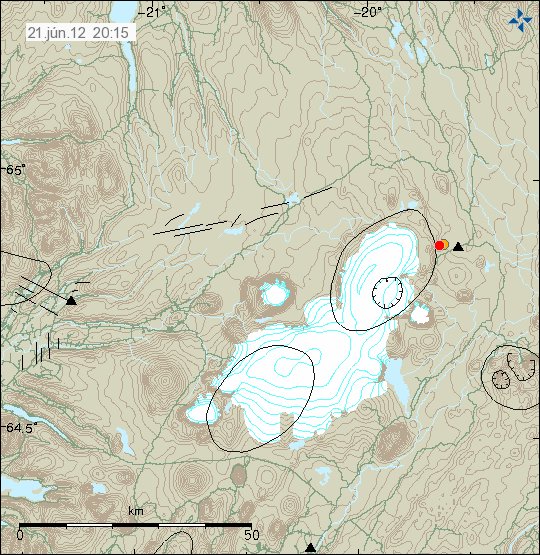
The two earthquakes that did appear on IMO earthquake map. Copyright of this picture belongs to Iceland Meteorological Office.
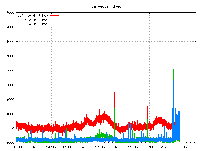
However, Hveravellir SIL station did show that more was going on then did appear on the earthquake map. Most of this earthquakes are too small to appear automatic on the earthquake list. Some might even be too weak to be properly located by the SIL network. Copyright of this picture belongs to Iceland Meteorological Office.
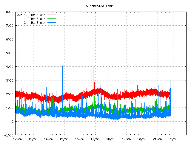
Some of this activity did also appear on Skrokkalda SIL station I think. Copyright of this picture belongs to Iceland Meteorological Office.
Katla volcano
Katla volcano did have an new earthquake swarm during the night. This earthquake swarm had around 30 or so earthquakes. Most of them where located almost in the central caldrea. This type of swarm activity has now been ongoing since end of April, when it started rather sharply with an earthquake swarm. Since then it has had many earthquake swarm. But the current rate of earthquake swarm is around 1 to 3 earthquake swarm pr. Week. Normally they are in an new area inside the Katla volcano caldera.
My geophone station at Skeiðflöt records most of the earthquakes if the background noise is not too high during that time.
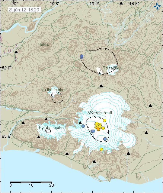
The earthquake activity in Katla volcano last night. Copyright of this picture belongs to Iceland Meteorological Office.
So far. This is just normal earthquake activity. It does not signal any chance of eruption activity so far. But this earthquake pattern is interesting. What it means is a different matter. So far, nobody knows for sure at this point in time. This activity seems to change hydrothermal activity inside Katla volcano caldera. This has also created minor glacier floods from Katla volcano caldera. But the flood have been seen on instruments that record water conditions in Múlakvíls glacier river. Glacier floods are marked by higher conductivity of the water, darker color and stronger sulfur smell (rotten egg smell). What happens next in Katla volcano is anyone guess. As Katla volcano has proven to be unpredictable volcano.
