Earthquake activity in Herðubreið is not volcanic in nature

The earthquake activity in Herðubreið during past few days is not volcanic in nature, or magnetic in nature. It is purely tectonic in nature. But the faults that have been moving are vertical, not horizontal as so many earthquake faults. Earthquakes are common in this area, as it on the eastern rift zone. The fault lines in this area of Iceland are highly active at times. Iceland Metorlogical Office has released this interesting information about the earthquake activity in this area during the past few years.
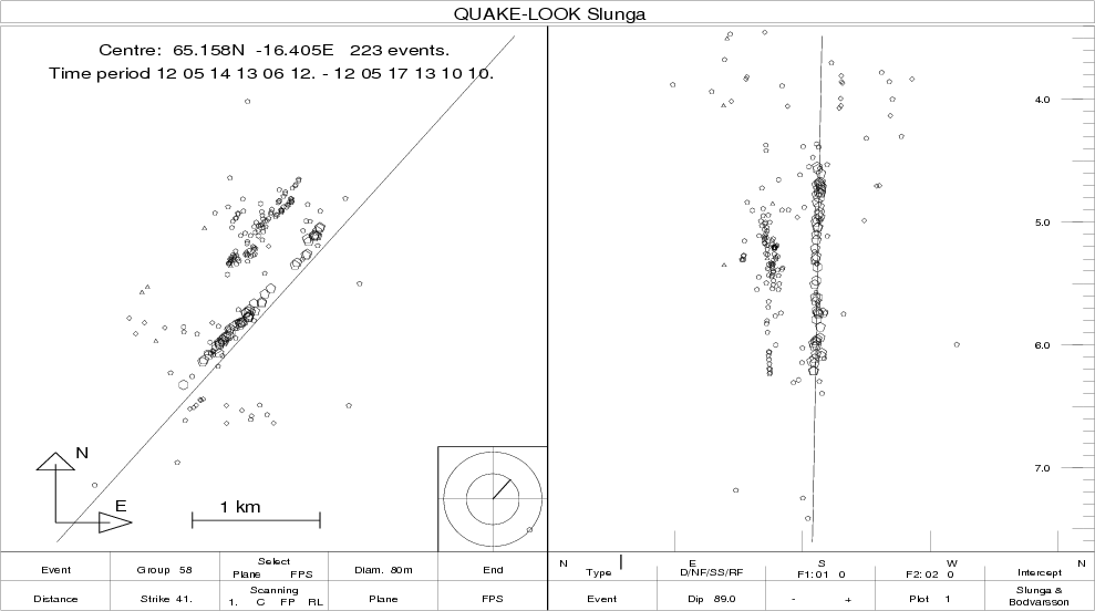

The first fault plane in Herðubreið. This one has the direction of N41°A. Copyright of this image belongs to Iceland Meteorological Office.
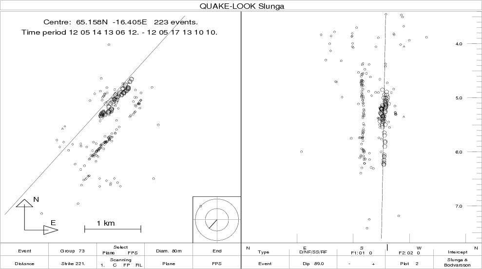

The second fault plane in Herðubreið. This second fault has the direction of N221°A (49°). Copyright of this image belongs to Iceland Meteorological Office.

Most of the earthquakes are on the depth of 5 to 6 km according to IMO.
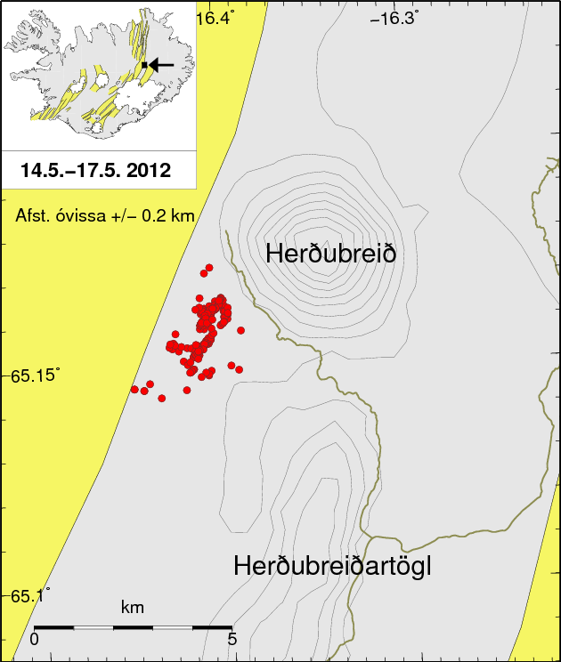

The earthquake activity in Herðubreið the days 14 to 17 of May 2012. Copyright of this image belongs to Iceland Meteorological Office.
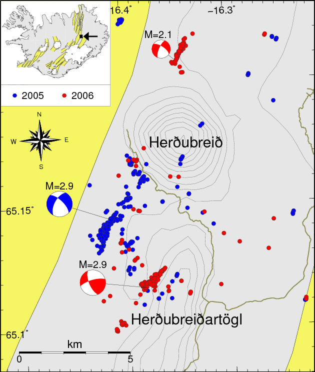

Earthquake activity in Herðubreið during the years 2005 to 2006. Copyright of this image belongs to Iceland Meteorological Office.
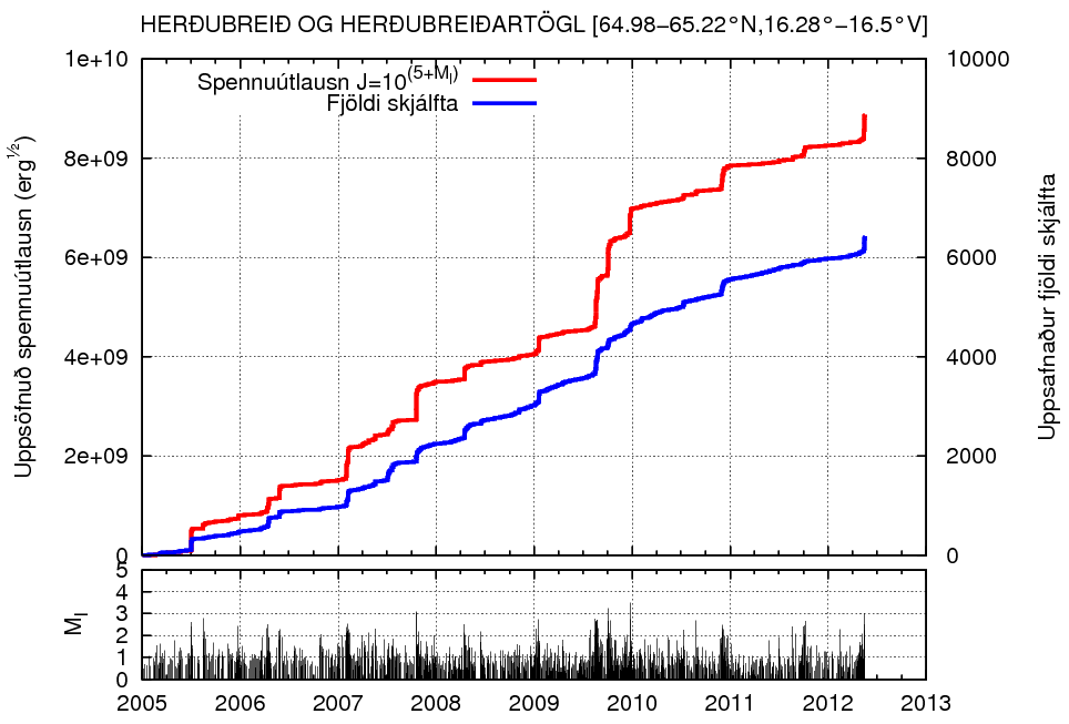

Total amount of earthquakes in Herðubreið from the years 2005 to 2012. This clearly shows that activity in this area has been rather constant during this period. Copyright of this image belongs to Iceland Meteorological Office.

The area in question is outside Askja volcano main fissure swarm. It is also outside Kverkjföll volcano main fissure swarm. So this earthquakes are tectonic in nature. But even so this area has erupted in the past. But for now. It is just earthquakes and not magma on the move, or breaking its path up to the surface as was case in Upptyppingar tuff mountain. The images are from Week 20 overview (what is up about it) at IMO web site.

Special report: Magnitude Mw6.1 earthquake hit northern Italy, many aftershocks recorded

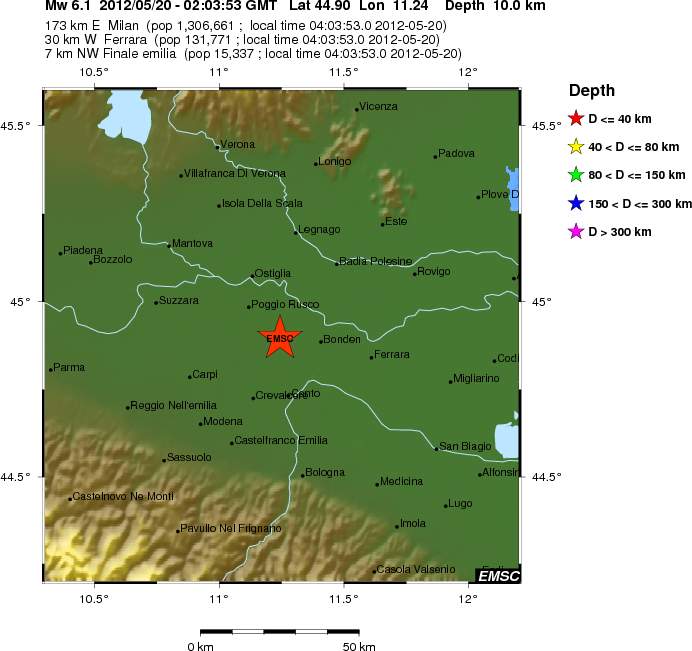
At 04:03 CEST (02:03 UTC) an earthquake with the magnitude of Mw6.1 did happen in north Italy. This earthquake was in an area that has seen a lot of earthquake activity during past several months now. But earthquake activity did start in this area late last year (2011). This earthquake did create a lot of damage in north Italy according to news reports. At least seven people have died from this earthquakes and well over 50 people have been injured because of this earthquake. Many historical sites have been damaged or completely ruined in this earthquake. I do not know what type of fault that did break. But data suggest that it was a slip fault that did break. I am unsure on directions of the fault that did break.


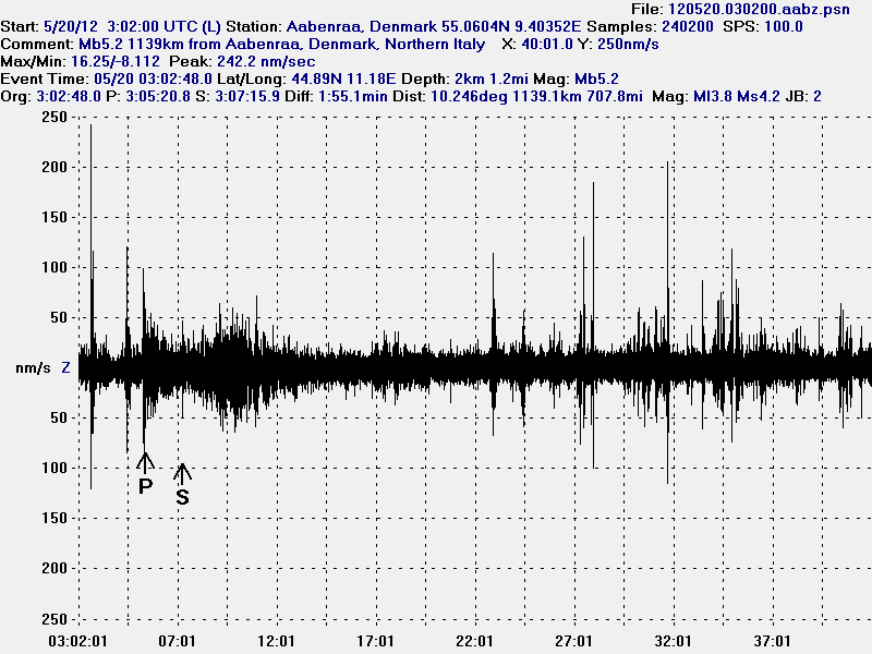
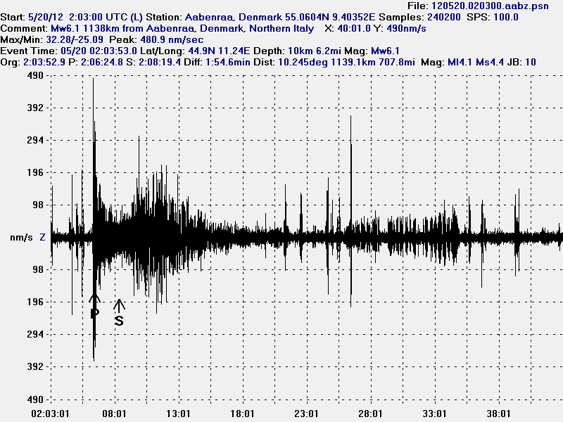
The earthquake in Italy as I did record it in Aabenraa, Denmark. There was a lot of surface waves following this earthquake. But those waves can be seen after the S-wave of the earthquake. This image is released under Creative Commons Licence. See CC Licence page for more details. Owner of this image is Jón Frímann Jónsson. Software used is WinQuake.


Local map of the Mw6.1 earthquake in North Italy. Copyright of this image belongs to EMSC.


The magnitude Mb5.2 earthquake in Northern Italy. I did not record this earthquake as clearly as the strongest one. This image is released under Creative Commons Licence. See CC Licence page for more details. Owner of this image is Jón Frímann Jónsson. Software used is WinQuake.


Local map of the Mb5.2 aftershock in North Italy. Copyright of this image belongs to EMSC.

What is most interesting about this earthquake is that it was had a pre-earthquake with the magnitude of ML4.2 about an hour to two hours before the main earthquake did happen. Web page of EMSC is not working properly at the moment. So I can’t check the time of the pre-earthquake at the moment. There have been more then dozen aftershocks less then Mb4.0 in size. But there have also been several earthquakes with the magnitude of Mb4.5. This aftershock activity continues at the moment.

Update 1: According to EMSC the pre-earthquake took place at 23:13 UTC on 19.05.2012.


Local map of the ML4.0 earthquake that took place at 23:13 UTC on 19.05.2012 in North Italy. This appears to be clearly pre-earthquake to the larger one. Copyright of this image belongs to EMSC.

I am going to update this blog post as more information are published.

English news about this earthquake.

At least 7 dead after quake rocks northern Italy (CNN.com)
Deadly northern Italy earthquake hits heritage sites (BBC News)
In pictures: Italy earthquake (BBC News)

Blog post updated at 15:44 UTC (17:44 CEST) on 20.05.2012.