Small glacier flood from Mýrdalsjökull glacier (Katla volcano)

During the night (and when I had unstable power) there was a small glacier flood from Mýrdalsjökull volcano. Some minor harmonic tremor change was detected following this glacier flood. This even was small one, many times smaller then what did happen on the 8 to 9 July 2011. Due to security concerns the Civil Emergency Authority did close the main road in Iceland for this area. Since they never know how big the flood can actually be. The main road was closed for about one hour. This glacier flood was detected around midnight 20 to 21 July 2011.

This flood is actually so small it is hard to see it on the harmonic tremor plot from the SIL stations around Katla volcano.
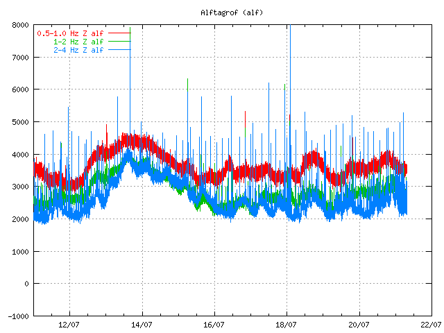

Tremor plot from 07:50 UTC this morning. It is hard to see the harmonic tremor from this minor glacier flood. Copyright of this image belongs to Icelandic Met Office.
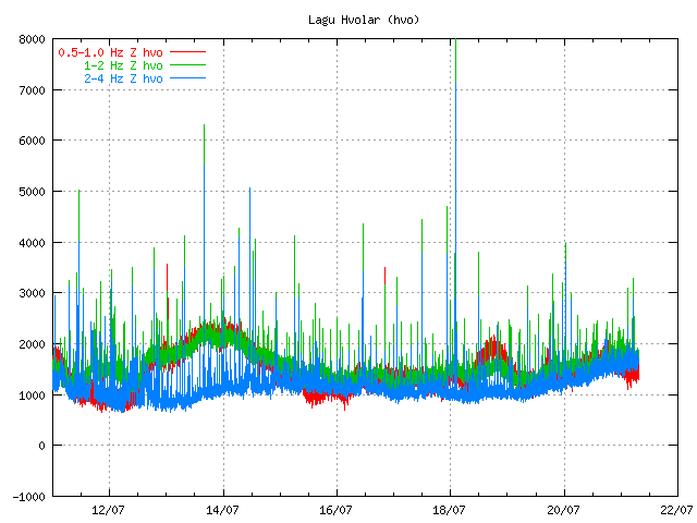

Tremor plot from 07:50 UTC this morning. It is hard to see the harmonic tremor from this minor glacier flood. Copyright of this image belongs to Icelandic Met Office.
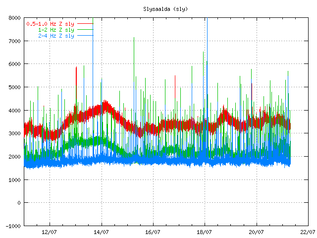

Tremor plot from 07:50 UTC this morning. It is hard to see the harmonic tremor from this minor glacier flood. Copyright of this image belongs to Icelandic Met Office.

What happens next is impossible to know for now. But it seems that activity continues to be high in Katla volcano. All that can be done is to wait and see what happens. But I am going to continue to monitor the changes in Katla volcano as best that I can do until I finish my summer job (29. July).

Icelandic News about this.

Aukin leiðni í Múlakvísl og órói í Mýrdalsjökli (Vísir.is, Icelandic)
Náið fylgst með Mýrdalsjökli (mbl.is, Icelandic)
Hringvegurinn opinn á ný (Rúv.is, Icelandic)
Breytingar í Múlakvísl (Rúv.is, Icelandic)

Interesting earthquake activity in Katla volcano

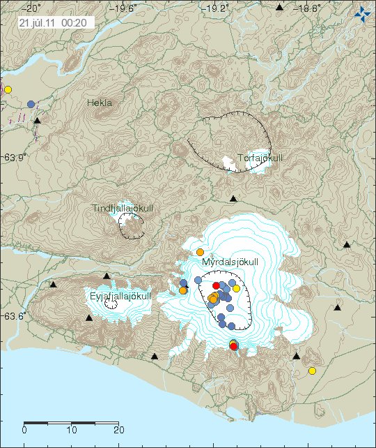
Sometimes there is a strange earthquake activity in volcanoes. I do think that this qualifies as one of that cases. But there has been odd and what appears to be grown earthquake activity in SE part of the caldera rim in Katla volcano.


The earthquake activity is the earthquake spot the SE in Katla volcano, out side the caldera. Copyright of this picture belongs to Icelandic Met Office.

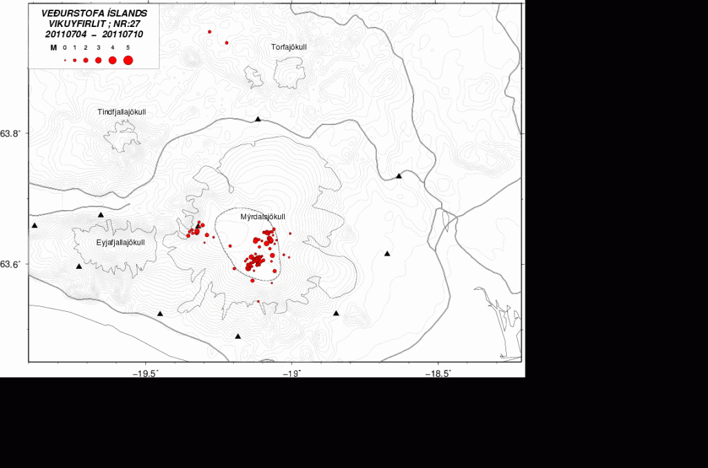
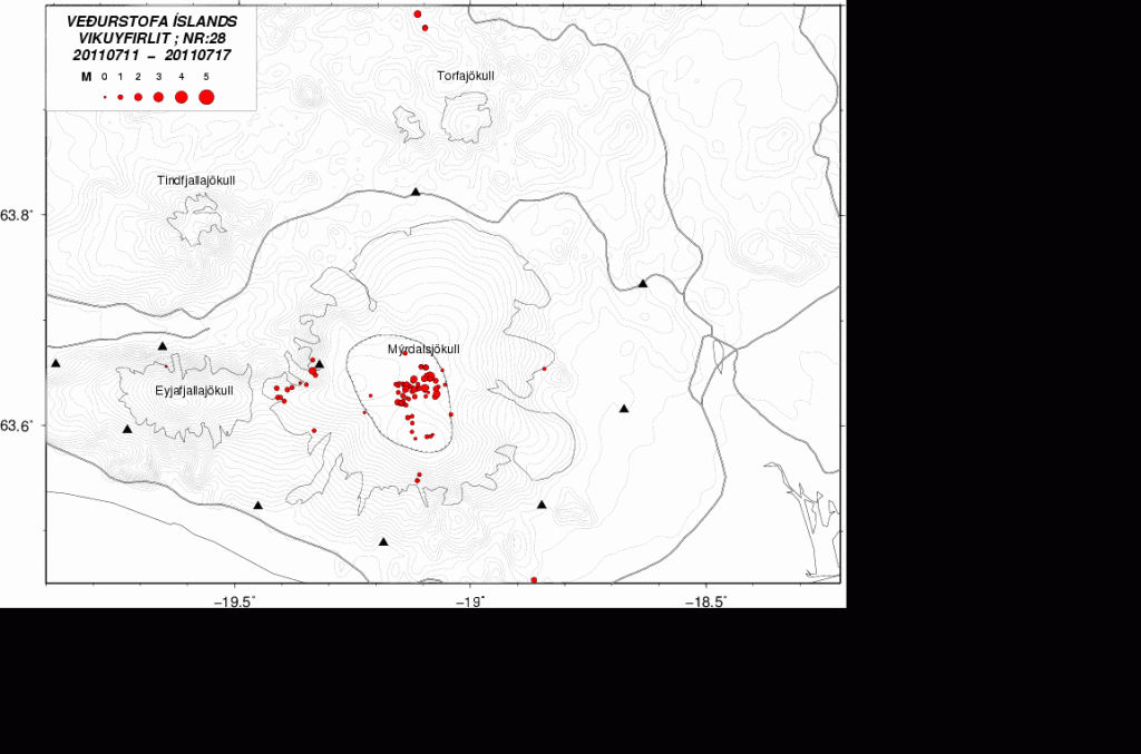
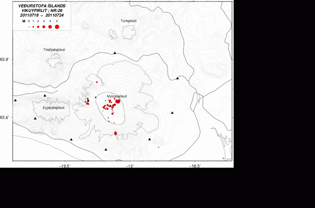
From what I can gather this activity started in Week 27 or about that time. Since then it appears to have been growing in number of earthquakes. I do not know yet if there have been any changes in the area, like hydrothermal activity.


Week 27. One earthquake can be seen in this area. Copyright of this picture belongs to Icelandic Met Office.


Week 28. More earthquakes in the same area. Clear sign that the activity is growing. Copyright of this picture belongs to Icelandic Met Office.


Weeek 29 (crurrent week) . Even more earthquakes at the same location. Copyright of this picture belongs to Icelandic Met Office.

While I do not yet what is going on there. This is something that might be interesting to watch and see what happens. Because small amount of magma might just have found a new pathway up the surface in this area. Even if it does not erupt, this might create new hydrothermal area if this is in fact magma. But given that this is in a volcano and really dense earthquake swarm. It is my guess that it is the case.

Power outage: Due to some maintenance work on the local power grid where I live I lost all power from 01:00 until about 06:20 UTC this morning. But that means that this blog post is late by several hours and my geophone webicorders have been off-line at the same time. Sadly I cannot afford few UPS like this one to keep my system up and running when the power goes out. As I need at least four of them at home and one with each webicorder computer (at location).

I am going to post update on what did happen during the night around 09:00 08:00 UTC. When I know more and after some more sleep.

Blog post updated at 07:29 UTC on 21. July 2011.