Many people don’t know how to spot a earthquakes on my helicorders web site (you can view it here). Here is a quick how-to. The earthquake used is a Mw6.3 earthquake that did happen in 2008 in Iceland.
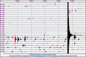
The second the earthquake did hit the sensor. The green line is when the power did go down in my apartment, just moment before the earthquake. Before that you can see background noise. That is people, cards and stuff like that. The earthquake is the big black-red line on the helicorder. After that you see smaller earthquakes happening (mag 3+ in size). This Hvammstangi geophone
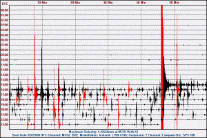
Same earthquake, different location. This station actually was low-gain at the time of the earthquake. But meant that it was less sensitive to smaller earthquakes then larger. But the aftershock can be seen clearly on the helicorder at the time.
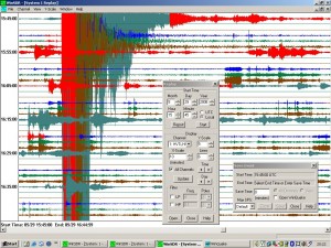
This is how my earthquake computer screen looked like at the time. The top line is currently not in use, as it is for a long period seismometers and I was just testing it at the time (it is also unclear on the signals as can be seen). The second and the third line in use is my geophone. But it clearly showed the earthquake and all it’s waves.
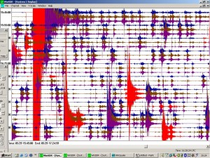
The Mosfellsbær station. That I had connection to at the time. But this is rather crazy view, as this is earthquakes and it is a lot of earthquakes in short space of time. I soon gave up trying to collect them.
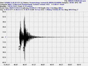
This is how I finally work out the earthquakes. I put in location and depth from IMO data, as I can’t plot them my self.
I hope that this examples help people to see when there is a earthquake on my helicorder and just noise from human movement. Harmonic tremors are different and so far I have not been able to get any good example of it. But during the Eyjafjallajökull eruption a wind was problematic and I was unsure if I was recording wind into the harmonic tremors of that eruption or not. So that is going to have to wait a better time.
