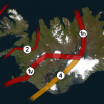
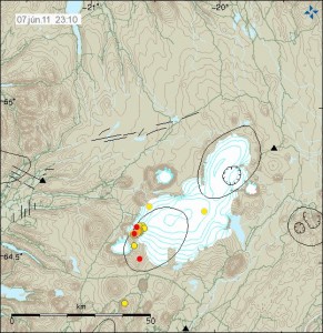
New video of Fimmvörðuháls craters and lava fields

Rúv News continues to show small bits of the area on Fimmvörðuháls that did erupt last year (2010) with lava fountains and Hawaiian type eruption.

It has been over one year since the eruption in Fimmvörðuháls took place. But the lava fields there are still warm and steaming. But they also have there share of dangerous gases too.

The news from Rúv.is.

Dularkraftur á Fimmvörðuhálsi (Rúv.is, Icelandic, video ,Windows Media Player required). Here is a direct link too the video.

Earthquake swarm close to Geirfuglasker on Reykjanes Ridge

Today at 15:08 UTC a earthquake swarm did start close to Geirfuglaskeri on Reykjanes Ridge. This earthquake swarm has so far been small, with the largest earthquake having the automatic size ML2.4 with the depth of 10 km.

So far this earthquake swarm has remained small. But it is unclear if this earthquake swarm is going to continue. But there was a break in this earthquake swarm from 16:12 UTC too 18:55 UTC. But I did think that this earthquake swarm was over, until it did start again.

It is impossible to know if this earthquake swarm is over or not.

New video of Eyjafjallajökull volcano crater

Tonight Rúv did show a new video of the Eyjafjallajökull volcano crater area. But the Rúv News team accompanied the scientist up too the top of Eyjafjallajökull volcano in order too view the crater that is there, and the lave field that did flow from the top crater. According to the news on Rúv it is going to take many years until the glacier recovers fully from the year 2010 eruption in Eyjafjallajökull volcano. As the lava field is up too 100 meters thick due the cooling from the glacier when it did flow form the crater in the eruption.

Rúv News. Use Google translate with the hope that it might translate…or not.

Eyjafjallajökull rannsakaður (Rúv.is, Icelandic)

Vísindamenn ofan í gígum Eyjafjallajökuls (Rúv.is, Windows Media Player required, Icelandic, at the end of the news on Rúv)

Blog post updated at 15. May 2011 at 00:08 CEST. Fixed text and added extra information.
Blog post updated at 15. May 2011 at 19:20 CEST. Fixed the blog post title.

New measurements of Eyjafjallajökull volcano crater

There is a short news piece about Eyjafjallajökull volcano on the news web site Morgunblaðið (mbl.is). It is about recent trip that geologist took to Eyjafjallajökull volcano. They where monitoring and during measurement of the crater that did form on top of Eyjafjallajökull volcano during the eruption in the year 2010.

According to the news, the crater lake in Eyjafjallajökull volcano is now frozen and there is already 10 meter thick snow layer in the crater. While the lake is cold it is still dangerous do go down into it and people are advanced against to do so. Due to carbon monoxide that is on bottom the crater. While the bottom of the crater is cold, the same cannot be sad about the crater walls. But they are still steaming and the temperature there is from 70C and up to 95C not far below the surface. So this area continues to be dangerous to people and travelling into it should be done with care and not without an experienced tour guide.

The reason why they did go to this trip today was too estimate the area before more detailed measurements are done this summer.

News from Morgunblaðið with picture can be found here.

Fóru ofan í gíginn (mbl.is, Icelandic, pictures)

Blog post updated at 02:24 CEST on 14. May 2011.

Deep earthquake in Herðurbreiðarfjöll volcano (Askja volcano fissure swarm)

Today at 06:57 UTC in Iceland there was a ML0.2 earthquake east of Herðurbreiðarfjöll volcano. While the size of this earthquake is really small. It is the depth that is interesting in this case. The depth of this earthquake was at 25,7 km depth. This is a interesting depth given the increase in earthquake activity in Askja volcano.

According to my geological map (a rather new one) the mountain named Herðubreiðarfjöll is a volcano that is inside Askja volcano fissure swarm. A common thing that happens in Iceland. This area has many active fault lines and has erupted in modern time. But I do not know when this volcano last erupted, as there are no information on Herðurbreiðarfjöll volcano activity in the GVP database and I have not found anything useful on the internet about this volcano.

Earthquake activity continues in Askja volcano. But at slower rate then before. Other then this, it is quiet in Iceland as it has been for the past few weeks.

eBook about Eyjafjallajökull volcano eruption 2010 planned

Too say big thank you too all the people how have donated money too me in my money problems while trying to live in Denmark. I have dedicated to write a ebook about Eyjafjallajökull volcano eruption in the year 2010. It is not going to be a scientific book. But rather a book on how I did view the eruption, along with some scientific data if I can get them into the book. Among other stuff about Eyjafjallajökull volcano.

This is going to be a ebook. But I am also going to check and see if I can get a print edition for those how want that rather then a ebook. But sadly, the print edition would cost extra. For the people how have donated to me in my money problems, the ebook is going to be free of charge. For everyone else it is going to be cheap. What price is going to be, I am not sure yet at this moment.

I have all the emails from the people how have donated to me. So if you want the ebook when the time come. All that has too be done is to drop me a email too get the ebook.

I am not sure when the ebook comes out. As it takes a bit of a time for me to write it. But I am going to announce it when the ebook is ready and published. I plan to start writing it when I have finished writing a sci-fi ebook that I have already started on.

The magma below Upptyppingar tuff mountains

Upptyppingar are a tuff mountains in the east highlands in Iceland. There formation is contributed to a sub-glacier eruption in this area around 12.000 years ago. A second older sub-glacier eruption feature is also present in this area, it is called Álftadalsdyngja. It is believed that it did form around 700.000 years ago in a basalt eruption in this area. Upptyppingar and Álftadalsdyngja are both inside Kverkfjöll volcano fissure swarm.


Map of the area. Copyright of this picture belongs to how created it. Author unknown. Picture is from here.

In the year 2007 (Week 50) a earthquake swarms started to appear in Upptyppingar area. Earthquake activity in Upptyppingar area have continued since then. With total number of earthquakes in this area since the year 2007 is something over 6000 total. The reason why earthquakes are happening in this location is because magma is pushing up trough the crust in this area. This has been confirmed by GPS measurements since the year 2007.

It is my opinion that increased activity in Askja volcano might trigger a eruption in Upptyppingar area or in nearby area. As the risk of dike intrusion from Askja volcano into the Upptyppingar magma sill might trigger a large fissure type of event in this area. This is just speculation based on observed data. So please take note of that fact. The reason why I fear dike intrusion from Askja volcano is due to the changes that Upptyppingar magma has created in the nearby crust. But if this happens depends on how Askja volcano eruptions are going to behave in the future.

Here are some scientific data on Upptyppingar and the magma that has been collecting at 15 km depth below Upptyppingar mountains since the year 2007.

EARTHQUAKE SWARMS AT UPPTYPPINGAR, NORTH-EAST ICELAND: A SIGN OF MAGMA INTRUSION? (pdf, study)


Location of the earthquakes since the year 2007. Copyright of this picture belongs to Icelandic Met Office. Picture is from here.


Depth of the earthquakes in the year 2007. As can be seen, the magma moved upwards with time. Copyright of this picture belongs to how created it. Author unknown. Picture is from here.


Estimated location of the magma below Upptyppingar mountain. This location is based on earthquakes and other measurements. Copyright of this picture belongs to how created it. Author unknown. Picture is from here.

What happens with Upptyppingar is now just a question of waiting and seeing. But there is also a good chance that this magma is never going to reach the surface in a eruption and is just going to cool down there and form a basalt dike that is going to be exposed in few million years when the weather and ice remove the rocks on top of it.

Earthquake in Askja volcano last night

Here is a picture of a earthquake that took place in Askja volcano last night. This earthquake was bearly visable on my geophone close to Hekla volcano. From this data it is clear that the earthquakes are created by magma movements inside Askja volcano. But the earthquake swarm is taking place on the edge of Askja volcano main system. It is not happening outside as it might appear.

It is also worth pointing out that not all of Askja volcano earthquakes might appear on the automatic SIL system. But most of them should do so. As Askja volcano is remote and in a unpopulated area there should not be any damage from a eruption. The only damage might happen if there is a eruption in Askja caldera lake due to ash cloud that might form.


Askja volcano earthquake. This is low pass filtered at 1Hz. This image is released under Creative Commons License, see top link for more information. Click on this picture for full resolution.

This earthquake has magma signature from the looks of the earthquake signal. But due to distance it is hard to be sure on that.

When this is written a tremor pulse appears to be starting in Askja volcano. But this might also be a swarm of micro earthquakes taking place in Askja volcano without the earthquakes appearing on the automatic SIL system. At this point it is hard to know for sure, as this activity is new.


Locations of the earthquakes in relations to the Askja volcano system. As can be seen on this map from Icelandic Met Office, the earthquakes are clearly inside Askja volcano. Even if they are not at the main caldera. Picture is from Icelandic Met Office web site. Copyright of this picture belongs to Icelandic Met Office.

Blog post updated at 16:37 UTC on 5 May 2011. Picture is added.

More information on the Askja volcano earthquakes

The earthquake activity in Askja volcano continues to evolve at rather fast phase. A lot faster phase then I did originally expect. Far as I can tell from the Icelandic Met Office SIL data (tremor plots). The earthquakes that are now taking place in north Askja volcano appear to be mostly magma related earthquakes. The strongest earthquake so far did happen today and had the size ML2.5 with the depth of 0.1 km. The deepest earthquake so far took also place today and had the depth of 19,6 km. It had the size ML1.4.

However earthquakes with the depth of 22 km has been recorded close to Herðubreiðartögl. Few days ago a tornillo earthquakes (most likely the case now. But yet unconfirmed from my point of view) started too appear in Askja volcano. But that means that magma is on the move in Askja volcano. Currently this might also be the case with the earthquake activity east of Askja volcano. But at this moment it is a bit more unclear what the activity east of Askja volcano means. But it is also possible that magma is also pushing east from Askja volcano. But so far earthquake activity east of Askja volcano has been different then from the earthquake activity north of Askja volcano. But it has not been focuesed on a single spot like the earthquake activity in north part of Askja volcano system.

It is unclear at this moment how this is going to evolve in the long term. But no reports of increased hydrothermal activity have so far appeared in the news. Currently the activity is rather low, so a eruption is not yet imminent in Askja volcano. But that might change without any warning at all at any time.


Current Askja volcano earthquake activity. Click on this picture for full resolution. Picture is from Icelandic Met Office web site. Copyright of this picture belongs too them.

Due to distance. I do not record any small earthquakes from Askja volcano. But they need to be larger then ML3.0 to appear on my geophone network.