Overview of activity in Iceland in week 23

During Week 23 there hasn’t been a lot of activity taking place. Normal minor-earthquake activity has been taking place all over Iceland, some glacier earthquakes have been seen in Vatnajökull glacier. This spread out earthquake activity is normal for Iceland, it is also easily detected in Iceland due to the dense seismometer network in Iceland. Earthquake activity continues in Bárðarbunga volcano.

150607_1940
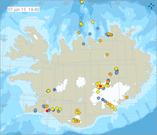
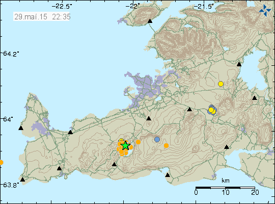
Normal earthquake activity in Iceland at the moment. Copyright of this image belongs to Icelandic Meteorologist Office.

At the moment the earthquake activity in Iceland is within normal background levels. Minor earthquake activity is almost always taking place in Iceland, there are few days when no earthquakes happen, but those days are rare and it is long between them. At the moment there is nothing to report in terms of the activity in Iceland.

Work schedule

This summer I am working Monday to Friday from 08:00 to 16:00. This means if anything happens I won’t me aware of it until I get back from work.

Donations

Please remember to support my work with donations. They help me work on this website and keep my alive. I have found out that food is expensive in Iceland and over the past two years that price has only gone up and it continues to do so. This means the budget I used in Denmark for food is not enough in Iceland (I have adjusted the plans, that type of living is going to be a challenge for the next 9 – 11 months when I am going to be living in Hvammstangi, Iceland). I am now close to getting completely broke. Most of my working income is going to pay up my debt (what I get of it, since I pay full tax [37,30%] of it in Iceland). I hope to be finished paying up all my debt in October. Thanks for the support.

Article updated at 20:48 UTC.
Article updated at 23:04 UTC.

Alert level for Bárðarbunga volcano lowered

Today (1-June-2015) the alert level around Bárðarbunga volcano was lowered to uncertainty level from danger level. This means there are no longer any travel restrictions in the area. Besides normal spring closure in the highlands due to the snow melting (and creating mud areas). There is a risk of snap floods in the area due to hydrothermal activity in Bárðarbunga volcano. It remains high according to the latest news. The risk area for that melt water is in Jökulsá á fjöllum glacier river, since melt water can collect under the glacier and then flood the river days to weeks later. It is also not known what is going to happen when the summer melt period starts in Jökulsá á fjöllum glacier river. A new lake might from in the area next to the glacier where the lava blocked the glacier river path, the glacier water comes from Dyngjökuli glacier.

Icelandic News about this

Frá hættu­stigi á óvissu­stig (mbl.is, Icelandic)
Ekki lengur hættustig vegna Bárðabungu (Rúv.is, Icelandic)
Viðbúnaður vegna jarðhræringa við Bárðarbungu færður niður á óvissustig (Vísir.is, Icelandic)

Strong earthquake swarm in Krýsuvík volcano

Yesterday (29-May-2015) there was a strong earthquake swarm in Krýsuvík volcano. Largest earthquake had the magnitude of 4,0, a smaller magnitude 3,1 earthquake also took place.

150529_2235
Green star shows the location of the magnitude 3,1 and 4,0 earthquakes. Copyright of this image belongs to Icelandic Meteorological Office.

Other earthquakes in this swarm where smaller, total of 97 earthquakes where recorded. Earthquakes swarms in this area are common, since the volcano has been inflating and deflating for the past few years. I don’t know if this earthquake swarm was related to such movements, since tectonic forces often create strong earthquake swarms in this area and along the Reykjanes peninsula and Reykjanes ridge.

hkbz.svd.30.05.2015.at.01.21.utc
The earthquakes as they appeared on my geophone in Heklubyggð. This image is under Creative Commons licence. Please see CC Licence page for more details.

On the geophone shut-down

There has been some discussion about me turning off the geophone network in Iceland. There is one station renaming in Heklubyggð and that station is going to continue to run for some time now (it doesn’t use the 3G network in Iceland). When it turns off I do not know. Besides 3G connection costs that have been going up in Iceland for the past few years, it has also become more expensive for me to fix the computers if they fail, along with 3G signal leak and other issues. It is also time consuming to run a remote network. I do help people if asked on what to buy in terms of hardware if they want to start there own geophone or seismometer. I don’t plan on stop recording earthquakes, I just plan on doing that just from my home once I am back in Denmark.

As for sensitivity of such hardware, it depends on what type of hardware is being used. Geophones are good for local earthquakes but more sensitive hardware is needed to record earthquakes at longer distance, like the magnitude 6,8 earthquake in Alaska this morning. It can be viewed here for the next few hours on long period seismometer (the top one and few others).

Böðvarshólar geophone station goes off-line on 28-May-2015

I am going to turn off the geophone station in Böðvarshólar on 28-May-2015. The only renaming geophone stations after this is going to be in Heklubyggð. I don’t know for how long I am going to keep it running. The Böðvarshólar geophone station has been recording earthquakes since 2012. It has however proved to be difficult to keep running remote geophone stations due to connection issues, hardware issues and so on. I have also been having a major problem with the 3G signal leaking into the recording and creating a problem (this was a huge problem this winter with all the snow). It was clear from the start that I would not be able to maintain a remote network forever. This was and always has been a temporary network. In the time I have been running this network. I have collected so much data that I am yet to properly work with it, install magnitudes, depths and locations in the data files. At the moment I got around of five years worth of unprocessed data. There is also a change taking place where this geophone is hosted. Changes that are outside of my control and I have nothing to do with them.

I won’t stop recording earthquakes, but since I won’t be living in Iceland I am only going to record earthquakes in Denmark and mostly long distant one [magnitude 6,0 and larger]. That is going to mean fewer earthquakes that I record each week and over the year (Denmark has few local earthquakes). The data is going to be easier to process at the same time due fewer recorded earthquakes that I have to handle. The only geophone station that I am going to continue to run for now is the one in Heklubyggð, how long it is going to remain on-line I do not know. That depends a lot on the person that owns the summerhouse where it is hosted. I hope everything understand why I have to turn my geophone network down in Iceland. Things are also changing for me personally and that change might not allow me to run this geophone network in the future. As I say above, I won’t stop recording earthquakes, I am just going to do with in a different way.

My geophones can be viewed here. Heklubyggð geophone doesn’t update at the moment due to failed WLAN transmitter (it is frozen). I am going to replace it soon with a new WLAN transmitter. The current WLAN transmitter is close to 10 years old (2007 or 2008) so it has started to fail due to old age and usage.

New swarm of deep earthquakes in Katla volcano

This morning (20-May-2015) a swarm of deep earthquakes took place in Katla volcano. This earthquake activity was at depth and it means that magma was moving or dyke intrusion taking place at depth.

150520_1900
Earthquake activity in Katla volcano this morning. The earthquake swarm took place close to 1918 eruption site. Copyright of this image belongs to Icelandic Met Office.

Deepest earthquake in this swarm had the depth of 28,9 km. Shallowest depth was 17,3 km. At this depth there is only magma that can create earthquakes, since crust at this depth in Iceland almost never has earthquakes (it might happen, but is rare event) that is not related to magma movements. This activity is something that needs to be monitored since it might suggest that conditions inside Katla volcano might be changing. There is no way to confirm at this point that to be the case. At the moment there is nothing to suggest that eruption is imminent in Katla volcano at this point. This deep earthquake activity appears to be over for now.

Warning of man made earthquakes in Hengill volcano

Almannavarnir put out a warning yesterday (19-May-2015) about increased risk of man made earthquakes in Hengill volcano. This happens when a water is pumped down into the ground it changes the pressure in the rock and creating earthquakes as a consequence. There is a risk of earthquakes with magnitudes up to 4,5 or larger. The first pumping down of this leftover water is expected to end by 19-June-2015.

Icelandic News about this

Vara við jarðskjálftum á Hengilssvæðinu (Rúv.is, Icelandic)
Niðurdæling vegna hitamengunar að hefjast (Rúv.is, Icelandic)

New study shows that ash cloud in Eyjafjallajökull and Grímsfjall volcanoes eruptions larger then expected

It was reported on Rúv News today about a new study that came out few days ago. In this study according to Rúv News the ash cloud from Eyjafjallajökull (2010) and Grímsfjall (2011) volcanoes where larger then appeared on satellite images. Meaning the ash could was covering larger area then appeared on images from space. The grain size in this eruptions was also underestimated. The decision to close down the airspace as was done in both eruptions was correct.

More details can be found here.

Rúv News

Viðbrögðin voru hárrétt (Rúv.is, Icelandic, audio in Icelandic)

Donations: Please remember to support my work with donations. It is also possible to support my work by using Amazon. Thanks for the support. 🙂

How Bárðarbunga volcano collapsed

There is a good article about how Bárðarbunga volcano collapsed during it’s six month long eruption in Holuhraun. The most recent data (the work on Bárðarbunga volcano is far from over even there is no eruption taking place currently) show that Bárðarbunga volcano did in fact collapse. This collapse was not marked by a big explosion, but rather slow subsidence of Bárðarbunga volcano over a large area. Holuhraun eruption is the largest eruption in Iceland for the past 230 years, both in magma and size of the eruption.

More details can be found here.

Iceland’s Bárðarbunga-Holuhraun: a remarkable volcanic eruption (blogs.egu.eu)

Small glacier flood from Grímsfjall volcano caldera

Today (11-May-2015) a glacier flood started from Grísmfjall volcano caldera. This is not a dangerous glacier flood due to its small size. There is however a danger from sulphur gases and other gases that dissolve when the pressure is dropped on the water. If people get too close to the Gígukvísl glacier river where the flood comes from Vatnajökull glacier they risk a damage to there eyes and lungs due to burning effects from the gases in the air.

grf.svd.11.05.2015.at.20.47.utc
Increased harmonic tremor from Grímsfjall volcano. Copyright of this image belongs to Icelandic Met Office.

There is now a increased harmonic tremor from Grímsfjall volcano. It is not clear why that is, it is either the glacier flood or hydrothermal vents boiling at the bottom of the lake due to the sudden pressure release on them. There is nothing suggesting that an eruption is going to follow this glacier flood from Grímsfjall volcano. Last glacier flood took place in 2014.

Icelandic News

Lítið hlaup í Gígjukvísl (Rúv.is, Icelandic)

Risk of rock collapse in Ketilbjörg cliffs

There is currently a high risk of rock collapse in Ketilbjörg cliffs in north-west Iceland. This area is located north of Sauðárkrókur town. The area is now extremely dangerous due to the fact that the rock can fall of it’s location without warning. This are big rocks that are breaking off and falling into the coastline, many of them having the size of small houses or cars. If people travel to this area they should not go to the edge where cracks are in the ground. Doing so puts your life at risk.

Icelandic News

Enn hrynur úr Ketubjörgum (Rúv.is, Images, Icelandic)