Special report: Update 4 on the eruption in El Hierro, Canary Islands, Spain

Short note on comments: During the eruption in El Hierro there has been a lot of comments on this blog. Over the past 4 days (or so) there have been about ~1500 comments. If your comments is held for moderation, the blog says so. Do not try to repost your comment if that is the case. As the second comment is just going to be held in moderation as the earlier one. It takes me a little while to approve the comment and to make it appear. If your comments disappears and cannot be seen, the spam filter has eaten it. It also takes me a while to check the spam filter and restore comments that have gone there. Please do not just post comment with nothing but links, that increases the risk that the comment is going to be eaten by the spam filter.
*****

Short note: Please note that I am not a expert in the field of volcanism, volcanoes and earthquakes. I never claim to be one. Regardless if I am asked or not. I am a man with interest in this field. I read a lot of books and studies on volcanoes and earthquakes. But that does not make me a expert in this field. If you want to speak with a expert, go and find one. Because I am not it.

Now. About the eruption in El Hierro volcano in Canary Islands. This is going to be a short blog post about the eruption.

From what I can tell and the information that I have seen. At least two more vents have opened up on the from what I can gather on the pictures and the reports from Canary Islands. So far all the new vents are under the ocean and at depth of no less then 150 meters. So seeing them directly is quite hard for the moment. There are continues deep earthquakes under El Hierro volcano, but that suggests that new magma is flowing into El Hierro volcano.

During the weekend floating magma bombs where (or some type of magma, I do not have the exact word for it in English at the moment) floating on the ocean. But this means that at least one of the vents that started erupting in the beginning is getting close to break the surface of the ocean. If the eruption continues in that vent for a little while longer. If it gets above the surface of the ocean, it is going to form a island and a lava eruption is going to start once the ocean cannot get any more into the crater.


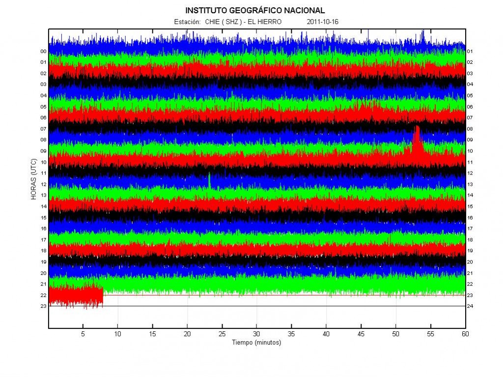
The harmonic tremor of the eruption in El Hierro volcano today (16 October, 2011) at 22:35 UTC. Copyright of this picture belongs to Instituto Geográfico Nacional.

There is a risk of new fissures in El Hierro opening up without warning. From what I am estimating, the area that this can happen has expanded about ~5 km or so from my original estimate that I made in few blog posts ago. The risk of new fissure opening up on land is going to remain high while this eruption is taking place. But this might well be a period of eruption activity for El Hierro. It is impossible to know for how long it is going to last, it could be weeks or it could be months and up to years of activity.

I am going to post more information on El Hierro when I know more tomorrow. I am also going to write about the earthquake activity in Hengill volcano tomorrow if I have time to do so.

Special report: Update 3 on El Hierro eruption in Canary Islands, Spain

I am going to fully integrate Canary Islands into my watch volcano monitoring system in the beginning of next month, but Canary Island won’t be part of my emergency system until I move to Canary Island (that is because of technical reasons mostly). When that happens, blog post regarding earthquake and volcano activity won’t be a special report. Just a normal blog post as with Icelandic volcanoes. I am doing this as I plan on moving to Canary Islands in about 10 years time (+- maybe few years depending on how my plans work out). A name change on this blog is planned in the beginning of the year 2012. But it takes a while for me to think up a new name for this blog.
******

The eruption in El Hierro volcano continues at the same phase as before. With little change so far. Currently the eruption seems to be in two vents, as it did when it started on Monday. There have been unconfirmed reports of new vents opening up closer to the coastline. But given lack of direct evidence that should be there. I do not believe that a new vents have opened up closer to the coastline so far.

Deep earthquake continue in El Hierro volcano. But that means a new magma is coming in from the mantle and is flowing upwards into the volcano. For long as deep earthquakes are being recorded the eruption is going to continue. It is impossible to know for how long this inflow of magma from the mantle is going to continue. But this means that the eruption is going to continue for time being. With the risk that new vents might open up at any time on and around El Hierro volcano. This inflow of new magma has also been confirmed by GPS measurements on El Hierro volcano (the island). But since the eruption did start, no major change has been seen on the GPS real time data.


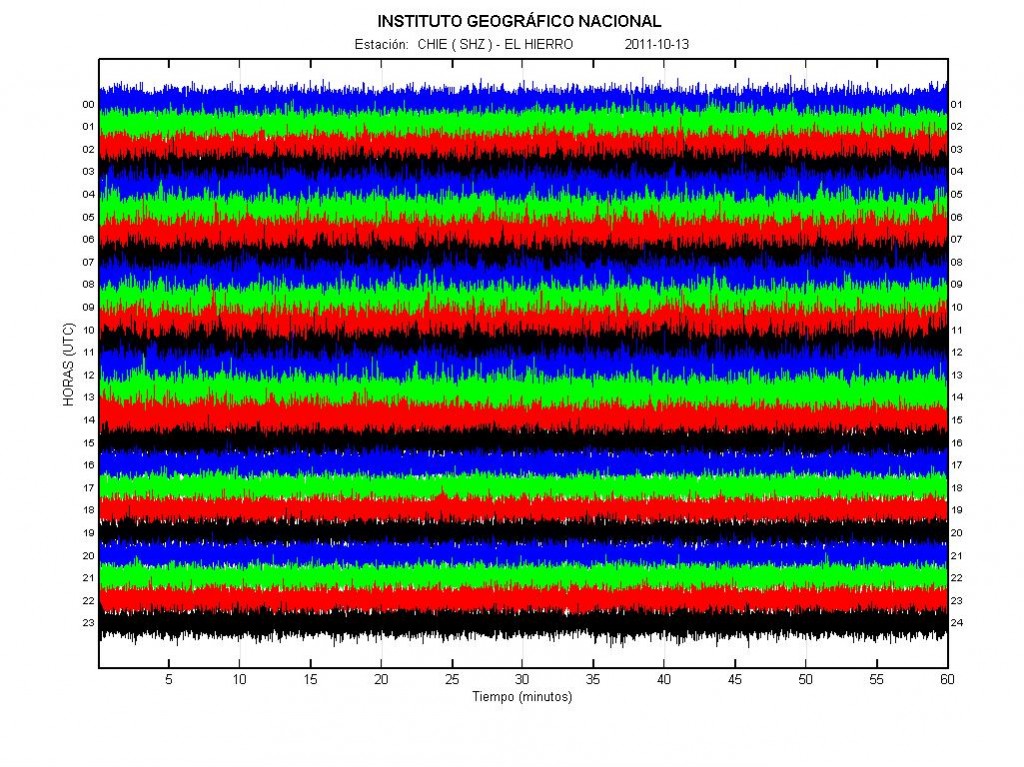
The harmonic tremor in El Hierro volcano yesterday. Copyright of this picture belongs to Instituto Geográfico Nacional.


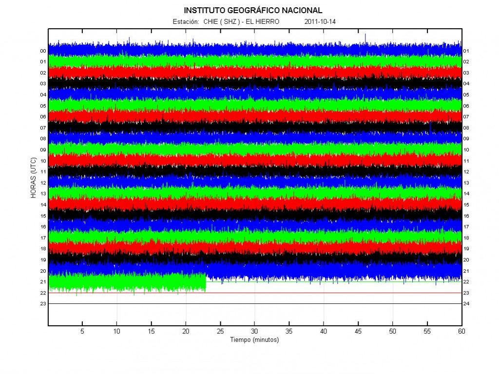
The harmonic tremor in El Hierro volcano today (until 21:20 UTC about). As can be seen by comparing the pictures between today and yesterday. Not much has changed since yesterday in terms or harmonic tremor. Copyright of this picture belongs to Instituto Geográfico Nacional.

If a eruption vents open up on a land. The following eruption is going to be lava only. No volcano ash and no explosions as El Hierro is a shield volcano like the one on Hawaii and that means only lava eruptions. If a eruption vents opens up on the shallow coastline, there are going to be explosions for as long the ocean water can get into the crater. The moment it closes up the explosions stop and lava eruptions starts.

Please note that I am on slow internet connection (3G). So I am not going to post anything if the internet connection is really slow, as sometimes seems to happen. I am going to try and solve this issue by using my 3G phone and connect that way. At least I am going to try and see what happens.

Blog post updated at 03:20 UTC on the 15 October, 2011.

Special Report: Update 2 on the eruption in El Hierro

This is a special report on the eruption in El Hierro. This is also a good time (as any) to announce that I plan to write about volcanoes in Canary Islands in the future. As I plan on moving to the Canary Islands in about 10 years time (no reason to start late on this). But I have already induced the Canary Islands volcanoes into my personal watch system. But I have my own personal system to watch volcanoes in Iceland and now Canary Islands. However, Canary Islands are not part of my personal emergency system until I move to Canary Islands.

Update to the name of this blog is going to happen soon, but I am not sure when. But I am going to move in a about 10 years time (going to live in Denmark until that happens). Until then, they are going to go into special report group and only major events are going to be blogged about. Please note that this might change if I move earlier to Canary Islands then I now plan.

******

The eruption in El Hierro volcano continues today, as it did yesterday. But the strength of the eruption appears to have dropped today from what it was yesterday. But this does not mean that the eruption is over. It just means that the current fissure that is erupting is about to close up, mostly due to the material that it has been ejecting into the ocean floor. That means a new fissure or vents is about to open up somewhere. When and where is impossible to know. But this is the nature of volcanoes that erupt in this manner, but El Hierro is a shield volcano [second link here]. Good examples are Krafla volcano and Vestmannaeyjar Island volcano. Both of those volcanoes are in Iceland.

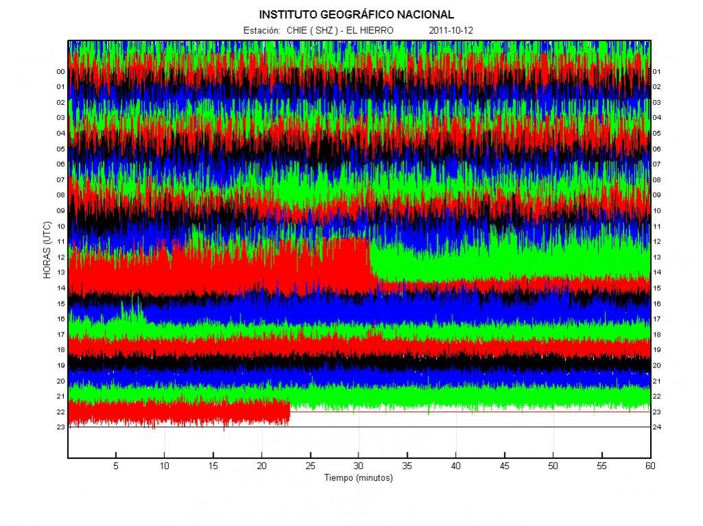
Today around 14:20 UTC there was a sharp tremor drop in El Hierro. This means that the magma flow dropped in the current eruption fissure. This also means that if the pressure is not enough that fissure is going to stop erupting. Because of this has happened a new fissure or a vent should be expect at any time as I have told before. When and where that might happen is impossible to know, as that outcome depends on where the magma finds its pathways inside the volcano. There might not be any earthquakes before this happens, as the rock is unlikey to be hard enough to make them. Some small earthquakes might happen if the rock layer is hard enough. Today few deep earthquakes have been recorded. This means that new magma is getting into El Hierro volcano from the mantle (where no earthquakes happen). This also means that this eruption might take place for some time now. But it is impossible to know for how long, as there might be a lot of magma flowing up from the mantle it self and up to El Hierro volcano.


The harmonic tremor and the drop in the harmonic tremor today. Copyright of this picture belongs to Instituto Geográfico Nacional.

Many people have been wondering why this eruption has not been seen. The fact is that depth drops quiet fast around El Hierro Island. Around 4 km out the depth is close to 1.5 to 2 km, it is only close to the island that the depth starts to get shallower. At the moment is is hard to say what happens next in this eruption on El Hierro. But more vents should be expect to open up then have already have.

I am going to update this blog post if anything changes in El Hierro volcano eruption.

Special report: Eruption at El Hierro volcano, Canary Islands

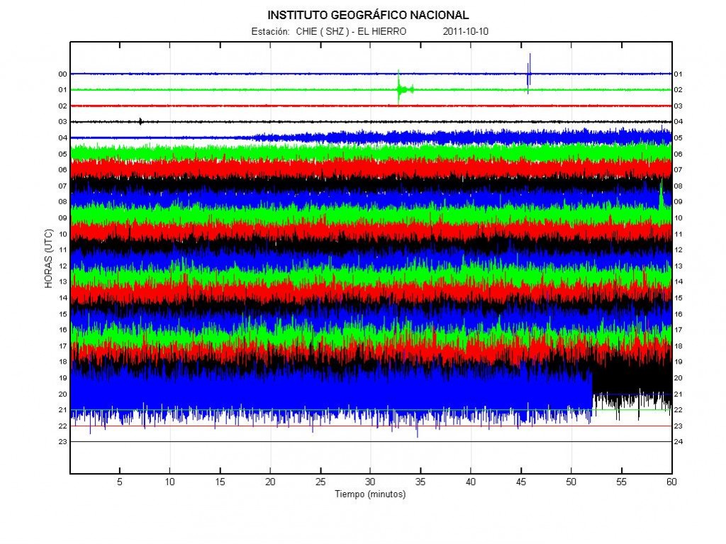
At 04:18 UTC on 10 October, 2011 a eruption did start somewhere close to the El Hierro volcano Island (but inside El Hierro volcano system). So far nothing has been seen to this eruption, so location is uncertain at the moment. At the moment this eruption has only been confirmed by harmonic tremors seen on seismometers on El Hierro island.

From what I can tell, based on the harmonic tremor plots. It seems that the eruption has been growing in size since it started well over 12 hours ago. This suggests that the eruption is growing in size. That also brings up the issue that new fissures might open, both into deeper ocean and on shallower depth and even on land without any warning at all.


The harmonic tremor from El Hierro at 21:08 UTC on 10 October, 2011. Copyright of this picture belongs to Instituto Geográfico Nacional.

A location for the eruption has been suggested, as can be see on this map here.


The speculated eruption in El Hierro. Copyright of this picture belongs to el-mundo.es Thanks to Dr. John v. Kampen for this map via email.

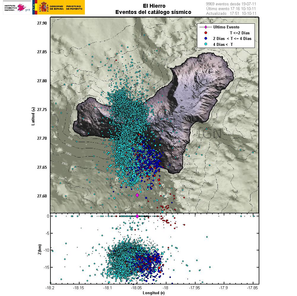
Lack of earthquakes does not mean that magma is not the move and has not reached the surface already. But this however suggests that magma now has a free flow upwards to the surface since sometimes yesterday, when the earthquake activity did drop suddenly from ~100 earthquakes to ~30 earthquakes over the day.


Current earthquake activity in El Hierro. It is my personal opinion that the eruption is around -18.05 and 27.65 to 27.70 (middle of that area, around 450 meter depth). Copyright of this picture belongs to Instituto Geográfico Nacional.


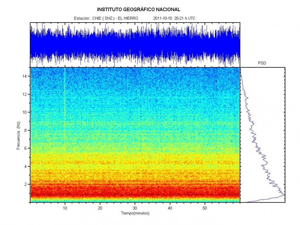
Spectral image of the harmonic tremor. This image clearly shows that the orgin of the harmonic tremor is magma on the move. Not something else. Copyright of this picture belongs to Instituto Geográfico Nacional.

I am going to update this blog post as more is known about the eruption in El Hierro.

Canary Island news about this. With thanks to Dr. John v. Kampen how did send them to me in a email.

Posible erupción al sur de El Hierro (Youtube, Spanish, Video)
¿Emergerá una nueva isla? (Youtube, Spanish, Video)

Blog post updated at 21:49 UTC on 10 October 2011.

Few points about Iceland geology

Here are few points about geology in Iceland (just because I cannot sleep at the moment). This is also a offshoot of this blog post here.

The basic thing that needs to be known about Iceland is the fact that it is just a island over a hot spot. In every other terms it behaves as expected by a volcanic island on a rift zone. There is a lot known about Iceland geological features and volcanoes. But there is also a lot unknown at the moment. There is nothing mysterious or strange about that. We just don’t know this at the moment, but in the future we hopefully are going to know this. As each eruption or earthquake swarm teaches us more about Iceland and how it works.

I have seen a lot of wrong things about geology in Iceland on this blog in past few days. For instance the claim that energy travels trough a fault zone with N-S bearing (mostly). The volcanoes in question where Hengill volcano and Hekla volcano. This volcano do not exchange energy over SISZ. It simply just does not happen, as law of nature does not allow for it to happen. The following natural laws prohibits this energy transfer (and there is no way around it), Laws of thermodynamics, Inverse-square law, Conservation of mass, Conservation of energy, Momentum, Angular momentum and whole a lot of other physical laws that apply in nature.

I know one of two thing about physics too. As I fully apply that when I am considering what a volcano or a earthquake swarm might be up to in Iceland.

The evolution of Iceland during the past ~20 million years is also a factor in this. As there are many fully formed rift zones, but there is also a lot of failed rift zones in Iceland. There might even be new failed rift zones being formed today. But it impossible to know that for sure at given time. Since we have no way of knowing what is “new” and what is “old”. Research into this matter is going to shed some light on it. But that might take years of hard work of scientists for years to come.


The basic evolution of Iceland from 15milyr ago until the today. Copyright of this image belongs to its owner.
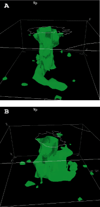

This is the best picture that I know of what they think is the Iceland hotspot. Copyright of this image belongs to its owner.

There is also the thing about the crust in Iceland. But it is believed that part of it might be from a old continent. But majority of it is currently covered with newer layers of rock and sediments. But studies have also suggested (or proved) this. The following papers can be read on this subject.

Older crust underlies Iceland (pdf)
Continental basement under Iceland revealed by old zircons
Continental geochemical signatures in dacites from Iceland and implications for models of early Archaean crust formation (ScienceDirect)

This in part explains the difference in crust thickness when it comes to Iceland.
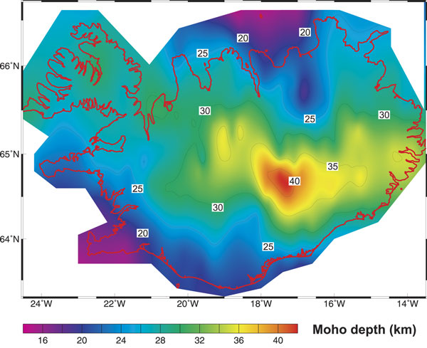

The thickness of the crust in Iceland. Copyright of this image belongs to its owner.

All pictures above are from this study into the Iceland mantle plume (they are trying to disprove it existence). Iceland & the North Atlantic Igneous Province

Here is a different map of Iceland volcanoes, fissure swarms and age of the lava fields.
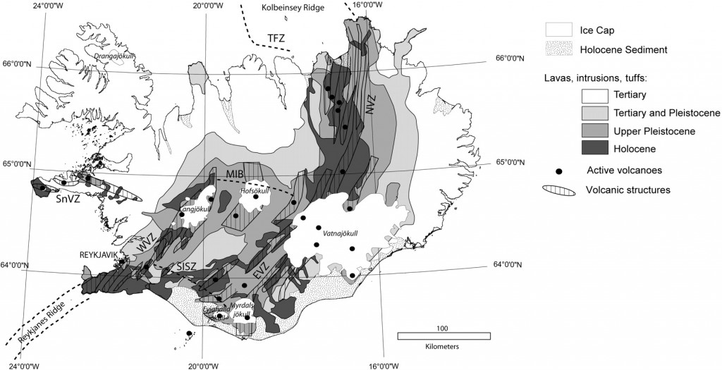

Iceland and its volcanoes. Copyright of this image belongs to its owner. This picture is from this web site here, Post-glacial rebound of Iceland during the Holocene Click on the picture to get full size.
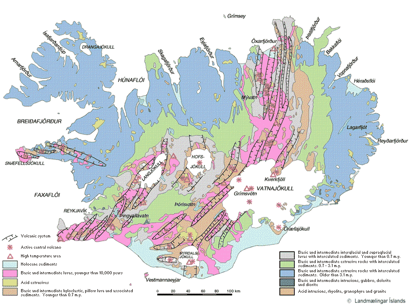

Similar map. But in colour. Copyright of this image belongs to its owner.

I hope that this clear few things up about Iceland and how it works and might work. Since we are still learning and there is a lot of things that we do not know about how Iceland actually functions. But me and professional geologists and scientists are doing there best to learn about how Iceland works.

If there is a claim about Iceland that just sounds crazy, it probably is crazy and not based in any actual fact about Iceland and the geology that makes up Iceland.
Extinct volcanoes in Hungathing Vestra county, Iceland

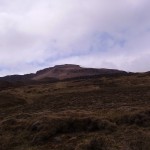
Here is an picture of how an ~5 million year old extinct volcano looks out. This pictures also show an old dike intrusion that might have gone up to the surface on that time. But I think it is hard to know that for sure, as erosion has changed the landscape a lot over the past 10 million years or so. So it hard to know for sure how deep this magma dike did actually form or if it was connected to an crater on the surface.


About 5 to 8 million years old dike intrusion into sedimentary rock that pre-dates this dike intrusion. I do not know by how much older the surrounding rock actually is. But it has small fossils in them.


The volcano that did create this old dike intrusion. The rocks in the area (old lavas) suggest that this was mostly basalt that did erupt from this volcano. But this volcano was on the old Snæfellsnes-Skagi Rift Zone.


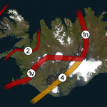
Rift Zones in Iceland. Picture is from Wikipedia. See original copy here along with copyright information. Please note that this picture is NOT completely correct in regards to the facts. But is good for basic illustration of the rift zones in Iceland. Note that this is picture is missing the Skagafjörður Rift Zone (failed rift zone).


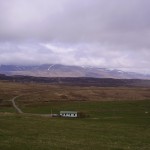
Picture of what can be seen of the Snæfellsnes-Skagi rift Zone. (I think it is the correct name for it). The mountain behind it is also an massive old volcano that was active at the same time as this rift zone. The houses there belong to my mon and dad (also on the picture below this one). They run an sheep farm.


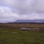
Picture of Snæfellsnes-Skagi rift Zone to the north. The same volcano as on picture above can also been seen on this picture. But what is not seen is the third volcano that is in this area (also extinct). But glacier activity did remove all major traces of that volcano long time ago.

I am going to post more pictures of this area during the summer. Even if it is just small part of Iceland, it has an lot of geological history to show. All of it is connected to volcanism and glacier activity over the past 8 million years (or about that) time. Too see full size of the pictures, just click on them.

General overview of Grímsvötn eruption on 23. May 2011 at 20:33 UTC

This is a general overview of Grímsvötn eruption on 23. May 2011 at 20:33 UTC.

Ash cloud: The ash cloud is still going strong. It is however a bit lower then in first few days. Measurements of the ash plume now says that it is between 5 to 9 km. Because of that it does not appear on the radar at IMO. The ash cloud has now been detected all over Iceland, except for the most western part of Iceland (Westfjod). In the areas closest to the main ash cloud the visibility is from 1 meter and up to 500 meters when it is at it’s best. Ash fall is expected to last for the next few days, or until the crater does not get any water into it to make the ash. The ash cloud is expected to reach Scotland tonight (Rúv, Icelandic). BBC News about cancelled flights due the ash cloud. Farmers live stock has started to die due to the ash cloud. It is unknown how the wild life is doing while the ash cloud covers part of south Iceland. Current output of the Grímsfjall volcano is about 1000 to 2000 tons of ash pr second. It was around 10,000 tons of ash pr second during the first days of the eruption.

Rúv News, Öskufall næstu daga (Icelandic, Rúv.is)

Eruption: Even if the ash cloud is lower now. It appears that the eruption is still going strong. In the evening news at Rúv it was reported that there was a chance the magma that powers this eruption might be from a great depth (more then 20 km). Tremor graphs that are online show and suggest that the eruption is still at full power. The reason why they are at lower noise level is most likely due to fewer explosion in the eruption, as less water is in the crater. When water no longer goes into the crater it turns into lava eruption. There is also an speculation that new fissures might open up in this eruption where there is more glacier cover (evening news on Rúv). But that would mean flash glacier flood and new ash cloud when the eruption would break the glacier covering it. But so far this has not happened and is nothing but a speculation. It would mean earthquake activity when the magma would break the crust, as happened when the eruption did start on 21. May 2011.

GPS data: According to report from IMO and University of Iceland the deflation now has been 50 cm to northwest and has subsided 25 cm. According to the report this about 60% larger then after the eruptions in the year 1998 and in the year 2004.

Web cameras: Grímsvötn Míla web cam is now up and running. It should be possible to see the eruption when an ash cloud is not in the way. But so far that has been the case.

Please note that information here might get outdated really fast and with no warning at all!

Updated at 20:42 UTC.

The magma below Upptyppingar tuff mountains

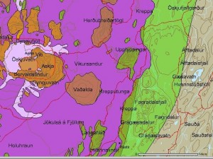
Upptyppingar are a tuff mountains in the east highlands in Iceland. There formation is contributed to a sub-glacier eruption in this area around 12.000 years ago. A second older sub-glacier eruption feature is also present in this area, it is called Álftadalsdyngja. It is believed that it did form around 700.000 years ago in a basalt eruption in this area. Upptyppingar and Álftadalsdyngja are both inside Kverkfjöll volcano fissure swarm.


Map of the area. Copyright of this picture belongs to how created it. Author unknown. Picture is from here.

In the year 2007 (Week 50) a earthquake swarms started to appear in Upptyppingar area. Earthquake activity in Upptyppingar area have continued since then. With total number of earthquakes in this area since the year 2007 is something over 6000 total. The reason why earthquakes are happening in this location is because magma is pushing up trough the crust in this area. This has been confirmed by GPS measurements since the year 2007.

It is my opinion that increased activity in Askja volcano might trigger a eruption in Upptyppingar area or in nearby area. As the risk of dike intrusion from Askja volcano into the Upptyppingar magma sill might trigger a large fissure type of event in this area. This is just speculation based on observed data. So please take note of that fact. The reason why I fear dike intrusion from Askja volcano is due to the changes that Upptyppingar magma has created in the nearby crust. But if this happens depends on how Askja volcano eruptions are going to behave in the future.

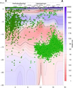
Here are some scientific data on Upptyppingar and the magma that has been collecting at 15 km depth below Upptyppingar mountains since the year 2007.

EARTHQUAKE SWARMS AT UPPTYPPINGAR, NORTH-EAST ICELAND: A SIGN OF MAGMA INTRUSION? (pdf, study)


Location of the earthquakes since the year 2007. Copyright of this picture belongs to Icelandic Met Office. Picture is from here.


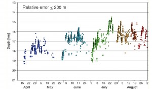
Depth of the earthquakes in the year 2007. As can be seen, the magma moved upwards with time. Copyright of this picture belongs to how created it. Author unknown. Picture is from here.


Estimated location of the magma below Upptyppingar mountain. This location is based on earthquakes and other measurements. Copyright of this picture belongs to how created it. Author unknown. Picture is from here.

What happens with Upptyppingar is now just a question of waiting and seeing. But there is also a good chance that this magma is never going to reach the surface in a eruption and is just going to cool down there and form a basalt dike that is going to be exposed in few million years when the weather and ice remove the rocks on top of it.

Interesting earthquakes 20 km WSW of Laki in Eldgjá volcano canyon (Katla volcano fissure system)

There are interesting earthquakes about 20 km WSW of Laki. The locations of the earthquakes suggests strongly that they belong to Katla volcano fissure system. Last eruption in this area took place around the year 934. When the Eldgjá volcano canyon was formed. That eruption did destroy a older volcano canyon located in this same area (lava flows volcano ash did fill up that canyon far as I know).

The earthquakes that have been taking place in this area are small. The largest so far has the automatic size of ML1.2, but only ~4 earthquakes have been recorded so far. But what is most interesting about this earthquakes is the depth. The earthquakes that has the best automatic detection by the SIL system has the depth of 0.7 km. But that makes the depth of ~700 meters and that is a shallow earthquake. Given that this area has only fissures and no activate volcanoes. It is not unheard of in Iceland that a fissure eruption to start with no warning at all. Last time this did happen was in Gjálp eruption in the year 1996. Before that a dike intrusion into the bedrock did manage to get to the surface in Askja eruption in the year 1878, when a 25 km long volcano fissure did open up (small compared to Eldgjá eruption around the year 920).

I do not know what is going on in this area at the moment. As the activity so far has been too small to make any clear picture of it. But Katla volcano is a big volcano and it is not out of volcano league to make a new fissure eruption instead of the regular caldera eruptions under the glacier as Icelanders have gotten used to over the past 1000 years or so. Last time this did happen there are suggestions that there was a also a eruption at the same time in Katla volcano caldera. But that this has only been revealed during research over the past 50 years or so in this area.

I have also noted that there is a small increase in earthquakes inside Katla volcano caldera, not far from Austmannsbunga. But at this moment it is too early too know what it means for sure. There is no eruption is imminent in Katla volcano when this is written. Just too be clear on that fact.

Update on the crack in Þingvellir (Thingvellir), Almannagjá fissure

Tonight Rúv did have a news about the fissure that did open up in Þingvellir (Thingvellir) few weeks ago. Now scientists have started to explore this new fissure. So far they have measured that it is about 10 meters deep. It is still unclear how long it is. The current theory is that this new fissure started to open up after the Mw6.8 and Mw6.7 earthquakes in SISZ in the year 2000, or the Mw6.3 earthquake in the year 2008. But that is however unclear at this time.

What appears also to have happened is that ground water have cleaned out loose material in this new fissure. This might possibly have deepened the fissure. But this aspect of this new fissure is still a bit unclear one. But what is the most amazing thing is that the road has not started to collapse earlier then it did. Due how big this new fissure appears to be.

News on Rúv about this. Use Google translate at own risk, as Google does not know what Icelanders are saying.

Furðulegt að ekki hafi hrunið fyrr (Icelandic, video (Windows Media Video), picture, Rúv.is)