This information is going to get outdated soon. Since the situation is changing quickly.
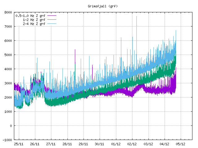
It is possible that a new eruption is about to start in Fagradalsfjall mountain in Krýsuvík-Trölladyngja volcano. This earthquake activity started around 17:00 UTC on 21-December-2021 and has been growing since then. At the writing of this article the largest earthquake had a magnitude of Mw3,3. Over 150 earthquakes have been recorded at the writing of this article. This earthquake activity doesn’t seems to be slowing down.
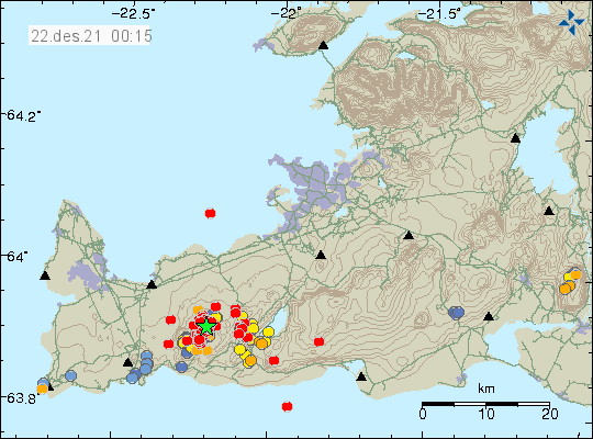
The situation is changing quickly. As of writing this article a new eruption has not yet started but that might only be question of hours until an eruption starts. This might happen during the night or sometimes tomorrow during the day. There is not any way to know that for sure at the writing of this article.
I’ll post update late tomorrow if this changes and a eruption starts. Since I’ll be busy during the day the late article can’t be helped.