What to expect from Bárðarbunga volcano

I am writing this now, since I might not have time to do so on Monday. Updates are going to continue to go here until Monday. Unless something major happens.

The collapse of Bárðarbunga volcano

The collapse of Bárðarbunga volcano has already started. The caldera collapse in Bárðarbunga volcano started on 16-August-2014 and has been going on since then. Here is what I am expecting from the caldera collapse once it reaches its peak.

  • There are going to be earthquakes in the range of 5,5 and up to 6,7. Maybe larger if the crust can handle it.
  • Glacier flood are going to go south-west and north (Húsavík area) and possibly in other directions. I am expecting damage to hydrothermal plants in the pathway of the floods. How much damage there is going to be depends on the magnitude of the flood and the path it takes.
  • I am expecting long periods of no power in parts of Iceland once the flood has passed. I am also expecting lack of communications in large areas of Iceland. This is why Rúv has been telling people to get long-wave radios for the past few days. Usage of mobile network is also going to be unreliable in large parts of Iceland once the collapse starts full force in Bárðarbunga volcano. Due to damage that glacier floods are going to create.
  • I am expecting an ash cloud that might go up to 20 km or higher up in the atmosphere. It is however impossible to know for sure what happens until this starts.
  • It is difficult to know fore sure how much drop is going to take place, but it can be up to many hundreds of meters.
  • I fear that north slope of Bárðarbunga might collapse forward once this starts. Earthquakes in the area give clues about weakness forming there.

Bárðarbunga volcano is 2009 meters high above the ocean. This means there is a lot of material that is going to blow outwards once the collapse starts full force. This is might be one of largest eruptions in Iceland since it got populated more than one thousands years ago. I am hoping that the picture that I am drawing up is not as bad the reality once this starts. I am also hoping that no loss of life is going to happen. I am hoping for the best in this case, but the clues that I am getting are no good at all.

Eruption update at 15:24 UTC

This is a short update on the eruption north of Vatnajökull glacier. The eruption has its origin in Bárðarbunga volcano. This information is going to get outdated quickly.

  • North end of the eruption fissure is in an area were no eruption has happened before (at least known eruption).
  • The eruption started around 03:00 – 04:45 UTC.
  • The eruption now is about large as largest eruptions in Krafla volcano during its eruption period according to the news.
  • Largest earthquake today was magnitude 5,1 that took place in North-east Bárðarbunga caldera. There is now an high risk of eruption in the Bárðarbungu volcano caldera.
  • There is a crazy storm in the area. Limiting viability at the moment. Wind is goes up to 25 to 30 m/s and wind gusts are even stronger.
  • The eruption fissure is now around 2 km long. It is on the glacier free area. The eruption fissure is the same one that erupted on 29-August-2014.
  • There is a high risk of new fissures opening up without warning in this area and under the glacier.
  • There are currently no signs of the eruption stopping at the moment.
  • The lava is now covering around 3 to 5 square km of area. This is just a desert area and nothing is at risk. It is running over the lava field that was created in the eruption of 1797.
  • There is currently no risk of any volcano ash. Since this is Hawaiian (Wikipedia link) type of eruption that is now taking place.

The eruption can be viewed on Míla web cam here (Bárðarbunga) and here (Bárðarbunga 2). Extremely bad weather is limiting visibility at times down to nothing. Weather is expected to clear up in few hours at the earliest.

Updates (as they come in)

  • There is now more power in the eruption. Reported by Rúv in last few minutes.
  • Lava fountains have been reported to up 70 meters high.
  • There is nothing indicating that the eruption is about to end.
  • North part of the fissure seems to have extended. There also seems to be less activity for the moment on the south end. That might change without warning.

Article updated at 15:25 UTC.
Article updated at 15:33 UTC.
Article updated at 19:41 UTC.
Article updated at 19:43 UTC.

Deep earthquake in Eyjafjallajökull volcano

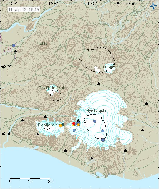
On 11.09.2012 at 10:24 UTC there was an deep earthquake in Eyjafjallajökull volcano. The magnitude of this earthquake was 0.8. It had the depth of 14.9 km. But that is among the deepest that happens in Eyjafjallajökull volcano. But before and during the eruption of Eyjafjallajökull volcano in the year 2010 the most depth of earthquake detected at that time was around 30 km.


The earthquake in Eyjafjallajökull volcano. Copyright of this image belongs to Icelandic Meteorological Office.

I do not expect this earthquake to mean anything. This is just single earthquake that now happen from time to time in Eyjafjallajökull volcano. But after the eruption in the year 2010 there has almost been no earthquake activity in Eyjafjallajökull volcano.

Volcano ash from Eyjafjallajökull volcano

Even if there are now two years since the eruption in Eyjafjallajökull volcano the local area continues to have problems with volcano ash from it. In certain wind direction the volcano ash is blown up and carried out to the sea. This wind direction is mostly when wind is blowing from north and does not carry any snow or rain with it. So today and maybe in next few days. The local people that live in the area around Eyjafjallajökull volcano to live in ash cloud from the eruption two years ago.

I did try to find an MODIS picture of this volcano ash storm. But I did not have any luck doing so.

Icelandic news about this wind blown ash

„Stödd í öskubakkanum“ (DV.is)

More fine ash in the volcano ash cloud from Eyjafjallajökull volcano eruption then predicted (2010)

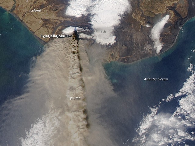
Rúv News had an interesting news bit about Eyjafjallajökull volcano this evening. It was about the eruption that took place in the year 2010. While Europe did not get a lot of volcano ash as expected. The amount of fine volcano ash in the air during this period was more then expected. A lot more according to a research into the ash cloud that happened in April 2010. This volcano ash is an danger to air planes and jet engines.


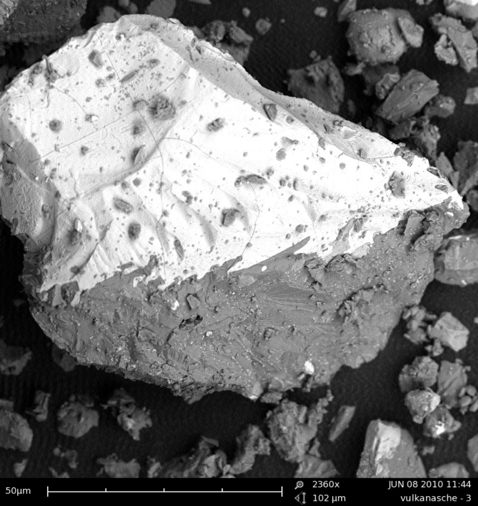
The volcano ash in question. Copyright of image belongs to Birgit Hartinger. Image used with permission.

The amount of fine volcano ash was underestimated by observing satellites. As they did not see this volcano ash clearly or just not at all according to the news about this study. The amount of fine volcano ash in the air at the time was about ten times more then current model predicted during the eruption. This study did use data from 400 observing areas. The study it self is published in Scientific Report. I have not located this study as of yet.


The ash cloud from Eyjafjallajökull volcano in the year 2010. Public domain picture by NASA/NOAA. (I think. Correction are welcomed.)

I am not sure what this means in terms of the flight ban that was in the effect when the eruption took place. But one thing is sure. The areas that where considered free of volcano ash simply might not have been that in reality.

Icelandic news about this

Lítið af gosefnum til Evrópu (Rúv.is, Icelandic)

General update for Katla volcano and El Hierro voclano

This is a general update for Katla volcano and El Hierro volcano.

Katla volcano, Iceland

During the weekend there was a minor dike intrusion into Katla volcano caldera. The largest earthquake in this earthquake swarm was a ML2.1 with the depth of 1.4km. This is among the smallest earthquake swarms in Katla volcano since activity started to increase after the small eruption in July 2011. The reason for this earthquake swarms in Katla volcano are dike intrusions (wiki). Sometimes following this are small glacier floods from Mýrdalsjökull glacier that is on top of the caldera. But that does not seems to have this time around, or the last time there was a dike intrusion in Katla volcano (few weeks ago).
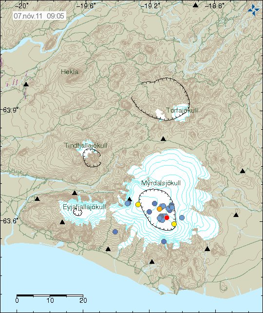

The earthquake activity in Katla volcano during the weekend. Copyright of this picture belongs to Icelandic Met Office.

El Hierro volcano, Canary Islands, Spain

The eruption in El Hierro volcano continues as it has been doing for the past four weeks (almost). But the chance of a new island forming has grown somewhat in the past few days. The main reason for that is that eruption did gain some strength during the past two weeks. The increased strength in the eruption was due to a new injection of magma into El Hierro volcano. Both at the main magma sill and what seems to be a new magma intrusion into El Hierro at depth. That magma has so far not been able to reach the surface and remains at the depth of 20 km or so. But there also seems to be some dike intrusion activity been taking place in the same area, as more magma is injected under El Hierro volcano North West of the town of Frontera (IGN name information).

For that reason the risk of new eruption vents open up in this area is high in my opinion and is going to remain that during this eruption. But it remains to be seen if a new eruptions vents open up in this area. But that depends on the amount of magma that is currently injecting into El Hierro volcano at depth. It is impossible to know for how long new magma is going to get supplied into El Hierro volcano. But so far this process has been ongoing since July, so that is already five months (or about that) that new magma has been flowing into El Hierro volcano.

The formation of new Island off the coast of El Hierro Island is now a real chance. As the erupting vent has build up close enough to the surface of the water to start the Surtsey Island process. That process in it self is going to take few weeks to complete, at least until the crater no longer gets water into it. When the water can no longer into the crater the eruptions turns to lava fountain eruption. A Hawaiian style of eruption to be exact. That progress is going to remain to the end of eruption. But this is only going to happen if the eruption lasts long enough to build a small Island off the coast of El Hierro Island. So far that remains unseen. However the chance for this to happen is good in my view.

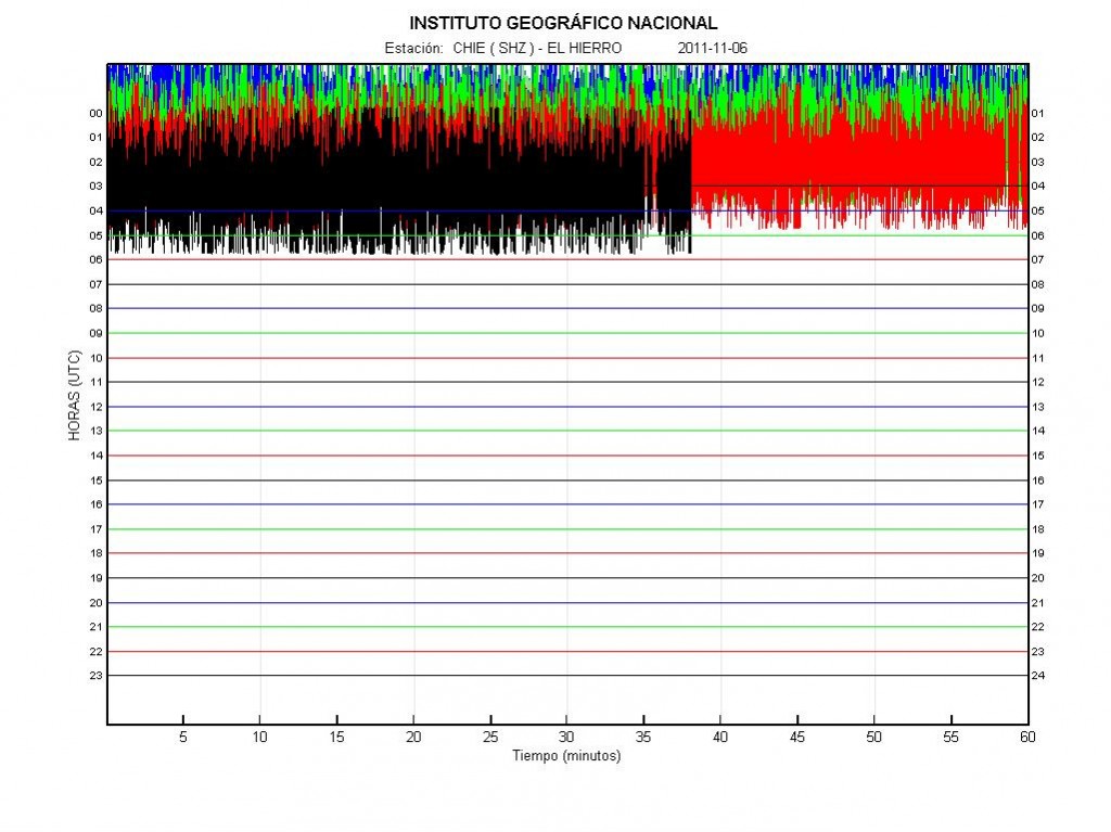
There is also worth noticing that this eruption is a bit variable in eruption strength. This can clearly be seen on the harmonic tremor plots that can be viewed online from El Hierro volcano. This is normal, as the flow of magma from inside El Hierro volcano is not stable and can change suddenly. The risk of new fissures to open up without warning remains high in the area around the current eruption vent is also high. The new fissure have the risk of opening up without any earthquakes and warning. To some extent this has already happened during this eruption. But I am not sure the new eruption vents did stay erupting for a long time. This is however most likely to repeat it self regularly during this eruption.
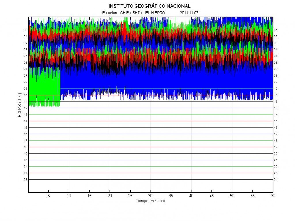

The harmonic tremor in El Hierro volcano on 7 November, 2011 at 09:32 UTC. Copyright of this picture belongs to Instituto Geográfico Nacional.

Off topic: Small apology

Here is a small apology to my readers. I have been a little bit under the weather in past few weeks. There are many reasons for this. But the biggest one is that my plan to live in Denmark failed this summer. But the chance of me moving back to Denmark has lifted my mood again. But I also found that playing computer games helps me dealing with my current status a bit. Because of this under the weather issue. My blog post have not been that good in my view. For that I want to apology. I can’t promise that this won’t happen again while I am living in Iceland. It is also a factor that the darkest time of the year never goes well with me (Mid October to early March).

El Hierro volcano enters Surtsey eruption phase

This is a short blog post about latest events.
***

Earlier tonight a Surtey eruption started in El Hierro volcano. Before this phase did start there has been increased harmonic tremor on seismometers that are located on El Hierro Island. Volcano ash is to be expected while water can still get into the crater. When the water does no longer get into the crater it is going to stop making volcano ash. The ash plume can go up to 3 to 10 km high, depending on the strength of the eruption. New vents have also been opening up south of town of La Restinga. That means the fissure is still growing, at least that was the case yesterday and earlier today from what I can gather. I am unsure of that has continued or stopped.

Earthquake activity still high north west of the town of Frontera. This suggests that fissure might open up there. But so far that has not happened. I do not think this are earthquakes due to tectonic stress changes due to the eruptions in south El Hierro volcano. But this stress changes are because of the magma injections at depth in El Hierro volcano.


Harmonic tremor from the eruption in El Hierr volcano. It now shows clear signs of explosions (strong ones) and increased eruption activity. Copyright of this picture belongs to Instituto Geográfico Nacional.

If new vents open up closer to the shore there is going to be instant Surtsey eruption activity. But that might only last for a short while the water gets into the crater. There the lava stage is reached much sooner then on the vents that are erupting on more depth at the moment.

I am going to post more updates on this. If I can get more details on what is going on.

Sources:

Renewed Eruptions at El Hierro in the Canary Islands (Eruption blogs)

I also want to thanks reader how email me about the current status of what is going on in El Hierro volcano. My Spanish is weak at the moment.

New pictures of Eyjafjallajökull Gígujökull glacier lava field

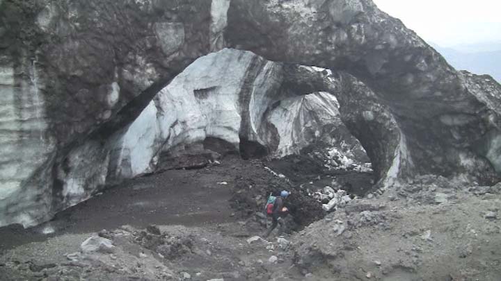
Rúv News has just published new pictures of Eyjafjallajökull volcano. The pictures are from Fimmvörðuháls lava field and the lava field that is in Gígujökull glacier. But in that area a lava flow did take place during the eruption. That lava field has not been explored before. According to the news, a moss has already started to grow on the new lava on Fimmvörðuháls. The Gígjökull glacier has already started to cover the lava field that did melt it during the eruption of 2010 in Eyjafjallajökull volcano.


From Gígjökull glacier. Picture from Rúv News. Copyright holder of this picture is Rúv.

The news of this can be found here. This is in Icelandic.

News from Rúv.

Undraveröld í Gígjökli (Rúv.is, Icelandic, Picture, Video)

Eruption in Grímsfjall volcano is over

According to the news at mbl.is the eruption in Grímsfjall volcano did end at 07:00 UTC on the 28. May 2011. But that was when the last harmonic tremor was seen on Icelandic Met Office SIL stations.

There is an lot of volcano as in the area around Grímsfjall volcano. That means it is going to blow easy with the wind in the dry summer.

According to GPS data from Icelandic Met Office. It seems that inflation has started at Grímsfjall volcano again. But it can be assumed that it is going to take several years until next eruption. But if that is going happen we just have too see.

Morgunblaðið news about the end of the eruption.

Goslokin sett klukkan 7 á laugardag (mbl.is, Icelandic)
Grímsvatnagosinu lokið (mbl.is, Icelandic)
Gosinu lokið (Rúv.is, Icelandic)

Eruption in Grímsvötn appears to be over (hopefully correct this time around)

It appears that the eruption in Grímsvötn / Grímsfjall volcano is over or is about to end, but authorities in Iceland might not declare the eruption over until after next weekend. No ash plume has been observed for over 24 hours now from Grímsfjall volcano. Harmonic tremor pulses are still taking place in Grímsfjall volcano and it is still dangerous to get close to the eruption site. As explosion still take place in the eruption area and that makes going there dangerous. It is not only the area where the water is that is having explosions. There are also gas and explosions taking place in the crater rims and nearby area. According to news today Icelandic Met Office did stop recoding the eruption in Grímsfjall volcano around 07:00 UTC this morning (28. May 2011). But harmonic tremor pluses might still be taking place in Grímsfjall volcano. But the SIL stations around Grímsfjall volcano have now started to record background noise again, including the SIL station at Grímsfjall volcano.

Earthquake activity has continued at similar levels as before the eruption took place. I am not sure why that is. But this might indicate that Grímsfjall volcano has already started to prepare it’s next eruption. But when that might happen is a question that only time is going to answer. The main earthquake activity is currently taking place NW of Grímsfjall volcano, and SW of Grímsfjall volcano.

According to automatic GPS data it appears that Grímsfjall volcano has started to inflate again. This inflation appears to be rather rapid at current moment. But it appears to be close to 1mm/day inflation to the south and east. This means that new magma has already started to flow into Grímsfjall volcano magma chamber and magma system from greater depth. So far Grímsfjall volcano has not started to inflate upwards and it might be an while until that happens, as there might be enough space for the magma to move into inside Grímsfjall volcano.

Measurements of the volcano tephra that did fall, along with measurement of the volcano ash that did fall have recorded the depth up to 170 cm in some areas of Vatnajökull glacier even at distance of 8 km from the eruption site. This is going to create problem in the summer when it is dry and the wind blows this volcano ash around Iceland. But mostly in the areas that where closest to the main ash fall areas.

Update 1: According to news on Vísir.is the Icelandic Coast Guard did see an plume with the hight of 1,5 km yesterday. This plume was however mostly made out of steam rather then volcano ash. The news about this can be found here, along with an picture of the plume. Here is an second news of this steam plume that was seen yesterday.

Update 2: According to news on Rúv there is small harmonic tremor being recorded. But most of the time, no harmonic tremors are being detected from Grímsfjall volcano. The Rúv news can be found here (Icelandic, Picture). It also has an new picture of the eruption crater. But this picture was taken around 10:00 UTC today (28. May 2011).

Icelandic News about this. Use Google translate on this for an risky translation.

Eldgosið mælist ekki lengur á jarðskjálftamælum (Vísir.is, Icelandic)
Enginn gosmökkur í dag (From 27. May 2011, Rúv.is, Icelandic)

Blog post updated at 19:11 UTC.
Blog post updated at 20:15 UTC.

Explosions are still taking place in Grímsvötn crater

While the activity has almost stopped in Grímsfjall volcano, but there are still explosions taking place in Grímsvötn lake where the eruption took place due to magma going up, explosions take place all over the fissure at random times. That makes travelling to this area really dangerous thing to do. Ash fall is still taking place in Grímsfjall volcano when explosions take place. But the ash fall is limited to the local area in Grímsfjall volcano. Because of this, the official word is that the eruption is not yet over. Even if it just an small eruption at the moment. So far there is no data that suggests that new magma is currently flowing into Grímsfjall volcano. This is according to news in Icelandic media.

An new caldera (correct word?) has formed in the glacier close to the eruption site. But that suggests that a lot of heat is below in the glacier and is creating strong melt where this taking place. This is according to news on Rúv. But they don’t say where this glacier melt is taking place. But it can be assumed that this formation is somewhere close to the current eruption site. But when I know more about this location. I am going to update this post when I can.

Harmonic tremors pulses are still being detected from Grímsfjall volcano up to 200 km away from the volcano. Why they are still taking place while there is no eruption taking place is unknown to me. It is important to notice that currently the harmonic tremor is slowly dropping for now. But it might increase again without any warning. For now there is no way to know what this tremor means for Grímsfjall volcano.

Automatic GPS data from Icelandic Met Office tells an interesting story. According to this data (it might not be 100% accurate due to nature of GPS) Grímsfjall volcano has moved close to 320mm to the west, close to 350mm to the north, it has also lowered down about 250mm. This is major movement in Grímfjall volcano. To compare it with something, Eyjafjallajökull volcano only inflated about 60mm before it did erupt. This is many times more deflation that took place in Grímsfjall volcano then in Eyjafjallajökull volcano for example.

Earthquakes are still taking place SE and SSE of Grímsfjall volcano. There is no volcano at this location. So I am assuming that this are tectonic earthquakes taking place due to stress changes in the crust around Grímsfjall volcano. All earthquakes so far have been small but with the depth from 15 and up to 5 km.

Extra: According to new news (while I was writing this blog post). The Civil Emergency Authority in Iceland has lowered the alert level from danger level to alert level. News about that can be read here (Icelandic, mbl.is)

Icelandic News about this. Google Translate in an maze. It might work or maybe not.

Enn sprengivirkni í Grímsvötnum (Rúv.is, Icelandic)
Jarðeðlisfræðingur: Orðum ofaukið að gosinu sé lokið (Vísir.is, Icelandic)