Earthquake swarm in Bárðarbunga volcano

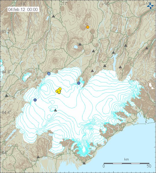
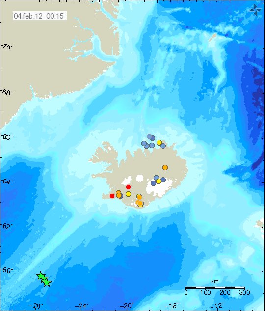
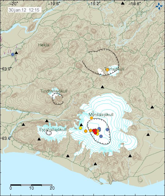
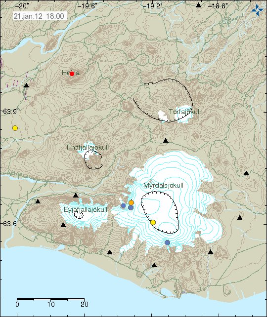
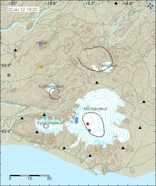
During the night there was an small earthquake swarm in Bárðarbunga volcano. The largest earthquake in this earthquake swarm was ML3.04 in magnitude. It had the depth of 8.5 km. This might have been a n dike intrusion. But it is hard to know that for sure at the moment. This earthquake swarm only lasted for an about 2 to 3 hours before it stopped.


The location of the earthquake swarm in Bárðarbunga volcano. Copyright of this picture belongs to Iceland Meteorological Office.


The earthquake swarm also did appear clearly on the tremor plots on the SIL stations that are close to Bárðarbunga volcano. The second set of spikes there are from Hamarinn volcano. Copyright of this picture belongs to Iceland Meteorological Office.


This earthquake swarm was also seen on Grímsfjall volcano SIL station. The rise in harmonic tremor is due to a storm that is passing over Iceland at the moment (going to go over Iceland today). Copyright of this picture belongs to Iceland Meteorological Office.

Hamarinn volcano

Following the earthquake swarm in Bárðarbunga volcano an earthquake swarm did start in Hamarinn volcano. This earthquake swarm is so far small and the largest earthquake so far is an ML1.9 in magnitude. But Hamarinn volcano had an minor eruption in July 2011. That minor eruption created an glacier flood that was larger then the flood that did come from Mýrdalsjökull glacier the week earlier. Activity after that has however been little and few earthquakes have taken place. It is impossible to know if there is going to be any more eruptions in Hamarinn volcano. But it cannot be ruled out given current activity in it.

Year in review on Rúv News

Rúv News has put up an page with major events in Iceland during the year 2011.

Grímsfjall volcano eruption in May 2011 can be viewed here.
The glacier flood from Mýrdalsjökull glacier due to the small eruption in Katla volcano can be found here. Sadly there is no mention of glacier flood from Hamarinn volcano yet.

This video should be available outside Iceland. If it is not. Please let me know I can send an complain email to Rúv News about it.

The dormant volcanoes in Iceland

While all the active volcanoes in Iceland get all the press and coverage. There are volcanoes in Iceland that are not so active and have remain dormant for thousands of years now and currently do not show any signs of activity. Some have some hot spring activity. But that is about it for them. The following volcanoes in Iceland have not erupted in historical times. Some have not even erupted in past 12.000 years best to my knowledge. But as history has proved in other parts of the world. An dormant volcano can start to erupt when it feels like it and without any warning at all in some cases.

This is based on Global Volcanism Program data. So it might be subject to errors and updates.

Volcano

Hrómundartindur – Last eruption is unknown. This volcano is an stratovolcano.

Grensdalur – Last eruption was in Pleistocene and its current status is Pleistocene-Fumarolic. This volcano is an stratovolcano.

Grímsnes – Last eruption is believed to have taken place around 3500 BC. But this volcano is marked as tephrochronology. This volcano makes crater rows when it erupts.
Geysir – This volcano last erupted in Pleistocene and is marked as Pleistocene-Geysers. This is an stratovolcano.

Hveravellir – This volcano last erupted around the year 950 AD. It is currently marked as radiocarbon. This is an subglacial volcano.

Hofsjökull – This volcano has erupted sometimes in the last 12.000 years. It has the marking holocene. This is an subglacial volcano. The second volcano in this system is not marked in GVP database. But that volcano is named Kerlingarfjöll. I do not know when it last erupted. There is also an embeeded second volcano in Hofsjökull volcano that is Independent from the main Hofsjökull volcano (yes, this is the case it seems). I do not have any idea when that did last erupt.

Esjufjöll – This is an sub-glacier volcano in Vatnajökull glacier. Its last eruption is uncertain. But is believed to taken place in the year 1927. From the year 2000 this volcano has been showing signs of increased activity. This volcano is an stratovolcano.

Fremrinamur – This volcano is last believed to have erupted in the year 1200 BC. This volcano is an stratovolcano.

Þeystareykjabunga – This volcano last erupted around the year 900 BC. This volcano is an shield volcano.

Snæfellsjökull – This volcano last erupted around 200 AD. It is currently marked as radiocarbon. This is an stratovolcano.

Helgrindur (also known as Lysuhóll) – This volcano has no record of eruption. But it is thought that it erupted sometimes in the past 12.000 years. But exact time is not known. This volcano makes pyroclastic cones. This volcano is the smallest volcano system in Iceland.

Tindafjallajökull – It is unknown if this volcano has erupted during holocene. But the GVP information say that dozen of small eruptions took place in early holocene. This is an stratovolcano.

Snæfell – This volcano is located east of Vatnajökull glacier and south of Kverkfjöll volcano. It was once believed that this volcano was extinct. But new research into it has changed that opinion. This is most likely an stratovolcano. But I do not have it confirmed. This volcano has at least not erupted for several thousands years or more. Currently there are no information about this volcano in the Global Volcanism Program database.

Skrokkalda – This volcano is dormant. But I do not know if it has erupted in historical times or not, but I do no think that is the case. I am also not sure what type of volcano it is.

There are few more volcanoes missing due the fact that they are not in the Global Volcanism Program database. But I have them on a map that I own. So they are going to be added later when I update this blog post.

Harmonic tremor continues to drop in El Hierro volcano

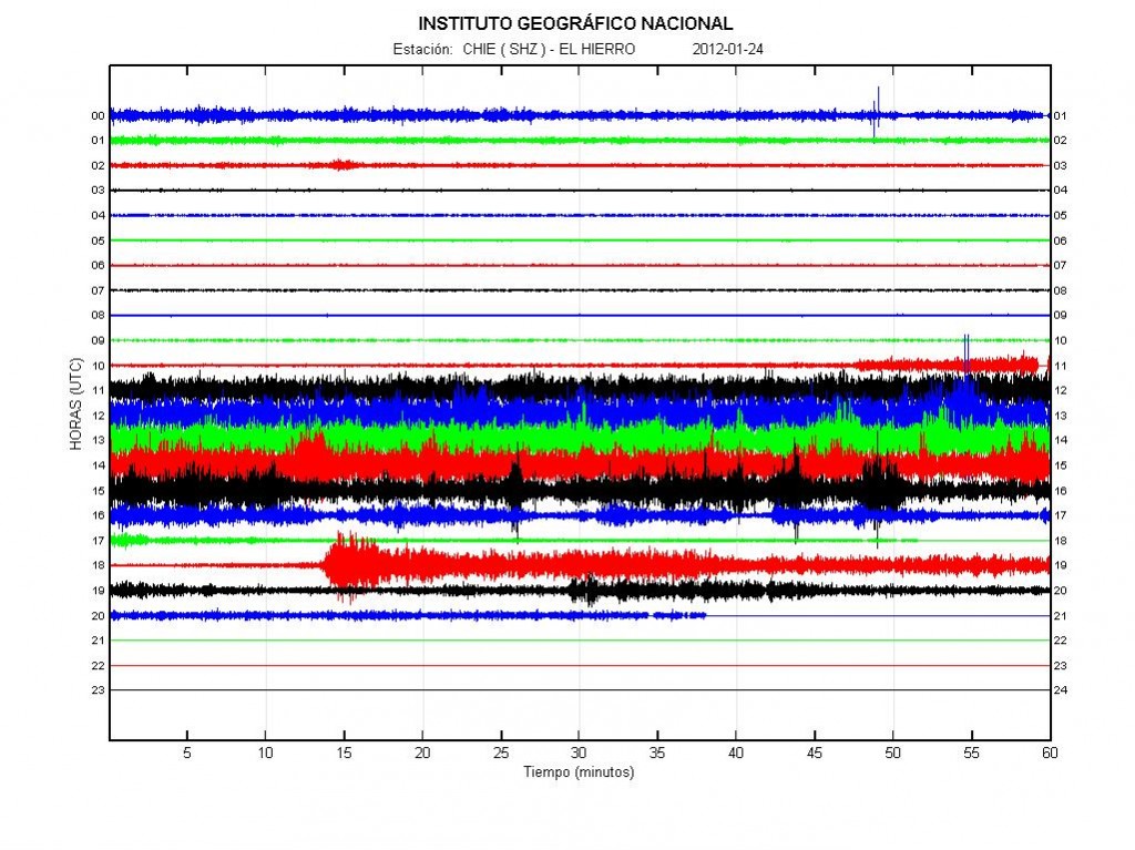
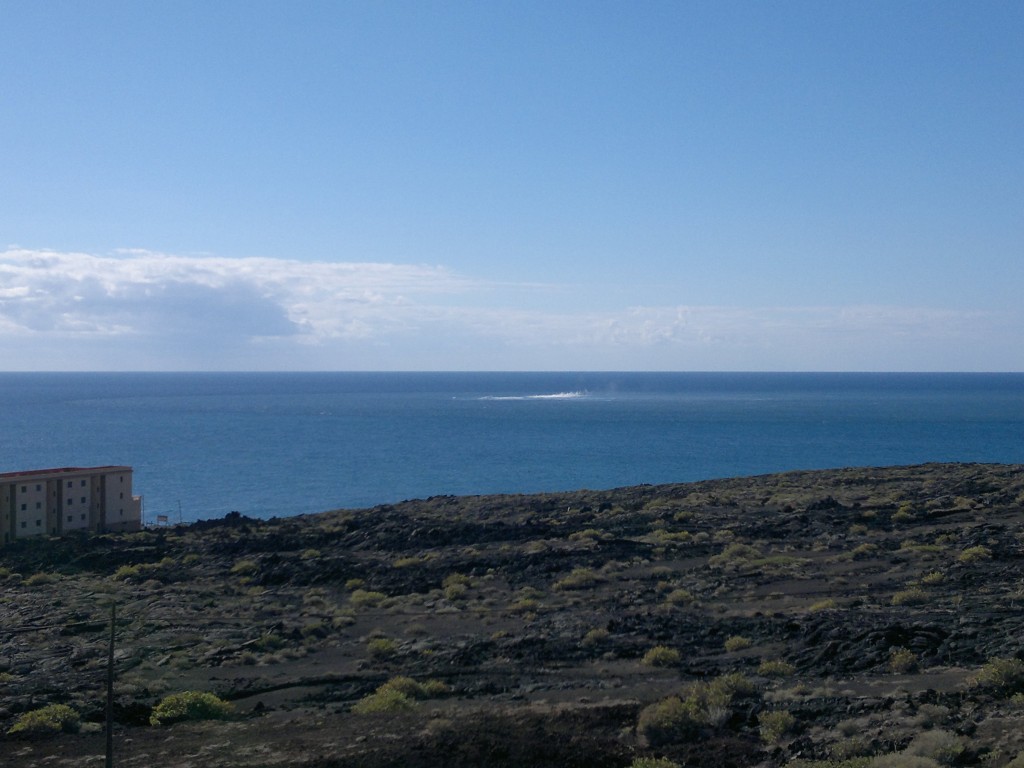
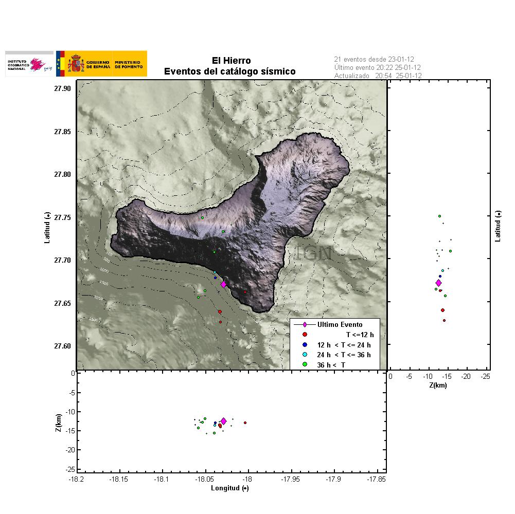
It seems that currently the eruption in El Hierro volcano is coming to an end. I do not know if this is an permanent end to the current eruption or just an short break in it. The reports that I have seen so far suggest that the main crater out of the coast of La Restinga has stopped erupting. The current harmonic tremor however suggests that an eruption is still taking place somewhere. But I have no idea where that might be at current time, and so far no clues where that might be. But the lack of earthquakes north of El Hierro Island suggests that an eruption might be taking place there. But that is just speculation.


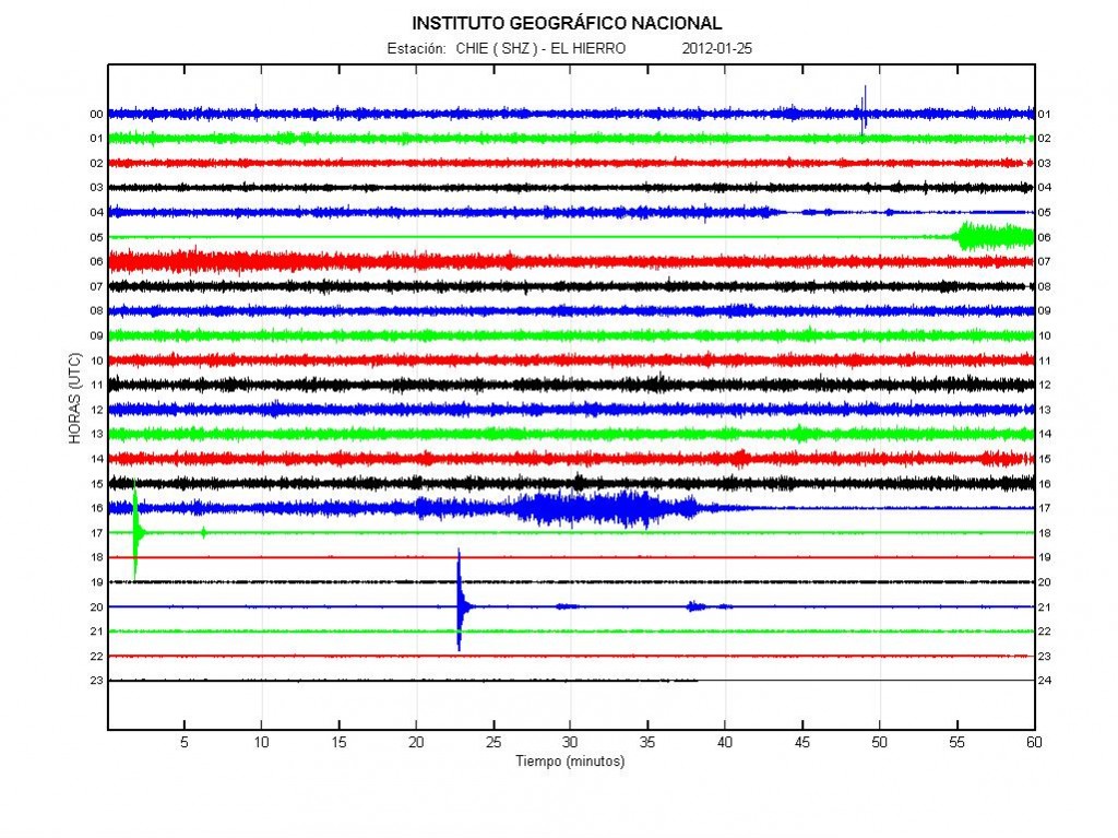
The harmonic tremor in El Hierro volcano at 20:36 UTC. Copyright of this picture belongs to IGN (Instituto Geográfico Nacional).
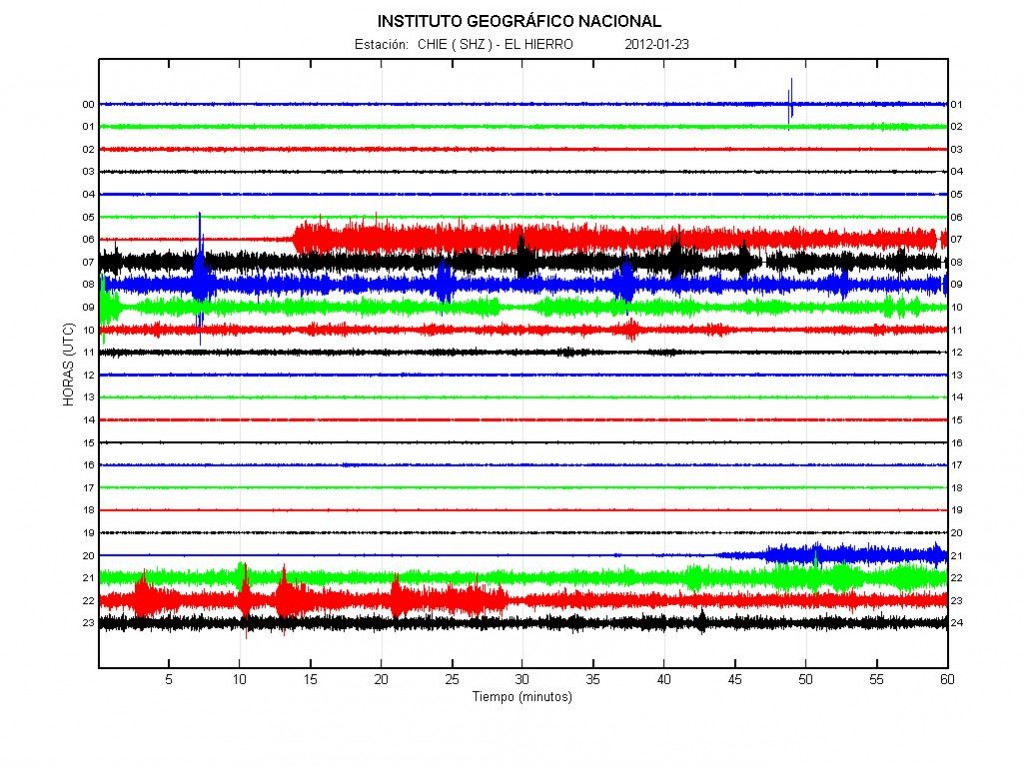
Other then this. There is not that much to report from the eruption in El Hierro volcano, or what is left of it at current time. If there are any major changes. I am going to report them soon as I can. But at current time. It does not look like there is isn’t a lot needed to be reported on the eruption in El Hierro volcano.

More man made earthquakes in Hengill volcano

Since 04:49 UTC this morning (17 December, 2011) there has been an earthquake swarm in Hengill volcano. This earthquake swarm is due to hydro-thermal power production that is currently taking place in this area. But the Orkuveita Reykjavíkur (OR) is obligated to pump down cold water into the bedrock at depth that is greater then 800 meters. This water is used hot water that they pump up from the ground to warm houses and make electricity.


The earthquake swarm at 12:45 UTC on 17 December, 2011. Copyright of this picture belongs to Iceland Met Office.


The evolution of the earthquake swarm since it did start. Copyright of this picture belongs to Iceland Met Office.


The earthquake swarm as it did appear on my geophone at Heklubyggð. But the geophone at Eyrarbakki is scheduled to be up and running in next week. This picture is released under Creative Commons licence. See top bar for more information under CC Licence.

The earthquake swarm in Hengill volcano is currently ongoing. So far the largest earthquakes have had the size ML2.1 according to the automatic SIL system. Due the high number of earthquakes, the earthquakes have been wrongly placed on the map of Iceland that Iceland Met Office has. This are not real earthquakes in most cases, just wrongly located earthquakes that are taking place in Hengill volcano. The earthquake swarm is currently ongoing. If there are any major changes to this earthquake swarm. I am going to update this blog post with information about it.

Earthquake activity continues in Katla volcano

Even if it is December and Mýrdalsjökull glacier has added around 6 meters of snow on top of it self. It seems that the earthquake activity in Katla volcano is rather strong, even if it winter already in Iceland.


Earthquake activity in Katla volcano past 48 hours. Some of this earthquakes might be frost-quakes due the freezing weather in Iceland for the past few days. Copyright of this picture belongs to Iceland Met Office.

The earthquake activity in Katla volcano is resistant in the Katla volcano caldera and has been that for several weeks already. I cannot interpreted this earthquake activity other then Katla volcano is preparing for an eruption. But when I am not sure at this moment. There is an pattern of earthquakes in Katla volcano caldera, this pattern has been in place since Week 27, but that is the week when the minor eruption took place in Katla volcano caldera last summer (summer 2011).

It is clear that this earthquake activity in Katla volcano is going to continue. I am assuming that this earthquake activity is going to continue until a eruption takes place in Katla volcano. But there is also the chance of the year 1999 event. When a small eruption took also place and earthquake activity remained high for several weeks after that. But after some time the earthquake activity started to drop. For the moment I find that to be unlikely outcome given how long the earthquake activity has remained high in Katla volcano after the minor eruption this summer.

Donations: I am going to try and setup the geophones in Eyrarbakki village and the geophone close to Katla volcano in December. But that trip is going to cost me some money (I pay for the car benzine), but the cost might go as high €157, 1169 DKK, $210, 25.000 ISK (current exchange rates) just for gas (on an car) for that trip. So if anyone can help with this cost it would be welcomed. Thanks for the support! 🙂

Update 1: I am most likely going with the bus. But that also costs some money, around 3900 ISK, 182 DKK, 24€. $32, 20GBP (Current exchange rates).

Blog post updated at 13:12 UTC on 12 December, 2011.

Earthquake activity in Katla volcano

Even if there is December and Katla volcano is supposed to have less earthquake activity during this time of year. It seems to be that currently that is not the case. But the earthquake activity is less then it was this summer after the minor eruption in July 2011. No major earthquake swarm has been taking place in Katla volcano for the past few weeks. But there is a lot of earthquakes taking place, without it being a earthquake swarm at one single location inside Katla volcano.


Current earthquake activity in Katla volcano. Copyright of this image belongs to Iceland Met Office.

Many people might ask if this earthquake activity is something to worry about. The answer is no. Katla volcano is unlikely to start an eruption in December. But if this pattern of earthquake activity it is clear that Katla volcano is going to erupt sooner rather then later. But the question after the mini-eruption last summer (July 2011), if there are going to be around 10 years until next eruption takes place in Katla volcano. For the moment nobody knows for sure.

Other: I want to remind people about the forum. It can be used to ask questions, chat, share pictures and so on.

Harmonic tremor in El Hierro volcano drops

There was a change in the eruption in El Hierro volcano last night. The harmonic tremor started to drop of slowly. This drop in harmonic tremor comes several days after a drop in earthquake activity happened. But it might be possible that this drop in earthquake activity in north El Hierro volcano might be because a erupting vent did open up in north El Hierro volcano. But at such depth that the eruption was not noticed on the surface on the ocean. At least that might be the reason. But without any data, this is just a speculation. But at any rate, the earthquake activity in north part of El Hierro volcano has dropped down to almost zero in few days time.


The harmonic tremor yesterday (5 December, 2011). The drop in harmonic tremor can clearly be seen here. Copyright of this picture belongs to IGN (Instituto Geográfico Nacional).
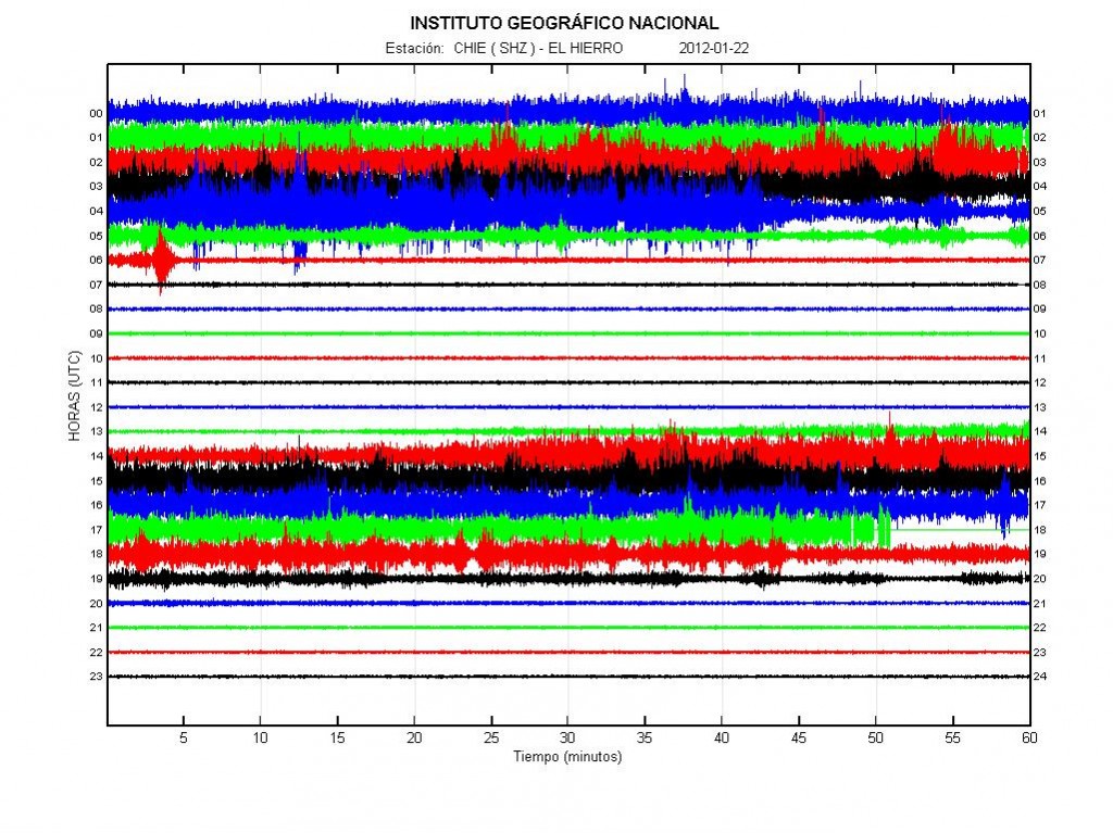

The harmonic tremor today at 08:15 UTC. The harmonic tremor continues to drop during the past few hours. Copyright of this picture belongs to IGN (Instituto Geográfico Nacional).

The harmonic tremor drop is something that has happened before in El Hierro volcano. Just before a new fissure did open up in El Hierro volcano eruption. I am unsure if that is the case now. But it should become clear in about two to three days. But it is also a possibility that this eruption is coming to a end. But it has been erupting now for close to three months now. So this eruption might just ending. But we might have to wait a bit until that is confirmed. But at the moment the harmonic tremor is dropping and that means the eruption is smaller for the moment.

Harmonic tremor pulse in Grímsfjall volcano

There have only been seven months since (May 2011) the last eruption in Grímsfjall volcano. But it seems that Grímsfjall volcano is getting ready for its next eruption. Even if the last eruption was the largest one for at least 140 years in Grímsfjall volcano. So far earthquake activity remains low in Grímfjall volcano. But I am not sure if that means anything for the moment. But there has been in earlier lead up to a eruption a build up of earthquake activity in Grímsfjall volcano.

Today at least two harmonic tremors spikes have been detected by IMO. But this type of harmonic tremor pulse have been detected before in Grímsfjall volcano. Older blog posts on that subject can be found here and here. But this time around it seems that the harmonic tremor is stronger then before. Currently it remains uncertain of there is a glacier flood starting from Grímsvötn lake, as was the case last time this type of harmonic tremor pulse was detected in Grímsfjall volcano.


Harmonic tremor in Grímsfjall volcano at 00:21 UTC on 5 December, 2011. Copyright to this picture belongs to Iceland Met Office.


The harmonic tremor in Grímsfjall volcano at 01:39 UTC on 5 December, 2011. Copyright to this picture belongs to Iceland Met Office.

There is a clear change in the harmonic tremor, as can be seen here. But why and what this actually means for Grímsfjall volcano I am not sure. But I am rather sure that this means a new eruption might only be several months away. But it is hard to know that for sure. But I am just base my estimate on earlier experience with Grímsfjall volcano. But it might not mean anything after last eruption.


The GPS data from top of Grímsfjall volcano. The data is missing for the last few days. Must be because of snow and ice. But given the last data set, the change so far it not that great since the eruption last spring. Copyright to this picture belongs to Iceland Met Office.

What happens next in Grímsfjall volcano is a big question. But it seems that Grímsfjall volcano is going to go for a new eruption. When that might happen I have no idea.

Earthquake swarm 14 km to the east of Akureyri town

At 19:22 UTC a small earthquake swarm started 14 km east of Akureyri town. The earthquake swarm started with a earthquake with the size of ML3.11 at the depth of 9 km. The area of activity is unusual, but there are none known fault lines in this area that I am aware of. This area is also a bit off TFZ fault zone. This area normally does not have any earthquakes. I am not sure yet if this are intra-plate earthquakes or not, as this area is close to the NVZ (North Volcanic Zone).

This earthquake was felt in Akureyri town by the local people. How well I do not know.


The area where the earthquake swarm is taking place. Copyright of this picture belongs to Iceland Met Office.

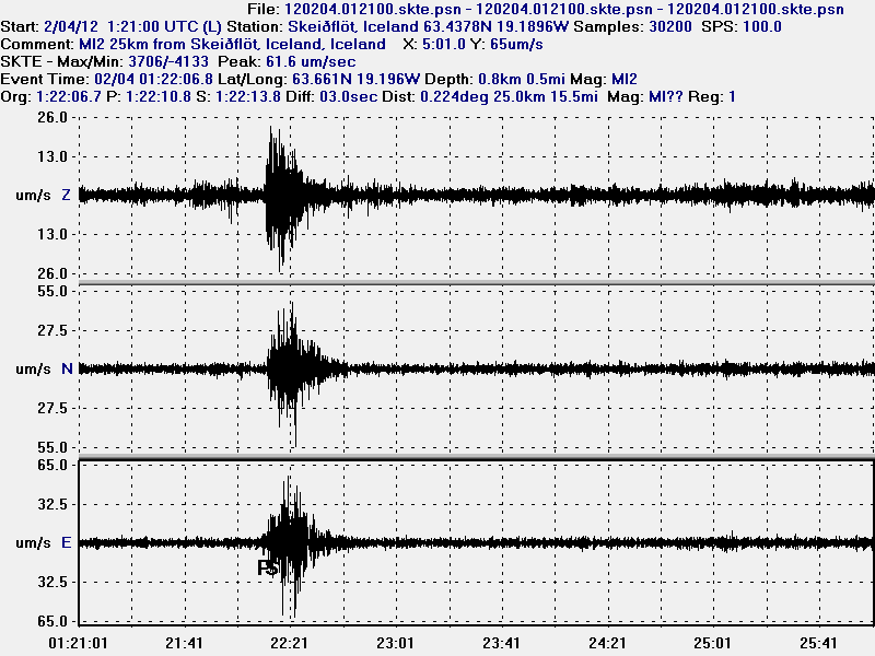
I did record the strongest earthquake on enough geophone to be able to make a plot map from my own software from software called WinQuake that I use to plot earthquakes time, location and depth information with data from Iceland Meteorological Office.


Here is the earthquake location according to my geophones with location data from IMO. This picture is released under Creative Commons licence. See top bar for more information.

Here are the wave form data that where recorded on my geophones (they can be viewed online here). The Sauðárkrókur geophone is a testing geophone that I am currently running. But it is going to be turned off now in December.


The earthquake as it was recorded on the Heklubyggð geophone. This picture is released under Creative Commons licence. See top bar for more information.


The earthquake on Hvammstangi geophone. This picture is released under Creative Commons licence. See top bar for more information.


The test geophone at Sauðárkrókur village. This geophone is noisy. This picture is released under Creative Commons licence. See top bar for more information.


The strongest aftershock that I did record on my Hvammstangi geophone. The wave form data on Sauðárkrókur geophone where not good for some reason. So I do not display them here. This picture is released under Creative Commons licence. See top bar for more information.

The wave form outside the earthquake are ocean waves. They are strong now and show clearly on my geophone. So they appear even more clearly on the SIL network as higher tremor levels. But that is nothing that looks like a volcanic harmonic tremor.

As for the earthquake swarm. It is hard to know what it means. But more aftershocks in this area for the next few days are not impossible. As has been seen before in areas that suddenly start to make earthquakes after a long break.

Icelandic News reports of this event. Please use Google Translate with care. It does not yet understand.

Jarðskjálfti við Akureyri (mbl.is)
Jarðskjálftar við Akureyri (Rúv.is)
Þrír jarðskjálftar nærri Akureyri (Vísir.is)

Blog post updated at 06:02 UTC on 3 December, 2011. Fixing errors in the text.

Activity remains low in Iceland. Eruption continues in El Hierro volcano

At the present time the earthquake activity remains low in Iceland. This goes for both Katla volcano and other areas of Iceland. This is the regular quiet time in Iceland, as it happens sometimes. For the next days, there is a risk of frost-quakes as the ground freezes over in a cold snap.

El Hierro volcano, Canary Islands

The eruption in El Hierro volcano continues as before. New eruption vents have been opening up at random in the south part of El Hierro volcano. Earthquake activity to the north has dropped. While at the same time, the earthquake activity seems to have increased slightly to the west part of El Hierro volcano. I am not sure why that is yet.

In the tremor data. I have been seeing several explosions taking place. But they create a spikes in the tremor plot, that is different then what happens when a earthquake takes place.


The current harmonic tremor from El Hierro volcano. Explosions are the spike activity (30 November, 2011). Some of this however might be sudden increase in eruption activity. Copyright of this picture belongs to IGN (Instituto Geográfico Nacional).

Other then that. The eruption in El Hierro volcano seems to be about the same for the moment as it has been for the past almost two months now. So far it is impossible to know when this eruptions ends. But eruption in La Palma volcano lasted about one month on average. Eruptions in Lanzarote volcano have lasted about three months (last eruption was in the year 1824). Based on this. This might be a eruption that lasts for about 3 to 5 months at the longest in my opinion. But what actually happens is just something that is a wait and see matter.