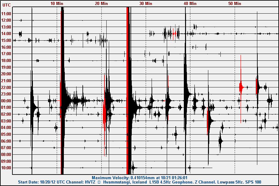
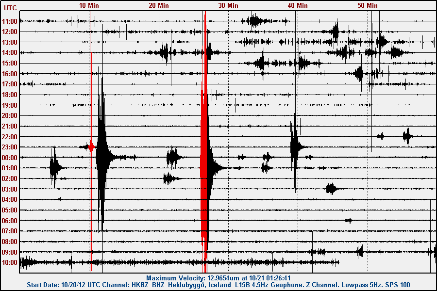
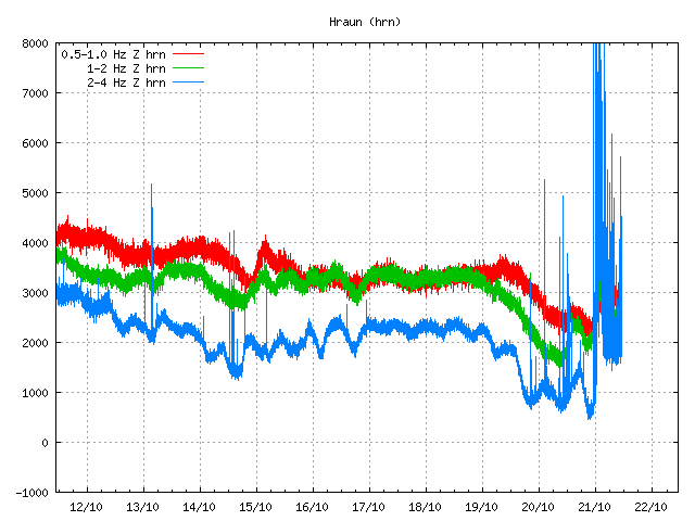
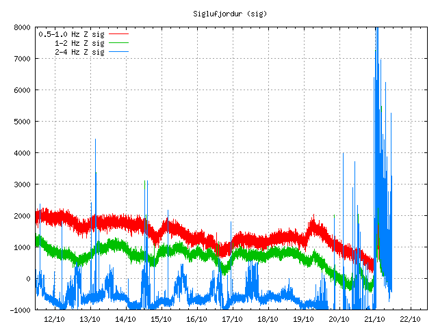
New earthquake swarm in Katla volcano

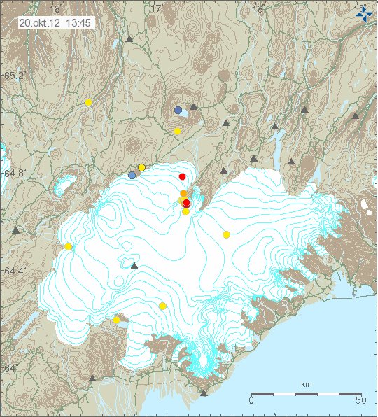
This morning at 07:03 UTC on 21. August 2012 an earthquake swarm started in Katla volcano. This earthquake swarm lasted for few minutes with the last earthquake taking place at 07:50 UTC. No harmonic tremor was detected following this earthquake swarm in Katla volcano. Update 1: The largest earthquake in this earthquake swarm had the magnitude of 2.6 at the depth of 0.1 km.


Earthquake activity in Katla volcano this morning. Copyright of this image belongs to Icelandic Meteorological Office.

It is impossible to know for sure what this activity means. But this might just be normal autumn activity in Katla volcano. I am expecting more earthquake activity in Katla volcano in next few days to weeks.

Icelandic news about this earthquake activity

Skjálfti í Mýrdalsjökli (Rúv.is, Icelandic)
Jarðskjálfti upp á 3,1 stig í Mýrdalsjökli (Vísir.is, Icelandic)
3,1 stigs skjálfti í Mýrdalsjökli (mbl.is, Icelandic)

Blog post updated at 15:18 UTC on 21.08.2012. I have not yet fully recovered from the heat wave. I forgot the important information about this swarm. They have now been added.

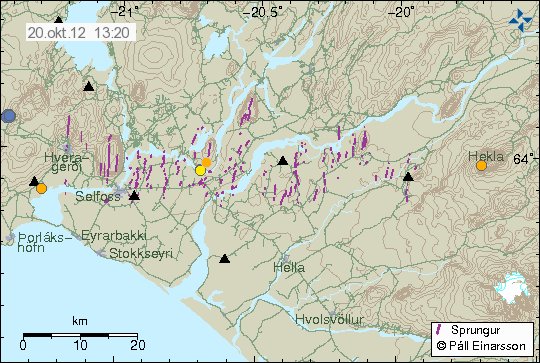
Earthquake swarm in progress in Krýsuvík volcano

Today (18.08.2012) at 15:52 UTC an earthquake swarm did start in Krýsuvík volcano. So far this swarm is not big. With the largest earthquake having magnitude 1.8 according to automatic size. It is impossible to know at this point if this earthquake swarm is going to be strong, or has just ended. So far earthquake activity continues with minor earthquakes.


The earthquake swarm in Krýsuvík volcano. Copyright of this image belongs to Icelandic Meteorological Office.

If the earthquake activity picks up. I am going to do my best to update this blog. But I am on limited 3G internet connection. So it might be a while until update takes place.

Earthquake in Katla volcano today (17.08.2012)

Today at 15:48 UTC there was an magnitude 3.8, at the depth of 0.1 km in Katla volcano. This earthquake took place on the caldera rim in Katla volcano. No major harmonic tremor was detected following this earthquake. However some harmonic tremor was detected. But it was minor. This might have been hydro-thermal-activity or magma on the move. It is impossible to know for sure what is the case now. This earthquake did appear clearly on my geophone network. Mostly on the geophone station at Skeiðflöt and Heklubyggð.


The location of the earthquake in Katla volcano. It was located on the edge of Katla volcano caldera. Copyright of this image belongs to Iceland Meteorological Office.


Influence map of todays ML3.8 earthquake. This suggests that it was not felt in nearby populated areas. Copyright of this image belongs to Iceland Meteorological Office.


Tremor plot that clearly shows the earthquake of today. The spikes are the earthquakes that have been taking place in Katla volcano or close by areas. This is Alftagrof SIL station. Copyright of this image belongs to Iceland Meteorological Office.


This tremor plot shows some minor harmonic tremor following the earthquake in Katla volcano. The spikes show the earthquake from Katla volcano and areas close by. This is Austmannsbunga SIL station. Copyright of this image belongs to Iceland Meteorological Office.

It is impossible to know what this means exactly. But Katla volcano has been quiet since around middle of July. It remains to be seen if earthquake activity is picking up again or if this was just an single event.

Icelandic news about this earthquake

Jarðskjálfti í Mýrdalsjökli (Rúv.is, Icelandic)
Jarðskjálfti í Mýrdalsjökli (Vísir.is, Icelandic)
Jörð skalf við Austmannsbungu (mbl.is, Icelandic)

Blog post updated at 18.08.2012 at 11:51 UTC. Blog post title fixed for the future.

Earthquakes deep south on the Reykjanes Ridge [Updated]

During last night there has been some earthquake activity deep south on Reykjanes Ridge. This earthquake activity is far from the south coast of Iceland so it has not been noticed by any people. It has only appeared on seismometers. The web page of EMSC has shows the current earthquake activity started at 00:21 UTC with two earthquakes. The largest earthquake recorded in following hours had the magnitude of Mb5.3 according to EMSC web page. But that is automatic size estimate and is subject to a change.


The location of the earthquake deep south on Reykjanes Ridge. Copyright of this image belongs to EMSC.

There most likely have been more earthquakes in this area then are registered by seismometer networks. It seems that earthquake activity in this area has quieted down again. For now at least. But this area is subject to strong earthquake swarms on regular basic.

Blog post updated at 21:33 UTC on 15.08.2012.

Fish dying in Kleifarvatn lake due to increasing toxic and hydro-thermal activity

According to Icelandic news today. Fish has been dying in Kleifarvatn lake. But Kleifarvatn lake is inside Krísuvík volcano system. The exact reason why the fish is dying is not known at this point. But report suggests that large amount of fish has been seen dead already. I do not know how much fish there is in Kleifarvatn lake.

This suggests that hydro-thermal and hot spring activity in increasing in the lake. This also suggest that increased toxic levels (for the fish) are now changing in the lake. What toxins are at work here I do not know. But it can be assumed that it is what comes with magma.

For the past three to four years. Krísuvík volcano has been inflating and deflating at regular time intervals. What this means in unclear at present time. But this is signs of increased activity in the volcano anyway. Hydro-thermal and hot spring activity has also been increasing during this period. This has also been followed by increased earthquake activity in Krísuvík volcano when inflation takes place. What happens next is impossible to know for sure. But it is clear that Krísuvík volcano is still far away from erupting any time soon.

Icelandic news about this

Fiskar í Kleifarvatni sagðir í andarslitrum (Vísir.is)
Fiskar i Kleifarvatni sagðir drepast í stórum stíl (Vísir.is)

Small glacier flood from Mýrdalsjökull glacier (Katla volcano)

According to Rúv News this evening. A small glacier flood started flowing from Mýrdalsjökull glacier (Katla volcano) few days ago. According to local farmer in the area. Glacier floods like this are common and several have taken place during this summer, none of them have created damage. The current glacier flood is from a glacier river called Leirá river. This glacier flood is from an cauldron somewhere close to middle of Mýrdalsjökull glacier. There is small risk of damage to local roads and fiber optics cable in the area. Some glacier breakage has been reported in the glacier where the floods comes from.

I am going to update this blog post if anything major happens with this glacier flood.

Update 1: It now appears that this glacier flood is now appearing on Rjúpnafell SIL station. So far just on this only SIL station. But that might change at any time if this glacier flood grows in size.


The tremor from the glacier flood can be see at the end of this harmonic trace. The spike is an earthquake in Katla volcano. Copyright of this image belongs to Iceland Meteorological Office.

Icelandic news about this.

Lítið hlaup í Leirá (Rúv.is, Icelandic)

Blog post updated at 00:07 UTC on 14.07.2012.

Minor earthquake swarm in Katla volcano

This Sunday is not quiet when it comes to earthquake activity in Iceland. Earlier today a small earthquake swarm started in Katla volcano. The largest earthquake in this swarm had the magnitude 2.3 according to the automatic SIL system. The largest earthquake did appear clearly on Skeiðflöt and Heklubyggð geophone stations. But Skeiðflöt geophone station is closest to the area where this earthquake swarm was taking place.


Earthquake swarm in Katla volcano. Copyright of this picture belongs to Iceland Meteorological Office.


The earthquake trace on Skeiðflöt geophone station. This is filtered at 1Hz. I have not located this earthquake trace (no P and S wave markers). This image is released under Creative Commons Licence. Please see CC Licence page for more details.


The earthquake trace from Heklubyggð geophone station. This is filtered at 1Hz. I have not located this earthquake trace (no P and S wave markers). This image is released under Creative Commons Licence. Please see CC Licence page for more details.

It is impossible to know what happens next in Katla volcano. But it is monitored heavily, so if anything happens. It is going to show up almost in real time on the internet.

GPS monitoring of Ice cauldron on Mýrdalsjökull glacier

In the news on Rúv yesterday (07.07.2012) they did tell about real time GPS monitoring of ice cauldron in Mýrdalsjökull glacier. But it is hoped that with this real time GPS monitoring they can give out warning sooner when a ice cauldron empties it self of the water it holds.

The news about this can be found here on Rúv News in Icelandic.

GPS-tæki komið í sigketilinn (Rúv.is, Icelandic, video)

Earthquake activity in Katla volcano and on SISZ

It has been quiet for the past weeks in Iceland. I do not know if that is changing. But this is the short update of what has been taking place in Iceland earthquake wise during this quiet period.

Katla volcano

Since Katla volcano earthquake spike in late April to middle of June. Sine then it has been rather quiet in June and what has passed of July. Today and yesterday there has been some earthquake activity in Katla volcano. But nothing like was seen in April to June.


Earthquake activity in Katla volcano during past few days. Copyright of this picture belongs to Iceland Meteorological Office.

South Icelandic Seismic Zone (SISZ)

Intresting earthquake activity has been taking place in South Icelandic Seismic Zone for few days now. Currently the activity is on the northern end of the fault that broke in the year 2008. This is most likely just an earthquake swarm in the fault area that is continuing to adjust after the Mw6.3 earthquake in the year 2008.


Earthquake activity on SISZ during the past few days and hours. Copyright of this picture belongs to Iceland Meteorological Office.

As for SISZ. This is just an earthquake activity. There is no volcano activity in this area of Iceland. But SISZ is a fault zone that moves N-S (W-E compared to Reykjavík). So with every major earthquake on SISZ, it is slowly moving south as the new rift zone (Iceland East rift zone) moves south at the same time. This is a slow progress. Takes millions of years and has been ongoing for million of years already.

Continuous earthquake activity in El Hierro volcano

There have not been great changes in El Hierro volcano. Currently no eruption has taken place. There are also no signs of magma movement on tremor plots on seismometers stations that are located on El Hierro Island. The dike intrusion in El Hierro volcano is continues, but at slower rate then before. But that it is continuing means there is continued risk of an eruption where the earthquakes are currently taking place. Currently the rate of earthquake is around 3 to 8 earthquakes during the hour. Most of the earthquakes are around ML1.5 to 3.4 in magnitude. Please note that I am missing all earthquakes with the magnitude of ML0.0 and up to ML1.5. So there might well be a lot more earthquakes taking place in El Hierro volcano then I am seeing on IGN web page.


Current tremor plot of El Hierro volcano. The spikes are earthquakes in most cases. Copyright of this picture belongs to IGN.


Last 36 hours of earthquakes in El Hierro volcano. It shows clearly where magma has pushed it self into the crust. Creating inflation and earthquakes. The spikes are earthquakes in most cases. Copyright of this picture belongs to IGN.


Past 7 months of activity in El Hierro volcano. This map shows well how magma has slowly been injecting it self into El Hierro volcano during the past few months. Some of the earthquakes there are also just tectonic earthquakes, due to stress changes that injection of magma creates in the crust. The spikes are earthquakes in most cases. Copyright of this picture belongs to IGN.

According to official reports. The inflation of El Hierro volcano is around 10 cm according to official reports, or around that. I am having hard time finding the official news reports on the inflation in El Hierro volcano at current time. For the moment, the current situation is stable for the moment. But when that might change is impossible to know for sure. But there is magma inside El Hierro volcano, so there is an increased risk of some of that magma finding it’s way to the surface and erupting. But that might be out in the ocean as last time, or on land. It is impossible to know that for sure until an eruption starts. For the moment, nothing can be done the to watch and monitor the current situation in El Hierro volcano.

Other

It seems that Icelandic volcanoes and fault zones are on some type of summer vacation for the moment. So I am covering other things while the quiet period in Iceland is currently ongoing.

Short update on activity in El Hierro volcano, Canary Islands / Corto sobre la actividad de actualización en el volcán de El Hierro, Islas Canarias

This is just a short update on El Hierro volcano activity. I plan on making a longer blog post tomorrow when I am not so tired.

Current earthquake activity in El Hierro volcano is continues. The rate of earthquakes taking place in El Hierro volcano is about 10 earthquakes pr 1 hour. With high up to 20 earthquakes pr hour, and down to 2 earthquakes pr 1 hour. The rate of earthquakes with the magnitude larger then ML3.0 is about the same. They happen every few hours at random intervals. For the past few days a cluster of large earthquakes takes place every 10 to 12 hours. This pattern is not something to trust in, as it is going to change without warning. But it is controlled by inflow of magma at depth under El Hierro volcano. Most earthquakes take place at around 20 km depth, as that is where magma is being injected into El Hierro volcano. That however does not rule out the possibility of magma having reached higher up in the crust. Some of the earthquake taking place in El Hierro volcano are crustal stress earthquakes. As magma and inflation of El Hierro volcano is changing the stress in the crust close to it. The

Based on the data from last years events, the magma now is up to 5 km depth in the crust. That magma is for the moment not moving. It is just staying where it and cooling. That might change without warning if something changes inside El Hierro volcano. It is impossible to predict such event with any manner of accuracy. This magma is most likely going to stay where it is and cool off for the next few centuries (this is a different magma sill that is not creating so much earthquakes at the moment). The current magma injection is going to start an eruption in my opinion. It is just question of when and where. It is not a question of “if” in my opinion (non-professional opinion). Update: There are two or three magma sill in El Hierro volcano at present time. Not all of them are going to erupt. Current magma sill that is forming now is however going to erupt in my opinion. That sill formation has been creating earthquakes and inflation during the past two weeks. I know this sounds to be contradicting it self. But the situation in El Hierro volcano is a lot more complex then it seems.

I believe this location to the most likely place for an eruption. More or less. But there is also a risk of magma going somewhere unexpected. As is the risk with all volcanoes that erupt in the same manner as El Hierro volcano.


View Larger Map

Inflation has also been sharp following this earthquakes activity. With some areas reporting up to 120mm inflation during short period of time. This is common for volcanoes like El Hierro volcano. Some of this inflation areas might erupt in a fissure vent eruption. When and where are in this case impossible to predict until an eruption actually starts. This types of eruptions are normally not dangerous unless they are close to human habitat. This fissure vents might however be large in length, from several meters in length and up to several km long.

It is hard to know what happens next when it comes to volcano, any volcano that is. What happens in a volcano is poorly understood by everyone. So what happens next in El Hierro volcano is anyone guess. But I find it to be good advice for people living on the Island of El Hierro to stay alert for sudden change in El Hierro volcano behavior.

Spanish / Español (via Google Translate)

Esto es sólo una breve actualización sobre la actividad del volcán de El Hierro. Mi plan es hacer un mañana después de blog cuando ya no estoy tan cansado.

La actividad sísmica actual en El Hierro volcán continúa. La tasa de los terremotos que tienen lugar en El Hierro volcán es de unos 10 terremotos pr 1 hora. Con alta hasta 20 horas pr terremotos y terremotos de hasta 2 pr 1 hora. La tasa de terremotos con la magnitud más grande que ML3.0 es aproximadamente la misma. Se producen cada pocas horas a intervalos aleatorios. Para los últimos días un grupo de grandes terremotos se lleva a cabo cada 10 a 12 horas. Este patrón no es algo que confiar, ya que va a cambiar sin previo aviso. Sin embargo, está controlado por flujo de magma en las profundidades del volcán en El Hierro. La mayoría de los terremotos tienen lugar en torno a 20 km de profundidad, ya que es donde el magma se está inyectando en el volcán El Hierro. Que sin embargo no descarta la posibilidad de que el magma de haber alcanzado más arriba en la corteza. Algunos de los terremotos que tienen lugar en El Hierro son los sismos del volcán corteza de estrés. Cuando el magma y la inflación del volcán El Hierro está cambiando la tensión en la corteza de cerca a él. La

Con base en los datos de eventos de los años últimos, el magma es hasta una profundidad de 5 km en la corteza. Ese magma es por no pasar el momento. Se acaba de estar donde y refrigeración. Eso podría cambiar sin previo aviso si algo cambia en el interior del volcán de El Hierro. Es imposible predecir tal caso con cualquier forma de precisión. Este magma es más probable que va a quedarse donde está y refrescarse durante los próximos siglos (esto es un umbral de magma diferente que no es la creación de terremotos, por lo tanto en este momento). La inyección de magma en curso va a comenzar una erupción en mi opinión. Es sólo cuestión de cuándo y dónde. No es una cuestión de “si” en mi opinión (no profesionales opinión) . Actualización: Hay dos o tres alféizar de magma en el volcán de El Hierro en la actualidad. No todos ellos van a entrar en erupción. Alféizar de magma actual que se está formando ahora es, sin embargo va a estallar en mi opinión. Que la formación de solera ha sido la creación de terremotos y de la inflación durante las últimas dos semanas. Sé que esto suena a contradicción en si mismo. Pero la situación en El Hierro volcán es mucho más compleja de lo que parece. Link: Lámina (geología) (Wiki)

Creo que esta ubicación para el lugar más probable para una erupción. Más o menos. Pero también existe un riesgo de magma ir a un lugar inesperado. Como es el riesgo con todos los volcanes que hacen erupción de manera semejante como El volcán Hierro.


View Larger Map

La inflación también ha sido fuerte después de esta actividad los terremotos. Con algunas zonas informar a la inflación 120 mm durante el período de tiempo corto. Esto es común para los volcanes como el volcán El Hierro. Algunas de estas áreas la inflación podría entrar en erupción en un fisura de ventilación erupción. ¿Cuándo y dónde están en este caso imposible predecir una erupción hasta que realmente empieza. Este tipo de erupciones normalmente no son peligrosos a menos que se acercan al hábitat humano. Estos respiraderos de fisuras sin embargo, podría ser de gran longitud, de varios metros de longitud y de hasta varios kilómetros de largo.

Es difícil saber lo que sucede a continuación en lo que respecta al volcán, un volcán que es. Lo que ocurre en un volcán es poco comprendido por todos. Entonces, ¿qué ocurre a continuación en el volcán El Hierro es que nadie adivine. Pero me parece que sea un buen consejo para las personas que viven en la isla de El Hierro para mantenerse alerta para el cambio repentino en el comportamiento del volcán de El Hierro.

Blog post updated at 01:17 UTC on 04.07.2012. Explanation added to the blog post.