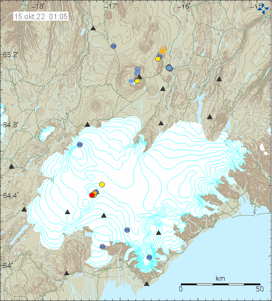
According to GPS data from Icelandi Met Office that can be viewed here for Krýsuvík-Trölladyngja volcano (Þorbjörn) and here for Reykjanes volcano. It seems that a inflation period, at least in Krýsuvík-Trölladyngja volcano started in early September and is ongoing at the writing of this article. Earthquake activity is low at the moment, but the area has already moved a lot in recent earthquake swarms and that might he dropped the crustal stress in the area. It might also explain some of the GPS movements. I have some, but limited understanding of reading GPS data so my assessment might be off, wrong or both.
There also seems to be inflation going on, without many earthquakes in Reykjanes volcano. That seems to be have been going on since start of August. There have not been any eruption in Reykjanes volcano even after repeated inflation and deflation cycles in the volcano. Inflation cycles often have earthquake swarm activity if dyke activity follows an inflation event. That does not seem have happened this time around.
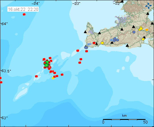
If this inflation continues, in either one or both volcanoes. It is clear a new period of high earthquake activity is about to start on Reykjanes peninsula. When that earthquake activity is going to start is impossible to know. Since recent earthquake and volcano activity has changed how the crust works in the parts of the Reykjanes peninsula where magma has been active. Since hot magma slowly softens the hard rock in the crust at depth and that lowers the earthquake activity. Rather then at the start of an volcano activity, when the crust is cold and brittle, resulting in high earthquake activity before an eruption.
Donations
Please remember to support my work with donations. Thanks for the support. 🙂