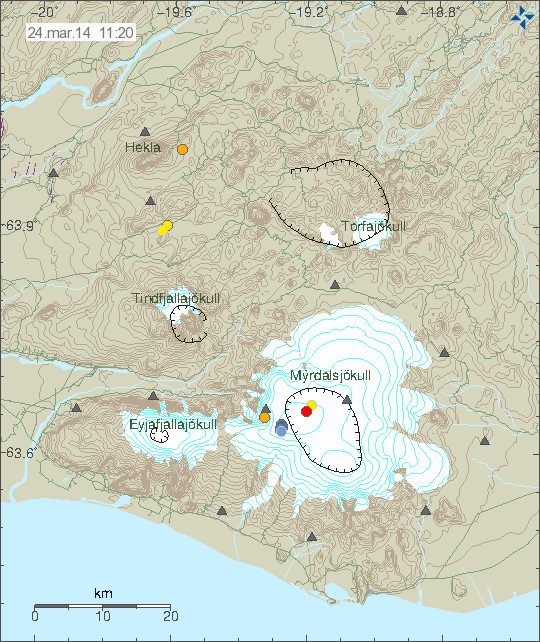
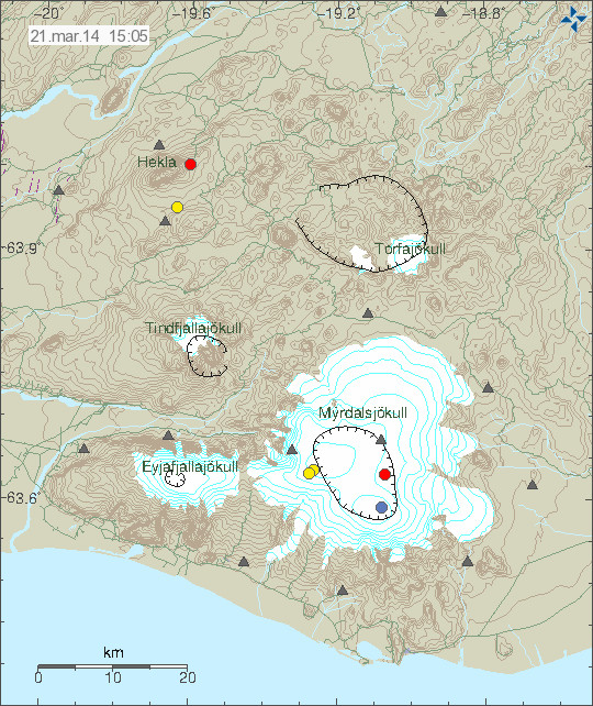
On the 17-March-2014 at 19:59 UTC an earthquake took place in Hekla volcano. This earthquake had the magnitude of 1,0 and the depth of 9,1 km. I did record it on my geophone just barley, it is possible to watch for activity in Hekla volcano here. This earthquake does not mean that Hekla volcano is about to erupt, but it is interesting anyway. What it means remains unclear at the present time.
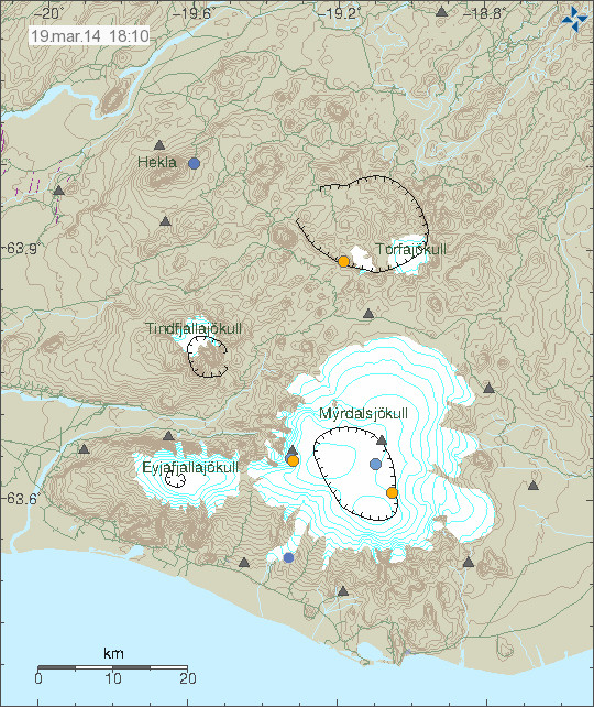
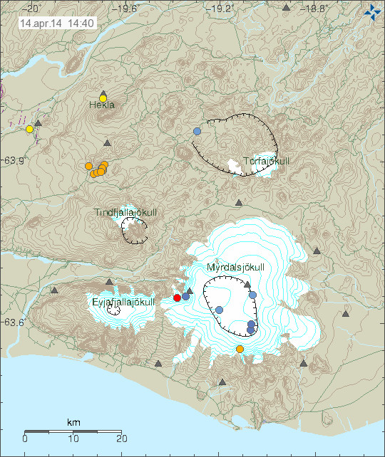
The earthquake in Hekla volcano. It is marked with an blue dot. Copyright of this image belongs to Icelandic Meteorological Office.
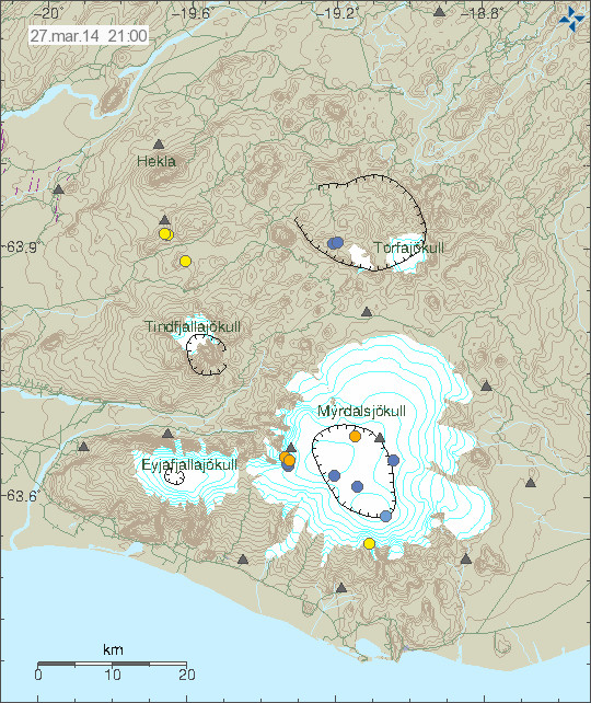
Katla volcano
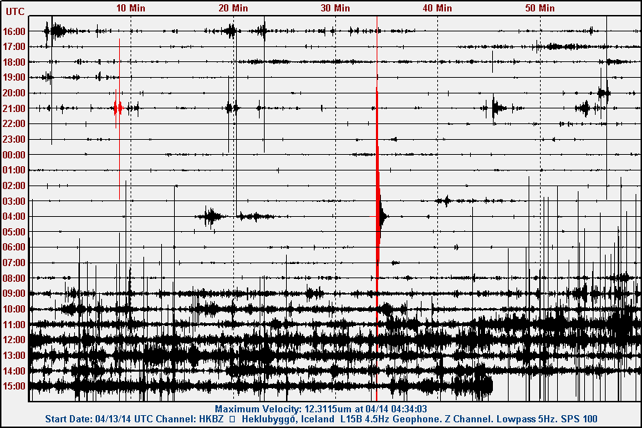
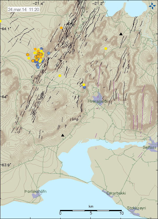
Yesterday (18-March-2014) an deep earthquake (in the picture above, in the central caldera) took place in Katla volcano. The magnitude of this earthquake was 0,7 and this earthquake had the depth of 28,9 km. As was mentioned in comment yesterday. This earthquake in it self is no important from the looks of it. No special harmonic activity took place following this earthquake.
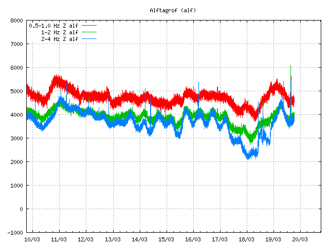
All quiet. Just wind and ocean waves. The spike on the 19-March-2014 is due to earthquake in Goðabunga part of Katla volcano. Copyright of this image belongs to Icelandic Meteorological Office.
Donations: Please remember to support my work by donation. Thanks!
Advertisements:
I did try to go advertisement free (for the second time) and it failed again. Since I need the extra income from this website and from my writing work to make a proper living. I want to be advertisement free, as I did explain here (I have updated this post now). Going advertisement free requires donations that I am simply not getting and it is an fact one cannot be without money. Without it it’s just hunger and pain. As it is not far from what I am currently experiencing (I got €0,49 in my bank account at current time or 3,61 DKK). The thing however is that I am well advised in not having any money so I prepare a little in terms of buying food but currently I am at my limit. I am not sure what the rest of this month (March) is going to be for me. This site might one day be advertisement free, that is however not going to happen until I can afford it. When that might be I have no idea.
The job question:
Many people wonders why I don’t have a job and many people expect that I have a job and don’t ask for donations. I have asperger’s syndrome [Second link here]. I have problem with working a normal job. It’s not that I am not physically able, because I am. But I have problem with communications and dealing with work social things. I have issues with normal social stuff on every day. I can and I have worked for a short period of time, but such things always drain me mentally and make things difficult for me in the long run. It would also prevent me from monitoring earthquakes and volcanoes as I do now. I am also writing more stories and I have already published one, even if I have not yet sold many copies so far.
Blog post updated at 20:45 UTC. Time of the earthquake corrected.
Blog post updated at 21:55 UTC.