Update on Hekla volcano status

Here is an update on Hekla volcano. First of, for the moment the inflation in Hekla volcano is deflating at the moment. This is following the same pattern as before last time this did happen. But that does not mean this might not happen again soon. For the moment, nobody knows what exactly is going on inside Hekla volcano as there are no earthquakes following this inflation period. The magma that is on the move down there is most likely moving deep down in the crust also, as Hekla volcano does not have shallow magma system that I know of (or is known of anyway).

What did happen inside Hekla volcano was most likely an dike intrusion somewhere in the volcano system. This dike intrusion did not create any earthquakes, that suggests to me that it was travelling trough an old dike system already in place inside Hekla volcano system. This is most likely to happen again in Hekla volcano, if that starts an eruption is hard to know for sure.

In regards to possible ash cloud from eruption in Hekla volcano is impossible of know for sure now what happens in next eruption. There might be an ash cloud, but then again there might not be. All that can be done is to wait and see what happens in the next days, weeks or years.


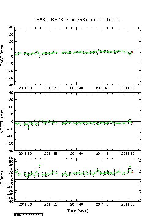
The GPS movement of Hekla volcano. The inflation and the deflation can clearly be marked here. There is an inflation spike around 2011.45 on this plot. But this did also happen in April/May I think (but it might be wrong). Daily updated chart can be found here. Copyright of this picture belongs to Icelandic Met Office.
It is also important to notice that Civil Emergency Authority (Almannavarnir) in Iceland advice against it travelling up to Hekla volcano at current time. Since an eruption can start in Hekla volcano without any warning at all and the maximum time that people have evacuate the mountain is from 1 hour and up to 1 hour and 30 min. No more then that. Being on top of Hekla volcano when an eruption starts is deadly to everyone. If you want to go up to Hekla volcano. Please let somebody know about and have an fully charged mobile phone with you at all times. As the Civil Emergency Authority send out an SMS message to all mobile phones in the area around Hekla volcano if an eruption is starting (I think they do that).

Icelandic News.

Almannavarnir: Hekla tilbúin í gos (Rúv.is, Icelandic)
Almannavarnir vara fólk við Heklu (Vísir.is, Icelandic)

New harmonic tremor spike in Katla volcano

Today around 16:00 UTC there was an new harmonic tremor in Katla volcano. This harmonic tremor has two sources. Hyrdothermal activity under the glacier, or magma moving deep inside Katla volcano (without creating many earthquakes in Katla volcano). It is unclear what is the case at the moment.

This spikes are so far not related to glacier floods from Katla volcano. But that sometimes also happen without an eruption being involved.


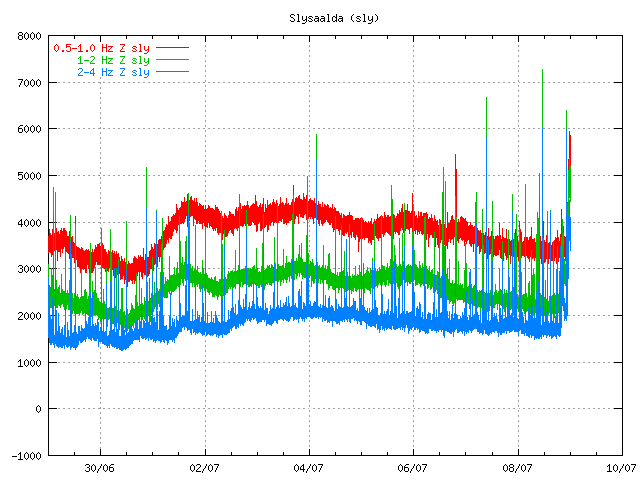
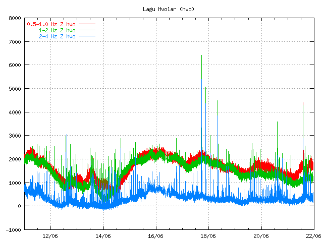
The harmonic spike can be seen here. Close the end of the chart. It is different then the background noise as it is more powerful then the background noise. Copyright of this picture belongs to Icelandic Met Office.
It is impossible to know what happens next. But it is also important to be aware of the fact that earthquake season is starting in Katla volcano. But that is normally from end of June to beginning of October (or when it starts to snow again in Iceland). So more earthquakes are going to be seen this summer also because of more SIL seismometers around Katla volcano.

So there is no reason to panic about Katla volcano at current time. But it is worth to keep watch on it anyway.

Notice: Updates might be an little few due the fact that I am now working all day during the week and I am tired in the end of the day with no energy to write new blog posts. But I am going to do my best anyway.

Earthquake swarm in Presthnjúkar volcano. Update on Katla volcano

Presthnjúkar volcano: Few days ago an earthquake swarm did start in Presthnjúkar volcano. This earthquake swarm is entirely tectonic in nature. There is nothing that suggests that this earthquake swarm is connected to magma movements inside Presthnjúkar volcano system. So far this earthquake swarm has been slow and small. But the largest earthquakes have gone up to ML3.3 in size according to Icelandic Met Office.


The location of current earthquake swarm in Presthnjúkar volcano. Copyright of this picture belongs to Icelandic Met Office.

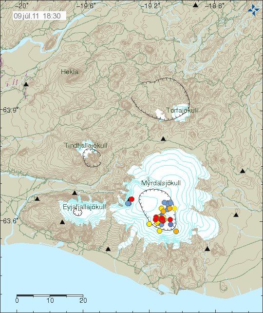
Katla volcano: Over the last 18 hours it has been quiet in Katla volcano. As no more earthquakes have been detected from it. I would not be surprised if there are more earthquakes swarms in Katla volcano in the next few weeks and months. It is an well known fact that Katla volcano is heading to an eruption. But nobody knows when that is going to happen.


Location of the earthquakes in Katla volcano yesterday. Copyright of this picture belongs to Icelandic Met Office.

Besides this two highlights of earthquake activity in Iceland. It has been rather quiet in the past few weeks. With just from ~100 to ~300 earthquakes during the week.

Earthquake swarm in Katla volcano

Around 17:10 UTC an earthquake swarm did start in Katla volcano. This earthquake swarm is focused inside the Katla caldera at small point. The one earthquake that I have so far been able to record was an long period earthquake, but that suggests that this earthquake was created by magma movement. At current time I am not sure from where this earthquake did originate from. But from Goðabunga area in Katla volcano this types of earthquakes are common and no surprise at all.

At current time I do not know what this means for Katla volcano. But so far no increase in harmonic tremor has been detected on the seismometers around Katla volcano. But that might not start at current time, as harmonic tremor is only going to increase when magma starts to move inside the Katla volcano, like did happen in Grímsfjall volcano few weeks ago.

The location of this earthquake swarm strongly suggests that what is going on in Katla volcano is an dike intrusion in the Katla caldera. If that is powerful enough to start an eruption is an question remained unanswered at current time.


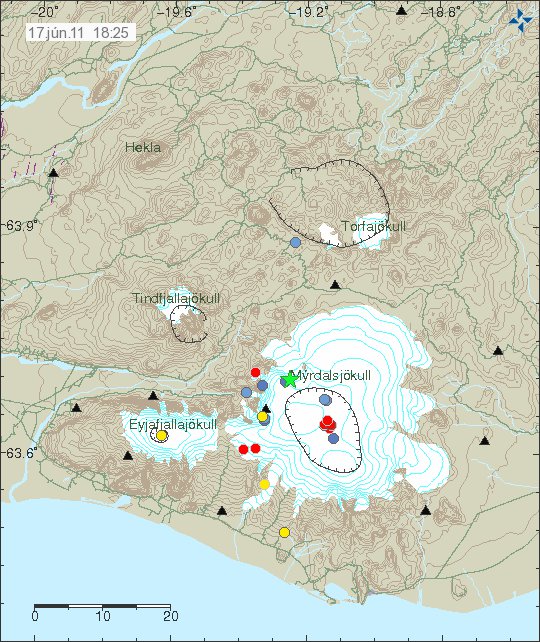
Area of activity is marked by the earthquakes. Looks like an dike intrusion into Katla caldera. Copyright of this picture belongs to Icelandic Met Office.

I am going to update or post new blog posts as this continues to develop. I do not think that this events are over. But it is hard to know for sure, since volcanoes are impossible to predict.

Post post updated at 18:39 UTC.

Harmonic tremor pulse in Katla volcano

There appears to be an harmonic tremor pulse going on in Katla volcano. While I currently do not think that this is going to start an eruption. It is worth watching this harmonic tremor pulse in Katla. But in the year 1999 this type of activity did result in minor eruption in Katla volcano on the 17. July that year (it is believed).


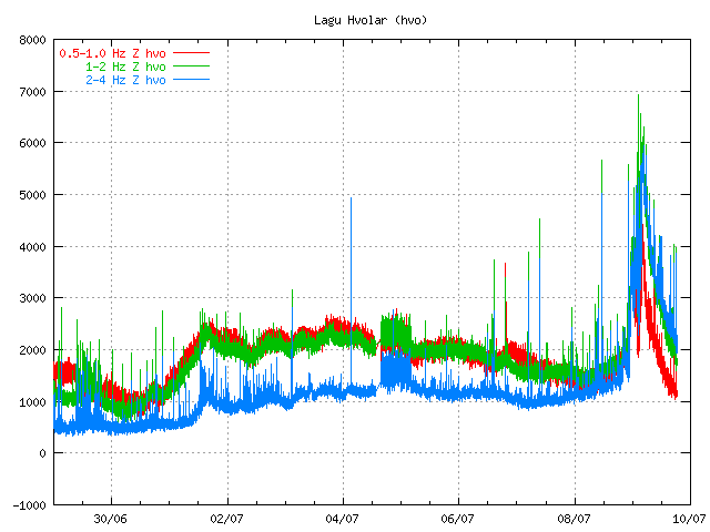
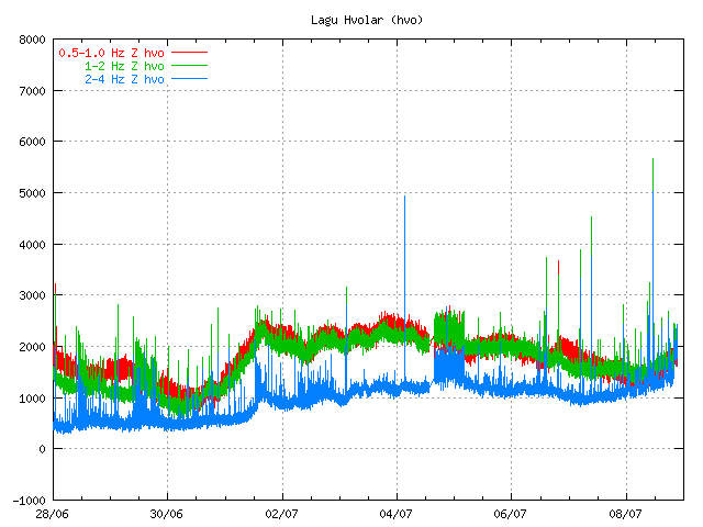
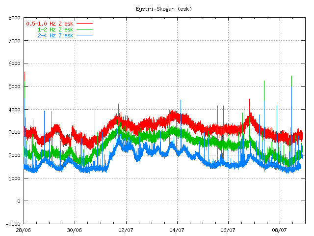
Harmonic tremor pulse can be seen on the SIL station Lágu Hvolar. Copyright of this picture belongs to Icelandic Met Office.


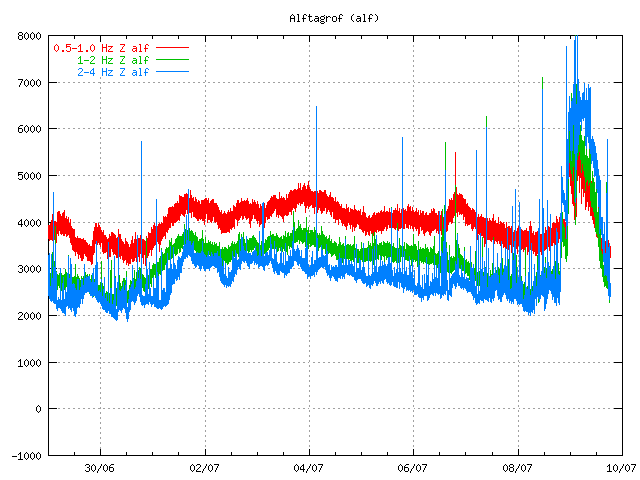
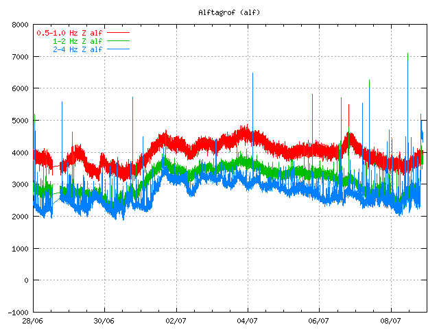
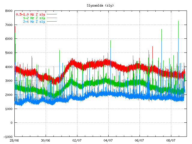
Harmonic tremor pulse can be seen on this SIL station Álftagröf. But it is hard too see it then on Lágu Hvolar. But that suggests that this tremor pulse is in fact quote weak one. Copyright of this picture belongs to Icelandic Met Office.


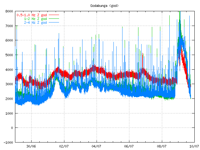
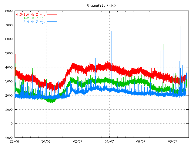
Harmonic tremor pulse can be seen on this SIL Rjúpnafell. It is more stronger signal then on Álftagröf, so it suggest that the source of this tremor pulse is closer to this station then on Álftagröf. Copyright of this picture belongs to Icelandic Met Office.

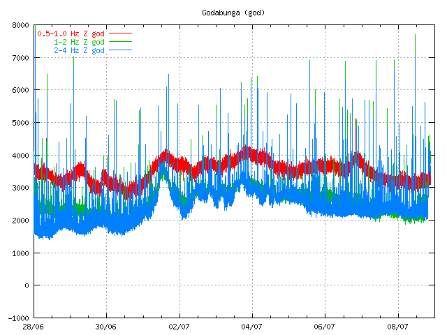
All pictures are from 16:28 UTC on 12. June 2011.

On other station around Katla volcano I do not see this harmonic tremor pulse on the Icelandic Met Office on-line tremor chart. But that does not mean that it this tremor pulse is not being detected on other SIL stations around Katla volcano.

The source of this tremor pulse is most likely an dike intrusion at great depth inside Katla volcano that is taking place without any earthquake activity. This has happened before without resulting in an eruption from Katla volcano (besides the event in the year 1999). I do not think that this means an eruption is going to happen soon. But this might signal that Katla volcano is about enter an more activity phase then in last few decades. But if that is going to turn out that way is something that only time can answer.

Extinct volcanoes in Hungathing Vestra county, Iceland

Here is an picture of how an ~5 million year old extinct volcano looks out. This pictures also show an old dike intrusion that might have gone up to the surface on that time. But I think it is hard to know that for sure, as erosion has changed the landscape a lot over the past 10 million years or so. So it hard to know for sure how deep this magma dike did actually form or if it was connected to an crater on the surface.


About 5 to 8 million years old dike intrusion into sedimentary rock that pre-dates this dike intrusion. I do not know by how much older the surrounding rock actually is. But it has small fossils in them.


The volcano that did create this old dike intrusion. The rocks in the area (old lavas) suggest that this was mostly basalt that did erupt from this volcano. But this volcano was on the old Snæfellsnes-Skagi Rift Zone.


Rift Zones in Iceland. Picture is from Wikipedia. See original copy here along with copyright information. Please note that this picture is NOT completely correct in regards to the facts. But is good for basic illustration of the rift zones in Iceland. Note that this is picture is missing the Skagafjörður Rift Zone (failed rift zone).


Picture of what can be seen of the Snæfellsnes-Skagi rift Zone. (I think it is the correct name for it). The mountain behind it is also an massive old volcano that was active at the same time as this rift zone. The houses there belong to my mon and dad (also on the picture below this one). They run an sheep farm.


Picture of Snæfellsnes-Skagi rift Zone to the north. The same volcano as on picture above can also been seen on this picture. But what is not seen is the third volcano that is in this area (also extinct). But glacier activity did remove all major traces of that volcano long time ago.

I am going to post more pictures of this area during the summer. Even if it is just small part of Iceland, it has an lot of geological history to show. All of it is connected to volcanism and glacier activity over the past 8 million years (or about that) time. Too see full size of the pictures, just click on them.

Grímsvöt eruption appears to be over

Given the current tremor plot on Icelandic Met Office and with reports it seems that the eruption in Grímsvötn (Grímsfjall volcano) is about to be over for now. It is impossible to know if the eruption is going to resume soon or not. But at the moment this eruption seems to be over as it looks now. If it remains like that has to be seen however.

This drop in the eruption has been confirmed by Icelandic Met Office tremor plots.

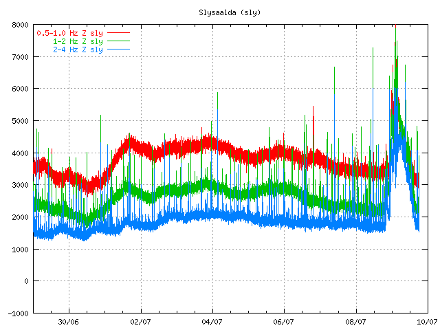
Tremor plots as of 07:00 UTC. This tremor plots are from Icelandic Met Office web site. Copyright of this pictures belongs to Icelandic Met Office.

Early news this morning in Iceland reported that steam was only coming from the main crater of Grímsvötn.

Other interesting development is that an earthquakes have started to appear SSE of Grímsfjall volcano (Grímsvötn). It is unclear why earthquake are happening at this location. But dike intrusion at this location is not impossible.

The reason for flight problems in Europe is because of the volcano ash that was ejected into atmosphere in the first days of the eruption. It is going take few days for that volcano ash to disappear from the air. Until that happens, it is going to create problems for air traffic.

Update 1: Even if the eruption appears to be over the tremor is still high. I do not know why that is. It is a question why that is or if this is just break in the eruption or not. Only time is going to tell what happens next.

Update 2: There was an news report this morning that before 02:00 UTC there was an spike in activity in Grímsvötn that did shoot the ash cloud up to 8 km. But that spike did only last for few moments before it was over. Rúv has released video here (Windows Media Player) of the eruption site.

Updated at 07:37 UTC.
Updated at 07:50 UTC.
Updated at 08:33 UTC. Blog post title updated.
Updated at 11:42 UTC.
Updated at 12:23 UTC.

The magma below Upptyppingar tuff mountains

Upptyppingar are a tuff mountains in the east highlands in Iceland. There formation is contributed to a sub-glacier eruption in this area around 12.000 years ago. A second older sub-glacier eruption feature is also present in this area, it is called Álftadalsdyngja. It is believed that it did form around 700.000 years ago in a basalt eruption in this area. Upptyppingar and Álftadalsdyngja are both inside Kverkfjöll volcano fissure swarm.


Map of the area. Copyright of this picture belongs to how created it. Author unknown. Picture is from here.

In the year 2007 (Week 50) a earthquake swarms started to appear in Upptyppingar area. Earthquake activity in Upptyppingar area have continued since then. With total number of earthquakes in this area since the year 2007 is something over 6000 total. The reason why earthquakes are happening in this location is because magma is pushing up trough the crust in this area. This has been confirmed by GPS measurements since the year 2007.

It is my opinion that increased activity in Askja volcano might trigger a eruption in Upptyppingar area or in nearby area. As the risk of dike intrusion from Askja volcano into the Upptyppingar magma sill might trigger a large fissure type of event in this area. This is just speculation based on observed data. So please take note of that fact. The reason why I fear dike intrusion from Askja volcano is due to the changes that Upptyppingar magma has created in the nearby crust. But if this happens depends on how Askja volcano eruptions are going to behave in the future.

Here are some scientific data on Upptyppingar and the magma that has been collecting at 15 km depth below Upptyppingar mountains since the year 2007.

EARTHQUAKE SWARMS AT UPPTYPPINGAR, NORTH-EAST ICELAND: A SIGN OF MAGMA INTRUSION? (pdf, study)


Location of the earthquakes since the year 2007. Copyright of this picture belongs to Icelandic Met Office. Picture is from here.


Depth of the earthquakes in the year 2007. As can be seen, the magma moved upwards with time. Copyright of this picture belongs to how created it. Author unknown. Picture is from here.


Estimated location of the magma below Upptyppingar mountain. This location is based on earthquakes and other measurements. Copyright of this picture belongs to how created it. Author unknown. Picture is from here.

What happens with Upptyppingar is now just a question of waiting and seeing. But there is also a good chance that this magma is never going to reach the surface in a eruption and is just going to cool down there and form a basalt dike that is going to be exposed in few million years when the weather and ice remove the rocks on top of it.

About the earthquakes north of Askja volcano

The earthquakes that are now taking place north of Askja volcano are interesting for many reasons. One of the biggest reason why this earthquakes are interesting is the fact how shallow they are. But it is also interesting on how small the area the earthquakes are taking place on.

This earthquake activity did start in Week 15 with one earthquake. In Week 16 the activity had grown up to few earthquakes. In Week 17 (current) the activity has continued to grow in this area. This activity currently stands out in the earthquake activity around Askja volcano.

While it is common for Icelandic volcanoes to erupt from a central vent. It is also common for Icelandic volcanoes too erupt from fissures (like Fimmvörðuháls Eruption 2010). One of the clues to this type of eruption close to a central volcano is a earthquake activity. It is my opinion that this earthquake activity qualifies as pre-activity for a fissure eruption in the area of Askja volcano. But if anything happens soon is a different question and it is impossible to predict for now. It is however sure that before such eruption the earthquake activity in this area needs to increase a lot more from the current levels of earthquake activity that are being seen today.

Currently no eruption is immanent in Askja volcano.

Interesting earthquakes north of Askja volcano

There is a interesting cluster of earthquakes north of Askja volcano. What is most interesting is the fact that this earthquakes are shallow This cluster of earthquakes is most interesting for the fact that it is shallow. The depth of the earthquakes is from 8.4 km and up to 0.1 km (~100 meters). This suggests that this is a dike intrusion is making. But appears to be growing slowly (a bit unclear at the moment however). But at this time it is impossible to know if this possible dike intrusion makes it too the surface or not.

History tells that it is not unclear for Askja volcano to erupt in small fissures. But that last happened in the Askja eruption in the year 1961.

Currently it is unclear what is going on north of Askja volcano. But this is for sure evolving into something in my opinion. But the question remains how long this is going to take. But this process has already been ongoing now for about 14 months and counting.