Special report: Update 5 on El Hierro eruption, Canary Islands, Spain

This is a special report on the eruption in El Hierro, Canary Islands, Spain.
***

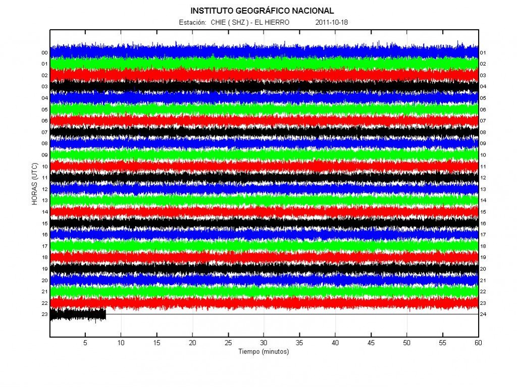
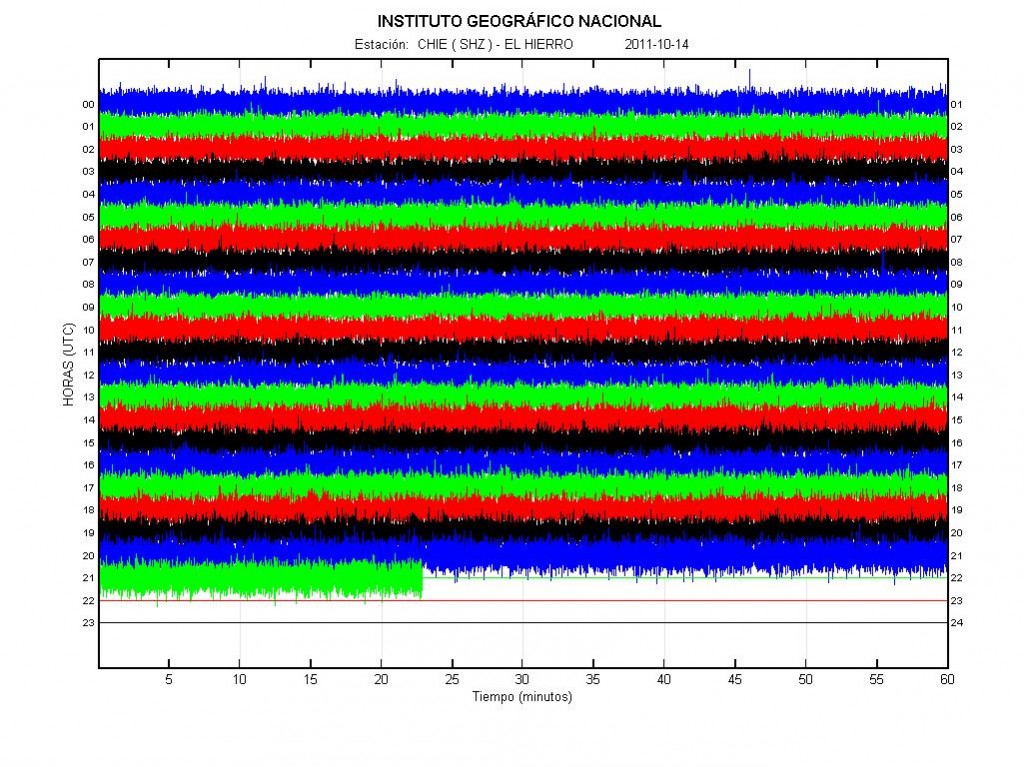
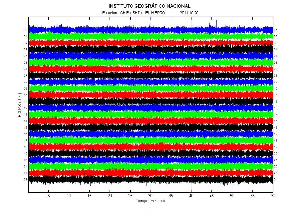
From the harmonic tremor data during the current eruption in El Hierro. It seems that the eruption has dropped in strength during the past 48 hours or so. But that most likely means that the current eruption crater is closing up. But this does not mean that the eruption is over, as new fissures might open up without any warning close the El Hierro Island or on the island it self. It is impossible to know that for sure at this moment. As it currently stands it is unlikely that a new Island is going to form offshore of El Hierro island, as the current eruption crater does not seem to have the energy to break the surface of the ocean. Earthquake activity in El Hierro volcano remains about the same as it has since the eruption did start on 10 October, 2011.


Harmonic tremor in El Hierro volcano at 18 October, 2011 at 23:26 UTC. Copyright of this picture belongs to Instituto Geográfico Nacional.
For the moment, the only thing that can be done is to wait and see what happens next. But it is clear that the eruption in El Hierro is far from over from the data that I have seen so far. But this eruption might pause for days to weeks, as that is not uncommon thing for a volcano to do during a active eruption cycle.

Special report: Update 4 on the eruption in El Hierro, Canary Islands, Spain

Short note on comments: During the eruption in El Hierro there has been a lot of comments on this blog. Over the past 4 days (or so) there have been about ~1500 comments. If your comments is held for moderation, the blog says so. Do not try to repost your comment if that is the case. As the second comment is just going to be held in moderation as the earlier one. It takes me a little while to approve the comment and to make it appear. If your comments disappears and cannot be seen, the spam filter has eaten it. It also takes me a while to check the spam filter and restore comments that have gone there. Please do not just post comment with nothing but links, that increases the risk that the comment is going to be eaten by the spam filter.
*****

Short note: Please note that I am not a expert in the field of volcanism, volcanoes and earthquakes. I never claim to be one. Regardless if I am asked or not. I am a man with interest in this field. I read a lot of books and studies on volcanoes and earthquakes. But that does not make me a expert in this field. If you want to speak with a expert, go and find one. Because I am not it.

Now. About the eruption in El Hierro volcano in Canary Islands. This is going to be a short blog post about the eruption.

From what I can tell and the information that I have seen. At least two more vents have opened up on the from what I can gather on the pictures and the reports from Canary Islands. So far all the new vents are under the ocean and at depth of no less then 150 meters. So seeing them directly is quite hard for the moment. There are continues deep earthquakes under El Hierro volcano, but that suggests that new magma is flowing into El Hierro volcano.

During the weekend floating magma bombs where (or some type of magma, I do not have the exact word for it in English at the moment) floating on the ocean. But this means that at least one of the vents that started erupting in the beginning is getting close to break the surface of the ocean. If the eruption continues in that vent for a little while longer. If it gets above the surface of the ocean, it is going to form a island and a lava eruption is going to start once the ocean cannot get any more into the crater.


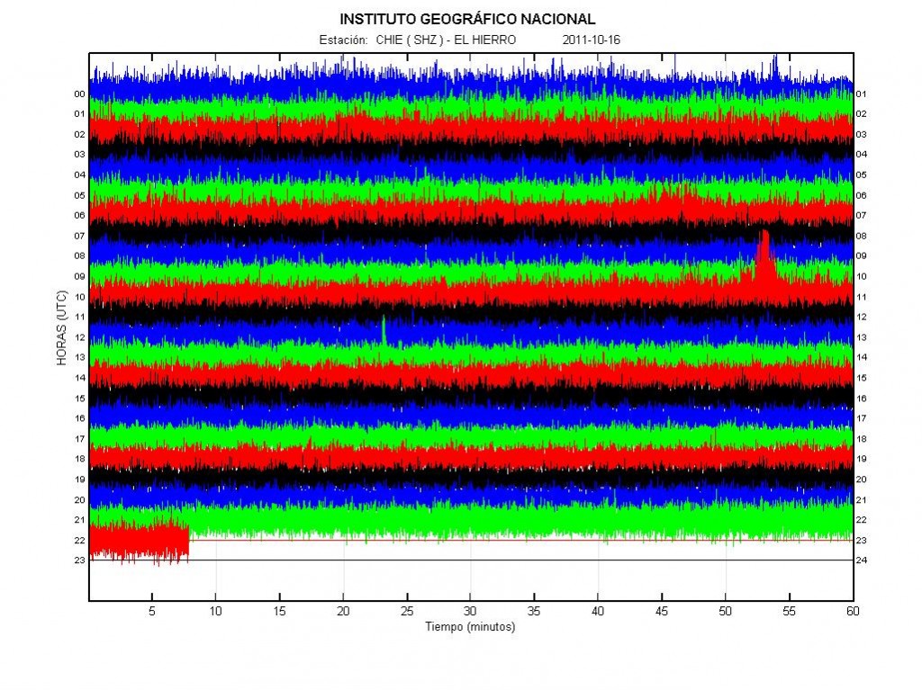
The harmonic tremor of the eruption in El Hierro volcano today (16 October, 2011) at 22:35 UTC. Copyright of this picture belongs to Instituto Geográfico Nacional.

There is a risk of new fissures in El Hierro opening up without warning. From what I am estimating, the area that this can happen has expanded about ~5 km or so from my original estimate that I made in few blog posts ago. The risk of new fissure opening up on land is going to remain high while this eruption is taking place. But this might well be a period of eruption activity for El Hierro. It is impossible to know for how long it is going to last, it could be weeks or it could be months and up to years of activity.

I am going to post more information on El Hierro when I know more tomorrow. I am also going to write about the earthquake activity in Hengill volcano tomorrow if I have time to do so.

Special report: Update 3 on El Hierro eruption in Canary Islands, Spain

I am going to fully integrate Canary Islands into my watch volcano monitoring system in the beginning of next month, but Canary Island won’t be part of my emergency system until I move to Canary Island (that is because of technical reasons mostly). When that happens, blog post regarding earthquake and volcano activity won’t be a special report. Just a normal blog post as with Icelandic volcanoes. I am doing this as I plan on moving to Canary Islands in about 10 years time (+- maybe few years depending on how my plans work out). A name change on this blog is planned in the beginning of the year 2012. But it takes a while for me to think up a new name for this blog.
******

The eruption in El Hierro volcano continues at the same phase as before. With little change so far. Currently the eruption seems to be in two vents, as it did when it started on Monday. There have been unconfirmed reports of new vents opening up closer to the coastline. But given lack of direct evidence that should be there. I do not believe that a new vents have opened up closer to the coastline so far.

Deep earthquake continue in El Hierro volcano. But that means a new magma is coming in from the mantle and is flowing upwards into the volcano. For long as deep earthquakes are being recorded the eruption is going to continue. It is impossible to know for how long this inflow of magma from the mantle is going to continue. But this means that the eruption is going to continue for time being. With the risk that new vents might open up at any time on and around El Hierro volcano. This inflow of new magma has also been confirmed by GPS measurements on El Hierro volcano (the island). But since the eruption did start, no major change has been seen on the GPS real time data.


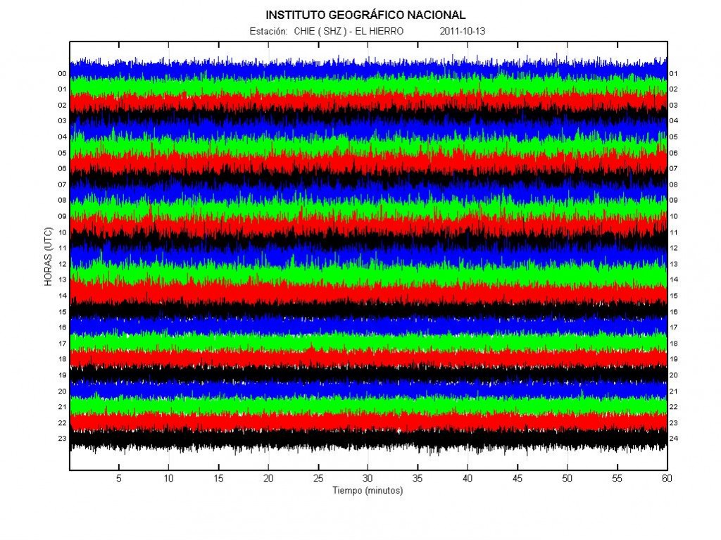
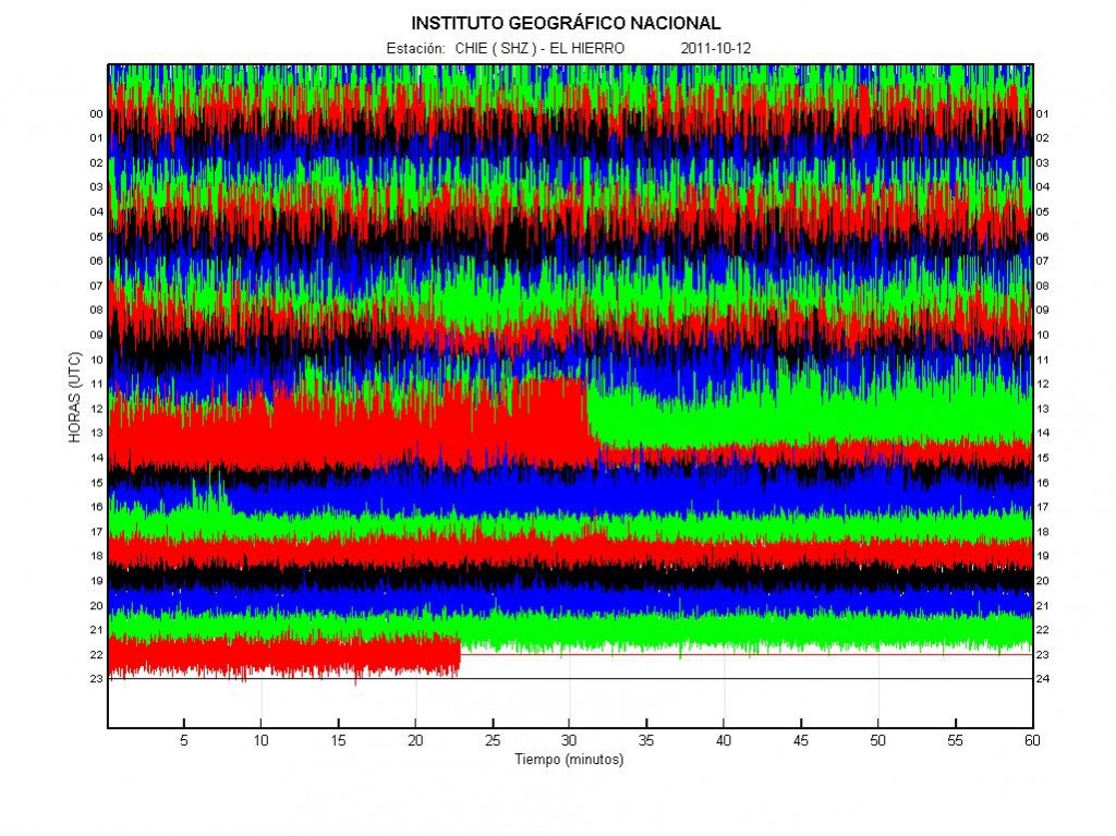
The harmonic tremor in El Hierro volcano yesterday. Copyright of this picture belongs to Instituto Geográfico Nacional.


The harmonic tremor in El Hierro volcano today (until 21:20 UTC about). As can be seen by comparing the pictures between today and yesterday. Not much has changed since yesterday in terms or harmonic tremor. Copyright of this picture belongs to Instituto Geográfico Nacional.

If a eruption vents open up on a land. The following eruption is going to be lava only. No volcano ash and no explosions as El Hierro is a shield volcano like the one on Hawaii and that means only lava eruptions. If a eruption vents opens up on the shallow coastline, there are going to be explosions for as long the ocean water can get into the crater. The moment it closes up the explosions stop and lava eruptions starts.

Please note that I am on slow internet connection (3G). So I am not going to post anything if the internet connection is really slow, as sometimes seems to happen. I am going to try and solve this issue by using my 3G phone and connect that way. At least I am going to try and see what happens.

Blog post updated at 03:20 UTC on the 15 October, 2011.

Special Report: Update 2 on the eruption in El Hierro

This is a special report on the eruption in El Hierro. This is also a good time (as any) to announce that I plan to write about volcanoes in Canary Islands in the future. As I plan on moving to the Canary Islands in about 10 years time (no reason to start late on this). But I have already induced the Canary Islands volcanoes into my personal watch system. But I have my own personal system to watch volcanoes in Iceland and now Canary Islands. However, Canary Islands are not part of my personal emergency system until I move to Canary Islands.

Update to the name of this blog is going to happen soon, but I am not sure when. But I am going to move in a about 10 years time (going to live in Denmark until that happens). Until then, they are going to go into special report group and only major events are going to be blogged about. Please note that this might change if I move earlier to Canary Islands then I now plan.

******

The eruption in El Hierro volcano continues today, as it did yesterday. But the strength of the eruption appears to have dropped today from what it was yesterday. But this does not mean that the eruption is over. It just means that the current fissure that is erupting is about to close up, mostly due to the material that it has been ejecting into the ocean floor. That means a new fissure or vents is about to open up somewhere. When and where is impossible to know. But this is the nature of volcanoes that erupt in this manner, but El Hierro is a shield volcano [second link here]. Good examples are Krafla volcano and Vestmannaeyjar Island volcano. Both of those volcanoes are in Iceland.

Today around 14:20 UTC there was a sharp tremor drop in El Hierro. This means that the magma flow dropped in the current eruption fissure. This also means that if the pressure is not enough that fissure is going to stop erupting. Because of this has happened a new fissure or a vent should be expect at any time as I have told before. When and where that might happen is impossible to know, as that outcome depends on where the magma finds its pathways inside the volcano. There might not be any earthquakes before this happens, as the rock is unlikey to be hard enough to make them. Some small earthquakes might happen if the rock layer is hard enough. Today few deep earthquakes have been recorded. This means that new magma is getting into El Hierro volcano from the mantle (where no earthquakes happen). This also means that this eruption might take place for some time now. But it is impossible to know for how long, as there might be a lot of magma flowing up from the mantle it self and up to El Hierro volcano.


The harmonic tremor and the drop in the harmonic tremor today. Copyright of this picture belongs to Instituto Geográfico Nacional.

Many people have been wondering why this eruption has not been seen. The fact is that depth drops quiet fast around El Hierro Island. Around 4 km out the depth is close to 1.5 to 2 km, it is only close to the island that the depth starts to get shallower. At the moment is is hard to say what happens next in this eruption on El Hierro. But more vents should be expect to open up then have already have.

I am going to update this blog post if anything changes in El Hierro volcano eruption.

What is happening in El Hierro volcano

This is a special blog post about the volcano El Hierro in the Canary Islands. The resons for this blog posts are those that this activity is interesting and there is not a lot happening at the moment in Iceland due to bad weather (nothing gets recorded in this bad weather).

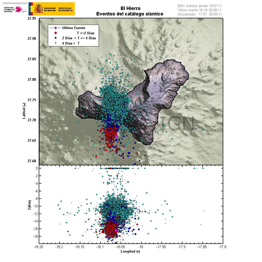
Currently El Hierro volcano is a phase that I personally call a magma intrusion phase (I have no other word for it). But that means that magma is currently coming from a depth, that is more then 20 km below the volcano and up the crust directly below the volcano. It is impossible to know how long this phase is going to last. As a example this phase for Eyjafjallajökull volcano lasted for good part of 17 years (with some breaks). When the pressure is high enough in the sill that is now forming in El Hierro the magma is going to break up the surface.

This pattern can clearly be seen on this image here.


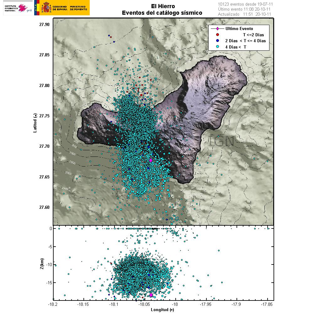
The magma is flowing up into the volcano at around 30 degree angle from the depth of more then 20 km. When a new magma injection starts, a new earthquake swarm starts in El Hierro. This magma injections are different in size and length. But as more magma collects into the bedrock in El Hierro the stronger earthquakes are going to take place. But this increases the pressure on the rock and inside the magma chamber that is now forming and can clearly been seen with the earthquake pattern. Copyright of this picture belongs to Instituto Geográfico Nacional.

I did see a picture that was made on Eruptions blog that did show his clearly, both the feeder channel of the magma and the magma chamber that is currently in the making. It seems that magma inflow into the new magma chamber or the sill in El Hierro is stable at the moment. But I base that view on the constant earthquakes that are currently taking place. But this magma inflow seems to have been stable since 16 July, 2011 when the magma started to push upwards into El Hierro.

Earthquakes that signal new inflow of magma do not need to be strong in size. But they are deep, with the most depth around 20 km. But the crust in this area is around 10 to 26 km thick. As this is a ocean crust in this area. But the Canary islands are the thickest crustal part in the area. But it is also important to notice that the magma chamber or the sill is expanding in all directions, not just upwards. That in it self is also going to create deep earthquakes. But those earthquakes should remain a bit outside the main area of the deep earthquakes that are currently taking place in the area.

I am expecting a lot more earthquake activity when or if El Hierro starts erupting. But when that might happen impossible to know for the moment. The only thing that can be done is too wait and see what happens.

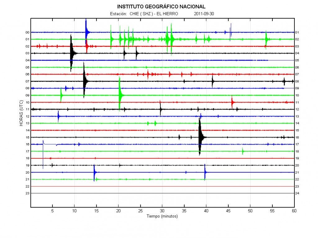
Update 1: Here is the earthquake activity for today (30 September, 2011).


Earthquake activity of today (30 September, 2011). There is less earthquake activity today. This happens when magma flows into a volcano. This did also happen with Eyjafjallajökull volcano in the year 2010. If anyone has the direct link too this plot, please leave it in the comments. Thanks. Copyright of this picture belongs to Instituto Geográfico Nacional.

Update 2: Links too El Hierro information can be found here.

Update 3: The Spanish news channel Canal 24 can be found here and it is live.

Update 4: Here is a news in english about the evacuation of El Hierro. It is from 28 September, 2011. Evacuation of El Hierro begins as fears of volcanic eruption grow. Thanks to Dr. John v. Kampen that did send this to me with a email.

Note: There are new pictures of Eyjafjallajökull volcano, Fimmvörðuháls craters here. They show the difference from the year 2010 and in the year 2011. The text is in Icelandic.

Also. Please support my effort so I can buy two new geophones and add them to my monitoring network in Iceland. Thanks! 🙂

Blog post has been updated 30 September, 2011 at 22:12 UTC.
Blog post has been updated 30 September, 2011 at 22:25 UTC.
Blog post has been updated 30 September, 2011 at 23:08 UTC.
Blog post has been updated 1 October, 2011 at 14:48 UTC.

New harmonic tremors spikes in Katla volcano

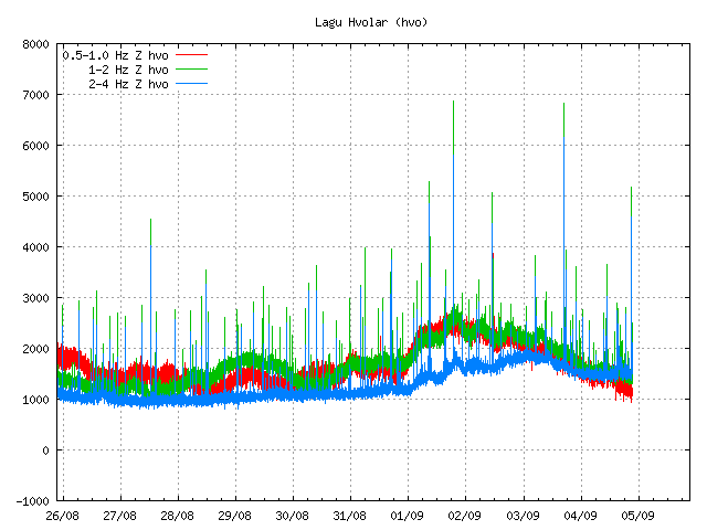
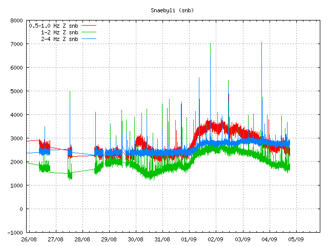
This has become almost a daily occurrence. But today there was one harmonic tremor spike (at least) in Katla volcano. It is unclear why this harmonic tremor spikes happen in Katla volcano. But they often do happen just before a earthquake swarm starts, but often several hours before (sometimes). I am not sure why that is. But one idea is that this activity is connected to hydrothermal areas that are under the Mýrdalsjökull glacier.

Earthquake activity has been quiet in Katla volcano today. But it is hard to know for sure if that is going to last. As earthquake activity appears to be on the rise in Katla volcano during the whole of the year 2011 according to news in Iceland (see earlier blog post for details).


Harmonic tremor spike as seen on Lágu Hvolar SIL station. The spike is between 04/09 and 05/09. The spike is a small top in the tremor chart (hard to spot). Copyright of this picture belongs to Iceland Met Office.


Harmonic tremor spike as seen on Snæbýli SIL station. The spike is between 04/09 and 05/09. The spike is the broad band that suddenly appears in the tremor data. It is easier to see then on Lágu Hvolar. Please note that it seems that Snæbýli SIL station has gone offline again, as it has stopped updating. Copyright of this picture belongs to Iceland Met Office.

It is clear that Katla volcano is going for a eruption. But the question remains is just when that is going to be, but it is impossible to predict when a eruption is going to take place in Katla volcano. But the signs have come clear in my opinion in this matter. For the moment it is just waiting and watching. But this might be a long wait until something happens in Katla volcano.

Inflation starts in Katla volcano

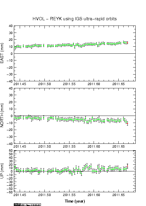
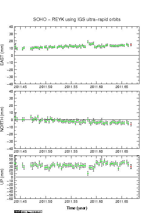
There seems to be inflation going on in Katla volcano, at least according to the automatic GPS data that IMO has on it’s web site. But this might be error in the data. But for the moment I do not think it is. But please do look at this data with the view that it might be wrong.


The inflation appears clearly on Lágu Hvolar GPS station. Copyright of this image belongs to Iceland Met Office.

The inflation can be seen on Lágu Hvolar and Sólheimaheiði GPS stations. But it appears to be more clear at HVOL GPS station. But that is most likey because that GPS station is closer to the magma pocket in question that creates this movement.


The inflation also appears on Sólheimaheiði GPS station. But not as clearly as on Lágu Hvolar GPS station. Copyright of this image belongs to Iceland Met Office.

What might be the critical inflation before a eruption starts is hard to know until it happens. For Eyjafjallajökull volcano that was 60mm, for Grímsfjall volcano the inflation was actually 350mm. But that volcano had eruptions that did not change it’s inflation numbers. I do not know why Grímsfjall volcano is so different in this respect from other volcanoes in Iceland (that I know of so far).

Grímsfjall volcano inflates after the large May 2011 eruption

It can be sad that Grímsfjall volcano did not waste any time starting to prepare for next eruption after the large May 2011 eruption. But that eruption was the largest one in at least 140 years or so. This large eruption did mean that there was a large deflation that took place during the eruption. Where the most deflation was around 250mm down, and around 300mm north, and around 350mm east.

Since then Grímsfjall volcano has however been inflating at interestingly high speed. Currently the GPS data shows that it has reached around 250mm east, north and 200mm up since the eruption. But the magma chamber is going to expand horizontal before it expands upwards (think of this in 3D). So it is going to be a while until a inflation upwards is going to be seen.

The GPS data is clear on this as can bee seen here.


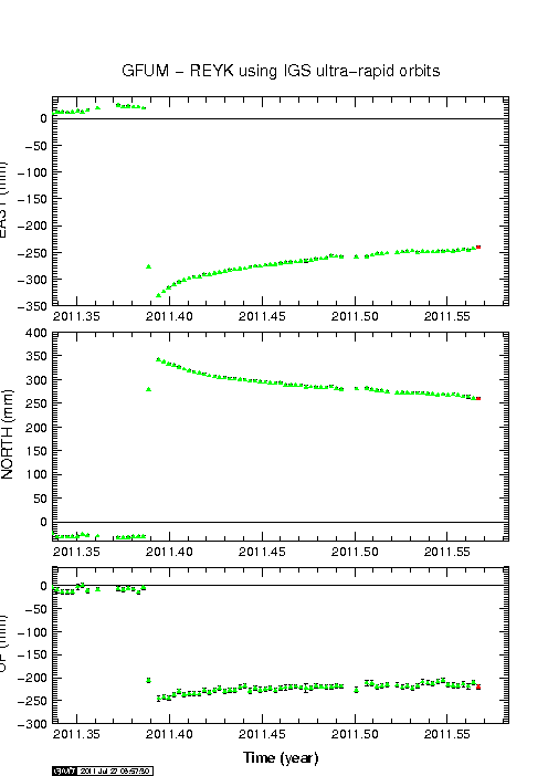
Current inflation at 27. July 2011. Copyright of this picture belongs to Icelandic Met Office.

It is hard to know when Grímsfjall volcano is going to erupt next after this big eruption. But it might take few years until we see a new eruption in Grímsfjall volcano.

Magma movements under Hekla volcano have been confirmed

According to the news on Rúv the GPS movements that many have been seeing around Hekla volcano in the past few days are real. At the moment the civil disaster authorities have been notified and also local emergency authorities. Nobody seems to know what is going on with this magma moments for the moment. But they can be tracked with the GPS network to some extent. What is more interesting is that this does not seems to have started until few days ago. But first signals of this happening did take place in April and May, but at lot smaller scale. What is interesting is that fact that no earthquakes appear during this magma movements, there is also no harmonic tremor when the magma is moving around in the crust close to Hekla volcano. But if there is any earthquakes, noise or whatever coming from Hekla volcano it is going to appear on my geophone that is located about 16 km away from peak of Hekla volcano. The distance is even less from the actual edge of the Hekla volcano system it self.

Normally, there are no changes in the GPS network before an eruption in Hekla volcano. So this is highly unusual event in Hekla volcano since instrumental monitoring started few decades ago.

It is an question if this means an fissure style of eruption is going to take place in Hekla volcano. But that does sometimes happen, as with any volcano in Iceland. For the moment however the only thing that can be done is wait and speculate (within reason).

No eruption has started in Hekla volcano. But it can be assured that it might start without any warning and I might not be around the computer when that start, since I am working during the day and feeling tiered during the evening. But I am getting slightly better on that front, thankfully.

I am going to post more on this when I do know more, or if anything happens in Hekla volcano related to this.

Icelandic News about this.

Hræringar í Heklu (Rúv.is, Icelandic)

Explosions are still taking place in Grímsvötn crater

While the activity has almost stopped in Grímsfjall volcano, but there are still explosions taking place in Grímsvötn lake where the eruption took place due to magma going up, explosions take place all over the fissure at random times. That makes travelling to this area really dangerous thing to do. Ash fall is still taking place in Grímsfjall volcano when explosions take place. But the ash fall is limited to the local area in Grímsfjall volcano. Because of this, the official word is that the eruption is not yet over. Even if it just an small eruption at the moment. So far there is no data that suggests that new magma is currently flowing into Grímsfjall volcano. This is according to news in Icelandic media.

An new caldera (correct word?) has formed in the glacier close to the eruption site. But that suggests that a lot of heat is below in the glacier and is creating strong melt where this taking place. This is according to news on Rúv. But they don’t say where this glacier melt is taking place. But it can be assumed that this formation is somewhere close to the current eruption site. But when I know more about this location. I am going to update this post when I can.

Harmonic tremors pulses are still being detected from Grímsfjall volcano up to 200 km away from the volcano. Why they are still taking place while there is no eruption taking place is unknown to me. It is important to notice that currently the harmonic tremor is slowly dropping for now. But it might increase again without any warning. For now there is no way to know what this tremor means for Grímsfjall volcano.

Automatic GPS data from Icelandic Met Office tells an interesting story. According to this data (it might not be 100% accurate due to nature of GPS) Grímsfjall volcano has moved close to 320mm to the west, close to 350mm to the north, it has also lowered down about 250mm. This is major movement in Grímfjall volcano. To compare it with something, Eyjafjallajökull volcano only inflated about 60mm before it did erupt. This is many times more deflation that took place in Grímsfjall volcano then in Eyjafjallajökull volcano for example.

Earthquakes are still taking place SE and SSE of Grímsfjall volcano. There is no volcano at this location. So I am assuming that this are tectonic earthquakes taking place due to stress changes in the crust around Grímsfjall volcano. All earthquakes so far have been small but with the depth from 15 and up to 5 km.

Extra: According to new news (while I was writing this blog post). The Civil Emergency Authority in Iceland has lowered the alert level from danger level to alert level. News about that can be read here (Icelandic, mbl.is)

Icelandic News about this. Google Translate in an maze. It might work or maybe not.

Enn sprengivirkni í Grímsvötnum (Rúv.is, Icelandic)
Jarðeðlisfræðingur: Orðum ofaukið að gosinu sé lokið (Vísir.is, Icelandic)