Strong earthquake swarm south of Jan Mayen (Norway)

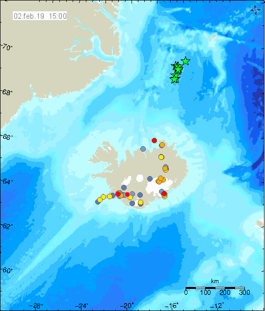
During early morning of 2-January-2019 a strong earthquake swarm took place south of Jan Manyen (Norway) or about 350 km north of Kolbeinsey island. I don’t know if there are any volcanoes in this area, but it is possible. This might also just be tectonic earthquake swarm. Largest earthquake in this swarm had a magnitude of 5,0 (EMSC information here). Second largest earthquake in this swarm had a magnitude of 4,6 (EMSC information here). Up to ten earthquakes with magnitude between 4,3 to 5,0 took place in this swarm. Icelandic Met Office has listed ten earthquakes on their map, the magnitude is not correct on their map due to distance from the SIL network.


Earthquake swarm south of Jan Mayen (Norway). Copyright of this image belongs to Icelandic Met Office.

Due to distance from any seismometer network a lot of smaller earthquakes were not recorded in this earthquake swarm. It also makes it impossible to know for sure if this earthquake swarm is currently ongoing or if it has ended.

Donations

Please remember to support my work with donations. They help me get trough broke months like February is going to be for me. Thanks for the support. 🙂

Two earthquakes larger then magnitude 3,0 close to Jan Mayen

Today (1-September-2015) two earthquakes happened close to Jan Mayen (around 360 km away from Iceland). Those earthquakes are possibly part of larger swarm in the area, but due to distance from Iceland Met Office seismic network it is difficult to know for sure. I didn’t find any information about those earthquakes in the NORSAR seismic array information system.

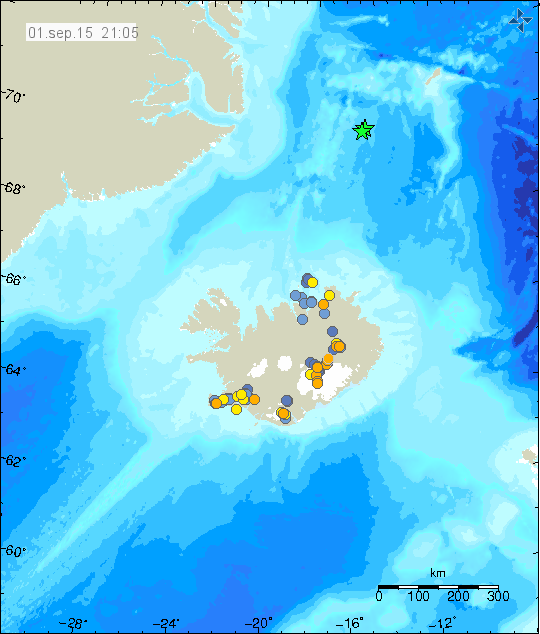
150901_2105
Earthquake location are where the green stars are on the map. Copyright of this image belongs to Iceland Met Office.

Those earthquakes had the magnitude of 3,3 and 3,5. Depth is uncertain due to the distance from SIL network. Smaller earthquakes from this swarm are not detected by the NORSAR (Norway) or the SIL network (Iceland) due to distance from seismometers at both locations. There is no populated area close to the source of this area (closer then 100 km).

Update on the missing person case

Body of the person that was found two weeks ago in east Iceland has been identified. More information can be found here.

Two earthquakes in Jan Mayen today (30.08.2012)

Today (30.08.2012) Jan Mayen was hit by two earthquakes. The second earthquake was not an aftershock of the first one. But it remains an question if it was triggered by the first earthquake. The first earthquake had the magnitude of Mw6.6 according to EMSC web site. The second earthquake had the magnitude of Mb5.3 according to EMSC. Both earthquakes where felt by Norwegian military and science staff that resides on Jan Mayen.
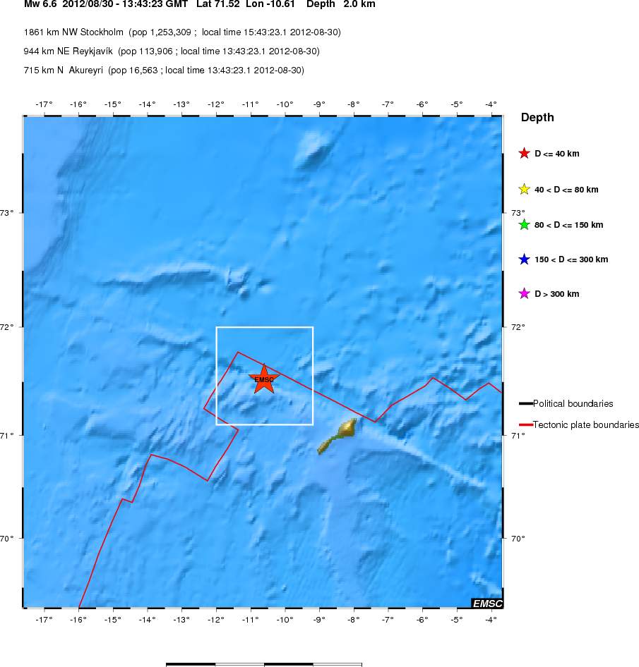

Location of the Mw6.6 earthquake off the coast of Jan Mayen. As can be seen. This earthquake took place far out in the ocean. Copyright of this image belongs to EMSC.

The second earthquake was less in magnitude. But was closer to the Jan Mayen Island. For that reason it was possibly felt better the first earthquake.
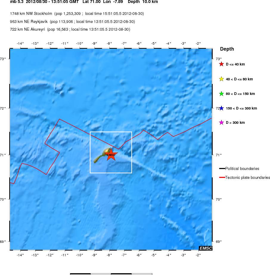

Large view of the second Jan Mayen earthquake. This earthquake had the magnitude of Mb5.3. Copyright of this image belongs to EMSC.
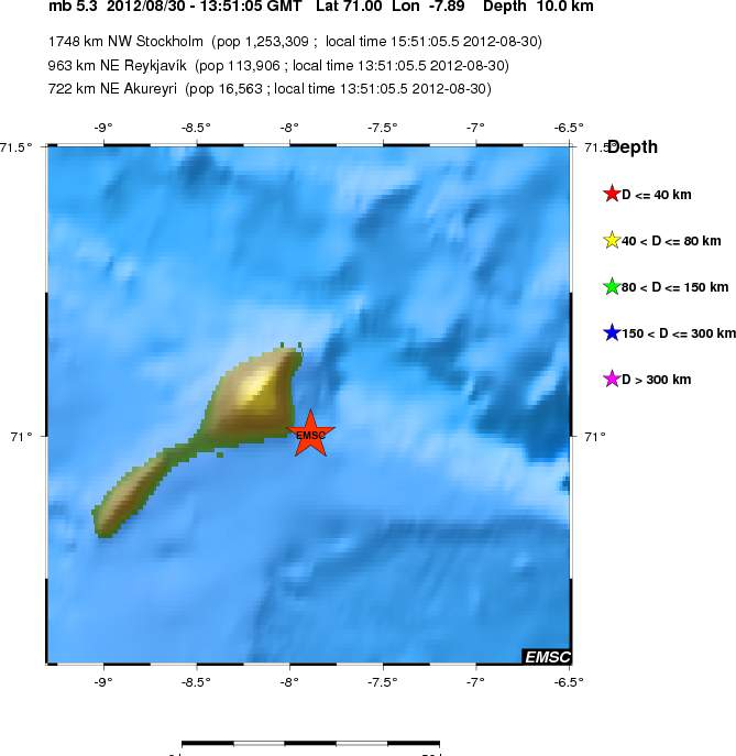

Close up view of the second Jan Mayen earthquake. Copyright of this image belongs to EMSC.
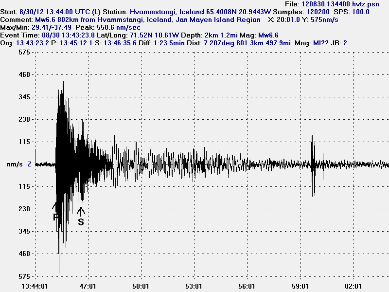

The Mw6.6 earthquake that took place in Jan Mayen. This geophone station is the closest to the earthquake in Jan Mayen. This image is released under CC licence. Please see CC licence page for more details.
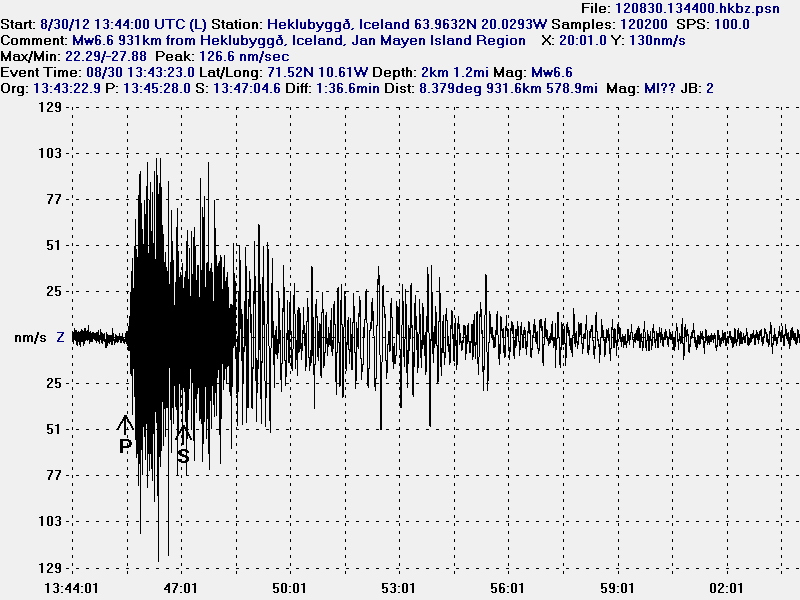

The Mw6.6 Jan Mayen earthquake as it was seen on Heklubyggð geophone station. This image is released under CC licence. Please see CC licence page for more details.
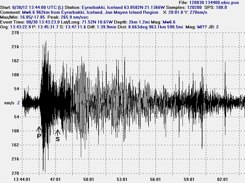

The Mw6.6 Jan Mayen earthquake as it was seen on Eyrarbakki geophone station. This image is released under CC licence. Please see CC licence page for more details.
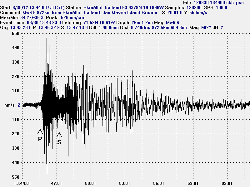

The Mw6.6 Jan Mayen earthquake as it was seen on Skeiðflöt geophone station. The P-wave goes trough something that speeds up it’s arrival. Something that the software that I use cannot account for. That is why the P-wave is in the wrong location. As model vs reality do not match in this case. This happen frequently with my location data. This image is released under CC licence. Please see CC licence page for more details.
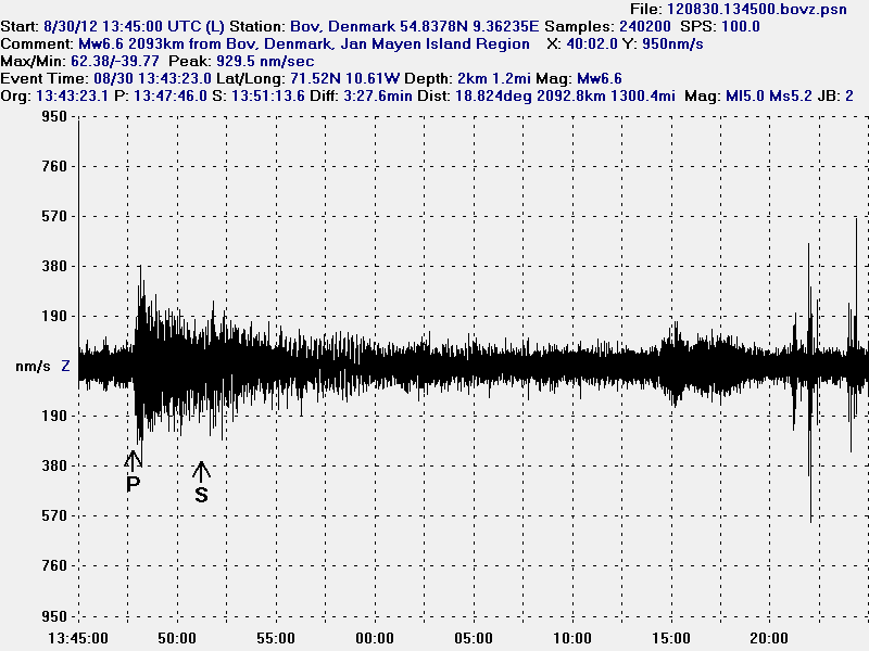

I did also record this earthquake in Denmark. Where I now live. This is the most distance that I did record this earthquake. But the distance was around 2000 km. The signal did appear. But I did not record any surface waves as I did in Iceland. Background noise is also higher here in Denmark then in most location in Iceland and it is more constant. This image is released under CC licence. Please see CC licence page for more details.

I did not record the Mb5.3 earthquakes on my geophones. It was just too small for my hardware to detect it. The waveform from the second earthquake was also lost in the surface waves from the first earthquake during this time period. At least when it comes to my hardware as it currently is.

Icelandic news about this earthquake

Jarðskjálfti við Jan Mayen – 6.6 stig (Vísir.is)
Almannavarnir: Ekki miklar líkur á flóðbylgju (Vísir.is)
Jarðskjálfti upp á 6,6 stig (mbl.is)

Norwegian and danish news about this earthquake

Kraftig jordskjelv utenfor Jan Mayen (NRK.no)
Skælv på 6,6 ryster Grønlands østkyst (DR.dk)
Earthquake swarm north of Jan Mayen Island

This blog officially also covers Jan Mayen Island north of Iceland. But since the Jan Mayen Island is uninhabited, activity there is not on the top priority list and I do not mention the Jan Mayen area as such because of this.

Yesterday (15.01.2012) there where two earthquakes detected by EMSC north of Jan Mayen Island. This earthquakes happened in the rift zone that is in this area. The largest earthquake had the size Mb4.9 with the default depth of 10 km. The smaller earthquake had the size Mb4.2 with the default depth of 10 km.

This area has the depth of around 2 km where it is shallowest (mountain peaks) so it is impossible to what is going on. But this is most likely tectonic earthquakes rather then volcanic earthquakes that are taking place in this area. But due the distance from populated areas and any seismometer networks only the largest earthquakes are detected when they happen. Norway National Seismic Network can be found here, they have some better resolution of earthquakes in the Jan Mayen Island then EMSC.