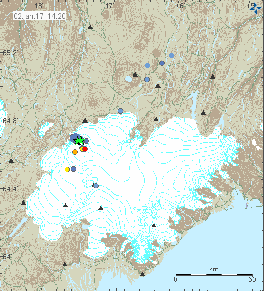
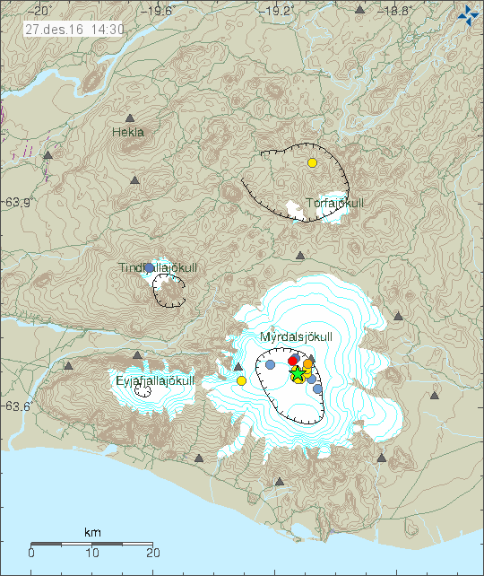
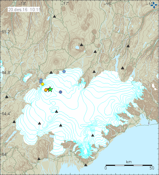
Images of earthquakes in Katla volcano and GPS data

Here are few images of the last earthquakes in the large earthquake swarm that took place in Katla volcano 28 – 30-September-2016. The alert status for Katla volcano has been downgraded from Yellow to Green.

Earthquake information from Heklubyggð geophone

I was only able to record few earthquakes from the swarm in Katla volcano. Along with the largest earthquakes that happened. Most of the earthquakes where hybrid earthquakes or Volcano tectonic earthquakes, few low frequency earthquakes took place, but I recorded them really poorly due to weather and strong wind at the time in south Iceland. More information about earthquake volcano types can be found here (USGS) and here (alaska.edu). There are no P and S wave markers in this images. I didn’t have the time to process this earthquakes properly yet.

160930-044000-hkbz-psn
The first earthquake appears to be hybrid earthquake. The second earthquake appears to be a volcano tectonic earthquake. This image is under Creative Commons Licence, please see CC Licence page for more details.

160930-120200-hkbz-psn
This appears to be a volcano tectonic earthquake. This image is under Creative Commons Licence, please see CC Licence page for more details.

160930-120700-hkbz-psn
The first earthquake appears to be volcano tectonic earthquake, the second earthquake appears to be two earthquakes happening at once. Making analyse of what type this is difficult. The last earthquake appears to be a hybrid earthquake. This image is under Creative Commons Licence, please see CC Licence page for more details.

The largest earthquakes all appear to be volcano tectonic earthquakes. Other earthquakes where difficult to record due to high wind noise at that time.

GPS information

I finally found the GPS information website for Katla volcano. There isn’t much change on most of GPS station around and on Katla volcano. The most change is happening in Austmannsbunga (AUST) inside the caldera. Other GPS stations do now show this change, suggesting that it might be highly localised change not appearing on other GPS station for now. This doesn’t look like a error or a fault in the measurements. The GPS website for Katla volcano can be found here.

Katla volcano update at 17:12 UTC

This is going to be the last update on Katla volcano until something more happens.

Currently everything is quiet in Katla volcano. Only two earthquakes happened during the night, the larger one had the magnitude of 2,0 the smaller earthquake had the magnitude of 0,5. There is a good chance that smaller earthquakes have been taking place without being detected due to a bad weather in the area at the moment. Conductivity remains high in Múlakvísl around 180 µS/cm, it is lower today then yesterday, possibly due to heavy rain in south Iceland.

161002_1645
The earthquake activity in Katla volcano during the past 48 hours. Copyright of this image belongs to Icelandic Met Office.

Quiet period in Katla volcano can last up to a week (in my experience). What exactly happens next is impossible to know, but it is clear that Katla volcano is getting real close to erupting. When that might happen is impossible to know as before. All that can be done is to wait and see.

Storm warning for Iceland Sunday and Monday

There is a storm warning for Iceland for Sunday and Monday. Wind gusts can go up to 40m/sec with constant wind at 20m/sec and heavy rain. Please check vedur.is for more information.

Katla volcano update at 20:44 UTC

This article is going to be updated as needed.

Since yesterday (30-September-2016) Katla volcano has been quiet. For the last 24 hours no major earthquakes (above magnitude 3,0) has happened. Only few minor earthquakes have happened in this period and almost all of them where less then magnitude 2,0 earthquakes. Only two earthquakes had the magnitude above 2,0 and none above 3,0.

161001_1940
The earthquake map of Katla volcano for the last 48 hours. Copyright of this image belongs to Icelandic Met Office.

Conductivity in Múlakvísl glacier rivers continues to be high and the glacier river has unusual low amounts of water in it. When this is written the value has dropped down to 104 µS/cm from the high of 221 µS/cm. The folk tale for this are is that sometimes Múlakvísl glacier river goes dry just before an eruption. I don’t know if that phoneme gets confirmed or not when a eruption starts in Katla volcano.

The reason for this earthquake activity in Katla volcano is due to magma trying to push it self to the surface from depth. If experience is anything to go by it is clear that current activity is not over, even if there is a drop in activity at the moment. I’ve seen this type of drop in activity before, few hours before the eruption (the first one) in Eyjafjallajökull 2010 and in Bárðarbunga volcano 2014. The lack of earthquake can have many reasons behind it. The magma might now be flowing without a resistance, the pressure has equalised for the next few hours (if that time is not running out already) or something else. Currently all that can be done is to wait and see what happens next.

Streaming web cameras of Katla volcano

Here are two streaming web cameras for Katla volcano.

Rúv live web camera of Katla volcano.
Live from Iceland web camera of Katla volcano.

Storm warning for Iceland Sunday to Monday

On Sunday and Monday there is going to have strong storm in Iceland with wind gusts up to 40m/s in south Iceland to start with. Heavy rain is going to follow this storm according to the weather forecast at the moment.

Article updated at 22:16 UTC. Links to live cameras of Katla added.

Katla volcano update at 10:48 UTC

This article is going to be updated as needed today (30-September-2016).

During the last 48 hours total of 261 earthquake has happened in Katla volcano when this is written. Largest earthquakes during the last 24 hours have the magnitude of 3,1 and 3,2. The largest earthquake had the magnitude of 3,6. Since there is no eruption currently there has not been any change in the harmonic tremor.

160930_1025
The earthquake activity in Katla volcano. Copyright of this image belongs to Icelandic Met Office.

The current earthquake activity started in end of August with the magnitude 4,5 and 4,6 earthquake activity. After doing a short review of the earthquake during this period I did see it. During this period the earthquake activity has been constant, but at lower lever then it is currently. There is now in my view a good chance that this is going to end in a eruption. It might not happen, but the odds are less in that outcome at the moment. Earthquake activity is pulsating, I don’t know why that happens. Same pattern was seen in Bárðarbunga volcano last year when magma was pushing it self through the crust until an eruption started. Currently the alert status for Katla volcano is green. Information can be found here.

Next update is going to be a few hours or soon as something interesting happens.

Update at 12:42 UTC

Colour code for Katla volcano has been upgraded to Yellow. Map can be found here.

Update at 15:35 UTC

When this is written the activity in Katla volcano has quieted down a little. This has happened several times during the last 48 hours so it might not mean anything. Large earthquakes happened at 12:07, a magnitude 3,6 and at 12:09 a magnitude 3,6. Earthquakes at 12:10 and 12:13 UTC where both magnitude 3,2. Some of the largest earthquakes have been felt in nearby populated areas (farms, not felt in Vík í Mýrdal far as I know). No harmonic tremor has been detected and that means an eruption has not yet started.

160930_1510
Green stars show the earthquakes with magnitude above 3,0 in Katla volcano. Copyright of this image belongs to Icelandic Met Office.

The current earthquake activity is now showing up in a area that has the direction North-East and South-West. Suggesting that magma might break up in a fissure at this location if it can break up trough the crust. The other possibility is always that this just stops and nothing more happens. I’m not sure if that is going to be the result now.

Update at 19:06 UTC

Uncertainty level has been declared for Katla volcano and nearby area.

Update at 23:06 UTC

The road to Sólheimajökull glacier has been closed by the police until the current situation is over in Katla volcano. Currently the rate of earthquakes is low but earthquakes do continue to happen in the same area as before.

160930_2135
The earthquake activity in Katla volcano. Green stars are earthquakes with magnitude above 3,0. Copyright of this image belongs to Icelandic Met Office.

While the activity has slowed down the for moment I don’t think this is over, at least not until the earthquake activity completely stops for a long period of time. Currently the earthquake activity is back to the levels it was on after the magnitude 4,5 and 4,6 earthquakes on 29-August-2016. It might increase again without warning.

Article updated at 11:00 UTC. Added missing links.
Article updated at 12:42 UTC. Update added.
Article updated at 15:35 UTC. Updated added.
Article updated at 19:06 UTC. Updated added.

Heavy earthquake activity in Katla volcano, high conductivity in glacier rivers

This is going to be a short article, as the current situation is constantly changing.

Earthquake swarm started around 03:00 UTC (29-September-2016) in Katla volcano, this earthquake swarm has been heavy due to high number of earthquakes, when this is written around 88 earthquakes have been recorded in Katla volcano. This number is going to change as the earthquake activity continues.

160929_1540
The earthquake activity in Katla volcano. Copyright of this image belongs to Icelandic Met Office.

According to a statement that Icelandic Met Office issued the conductivity in glacier rivers from Katla is higher than normally during this time of year. At current it is 190uS and according to the Icelandic Met Office this is not normal during this time of the year. At the present no harmonic tremor has appeared, if it appears it is going to be clear on the SIL stations around Katla and maybe good distance away from the volcano. As it is going to override any background noise that might be happening (wind, noise, traffic).

This article is going to be updated as I learn more.

Update at 19:00 UTC

The earthquake activity has continued today as before, there have been small drops in activity for up to a hour, after that the earthquake activity continues. Currently (when this is written) there is a low in the earthquake activity. Largest earthquake was at 16:28 UTC and had the magnitude of 3,0. Other earthquakes have been smaller in magnitude.

160929_1845
The earthquake activity at 18:45 UTC. Copyright of this image belongs to Icelandic Met Office.

Update on earthquake area location

Most of the earthquake activity today (29-September-2016) has been taking place north of cauldron 16 (see map). This makes it less likely to be connected to hydrothermal area and changes in that type of area. Since hot-springs create the cauldron seen in the Mýrdalsjökull glacier, the heat melts the bottom of the glacier and creating glacier outburst once in a while. It does appear that the earthquake activity has extended it self into cauldrons 10 and 11 and maybe cauldron 16, but I’m not sure on that detail currently.

katla2011
Earthquake activity in Katla after the year 2011. Cauldrons are marked with numbers and location on this map. Copyright of this map belongs to Icelandic Met Office. Source link.

Article updated at 16:05 UTC. Time corrections on when this activity started.
Article updated at 19:00 UTC. Updated added.
Article updated at 19:47 UTC. Map added from 2011.

Overview of micro-earthquake activity in Iceland 28-September-2016

This is a short overview of the micro-earthquake activity in Iceland on 28-September-2016. Please note that some of this earthquake activity may have started some days ago and only got really busy on 28th September 2016.

Kolbeinsey Island / Ridge

Late on the 28-September-2016 an earthquake swarm took place in Kolbeinsey Island / Ridge. This is the largest earthquake swarm in this article. With the largest earthquakes having the magnitude above 3,0. Due to distance from the SIL network exact calculation of the magnitude and depth doesn’t appear to be possible. Last eruption taking place in Kolbeinsey Island / Ridge took place in the year 1755. No other eruptions have been documented since, but they might regardless have happened. The area is far from land and difficult to observe.

East of Grímsey Island (Tjörnes Fracture Zone)

Minor earthquake swarm has been taking place earth of Grímsey Island in a area that many suspect is a volcano (it is marked as such in the GVP database). The earthquake swarm in question does not appear to be a volcanic in origin. This appear to be a tectonic activity taking place, as the movement of TFZ is 20mm lateral movement/year (they fault slide each other 20mm/year) the rift movement is only 5mm/year (eastern part only). Image showing the movements can be found here (vedur.is).

160929_0025
Earthquake activity in Kolbeinsey Island and Tjörnes Fracture Zone. Copyright of this image belongs to Icelandic Met Office.

South Seismic Zone (SISZ)

A small swarm of earthquakes has been taking place in SISZ this week. The largest earthquake in this swarm has only had the magnitude of 2,1. The activity is only minor and does not suggest a large earthquake is about to happen. This might be aftershocks of the earthquakes in 2000 or 2008.

160929_0045
The earthquake activity in SISZ. It’s only minor and west of Selfoss (red dot). Copyright of this image belongs to Icelandic Met Office.

Reykjanes peninsula

Earthquake swarm started on 28-September-2016 on the Reykjanes peninsula. This earthquake swarm was not strong and the largest earthquake in this swarm only had the magnitude of 2,1 and all other earthquakes where smaller in magnitude. Total of 60 earthquake happened when the swarm was active.

160928_1425
The earthquake swarm on the Reykjanes peninsula. It was not big in magnitude, but had a total of 60 earthquakes. Copyright of this image belongs to Icelandic Met Office.

Few earthquake have also been taking place around Iceland without any other activity. This type of one-off earthquake activity is common in Iceland. Why it happens is unclear.

Article updated at 02:03 UTC on 29-September-2016. Word corrections.

Magnitude 3,9 earthquake in Katla volcano

Today (26-September-2016) an magnitude 3,9 earthquake took place in Katla volcano caldera. This earthquake had the unusual depth of 0,0 km (error margin is around +-200 meters or more). This was the largest earthquake in a earthquake swarm that started yesterday (25-September-2016). It has for the past 48 hours been slowly increasing in magnitude and size. Most of the earthquakes where smaller than 1,0 in magnitude. Few magnitude 2,0 (and larger) earthquakes took place today in Katla volcano. In total 30 earthquakes have so far taken place in Katla volcano during the past 48 hours.

160926_1600
The earthquake activity in Katla volcano. Copyright of this image belongs to Icelandic Met Office.

This earthquake swarm and the largest earthquake happen slightly south of the area that had the magnitude 4,5 and 4,6 earthquake swarm almost a month ago (article can be found here). This same area was also active month ago, but only with minor earthquakes. What this pattern suggests is that possible two or more fissures might open up inside the caldera once it erupts. The east-west fissure might be up to 10 km long and south of it a fissure that is up to 5 km long might open up. This is only my view and only speculation, but I cannot ignore the fact that this earthquake swarm activity is lining up in interesting way and that highly suggests that a fissure or a rift process has started in Katla volcano. If it continues or stop is impossible to know.

During documented history (~1000 years) Katla volcano has had most eruption during the period of July until end of November. With few eruptions taking place in January and February. There are huge gaps in this information due to historical inaccuracy, lost information and so on. As before, there are no clear signs of eruption being imminent, but I got the feeling that its not long now, at least less than 10 years until an eruption in Katla volcano.

Article update at 22:11 UTC on 27-September-2016. Minor spelling fixes.

The earthquake swarm in Hengill volcano

For the past two days swarm of earthquakes have been taking place in Hengill volcano. Looking at the earthquake swarm it might look like something was about to happen in this volcano. The fact is however that nothing is happening in the volcano, this earthquake swarm is entirely human made. Largest earthquakes so far have had the magnitude of 3,0 (x2), 3,2 (x1), 3,6 (x1). Over 300 earthquakes in total have happened so far, most less than magnitude 1,0 few dozen above magnitude 2,0.

160919_1920
The earthquake swarm as it was at 19:20 UTC. Copyright of this image belongs to Iceland Met Office.

Source of this activity is water pumping into the ground. The hydro-thermal electric plant (it also serves hot water to Reykjavík area and other towns nearby) does that with unwanted waste water, since that water is full of toxic chemicals. The hot water used in hot taps and showers in Reykjavík now is warmed up cold water (they use thermal exchangers to do this, some houses have this unit installed inside the house).

This earthquake swarm is currently on-going and if anything major happens I will update this article.

Weather warning for Thursday 22-September-2016

It appears that a strong low pressure system is on its way to Iceland and is going to at the south coast on 22-September-2016. I don’t have a exact time at the moment. This might the first real storm in Iceland this fall. More weather details are going to appear tomorrow as the forecast gets better.

Earthquake activity in Bárðarbunga volcano

Two earthquakes with magnitude above 3,0 have taken place in Bárðarbunga volcano. The earlier earthquake had the magnitude of 3,8 and the second earthquake had the magnitude of 3,8. Other minor earthquakes also happened.

160918_2250
Earthquake activity in Bárðarbunga volcano. Copyright of this image belongs to Iceland Met Office.

This type of earthquake activity in Bárðarbunga volcano has been going on for months already. What has mostly changed over the last four months is the magnitude of the earthquakes. The rate they are happening is about the same at the moment, once to twice a week currently. I don’t expect this to change until it does.

Fresh earthquake activity in Katla volcano

Today at 12:19 UTC an earthquake swarm started in Katla volcano. This has been mostly normal earthquake activity for Katla volcano, with earthquakes that are small in magnitude and most not reaching magnitude 2,0. Largest earthquake took place at 15:57 UTC and was a magnitude 3,0 and at magnitude 16:12 UTC and had the magnitude of 3,3.

160911_2135
The earthquake activity in Katla volcano. Copyright of this image belongs to Icelandic Met Office.

It is difficult to know if this earthquake activity was due to change in hydrothermal systems that exist in this area or due to magma or gas pressure changes. No harmonic tremor changes have taken place following this earthquake activity. Since the largest earthquakes happened the activity has quieted down considerably. This earthquake activity or a new one might start without warning in Katla volcano.