Special Report: Update 2 on the eruption in El Hierro

This is a special report on the eruption in El Hierro. This is also a good time (as any) to announce that I plan to write about volcanoes in Canary Islands in the future. As I plan on moving to the Canary Islands in about 10 years time (no reason to start late on this). But I have already induced the Canary Islands volcanoes into my personal watch system. But I have my own personal system to watch volcanoes in Iceland and now Canary Islands. However, Canary Islands are not part of my personal emergency system until I move to Canary Islands.

Update to the name of this blog is going to happen soon, but I am not sure when. But I am going to move in a about 10 years time (going to live in Denmark until that happens). Until then, they are going to go into special report group and only major events are going to be blogged about. Please note that this might change if I move earlier to Canary Islands then I now plan.

******

The eruption in El Hierro volcano continues today, as it did yesterday. But the strength of the eruption appears to have dropped today from what it was yesterday. But this does not mean that the eruption is over. It just means that the current fissure that is erupting is about to close up, mostly due to the material that it has been ejecting into the ocean floor. That means a new fissure or vents is about to open up somewhere. When and where is impossible to know. But this is the nature of volcanoes that erupt in this manner, but El Hierro is a shield volcano [second link here]. Good examples are Krafla volcano and Vestmannaeyjar Island volcano. Both of those volcanoes are in Iceland.

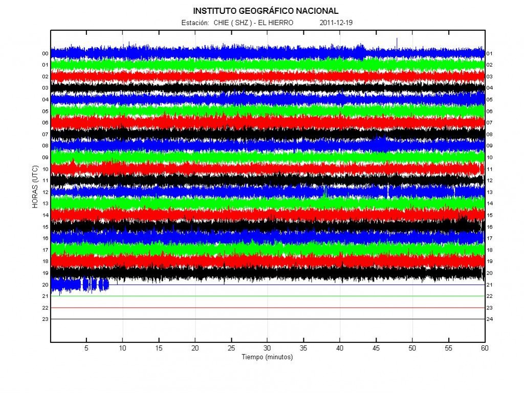
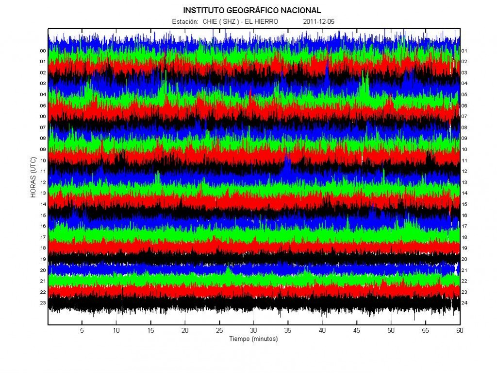
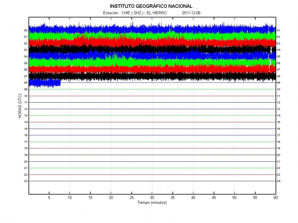
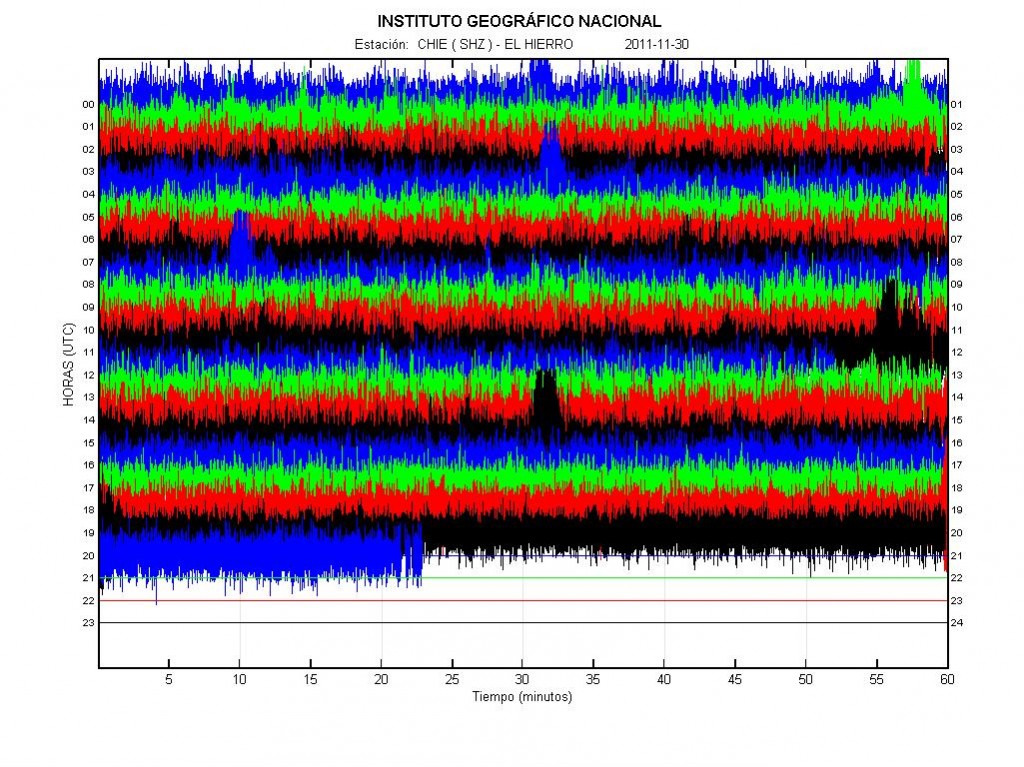
Today around 14:20 UTC there was a sharp tremor drop in El Hierro. This means that the magma flow dropped in the current eruption fissure. This also means that if the pressure is not enough that fissure is going to stop erupting. Because of this has happened a new fissure or a vent should be expect at any time as I have told before. When and where that might happen is impossible to know, as that outcome depends on where the magma finds its pathways inside the volcano. There might not be any earthquakes before this happens, as the rock is unlikey to be hard enough to make them. Some small earthquakes might happen if the rock layer is hard enough. Today few deep earthquakes have been recorded. This means that new magma is getting into El Hierro volcano from the mantle (where no earthquakes happen). This also means that this eruption might take place for some time now. But it is impossible to know for how long, as there might be a lot of magma flowing up from the mantle it self and up to El Hierro volcano.


The harmonic tremor and the drop in the harmonic tremor today. Copyright of this picture belongs to Instituto Geográfico Nacional.

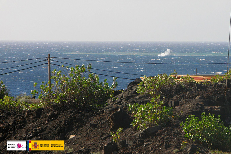
Many people have been wondering why this eruption has not been seen. The fact is that depth drops quiet fast around El Hierro Island. Around 4 km out the depth is close to 1.5 to 2 km, it is only close to the island that the depth starts to get shallower. At the moment is is hard to say what happens next in this eruption on El Hierro. But more vents should be expect to open up then have already have.

I am going to update this blog post if anything changes in El Hierro volcano eruption.

Special report: Update on El Hierro volcano eruption

While everything is quiet in Iceland. I am going to continue my coverage of the eruption in El Hierro volcano. Information in English also seems to be lacking for some reason. Please note that I have little understanding of Spanish, so I am just using the data that is available to me on the internet to figure out what is going on.

First I want to say that I am not a expert. I never claim to be one. My knowledge of volcanoes and earthquakes are the result of hard work and studying them on my own (reading research papers and other sources).

It is bit unclear what is going on in El Hierro. But from what I can tell least two things have happened during the past 24 hours. The first thing is that a eruption started at ocean floor around 04:18 UTC yesterday (10 October, 2011). This eruption appears to have been small and was not noticed on the surface of the ocean. Around 06:10 UTC this morning (11 October, 2011) a large movement of magma started to take place inside El Hierro volcano. Where exact break up of this magma is going to take place is unclear at the moment. But it is clear that a eruption is taking place and it is more chance then less that magma is going to find it self a new pathway up to the surface soon. As I do not think that the current eruption vent is keeping up with the current magma that is under El Hierro. But it is worth to notice that El Hierro does not seem to have a magma chamber, like Eyjafjallajökull volcano in Iceland so the eruption size is terminated by the current inflow of magma.

Here is a comparison of harmonic tremor charts from yesterday and today (10 and 11 October, 2011).


The harmonic tremor as it was on 10 October, 2011 at 21:08 UTC. Copyright of this picture belongs to Instituto Geográfico Nacional.


The harmonic tremor as it was on 11 October, 2011 at 20:29 UTC. As clearly can be seen it has grown by a margin or more (I can’t tell for sure) in the last few hours. Copyright of this picture belongs to Instituto Geográfico Nacional.

What is however really interesting is how this eruption is changing fast and without any warning at all. But this is however something that might be expected from a volcano like El Hierro. I see in the news that they are expecting earthquake activity before new vents or fissures open up. That is wrong assessment in my opinion. As new eruption vents and fissures can open without any or much earthquakes activity at all. Earthquake activity before a fissure vents open up depends only on the rock that the magma has to break trough. In many cases it does not have to create any earthquakes before a eruption starts. Good example of this is the eruption in Heimaey Island in the year 1973. Only a small earthquake swarm was detected before a eruption started. All I personally except before a eruption in a new place on El Hierro volcano is a minor earthquake activity. It is also hard to know if that earthquake activity can be detected based on the amount of harmonic tremor taking place at the moment.

Here is my personal assessment on where eruption might take place in El Hierro. Please note that it might be completely wrong. But I base my assessment on the data out there, that assessment might be wrong.


The most chance of the eruption in El Hierro in my personal opinion marked by the two red circles. Copyright of this picture belongs (original) to Instituto Geográfico Nacional.

There have been some deep earthquakes in El Hierro volcano over the past few hours. This deep earthquakes mean that new magma is flowing under El Hierro volcano. This means that the flow is steady (pressure pulse in the magma creates the earthquakes). So this eruption is far from being over it seems. How long it is going to last is a good question that currently nobody has a answer to at the moment.

I am going to update this blog post if I have to or if something new happens in El Hierro.

Special report: Eruption at El Hierro volcano, Canary Islands

At 04:18 UTC on 10 October, 2011 a eruption did start somewhere close to the El Hierro volcano Island (but inside El Hierro volcano system). So far nothing has been seen to this eruption, so location is uncertain at the moment. At the moment this eruption has only been confirmed by harmonic tremors seen on seismometers on El Hierro island.

From what I can tell, based on the harmonic tremor plots. It seems that the eruption has been growing in size since it started well over 12 hours ago. This suggests that the eruption is growing in size. That also brings up the issue that new fissures might open, both into deeper ocean and on shallower depth and even on land without any warning at all.


The harmonic tremor from El Hierro at 21:08 UTC on 10 October, 2011. Copyright of this picture belongs to Instituto Geográfico Nacional.

A location for the eruption has been suggested, as can be see on this map here.


The speculated eruption in El Hierro. Copyright of this picture belongs to el-mundo.es Thanks to Dr. John v. Kampen for this map via email.

Lack of earthquakes does not mean that magma is not the move and has not reached the surface already. But this however suggests that magma now has a free flow upwards to the surface since sometimes yesterday, when the earthquake activity did drop suddenly from ~100 earthquakes to ~30 earthquakes over the day.


Current earthquake activity in El Hierro. It is my personal opinion that the eruption is around -18.05 and 27.65 to 27.70 (middle of that area, around 450 meter depth). Copyright of this picture belongs to Instituto Geográfico Nacional.


Spectral image of the harmonic tremor. This image clearly shows that the orgin of the harmonic tremor is magma on the move. Not something else. Copyright of this picture belongs to Instituto Geográfico Nacional.

I am going to update this blog post as more is known about the eruption in El Hierro.

Canary Island news about this. With thanks to Dr. John v. Kampen how did send them to me in a email.

Posible erupción al sur de El Hierro (Youtube, Spanish, Video)
¿Emergerá una nueva isla? (Youtube, Spanish, Video)

Blog post updated at 21:49 UTC on 10 October 2011.

Tremor pulses in Hamarinn volcano (most likely)

During the past two weeks there have been tremor pulses in Hamarinn volcano (is claimed to be part of Bárðarbunga volcano system), at least most likely that volcano. But it might also be a volcano that I call Skrokkalda Volcano (other name might be Hágöngur volcano) (it has no entry on GVP web page, I do not know why). But given recent history I find it unlikely to be the case.

This harmonic tremors might be due to dike intrusions. I find it unlikely to be from a man made lake called Hágöngulón that is in this area. The harmonic tremor pulses look like sharp spikes on the tremor plot on the Skrokkalda SIL station.


Harmonic tremor spikes from Hamarinn volcano. Copyright of this picture belongs to Iceland Met Office.

This pattern of harmonic tremor spikes was seen all last year and all of the year 2009 from what I can remember. I do not have tremor charts from that period. But however this suggests that more magma has now started to flow into Hamarinn volcano. But there was a small volcano eruption (it seems so, given the flood that took place in July) in Hamarinn volcano last summer (summer 2011). What happens next is a good question.

This process of inflow of magma seems to without earthquakes, or close to it. I do not know why that is and I have no ideas that explain it.

Large earthquake swarm in Katla volcano

At 02:45 UTC a large earthquake swarm did start in Katla volcano. I do not know if this an start of a eruption in Katla volcano or not. For the moment it is too early to know for sure. I have to wait few more min before that becomes clear on the harmonic tremor plots. The largest earthquake so far according to the automatic SIL systems is a ML3.9 earthquake.


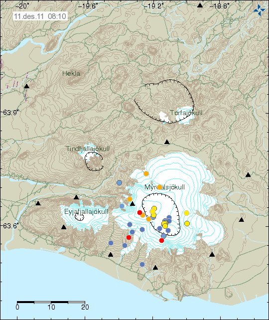
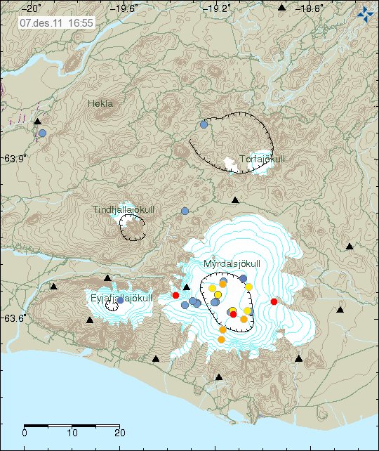
The earthquake swarm in Katla volcano. The second green star is from a fake ML3.3 earthquake from yesterday. Copyright of this picture belongs to Iceland Met Office.


The harmonic tremor plot on Slysaalda SIL station at 03:04 UTC on 5 Október 2011. Copyright of this picture belongs to Iceland Met Office.

It takes a few moments to become clear if Katla volcano is starting a eruption or not. I am going to post updates as this situation changes if I have too.

Magma on the move in El Hierro, Canary Islands

This is happening faster then I expected. But it seems that magma is now on the move upwards in El Hierro volcano in Canary Islands. This is evident by the earthquake patterns that are emerging from the volcano. Given the earthquake locations, most likely place for a eruption to take place is out on the ocean based on that. But sometimes magma can find different pathways up the surface without a lot of warning.


Latest earthquake map from Instituto Geográfico Nacional that shows clearly the earthquake pattern since the dike intrusion did start in El Hierro. Copyright of this picture belongs to Instituto Geográfico Nacional.

At the moment it is impossible to know when and where a eruption might start. It depends on many factors. But it is now clear that magma is on the move upwards. So far the magma seems to be around 10 km up in the earth crust under El Hierro. So it is clear that the magma is on the way up and most likely preparing for a eruption.

What is happening in El Hierro volcano

This is a special blog post about the volcano El Hierro in the Canary Islands. The resons for this blog posts are those that this activity is interesting and there is not a lot happening at the moment in Iceland due to bad weather (nothing gets recorded in this bad weather).

Currently El Hierro volcano is a phase that I personally call a magma intrusion phase (I have no other word for it). But that means that magma is currently coming from a depth, that is more then 20 km below the volcano and up the crust directly below the volcano. It is impossible to know how long this phase is going to last. As a example this phase for Eyjafjallajökull volcano lasted for good part of 17 years (with some breaks). When the pressure is high enough in the sill that is now forming in El Hierro the magma is going to break up the surface.

This pattern can clearly be seen on this image here.


The magma is flowing up into the volcano at around 30 degree angle from the depth of more then 20 km. When a new magma injection starts, a new earthquake swarm starts in El Hierro. This magma injections are different in size and length. But as more magma collects into the bedrock in El Hierro the stronger earthquakes are going to take place. But this increases the pressure on the rock and inside the magma chamber that is now forming and can clearly been seen with the earthquake pattern. Copyright of this picture belongs to Instituto Geográfico Nacional.

I did see a picture that was made on Eruptions blog that did show his clearly, both the feeder channel of the magma and the magma chamber that is currently in the making. It seems that magma inflow into the new magma chamber or the sill in El Hierro is stable at the moment. But I base that view on the constant earthquakes that are currently taking place. But this magma inflow seems to have been stable since 16 July, 2011 when the magma started to push upwards into El Hierro.

Earthquakes that signal new inflow of magma do not need to be strong in size. But they are deep, with the most depth around 20 km. But the crust in this area is around 10 to 26 km thick. As this is a ocean crust in this area. But the Canary islands are the thickest crustal part in the area. But it is also important to notice that the magma chamber or the sill is expanding in all directions, not just upwards. That in it self is also going to create deep earthquakes. But those earthquakes should remain a bit outside the main area of the deep earthquakes that are currently taking place in the area.

I am expecting a lot more earthquake activity when or if El Hierro starts erupting. But when that might happen impossible to know for the moment. The only thing that can be done is too wait and see what happens.

Update 1: Here is the earthquake activity for today (30 September, 2011).


Earthquake activity of today (30 September, 2011). There is less earthquake activity today. This happens when magma flows into a volcano. This did also happen with Eyjafjallajökull volcano in the year 2010. If anyone has the direct link too this plot, please leave it in the comments. Thanks. Copyright of this picture belongs to Instituto Geográfico Nacional.

Update 2: Links too El Hierro information can be found here.

Update 3: The Spanish news channel Canal 24 can be found here and it is live.

Update 4: Here is a news in english about the evacuation of El Hierro. It is from 28 September, 2011. Evacuation of El Hierro begins as fears of volcanic eruption grow. Thanks to Dr. John v. Kampen that did send this to me with a email.

Note: There are new pictures of Eyjafjallajökull volcano, Fimmvörðuháls craters here. They show the difference from the year 2010 and in the year 2011. The text is in Icelandic.

Also. Please support my effort so I can buy two new geophones and add them to my monitoring network in Iceland. Thanks! 🙂

Blog post has been updated 30 September, 2011 at 22:12 UTC.
Blog post has been updated 30 September, 2011 at 22:25 UTC.
Blog post has been updated 30 September, 2011 at 23:08 UTC.
Blog post has been updated 1 October, 2011 at 14:48 UTC.

Hengill volcano man made earthquake swarm

The man made earthquake swarm in Hengill volcano that happened today seems to have subsided, as it is most likely that Orkuveita Reykjavíkur has stopped pumping down water into the new drill hole that they where using today.

Over 400 earthquakes have been recorded in this man made swarm. I am not sure on the depth on most of the earthquakes. But it is in the range of 1 to 10 km from what I can tell. The largest earthquake in this earthquake swarm was ML3.4 in size, it had the depth of 3.9 km.


The man made earthquake swarm in Hengill volcano. Copyright of this image belongs to Icelandic Met Office.

I am going to post earthquake traces on Sunday or Monday. I am currently not at “home” (where my main computers are located), as I am taking this weekend off (if nothing large happens this weekend).


Two of the earthquakes from the man made earthquake swarm in Hengill volcano. This picture is released under Creative Common Licence. See licence web page for more details.

It is hard to know what happens as Orkuveita Reykjavíkur continues to pump down water into Hengill volcano. All that can be done is too wait and see what happens.

Blog post updated at 21:48 UTC on 26. September 2011.

Earthquakes in Katla volcano, strong sulphur smell in Múlakvísl river before the earthquake happened

This morning there has been some earthquake activity in Katla volcano. But it has also been reported in the news this morning that a really strong sulphur smell was found around 06:00 UTC on nearby farm to Múlakvísl river this morning. But this was before the earthquake did happen. I am not sure if this sulphur smell continues to be felt in the area close to Katla volcano. No changes in water hight has been detected in Múlakvísl glacier river.

The ML2.6 earthquake in Katla volcano was on 2.3 km depth. This was mostly a dike intrusion into the bedrock of the Katla volcano caldera.


The earthquake swarm this morning in Katla volcano. Copyright of this picture belongs to Iceland Met Office.


High resolution of the Katla volcano earthquake this morning. Along with correct depth and size. This picture is released under Creative Commons licence. See Licence page for more details.

As before. This is just a wait and see what is going to happen in Katla volcano as before.

Icelandic News of the sulphur smell in Múlakvísl glacier river.

Brennisteinslykt fannst við Múlakvísl í morgun (Vísir.is, Icelandic)
Brennisteinslykt við Múlakvísl (mbl.is, Icelandic)

Update 1: According the news on Rúv this activity suggests that hydrothermal activity is continuing to increase in Katla volcano caldera. But the news also says that this activity is something like that did happen from the year 2002 to the year 2004, when hydrothermal activity did increase before it started to get lower again. It is also pointed out my Matthew Roberts that Múlakvísl glacier river is sensitive to changes in Mýrdalsjökull glacier and small floods can happen without any warning in it due to increased hydrothermal activity.

Rúv news in Icelandic about this.

Bendir til aukinnar jarðhitavirkni (Rúv.is, Icelandic)

Blog post updated at 13:07 UTC, 23 September 2011.

A ML2.7 earthquake in Skagafjörður rift zone (mostly extinct one)

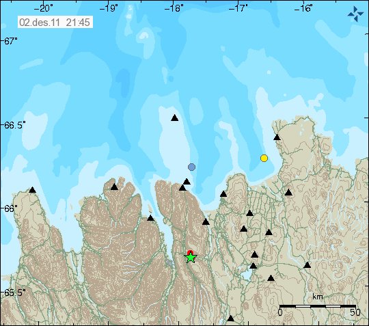
This earthquake is a odd one. But it is rare that earthquakes happens in this are of Iceland. But it is not unheard of. As there have even been small earthquake swarm in this area few years ago (2 or 3 years ago I think). This area is part of Skagafjörður rift zone (pdf file) (also known as Skagafjörður Volcanic zone), but that is believed to be a failed rift zone that formed in about 1.7 million years ago. Just around when current eastern rift zone started to form in Iceland.


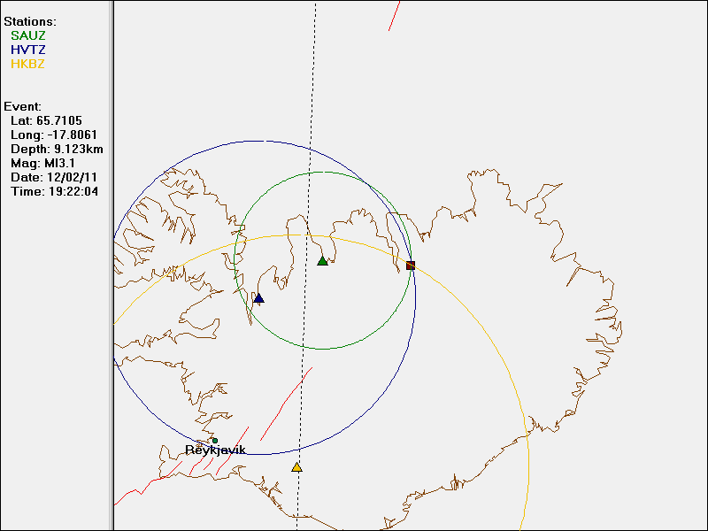
The ML2.7 earthquake is the left corner of this image, a bit far away from TFZ earthquake zone. Copyright of this image belongs to Icelandic Met Office.


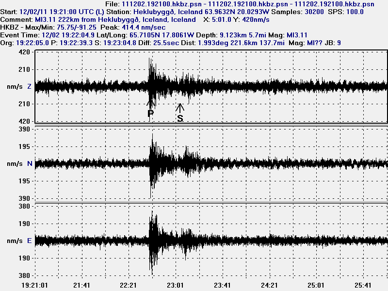
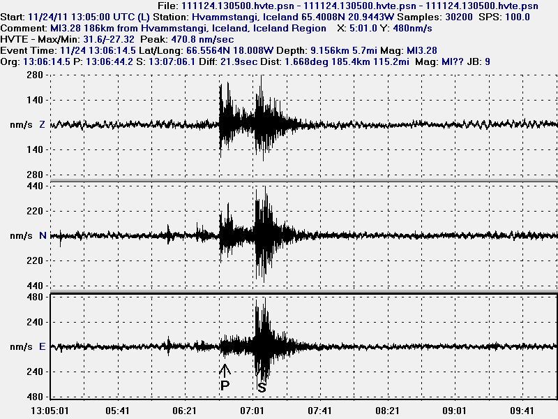
The ML2.7 earthquake seen from Sauðárkrókur geophone that I am going to run until December 2011. Sadly, no live gif image of it due to network issues. Please note that this geophone is in a noisy location. This picture is released under Creative Commons Licence. See licence web page for more details.


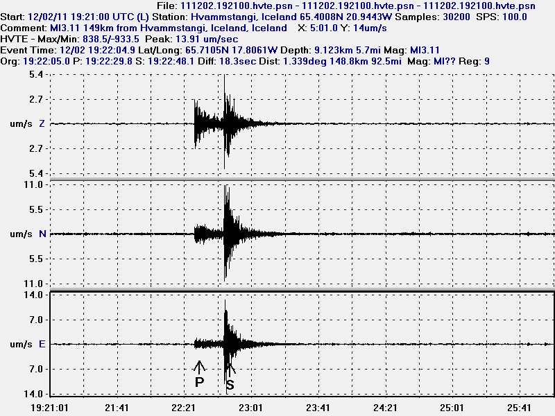
The ML2.7 seen on Hvammstangi geophone. Sadly, no live gif image of it due to network issues. This picture is released under Creative Commons Licence. See licence web page for more details.

I do not know if there are going to be more earthquakes in this area. But it seems that this earthquake has happened in a area with known faults from post-glacial times (they are on my geological map of Iceland). So for now all that can be done is to wait and see what happens next this this area. But I am not expecting anything special in terms of more earthquake activity. There are no active volcanoes in this area.