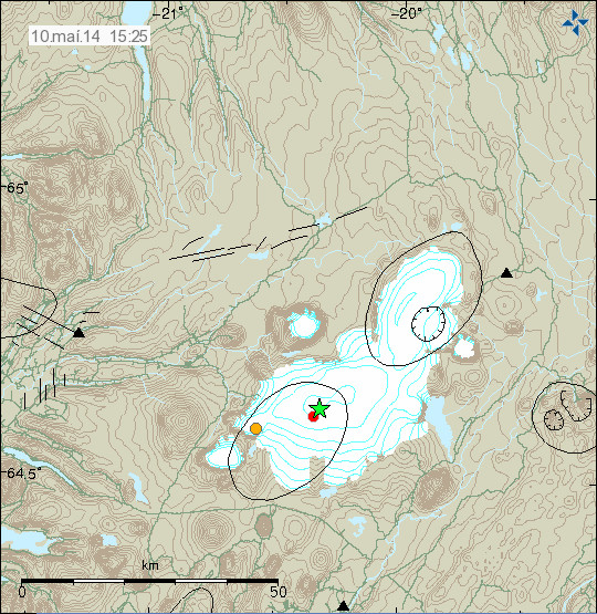
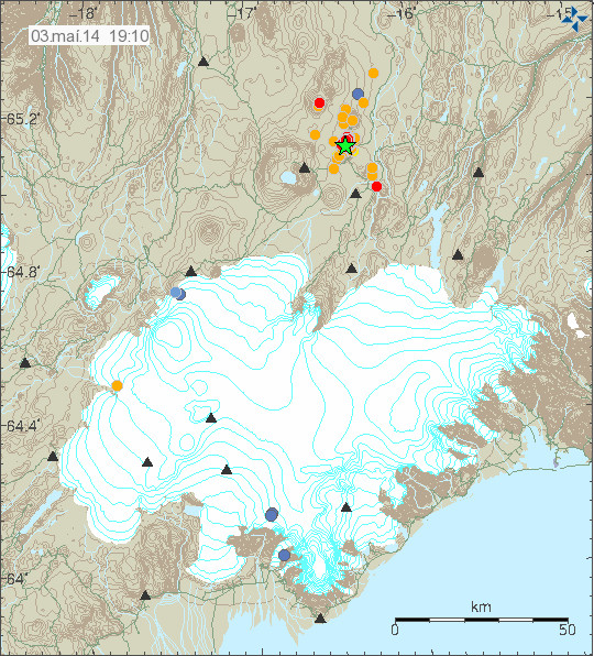
Today (11-May-2014) at 01:57 UTC a magnitude 3,6 earthquake took place in the Reykjanes volcano on the Reykjanes ridge. Depth of this earthquake was 11,6 km and there have not been any reports that this earthquake was felt.
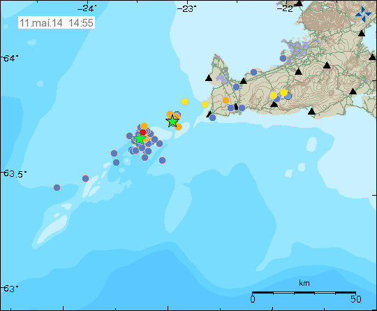
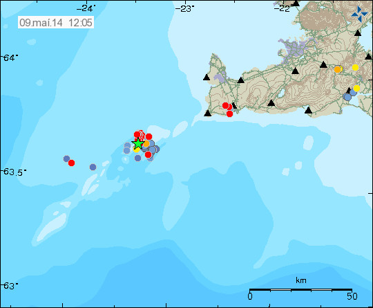
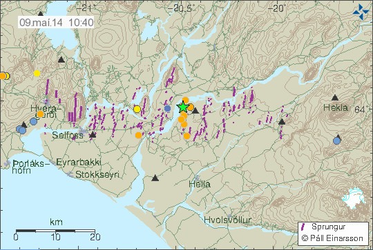
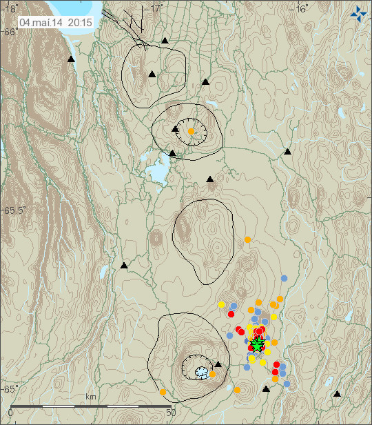
The magnitude 3,6 earthquake is the green star closest to land on this map. Copyright of this image belongs to Icelandic Meteorological Office.
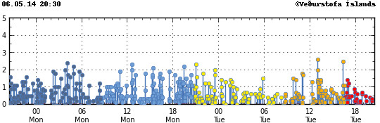
There has been constant earthquake activity in this part of the Reykjanes ridge for the past two weeks (about 17 days so far). This activity has however remained minimal with few earthquakes reaching the magnitude above 2,0. There has been increase and decrease in the during this time as expected. I reported an earthquake swarm in this area on 27-April-2014, on 13-April-2014 an minor earthquake swarm took place on the Reykjanes ridge (no earthquakes above 3,0), I wrote about it here.
Other dates of earthquake activity in this area are 4-April-2014 as can be seen here. There seems to have been close to continues earthquake activity on the Reykjanes ridge during the month of April and May. I am not sure why that it is, but this might be related to magma movements in this area, so far there is nothing to suggest an eruption is going to take place in this area. I expect earthquake activity to continue in this part of the Reykjanes ridge. All larger earthquakes are going to appear clearly on my geophone network, its website can be found here.
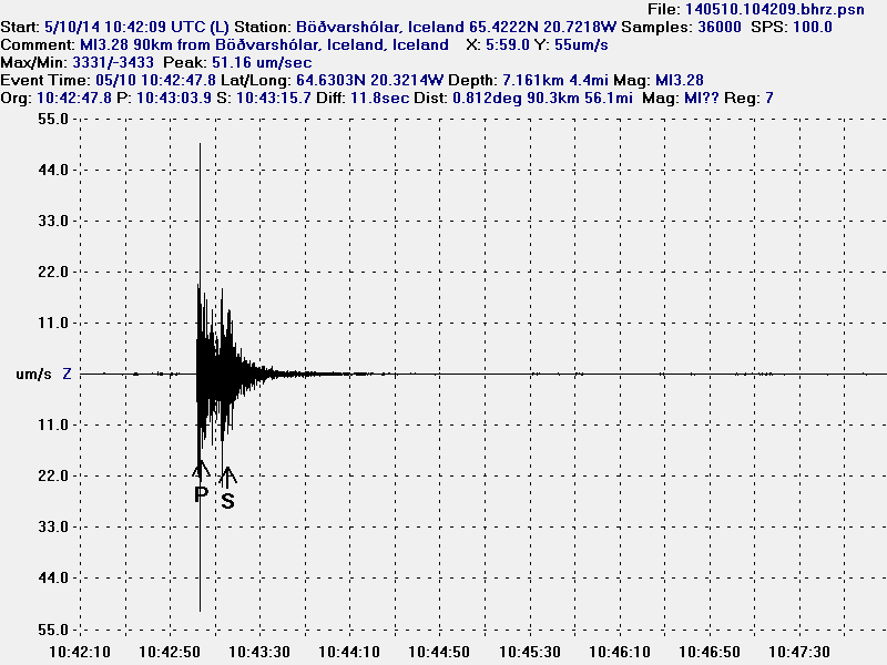
Update 1: New magnitude has been issued for the earthquake on the Reykjanes ridge that took place yesterday (11-May-2014). The new magnitude is 3,8 with the depth of 11,5 km. Two magnitude 3,1 earthquake also took place at the same time (01:55 and 01:59 UTC) at the same location.
The green stars show the magnitude 3,8 earthquake, along with the magnitude 3,1 earthquakes at the same location. Copyright of this image belongs to Icelandic Meteorological Office.
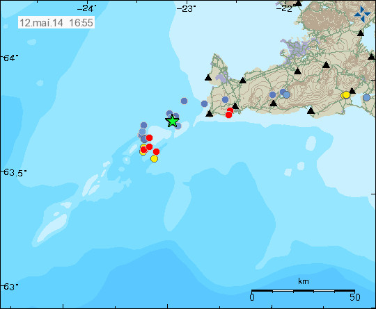
New earthquake activity has taken place at Reykjanes ridge today, so far no earthquake has the magnitude above 3,0 according to automatic results from Icelandic Meteorological Office. I am expecting more earthquake activity to take place at this location. Earthquake activity at this location is not continuous and has short and long breaks in them. Earthquakes larger than magnitude 2,5 appear clearly on my webicorders and can be viewed here.
Updated at 17:19 UTC.