New volcano monitoring project in Iceland

A new volcano monitoring project and a study is about to start in Iceland. This project hopes to provide real time information in volcano activity in Iceland. It has been funded by EU grand of 6 million euros. The reason for this project is the Eyjafjallajökull volcano eruption, among other volcano activity in Iceland. Among this project goals is to setup coordinated European volcano monitoring system.

Freysteinn Sigmundsson geophysics is the controller of this project. Icelandic Meteorological Office and University of Iceland also take part in this project. In total, 26 partner in 9 European countries are going to take part in this project during its duration. Something about 200 scientists are going to take part in this project during its duration. It is going to be interesting to see what comes out of this project in the long run.

Update 1: I forgot the name of this project. It is called; European volcanological supersite in Iceland: a monitoring system and network for the future

Icelandic news on this

Bætt mannlíf nærri eldfjöllum (Rúv.is)
Milljarður í eldfjallaverkefni íslensks vísindamanns (Vísir.is)
Fá 950 milljónir í rannsóknarstyrk (mbl.is)

Blog post updated at 14:26 UTC.

Earthquake swarms in Brennisteinsfjöll volcano and TFZ

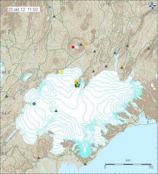
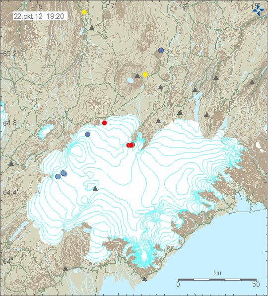
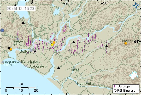
Over the past few days there has been continued earthquake activity in Breinnisteinsfjöll volcano. The largest earthquake in this swarm had the magnitude of ML2.5. It is possible that this earthquake swarms have there orgin in SISZ. Rather then Breinnisteinsfjöll volcano. But at current time is hard to be sure on this detail.


Earthquake activity in Breinnisteinsfjöll volcano during the past few days. Copyright of this image belongs to Icelandic Meteorological Office.

Tjörnes Fracture Zone

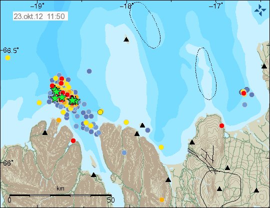
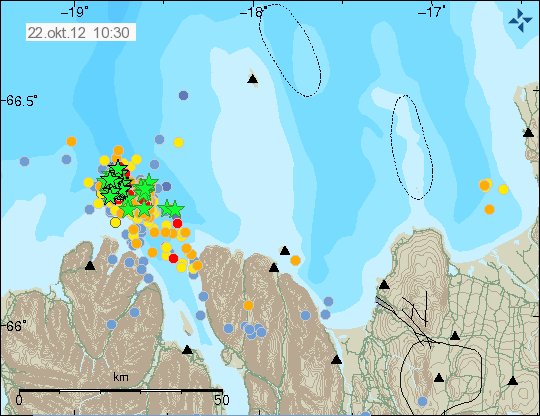
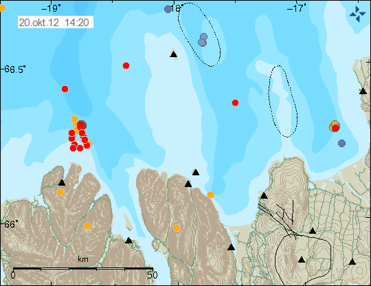
Earthquake activity has also been taking place east of Grímsey Island. This earthquake activity has mostly been small. But this are earthquake swarm did not have any earthquake that was above 3.0 in magnitude.


Earthquake swarm on TFZ. Copyright of this image belongs to Icelandic Meteorological Office.

The largest earthquake in this swarm had the magnitude of ML2.8. More earthquake activity should be expected in this area. As this is one of most active areas in Iceland when it comes to earthquake swarm.

Magnitude 3.8 earthquake in Breinnisteinsfjöll volcano

Earthquake with the magnitude of 3.8 took place in Breinnisteinsfjöll volcano at 19:42 UTC. This earthquake was felt in Reykjavík and nearby area. Many aftershocks have followed this earthquake. Most of them are however below 2.0 in magnitude. There was also pre-earthquake activity before the magnitude 3.8 earthquake did take place. Most of those earthquakes where below 2.0 in magnitude. Last month an earthquake with the magnitude 4.3 took place in this same area. Earthquake activity is currently ongoing with smaller earthquakes for the time being.


Green star marks the place where the magnitude 3.8 earthquake took place. Copyright of this image belongs to Icelandic meteorological Office.

So far there is nothing to suggests that current earthquake activity is nothing but tectonic. But this area is a riftzone. So there are earthquake swarm often take place there without them being related to any volcano activity in this area. This earthquake swarm appears clearly on my geophone network in Iceland. I am going to continue to monitor this earthquake activity. As more strong earthquakes in this area can take place in the next few hours to days.

Icelandic news about this earthquake activity

Jarðskjálfti upp á 3,8 í Bláfjöllum (Rúv.is)
Jarðskjálftar við Bláfjöll (mbl.is)
Jarðskjálfti í Bláfjöllum (Vísir.is)
Skjálftinn var 3,8 stig (mbl.is)

Earthquake swarm east of Grímsey Island.

This morning a earthquake swarm started east of Grímsey Island. This is activity in TFZ area that possibly has two active volcanoes (GVP information). This is however most likely just a normal earthquake activity taking place now in this area of Iceland. The largest earthquake in this earthquake swarm was a magnitude 3.1 earthquake that took place at 11:35 UTC.


Earthquake swarm on TFZ. Copyright of this image belongs to Icelandic Meteorological Office.

This earthquake swarm might continue for the next few hours. With the possibility of more earthquakes reaching magnitude 3.0 or larger. But it is common for earthquakes swarms in this area to just stop over period of few hours. The largest earthquake in this earthquake swarm was not felt according to the news.

Icelandic news about this earthquake swarm

Jarðskjálfti norðan Grímseyjar (Rúv.is)
Jarðskjálftahrina við Grímsey (mbl.is)

Magnitude 3.1 earthquake in Katla volcano this morning

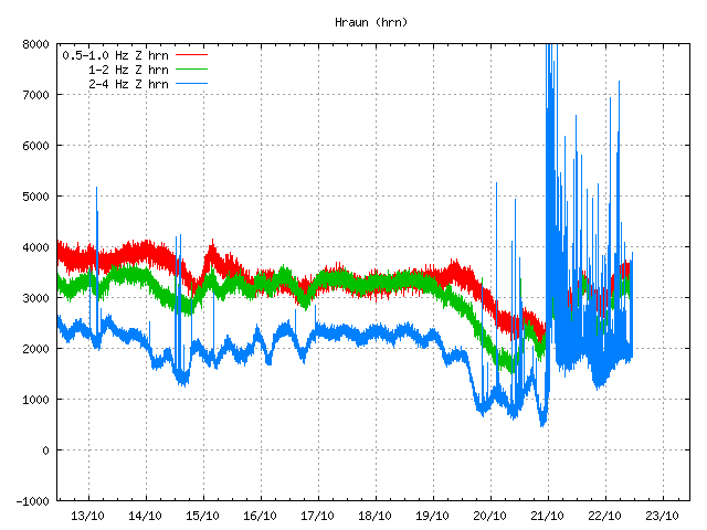
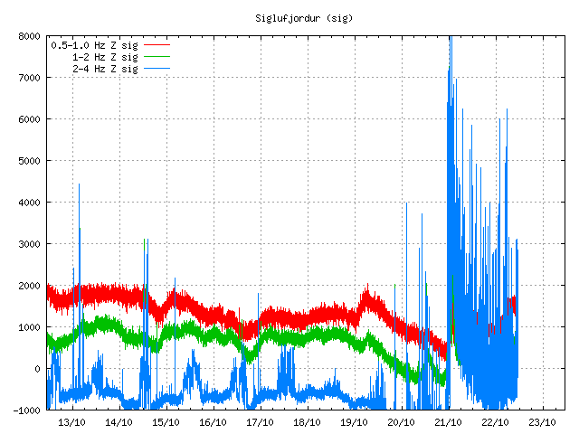
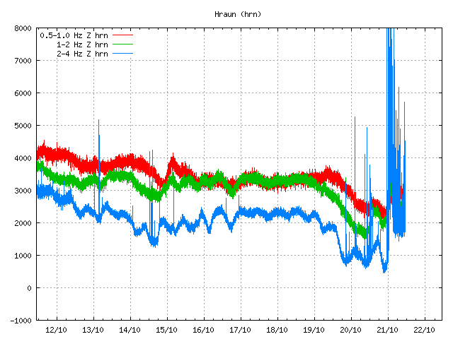
Today at 08:26 UTC this morning a magnitude 3.1 earthquake took place in Katla volcano. There was minor pre-earthquake activity before the magnitude 3.1 earthquake took place, the depth of this earthquake was around 100 meters (0.1 km). There was also some minor aftershock activity following this earthquake. No change in harmonic tremor took place following this earthquake. So there is a good chance this was just part of normal autumn activity in Katla volcano. This earthquake activity did appear clearly on my geophone network. It can be viewed here on my geophone network web page.


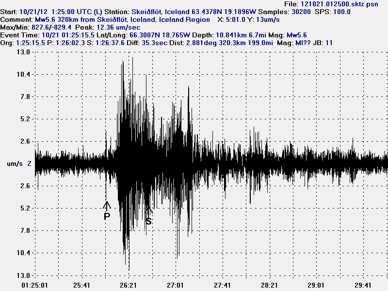
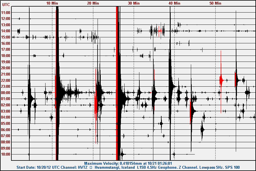
The earthquake as it did appear on my geophone station in Skeiðflöt. This image is released under Creative Commons licence. See CC licence page for more details.


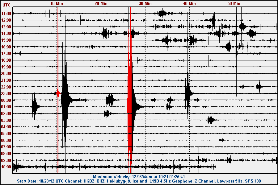
The earthquake as it did appear on my geophone station in Heklubyggð. This image is released under Creative Commons licence. See CC licence page for more details.


The location of the earthquake in Katla volcano. Copyright of this image belongs to Icelandic Meteorological Office.

More earthquakes like this should be expected in Katla volcano. But it is impossible to know if there is going to be an eruption in Katla volcano any time soon. But so far everything is quiet in Katla volcano. Besides occasional earthquake swarm that is taking place in Katla volcano.

Icelandic news about this earthquake activity

Jarðskjálfti í Kötlu – 3,2 að stærð (Rúv.is)
3,2 stiga skjálfti í Kötlu (mbl.is)
Snarpur skjálfti í Kötlu (Vísir.is)

Blog post updated at 19:34 UTC on 03.10.2012
Blog post updated at 05:45 UTC on 04.10.2012

Katla volcano eruption in the year 1918

Last large eruption in Katla volcano was in the year 1918. Cameras where a bit hard to find during this time and it took long time to take pictures of eruptions in those days. There are few pictures that exist today of the eruption in the year 1918 and the aftermath that did follow it.

Here are the only pictures of the eruption taking place in Katla volcano during the year 1918.


The ash cloud from Katla volcano during the eruption in the year 1918.Author of this picture is unknown. Picture is assumed in public domain due to age (94 years ago). Death of author is unknown to me. Corrections welcomed.


Ice bergs from the glacier flood that did follow the eruption in Katla volcano during the year 1918. Author of this picture is unknown. Picture is assumed in public domain due to age (94 years ago). Death of author is unknown to me. Corrections welcomed.


Painting showing the ash cloud of the Katla volcano eruption in the year 1918. I sadly do not know how did paint this picture or it’s copyright status. Corrections welcomed.

Based on this pictures. This is what we should expect from Katla volcano in the next big eruption. I do not know when that might be. It might be a long wait.

Earthquake activity east of Grímsey Island (TFZ). Possible fake earthquakes in Eyjafjallajökull volcano

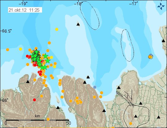
At 03:03 UTC an earthquake with the early and unconfirmed magnitude of ML3.3 took place east of Grímsey Island. This earthquake did take place on TFZ. It is possible, but this earthquake might be the start of an earthquake swarm in this area. But that is not uncommon pattern for earthquakes in this area. But however it also happens that earthquakes like this one takes place. But then nothing more happens.


Earthquake activity in TFZ. The early magnitude ML3.3 earthquake is marked with a green star. Copyright of this image belongs to Icelandic Meteorological Office.

Eyjafjallajökull volcano

There has also been some earthquake activity in Eyjafjallajökull volcano during the night. This activity is possibly false due to weather or faulty SIL seismometer. The earthquake that have been detected so far have extremely low quality. But the increases the chance of them being false, rather then real events. It is not going to get known if this activity is real or not until it is reviewed by seismologist at Icelandic Meteorological Office.


The possible earthquake activity in Eyjafjallajökull volcano. This activity might be due to faulty hardware or weather, rather then real activity in Eyjafjallajökull volcano.Copyright of this image belongs to Icelandic Meteorological Office.

Eyjafjallajökull volcano has been quiet since it’s eruption in the year 2010. I do not expect that to change any time soon. Since it seem that Eyjafjallajökull volcano eruption cycle is around 150 to 500 year (theoretical maximum in my opinion). So I am not expecting anything to happen in Eyjafjallajökull volcano any time soon. If this earthquake activity is confirmed it is interesting. What might come out it is impossible to know for sure.

Name change has taken place

This blog is now known as Iceland geology blog. Now I am going to cover all types of geology in Iceland. Not just earthquakes, volcanoes activity. But that is going to remain large part of what I am going write on this blog. Since that is where most activity takes place in Iceland.

I hope that everyone enjoy the new format of shorts.

Forum has been closed, blog name change, two new blogs about geology

I have closed down the Iceland volcano and earthquake forum. Nobody was using it and I don’t see any reason to keep it running when nobody had used it for a long time. It was just collecting spam bots. But thankfully not many spam posts. But that might have changed on short notice. After 2. October 2012 the domain volcanoforum.eu is going to point to this blog until it expires (in 2013 or 2014).

Changing the name of this blog (again)

I am going to change the name of this blog on the 1. October 2012. The reason is for simply-faction and broaden this blog subject range. Also after 1. October 2012 this blog is only going to cover events and geology in Iceland. I am not going to delete older blog post about activity in El Hierro, Sweden and Denmark. But they are going to be moved into there own sub-category. Where they can be found if anyone is looking. That way I can clean up the list of subjects on this blog. Without having to delete any blog post that I have written in the past. My coverage of earthquakes in Denmark are going to be moved over to my oldest blog. That can be found here. All earthquake related blog posts about Denmark are going to be in English on that blog.

The new name for this blog is Iceland geology blog. I am going to cover earthquakes, volcanoes, landslides, geological history and a lot more then what I have been doing for the past two years. This name is also simpler to remember then Iceland volcano and earthquake blog. So I think it is going to contribute to better success of this blog as an medium on the internet.

Two new blogs

I am moving all the Canary Island coverage to it’s own blog. That blog is called Canary Island geology blog. It is just going to cover geology events in Canary Islands. Earthquakes, landslides, cracks and such. I do not know how often I am going to update that blog. But I am going to update is as often as something interesting is happening in Canary Islands.

The link to the blog is http://www.jonfr.com/canary – Currently the link is inactive (the link works. But you just get a empty folder). But I am going to get it up and running in few hours.

The second blog that I am creating is called Falkland Island geology blog. Since I am going to move to Falklands Islands in about 10 years time. While there is no volcano or earthquake activity as such in the Falkland Islands. I am going to cover any major earthquake that happens close to the Falkland Islands. But Falkland Islands are located close to major fault lines that are close to Antarctica and South Georgia and the South Sandwich Islands.

I am not going to cover any event in Antarctica or South Georgia and the South Sandwich Islands as such. But I am going to cover any events that might have an effect in Falklands Islands. But as most of the earthquake activity happens some distance from Falklands Islands it is unavoidable that I am going to cover activity that is closer to the Antarctica and South Georgia and the South Sandwich Islands. This applies mostly when major earthquakes happens or an eruption sends ash cloud towards Falklands Islands. Earthquakes do happen close to Falklands Islands. With the magnitude up to Mw7.0 and larger. But they do not happen so often. Ash clouds often happen. As erupting volcanoes in Chile often push ash in the wind direction that takes ash cloud towards Falklands Islands. I do not know yet how often this happens. But it happens once in a while I think.

I am also going to cover fossils finds, general geology in Falklands Islands among other things. This new blog is going to be updated when something happens and when I have something new to tell about.

The link to the new blog is http://www.jonfr.com/falkland – Currently the link is inactive (the link works. But you just get a empty folder). But I am going to get it up and running in the next few hours.

My other blogs

I have two other blogs then this blog. My oldest blog can be found here. I blog both in Icelandic and English on that blog. I publish many things on it. Videos, Icelandic blogs, English blogs and more. I also have a blog called Spacewatch. I try to update that when I can. But in the future I hope to publish my own space pictures on it. But it is going to be a while until I can do that.

Other

I hope that people like the changes that I am doing now. But I have been thinking about this for the longest time now. But now is the time for action. Not just thinking.

Update 1: The blog Falkland Islands geology blog is now up and running. The blog Canary Islands geology blog is now up and running.

Blog post updated at 21:18 UTC on 30.09.2012.

Minor earthquake swarm in Katla volcano

Tonight around 22:30 UTC there was an minor earthquake swarm in Katla volcano. This earthquake swarm did last in about 20 minutes. After that the earthquake activity did drop back to normal background levels. This earthquake swarm is most likely part of normal autumn earthquake activity in Katla volcano. More earthquake swarms like this should be expected in Katla volcano during next few weeks.


Earthquake activity in Katla volcano this evening (28.09.2012). Copyright of this image belongs to Icelandic Meteorological Office.

What happens next is impossible to know. But I am not expecting anything special to happen in Katla volcano following this earthquake swarm. This earthquake swarm did appear clearly on my geophone at Skeiðflöt and Heklubyggð. The geophones can be viewed here.