New video of Eyjafjallajökull volcano crater

Tonight Rúv did show a new video of the Eyjafjallajökull volcano crater area. But the Rúv News team accompanied the scientist up too the top of Eyjafjallajökull volcano in order too view the crater that is there, and the lave field that did flow from the top crater. According to the news on Rúv it is going to take many years until the glacier recovers fully from the year 2010 eruption in Eyjafjallajökull volcano. As the lava field is up too 100 meters thick due the cooling from the glacier when it did flow form the crater in the eruption.

Rúv News. Use Google translate with the hope that it might translate…or not.

Eyjafjallajökull rannsakaður (Rúv.is, Icelandic)

Vísindamenn ofan í gígum Eyjafjallajökuls (Rúv.is, Windows Media Player required, Icelandic, at the end of the news on Rúv)

Blog post updated at 15. May 2011 at 00:08 CEST. Fixed text and added extra information.
Blog post updated at 15. May 2011 at 19:20 CEST. Fixed the blog post title.

New measurements of Eyjafjallajökull volcano crater

There is a short news piece about Eyjafjallajökull volcano on the news web site Morgunblaðið (mbl.is). It is about recent trip that geologist took to Eyjafjallajökull volcano. They where monitoring and during measurement of the crater that did form on top of Eyjafjallajökull volcano during the eruption in the year 2010.

According to the news, the crater lake in Eyjafjallajökull volcano is now frozen and there is already 10 meter thick snow layer in the crater. While the lake is cold it is still dangerous do go down into it and people are advanced against to do so. Due to carbon monoxide that is on bottom the crater. While the bottom of the crater is cold, the same cannot be sad about the crater walls. But they are still steaming and the temperature there is from 70C and up to 95C not far below the surface. So this area continues to be dangerous to people and travelling into it should be done with care and not without an experienced tour guide.

The reason why they did go to this trip today was too estimate the area before more detailed measurements are done this summer.

News from Morgunblaðið with picture can be found here.

Fóru ofan í gíginn (mbl.is, Icelandic, pictures)

Blog post updated at 02:24 CEST on 14. May 2011.

How to get Icelandic media in a case of a eruption in Iceland

When a eruption starts in Iceland. All media in Iceland covers it. Both in there news web sites and on the radio stations on the internet that publish information in english and other languages if needed. Here is a list of the main media stations in Iceland.

Radio stations:

Rúv Rás 1 – Public radio station. Needs Windows Media Audio player to listen to this radio station. It is also possible to listen to Rás 1 over satellite on 1W.
Rúv Rás 2 – Public Radio station. Needs Windows Media Audio player to listen to this radio station. It is also possible to listen to Rás 2 over satellite on 1W.
Bylgjan FM 98,9 – A radio station with news. A flash might be needed to listen to this radio station.

Tv stations:

Rúv Sjónvarpið – Can be watched on-line here. Both with flash player and Windows Media Video capable player. In Europe Rúv Sjónvarpið can also been watched over satellite on 1W if you have Conax access card to view the channel (only available in Iceland to Icelandic citizen living in Iceland, don’t ask me for it). But Teletext information is still available even if the channel is scrambled and cannot be viewed because of that.
Stöð 2 – Can be viewed on-line on the web-site Vísir.is. But at that web page only news can be viewed. Flash player is required to view it. Stöð 2 does not broadcast over satellite.

When a eruption starts in Iceland. This are the best options to get into touch with Icelandic media that broadcast live video or audio. But other news web sites are mbl.is, dv.is. But this are only news papers that don’t offer any direct and live coverage when a eruption starts in Iceland.

Changes in Grímsfjall volcano

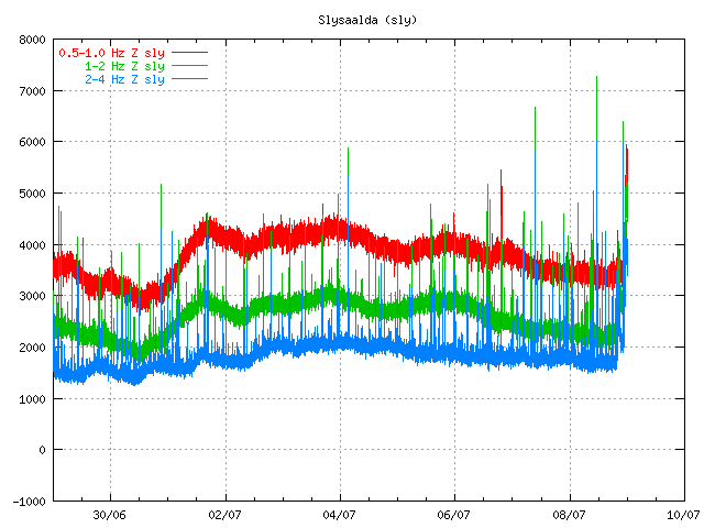
Few days ago changes started to happen in Grímsfjall volcano. It is hard to describe this changes. But they appears to be changes in harmonic tremor levels in Grímsfjall volcano. But they appears to be above background levels and the reason why that is a bit unclear at the moment, but I do not think that this is ice movement as I did think it was first. As this has been lasting for too long. Following this has been a slow increase in earthquakes in and around Grímsfjall volcano. This earthquakes don’t appear on the automatic SIL system, even if they are up to ML2.0 in size. This suggest that there origin is from magma movements, not tectonics one (tectonics earthquakes also happen there).

So far nothing suggest that a eruption is immanent. But that can change without any warning. As Grímsfjall volcano is known to start a eruption with no warning at all.


Harmonic tremor levels in Grímsfjall volcano on 30th March 2011. Picture is from around 17:30 UTC. Copyright of this picture belongs to Icelandic Met Office. The picture is from there web site.
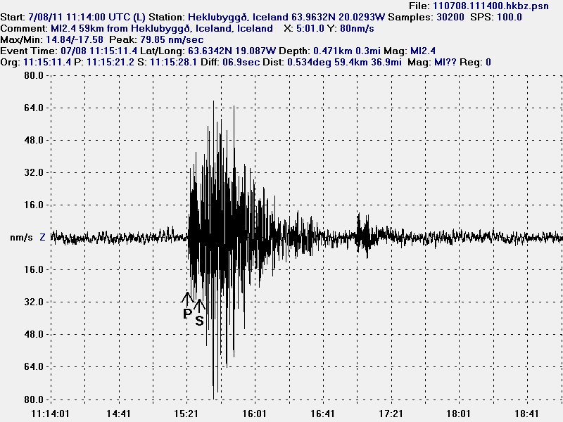

Earthquakes in Grímsfjall volcano on 30th March 2011. Picture is from 17:30 UTC. Copyright of this picture belongs to Icelandic Met Office. The picture is from there web site.
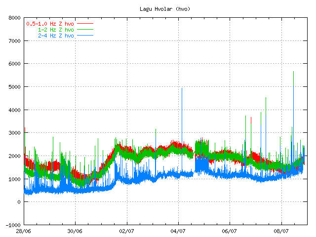
All that can be done for now is to wait and see what happens. But my opinion is that something is up in Grímsfjall volcano. But what that is remains unclear at the moment.

There might be a volcano eruption in less then a one year time in Báðarbunga volcano (Kistufell field)

I do not know if this is Icelandic media sensationalism or just a simple misquote in the news article. But according to Morgunblaðið (mbl.is) in a interview with the geologist named Sigurlaugar Hjaltadóttir (works at Icelandic Met Office) she sad that there is more risk of a eruption in north-west side of Vatnajökull glacier due to the high earthquake activity in the area. But while the earthquakes continue to be at great depth, there is a less chance of a eruption in the area.

But she might be referring to is that a earthquake activity in the area might be increasing because of Grímsfjall volcano and Bárðarbunga volcano interaction. But it remains be seen if that is the case or not here. It is however clear that only time is going to tell us if there is going to be a eruption in this area soon or not.

The news in Icelandic. Please use Google Translate or something similar to understand.

Gæti gosið innan árs (mbl.is)

Minor earthquakes where seen after the large earthquakes in Grímsfjall volcano

Following the two large earthquakes (ML3.5 and ML4.2) there was a swarm of small earthquakes in that area. The earthquakes where seen on Grímsfjall SIL station, but do not appear to have been strong enough to be recorded on other SIL stations around Vatnajökull glacier. This appears to have lasted until around 13:00 UTC on 13th of January 2011. But after that it did quiet down.


Plot is from IMO web site.

Icelandic Met Office tremor plot that shows the two large earthquakes and following minor earthquakes. This area in Grímsfjall volcano has been quiet since the two earthquakes took place few days ago.

Earthquake detection and winter storms

In the last two days there have been a strong winter storm going over Iceland. The wind has been coming from the north with snow and cold weather. But this has also been followed by a strong wind all over Iceland and this strong wind has been preventing the SIL network from detecting micro-earthquakes in Iceland. Because of that it appears that Iceland has been unusually quiet on Iceland Met Office maps. This might not necessary be the case in reality. But due to a lot of wind noise the SIL network is unable to detect the smallest earthquakes that happen in Iceland. Some stronger earthquakes might appear on the SIL network if they take place.

So the quiet time in Iceland is down to weather, not something else. As the weather improves we should start to see micro-earthquakes again on Icelandic Met Office maps. It is always a good idea to check the weather forecast in Iceland if there is a sudden drop in earthquakes in Iceland.

Note 1: There are sometimes times however in Iceland when there is nothing wrong with the weather and yet still no earthquakes. What is going on there is simple, there are no earthquakes taking place in Iceland. This happens sometimes. But this is a rare, but it does sometime happen.

New SIL seismometers around Eyjafjallajökull volcano and Mýrdalsjökull (Katla)

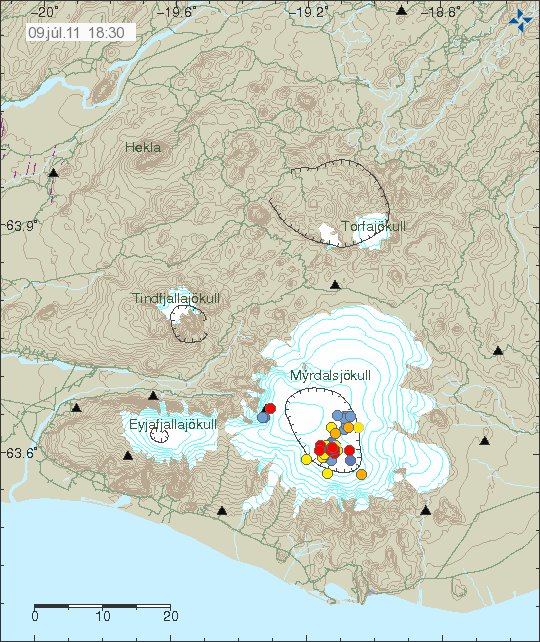
The seismometers that British Geological Survey did pay for to be installed around Eyjafjallajökull volcano and Mýrdalsjökull (Katla volcano) have been integrated into the Icelandic Met Office SIL Seismometer Network. They have at least been marked into the Icelandic Met Office earthquake web page.


Image is from Icelandic Met Office. Copyright of this picture belongs to them.

The new stations are marked with a triangles on the map. The older SIL stations can be found at Icelandic Met Office tremor web page. Currently the new SIL stations are not on Icelandic Met Office Tremor web page yet.

What this means for earthquake recording in this area is that Icelandic Met Office is now able to detect smaller earthquakes. Location of earthquakes is also going to improve a great deal, so automatic location of earthquakes is going to improve a great deal in this area. This means that more earthquakes are going to be visible on Icelandic Met Office maps then before.