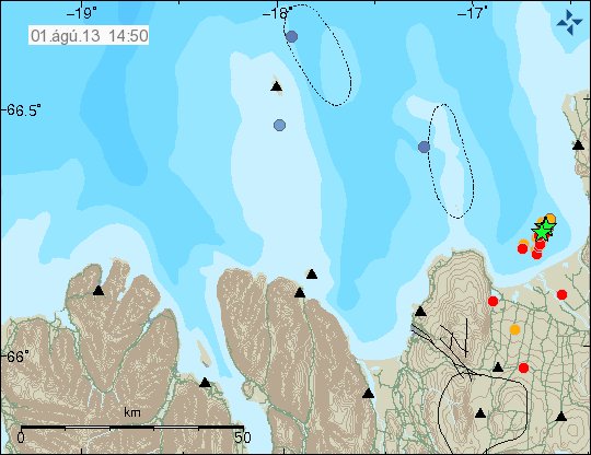
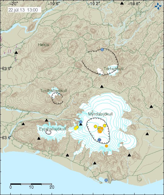
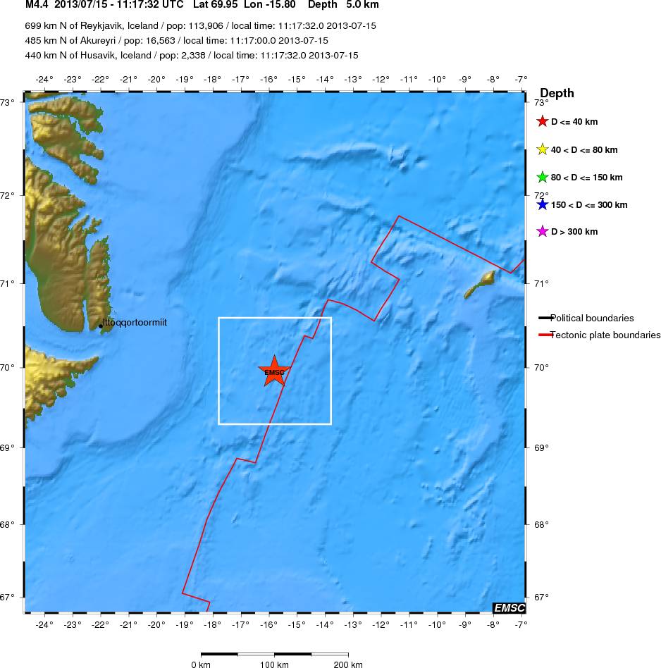
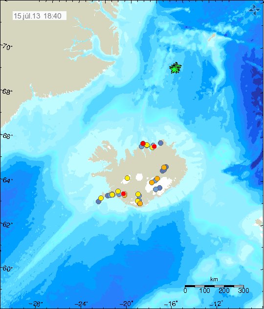
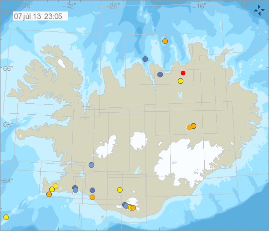
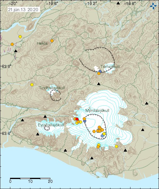
Minor earthquakes in Katla and Bárðarbunga volcanoes

There has been minor earthquake activity in Bárðarbunga volcano and Katla volcano for the past few days. This is just a short overview of this earthquake activity.

Bárðarbunga volcano

A minor dike intrusion took place in Bárðarbunga volcano on 18-June-2013. This was a small earthquake swarm, with largest magnitude at 1.2, the most depth in this earthquake swarm was at 24.3 km. So this was most likely a magma dike formation.

130618_1835
The magma dike earthquakes form a nice line on this IMO map. Copyright of this image belongs to Icelandic Meteorological Office.

Katla volcano

A minor earthquake activity has been taking place in Katla volcano for the past few days. So far it does not mean anything, this is most likely a summer related earthquake activity as glacier weight gets less on Katla volcano during the summer. Some deep earthquakes have been taking place in Katla volcano, it is unclear if they are sign of anything at this stage. This is most likely a some magma dike intrusion at depth, it happens commonly in Katla volcano without resulting in a eruption.

130618_1835
Activity in Katla volcano. Copyright of this image belongs to Icelandic Meteorological Office.

Other then minor activity, it is rather quiet in Iceland at the moment. With no special activity taking place currently.

Thieves stealing batteries from remote monitoring stations in Iceland

I did see in Rúv News today that thieves are now stealing batteries from scientists remote monitoring stations, this are the stations that monitor volcanoes, earthquake activity, GPS data and more. Each theft cost around 3 to 5 million ISK (damage to hardware), data is also being lost. Along with other hardware damage that happens when the batteries are removed forcefully from the hardware.

This theft prevents important measurements on active volcanoes in Iceland, that can prevent important measurements of a volcano if something is taking place in it. Theft has happened on monitoring station in Krísuvík volcano and Eyjafjallajökull volcano, not long time ago (about 3 weeks) a battery was removed from both places. It is important if people come across this hardware to just leave it be, it is important to monitoring active volcanoes in Iceland and damage cost money, lost data and even important signs of eruption in worst case.

So if you come across monitoring hardware in Icelandic nature. Leave it at peace!

Icelandic News about this

Stela rafgeymum vísindamanna (Rúv.is)

Blog post updated at 17:25 UTC on 16-June-2013.
Blog post updated at 18:55 UTC on 16-June-2013.

Update on Skeiðflöt geophone hard drive issue

I am now monitoring the hard drive issue. This might not have been a hard drive failure as I did first think, this might have been a SATA – Bios issue for some reason. I am not sure on the details yet. If things work properly in the next 48 hours, it is a bug in the bios of the computer. Rather then a failing hard drive as I did first think. If that is the case, I do not have to turn the computer off as I planned.

Skeiðflöt geophone going off-line due to hard drive failure

Due to a hard drive failure the geophone station of Skeiðflöt is going off-line. I have to do this to protect the data on the hard drive until it can be replaced. When I write this I am currently running a hard drive check on it (and I hope it works after that). Once that is finished, I am going to turn the computer off until I can replace the hard drive with a new one. When that is going to happen I do not know yet, at latest this is going to take place in December when I go to Iceland over Christmas.

There is nothing I can due at the moment, since I do not have the money to buy (I am poor person) a new hard drive for the computer. I am also not sure if anyone locally can fix the computer, and clone the hard drive for me (as I plan to due in order to save me setting Windows XP up again from scratch, if I can do so to start with). Until the Skeiðflöt geophone computer can be fixed, it is going to remain off-line.

My next geophone to Katla volcano, in the case something happens is Heklubyggð geophone. All my geophones can be viewed here on my geophone web page.

More frequent earthquake swarms expected in Tjörnes Fracture Zone

According to a news on Rúv.is, there is now a risk of more frequent earthquake swarms in Tjörnes Fracture Zone. This is due to the tension that has been building up in Tjörnes Fracture Zone for the past 200 years, with the last large earthquake taking place 37 years ago (Kópasker magnitude 6.5 earthquake in January 1976). This short and small earthquake swarms in TFZ are not going to release the tension that has been building up there for the past 200 years (in some areas), for that too happen. It takes one or more earthquakes that are stronger than magnitude 6.0 to take place before tension starts to drop in the Tjörnes Fracture Zone.

Icelandic news about this

Útlit fyrir tíða skjálfta fyrir norðan (Rúv.is)

Increased monitoring for volcanoes in Vatnajökull glacier

I did see a short news about increased monitoring for volcanoes (you have zoom in manually, the new web page is a mess and not highly useful as such in my view) in Vatnajökull glacier.

Two new seismometer have been added to the SIL network in Vatnajökull glacier. Making detection of activity in Öræfajökull, Grímsfjall, Bárðarbunga, Esjufjöll and other volcanoes easier and more sensitive. It is going to be interesting to see what this information this new seismometer bring to light when it comes to activity in Vatnajökull glacier volcanoes.

Icelandic news about this

Vatnajökull undir nánara eftirliti en áður (Vísir.is)

Risk of landslides in north and east Iceland at the moment

It is worth pointing out that Icelandic Meteorological Office has put out a warning for landslides in north and east Iceland due to spring melt water and heavy rain on top of that.

There have already many landslides taken place in north and east Iceland, many of the blocking roads and damaging them in the worst cases. Along with creating damage to power lines in few rare cases. Any travelers in north and east Iceland should at least keep a eye out for landslide risk if they are going up in Iceland. Due to heavy snow highland roads are still closed, please see Iceland Road administration road conditions web page for more details, it is in Icelandic and can be viewed here.

There is also a considerable risk of ice-dam formation in Iceland at the moment, when it breaks a flood follows and those floods can be dangerous to both people and animals.

For pictures and videos of the landslides, please see the Rúv news coverage below. It is in Icelandic.

Aukið rennsli sést utan úr geimi (Satellite pictures)
Vatnavextir valda tjóni (Pictures)
Enn falla skriður á Norðurlandi (Pictures)
Lokað um Köldukinn fram yfir helgi (pictures and a video, road closed news)
Enn talin hætta á skriðuföllum í Köldukinn (Picture, risk of more landslides)
250 metra aurskriða tók veginn í sundur (picture, video of a large landslide)
Þjóðvegur 85 lokaður (road 85 closed, picture)
Stórt krapaflóð í Fljótsdal (flood due to ice-dam, video, pictures)

Blog post updated at 22:12 UTC on 05-June-2013.

Interesting earthquake swarm south of Grímsfjall volcano

Interesting earthquake activity took place in Vatnajökull glacier today (03.06.2013). This earthquake activity took place just south of Grímsfjall volcano, that last erupted in the year 2011.

130603_2055
The earthquake activity south of Grímsfjall volcano. Copyright of this image belongs to Icelandic Meteorological Office.

This earthquake activity is interesting, since it started after the eruption in Grímsfjall volcano at that area. It has been suggested that this activity is due to stress changes in this are, following the eruption in Grímsfjall volcano in the year 2011.

bab_week21
Earthquake activity in the same area in week 21 in the year 2011. Copyright of this image belongs to Icelandic Meteorological Office.

I am not sure what is going on in this area, no volcano is known, or volcano fissure is known in this area. But that might well just be because this area is covered with a thick glacier. What makes this also interesting is the fact this area has been having earthquake activity since the year 2011 and there doesn’t seems to be any end in sight. This is clearly something worth keeping a eye out for, even if nothing happens in this area for a long time.

Minor earthquake swarm on the Reykjanes Ridge on the 29th of May

On the 29th of May (2013) a minor earthquake swarm took place on the Reykjanes Ridge. The largest earthquake in this swarm had the magnitude of 2.3, the depth range in this earthquake swarm was about 5.5 to 12 km. This was just a minor earthquake swarm, it also did not last long.

130529_2340
The earthquake swarm on the Reykjanes Ridge on 29th of May 2013. Copyright of this image belongs to Icelandic Meteorological Office.

This area of the Reykjanes ridge is highly active, only about three weeks ago there was a strong earthquake swarm in this area. This might just be a aftershock activity from that, it is however difficult to know for sure. I am expecting more earthquakes in this area in next few weeks to months.