Overview of current events in Askja volcano

The current events in Askja volcano started in Week 9 of the year 2010. Before that, Askja volcano has been showing signs of change since the year 2007 at least. In the year 2010, Week 9 a earthquake swarm was recorded by Iceland Meteorological Office. Most of the earthquakes where at around 20 km depth, and it was followed by considerable amount of harmonic tremor activity. I did know about it at the time, but I did think it would be at least 10 to 20 years until Askja volcano would not erupt. But this might have been a event in an series of event that started long time ago, without me knowing about it before (I am still checking data, it takes some time).


The earthquake activity in Askja volcano in Week 9 of the year 2010. Copyright of this picture belongs to Iceland Meteorological Office.

The image above clearly shows where magma was flowing into Askja volcano around 20 km depth. But they are to the north-east of Askja lake. The depth of this earthquakes was from 20 to 23 km.


Map of earthquake activity in Askja volcano. The green dots are earthquakes with a shallow depth, that is depth from 2 to 8 km. Yellow earthquakes have the depth of 12 to 30 km. This data is from the year 2007 at least. Copyright of this picture belongs to its owner (Janet Key).


The depth of the earthquakes in Askja volcano. Copyright of this picture belongs to its owner (Janet Key).


Depth of the earthquakes. This view shows also where the earthquakes are taking place in Askja volcano and close to it. Copyright of this picture belongs to its owner (Janet Key).

All of this map and charts are from this blog post here.


This is a heat camera image of Askja lake. Copyright of this picture belongs to Iceland Coast Guard, the image is from here.

Last year (2011) there was an dike intrusion in north part of Askja volcano. This dike intrusion was clear by a earthquakes that took place. But it stopped and has not shown any activity again in this area. As sometimes happens with dike intrusions. But this activity is an good sign that magma is now flowing into Askja volcano again. But over period of at least 10 to 20 years, it seems that magma has been flowing out of Askja volcano system. Where it has been going I have no idea. But some hypothesis suggests that it might be flowing into Krafla volcano. But there is no good data to support this hypothesis in partial.


Activity in Askja volcano in the year 2011. This activity took place on 05.05.2011 at 16:25 UTC. Copyright of this picture belongs to Iceland Meteorological Office.

At the moment there is nothing that suggest eruption is imminent. But current progress in Askja volcano is something to keep an watch on. But it is also clear that current status in Askja volcano is changing fast. So while there is nothing to suggest a eruption at the moment, it might change without warning in Askja volcano.

Pictures of Askja lake.

Askja lake 12 June 2011.
Picture of Askja lake (32 months ago according to flickr.)

More on Askja lake sudden warming up

Few more news have appeared about the sudden warming of Askja volcano caldera lake. From what I this news say. It seems that this sudden melt of ice in Askja lake did start in beginning of March, by the end of March the lake had gone completely ice free. This is highly unusual and is not known to have happened before. This increase in hydro-thermal activity seems to be located at the bottom of the lake. But so far there is no new change around Askja lake. But it was reported yesterday that known hydro-thermal areas in Askja volcano where well active. It is now being reported that Askja lake got ice-free over period of two weeks so. But that is highly unusual and fast change in Askja lake.

Earthquake activity has not been above background level in Askja volcano so far. But this increase in hydro-thermal activity is interesting from geological point of view, and is the most clear sign that Askja volcano is preparing for a eruption. But there have been earthquakes taking place in Askja volcano. But as I sad yesterday. There have been few earthquakes in Askja volcano during past few months. Askja lake is about 1000 meters above the sea level. This means that once ice settles the lake in December it normally lasts until mid July. But the lake is self is normally up to 22C warm. So the warm increase

If anyone is going to Askja volcano. It is now official advice that people how are travelling in this area not to into Víti lake, or into Askja lake due to risk of dangerous gases that might be coming up from the ground. If you have no special reason going to Askja volcano, you should not go there at this point due to the changes in the volcano. As at this moment it is unknown what exactly is creating this changes in the Askja lake, and possibly nearby hydro-thermal areas.

University of Iceland and Iceland Meteorological Office are going to go after Easter and setup more monitoring hardware and run some test on what might be taking place in Askja volcano.

Update 1: Here is a youtube video by the user gummih that shows how fast Askja lake did thaw during middle of winter.

Icelandic news about this. Use Google translate to make sense of it.

Fylgst með framvindu mála í Öskju (mbl.is)
„Óeðlilegt ástand“ í Öskjuvatni (DV.is)
Fólk fari ekki að Öskjuvatni (mbl.is) – The news with the offical warning about going to Askja lake and Askja volcano.
Vara ferðafólk við Öskjuvatni og Víti (Rúv.is)
Almannavarnir: Ekki fara að Öskju (DV.is)
Óvenjulegt ástand við Öskju (Almannavarnir, Iceland Civil Emergency Authority)
Fólki bent á að fara ekki að Öskju (Vísir.is)

News in English about this

Photos: Iceless Iceland Volcano Lake Causes Speculation (icelandreview.com)

Blog post updated at 18:46 UTC on 04.04.2012.
Blog post updated at 19:12 UTC on 04.04.2012.
Blog post updated at 20:12 UTC on 04.04.2012.
Blog post updated at 01:28 UTC on 05.04.2012.

Askja lake ice free during winter

It seems that Askja volcano is warming up. Literally. According to news on Morgunblaðið web site. The Askja volcano lake is now ice free. But that is highly unusual event. But normally during this time of year it is frozen over. In the news it is explained that this might be because the south wind in Iceland during the past few days, or the most likely second option. Askja volcano lake is now ice free because of more hydro-thermal activity in it. But that is seen as more likely option, as Mývatn lake, that is at considerable lower altitude is now frozen over. There was done a air survey with thermal cameras to see if there was any increased heat on the surface. So far that is not the case at the moment. But it might well be that the hydro-thermal areas under Askja lake are getting more active an warmer. At least that is the only explanation that makes logical sense to the scientists according to this news report. But while the surface activity is none. The chance is that at the bottom of the lake it is getting really hot, and that in turn warms up all the water mass in the Askja lake. But this means that the energy output from the hydro-thermal areas is already high. Even if it is not visible at the surface of the lake.

Askja lake is around 220 meters deep. It was formed in large eruption in the year 1875 (VEI=5). But that was an caldera formation event that took place. But where Askja lake is now, it used to have a mountain that was in decent high before it was blown up into the air. At current time there is no new hydro-thermal activity in Askja volcano (around the lake). Besides the one reported in Askja lake. But based on recorded history, that might change soon. But it seems that before an eruption in Askja volcano, hydro-thermal activity increases in Askja volcano. But that means new hot springs, geysers and such. With all associated dangers and smells from sulfur. At current time, there is no risk of imminent eruption. As the activity at this moment suggests this is just starting, a long more might need to happen before an eruption. But that might change without warning as always. Since all volcanoes are impossible to predict what happens in them. Askja volcano has been having slight increase in earthquake activity during past few months. That suggests new magma is flowing into Askja volcano. But that earthquake activity has somewhat stopped completely and activity has quieted down from what it was few months ago.

Update 1: Here is a new picture of Askja volcano. Taken by Ómar Ragnarsson retired news reporter from Iceland. He also has a new image from Kverkfjöll volcano here.

Update 2: Iceland Meteorological Office has issued a press release about Askja volcano. It says that Askja lake is now ice free (same as in other news). The coast guard did go to check Askja lake on 2nd April 2012 with thermal cameras. In that trip it was discovered that Askja lake is completely ice free with no floating ice in it. The known hydro-thermal areas that are known where well active according to IMO. But no new areas of hydro-thermal activity where spotted in this flight over Askja volcano. Iceland Meteorological Office is going to increase surveillance with Askja volcano and to watch for future progress on what might happen in Askja volcano in the future.

News about this in Icelandic. Use Google translate to scare the Easter Bunny.

Öskjuvatn íslaust með öllu (mbl.is)
Íslaust Öskjuvatn í mars (Vatnajökulsþjóðgarður)
Öskjuvatn íslaust (Iceland Meteorological Office)

New pictures of Askja lake are in both news. Showing it completely ice free during the winter. Pictures are taken on 18th and 27th of March. Iceland Meteorological Office has MODIS picture of Askja volcano that clearly shows how ice free Askja lake actually is.

Blog post updated at 01:32 UTC on 03.04.2012.
Blog post updated at 01:45 UTC on 03.04.2012.
Blog post updated at 16:32 UTC on 03.04.2012.
Blog post updated at 16:48 UTC on 03.04.2012.

Grímsfjall volcano continues to prepare for a new eruption

As I did mention in a blog post from 16. January 2012. Grímsfjall volcano is preparing for a new eruption. That progress has not slowed down at all. I am rather sure that the eruption prepare progress in Grímsfjall volcano has sped up. But this is nothing confirmed at the moment. I am just noticing slow increase in earthquakes from Grímsfjall volcano.


Today’s activity in Grímsfjall volcano. Copyright of this picture belongs to Iceland Met Office.


Grímsfjall volcano activity in Week 11 2012. Copyright of this picture belongs to Iceland Met Office.


Grímsfjall volcano activity in Week 12 2012. Copyright of this picture belongs to Iceland Met Office.

It is impossible to know for sure when next eruption starts in Grímsfjall volcano. But at the current time, the clock is ticking down faster then it did before in my opinion. As is known from history. Grímsfjall volcano has erupted sometimes the year after. Even after a big eruption. As was the case last year (2011), when it had the largest eruption in 140 years.

Pictures of a old volcano rift zone

Here is a picture of what remains of Snæfellsnes – Húnaþing Rift zone. But this rift zone was activity about 4 million years ago. I do not know why this part of the rift zone is visible. But it seems to have escaped glacier erosion during past 4 million years since it became extinct.


The visible part of the Snæfellsnes – Húnaþing rift zone that was active about 4 million years ago. The farm in this picture is called Bjarghús. This picture is released under Creative Common Licence. Jón Frímann Jónsson took this picture on 24.03.2012.


This is where the visible rift zone disappear back into the ground. Its visibility resumes at distance. This picture is released under Creative Common Licence. Jón Frímann Jónsson took this picture on 24.03.2012.


The Snæfellsnes – Húnaþing rift zone is number two on this picture. What can be seen above ground is just a small part of it. This picture has been released under public domain licence. See this web page here for more details. This picture is not 100% correct on the details on the rift zones in Iceland. But is a good start for it.

Older blog post about this area can be found here. I am not expecting any eruption in this area. But it is always a possibly of a volcanic cone popping up in area like this. As the closest volcanoes to this area are only at the distance of 80 to 90 km south of it. But that is the Langjökull volcano, in the north part of it.

Minor earthquake cluster in Katla volcano caldera

There seems to be forming of minor earthquake clusters in Katla volcano caldera. But this has been following growing number earthquakes in Katla volcano caldera during past few weeks. This is most likely an signal of increased activity in next few weeks to months. But the increase does not have to been slowly up. It can be sudden as did happen in July 2011 in Katla volcano caldera when earthquake activity did increase suddenly and there was an small eruption without an warning.


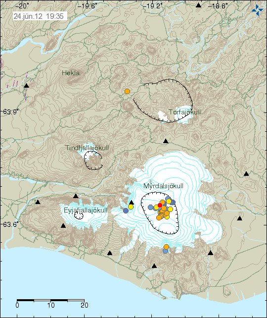
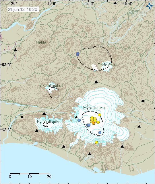
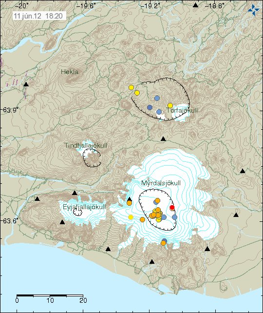
Current earthquake activity in Katla volcano. Note the small cluster of earthquakes close the area where an small eruption took place in the year 1999. Copyright of this image belongs to IMO.

There has been some small cluster of earthquakes taking place in Katla volcano caldera. I am not yet sure what that means at the moment. However this might be clues to minor dike intrusions into Katla volcano caldera. But without more data, it is impossible to be sure on this detail at current time.

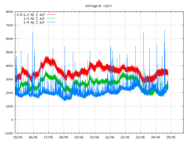
Last night there was an change in harmonic tremor on two SIL stations around Katla volcano. But due to high wind noise I am unsure what was going on. But it is possible that this was an small dike intrusion taking place close to Goðabunga part of Katla volcano, or this was an minor glacier flood that was taking place under the glacier. At current time I have no good idea what was going on.


The harmonic tremor on Smjörgil SIL station. The signal is unclear due to high wind noise. Copyright of this picture belongs to IMO.


The harmonic tremor signal on the Goðabunga SIL station. Due to high wind the signal is unclear and hard to see. Copyright of this picture belongs to IMO.

It is hard to know for sure what happens next in Katla volcano. But important signs can be found in earthquake patterns. But it is also important not to overlay broad interpret the data in the favor of an eruption taking place. As it is impossible to know for sure when Katla volcano erupts, and then how big. All we might get is an new small eruption like in July 2011. As Katla volcano can also have small eruptions like big ones.

Continued harmonic tremor in Katla volcano

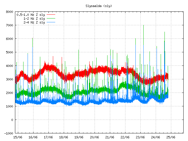
The harmonic tremor that started yesterday in Katla volcano continues. It is however at less strength then yesterday. Often there are small earthquakes following it. They can be poorly observed on my Heklubyggð geophone. Few earthquakes have happened during this unrest. GPS data is unreliable, as it has not been updates since mid December 2011 (why that is I do not know). At current time it seems that this harmonic tremor is dropping down at the moment. It is impossible to know for sure if this is the end of this tremor in Katla volcano for the moment or not.


The tremor noise as seen on Slysaalda SIL station. Copyright of this picture belongs to IMO.


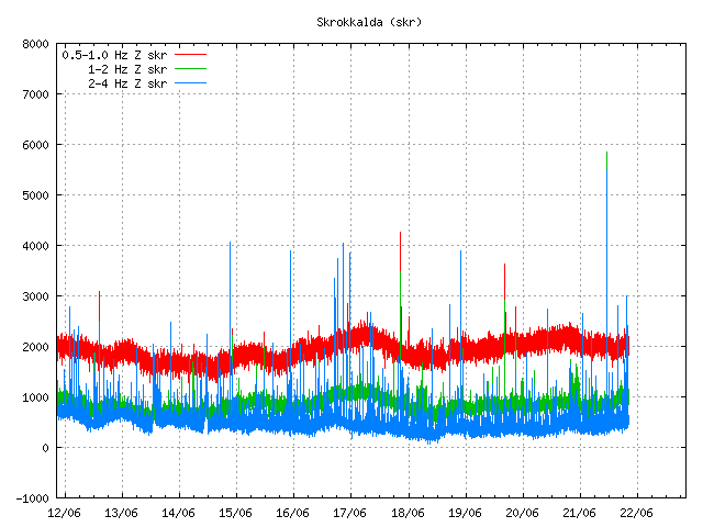
The harmonic tremor noise as seen on Skrokkalda SIL station. Copyright of this picture belongs to IMO.

There are now two possible reasons why this is happening. This might be an increase in hydro-thermal activity in north part of Katla volcano. Second reason might be that this is magma moving around inside Katla volcano at depth, then out visible effects on the surface. That is earthquakes have not happened following this event to any extent. There have only been two registered earthquakes so far. There location is both poor and depth poorly located. It has been my experience that following smaller event of this type there is generally an earthquake swarm in Katla volcano caldera. The time is is from from this type of event to take place until the earthquake swarm takes place differs a lot.

Last minor eruption that took place in Katla volcano was on 6. September 2011. My blog posts about it can be found here. It was believed at the time this was water. But today I now think this was an small eruption rather then water flooding under Mýrdalsjökull glacier.

Strong harmonic tremor pulse starting in Katla volcano
Most likely water creating harmonic tremors in Katla volcano (for the moment)

Both blog posts are from 6. September 2011.

Harmonic tremor pulse in Katla volcano

Today there was an harmonic tremor pulse in Katla volcano. I am not sure when this harmonic tremor pulse did start. But I am guessing around 15:22 UTC or maybe around 16:00 UTC. It seems that this harmonic tremor pulse was small, considering the activity in July 2011 in Katla volcano (an minor eruption). This harmonic tremor pulse seems to have happened in the north part of Katla volcano, outside the caldera from my best estimates but might well be inside it in the north part of it. But it hard to be sure on that detail. From what I can tell, this harmonic tremor pulse does not appear on my geophones clearly. But it might have appeared on Hekla geophone poorly. But it is hard to be sure on that due to wind noise. When this is written the harmonic tremor pulse appears to be dying down. But there is still an possibly that it might pick up again or an new one might start without warning. It is impossible to know for sure how long this is going to stop after this harmonic tremor pulse. This harmonic tremor pulse is due to dike intrusion in Katla volcano at depth, so earthquakes might not happen until it reaches shallower surface in the crust. If the dike intrusion gets that far to start with.


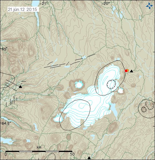
The possible location of the harmonic tremor marked by the poorly located earthquake in Katla volcano. Copyright of this image belongs to IMO (Iceland Met Office).


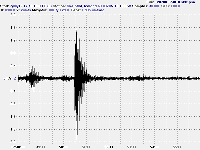
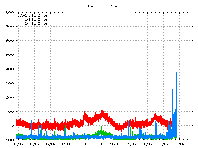
The harmonic tremor on the Slysaalda SIL station where it is the strongest. But that means it is closest to this SIL station. Copyright of this image belongs to IMO (Iceland Met Office).


The harmonic tremor pulse on Goðabunga SIL station. The harmonic tremor pulse is weaker here then on Slysaalda SIL station. Copyright of this image belongs to IMO (Iceland Met Office).


The harmonic tremor pulse on Skrokkalda SIL station. One of the SIL station that have the most distance from Katla volcano area where the tremor pulse is taking place. Copyright of this image belongs to IMO (Iceland Met Office).


The harmonic tremor pulse can clearly be seen on Lágu Hvolar SIL station. Copyright of this image belongs to IMO (Iceland Met Office).


The harmonic tremor on Smjörgil SIL station, it is located in the flanks of Eyjafjallajökull volcano. This SIL station is close to Goðabunga SIL station. Copyright of this image belongs to IMO (Iceland Met Office).

What happens next in Katla volcano is hard to know. It all comes down to wait and see what happens next in Katla volcano. Eruptions in Katla volcano in January – February time period are not common, but due happen at times. So this harmonic tremor pulse might be an advance warning of what is to come. But that is just speculation on my part. It is impossible to know for sure what happens in Katla volcano until it happens.

Earthquake swarm in Katla volcano, earthquake in Hekla volcano

Tonight at 21:13 UTC there was an earthquake with the size of ML1.2, it had the depth of 0.1 km. But that is about 100 meters. This is the second earthquake in Hekla volcano during that past three weeks (almost an month since last earthquake did happen in Hekla volcano). So far nothing more has happened. But that might change without warning.


The earthquake in Hekla volcano. It is the red dot in Hekla volcano. Copyright of this picture belongs to IMO.

Katla volcano

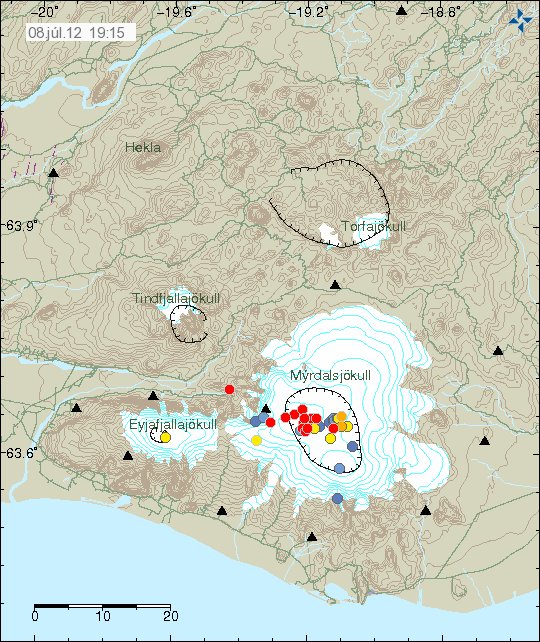
Today at 16:04 to 16:27 UTC there was an minor earthquake swarm in Katla volcano. The largest earthquake had the size of ML2.6, with the depth of 1.4 km. Like before this earthquake swarm was because of an dike intrusion into Katla volcano caldera. But this suggests that the unrest that started in Katla volcano in July 2011 is not over. But for the moment it continues at lower rate then before. But that might also change without warning at any time.


The earthquake swarm in Katla volcano. The earthquake in Hekla volcano can also be clearly seen on it. Copyright of this picture belongs to IMO.

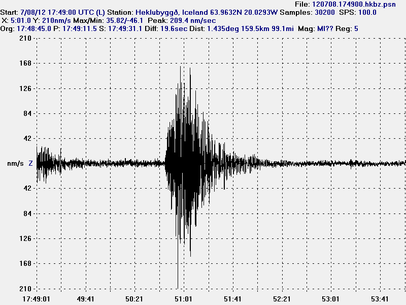
It is impossible to know for sure what is going to happen next in both of this volcano. But it is clearly worth watching what is going on. The earthquake in Hekla volcano can clearly be seen on my Heklubyggð geophone, as it forms an clear spike on it, the web site can be found here. Same does the largest earthquake from Katla volcano earlier today.

Interesting earthquake activity in El Hierro volcano

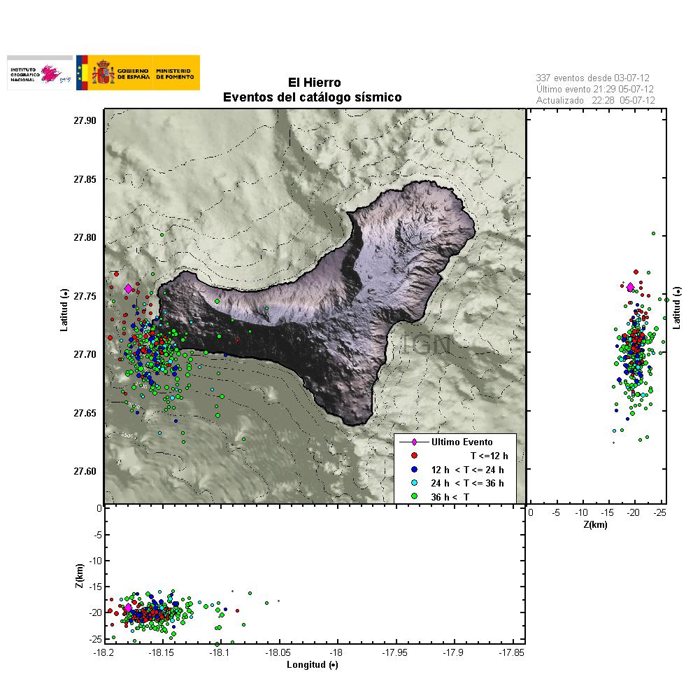
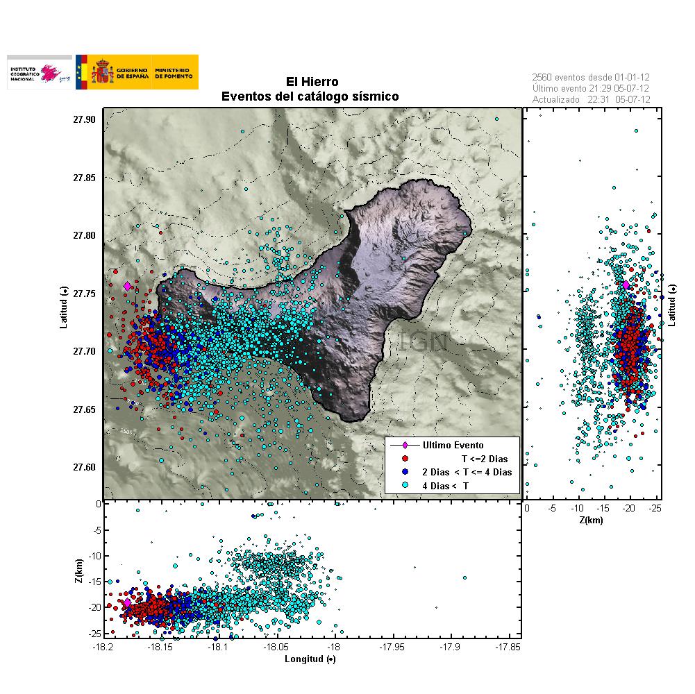
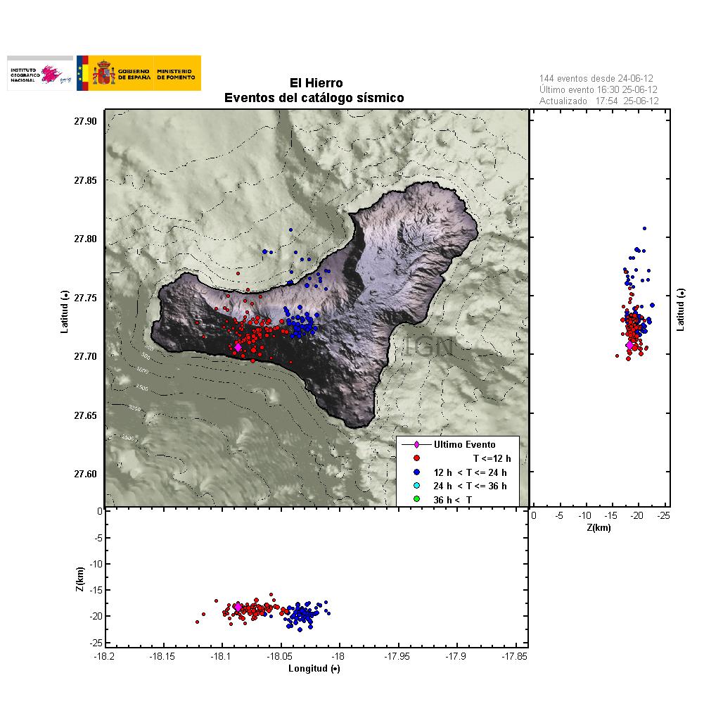
Over the past two weeks there has been interesting earthquake activity in El Hierro volcano in Canary Islands. What is so interesting about this earthquakes is the fact they are getting more shallow every day or so. Currently the most shallow activity that has been taking place is around 6km depth. But this is an rise from about 12 km depth.

What this means in my opinion is that magma is most likely rising to the surface at the location where the earthquakes are currently taking place (dike intrusions). This did happen before the first eruption in Eyjafjallajökull volcano. So it is an important to keep an eye on this earthquakes and where they happen, as eruption might take place in nearby area of this earthquakes. As magma might, and most likely is going find an clear path to the surface soon. The last part of that before an eruption might happen with no noticeable earthquakes at all. They might well be just over ML2.0 in magnitude or smaller.


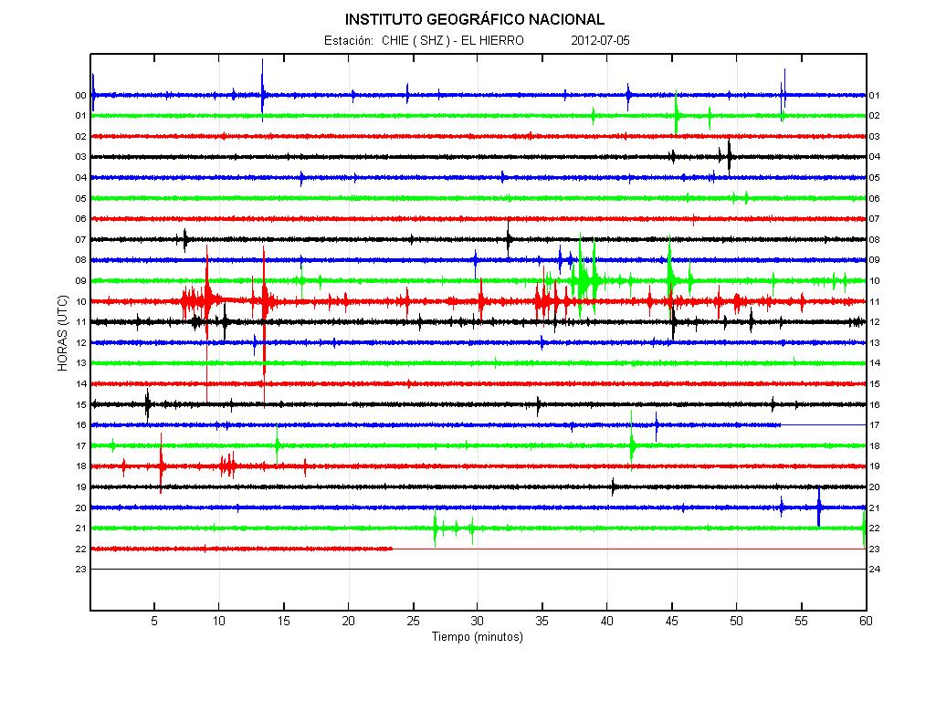
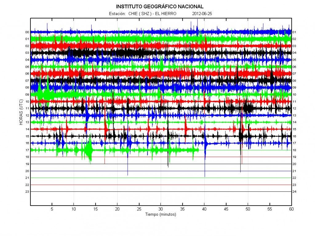
Earthquake activity in El Hierro volcano over the past 10 days. Copyright of this image belongs to ING.

It is impossible to know for sure when or if an eruption happens in this area. But I find that is most likely going to be the case given the current activity. When and where is impossible to know for sure at current time.