Today (24. December 2022) an small earthquake swarm took place in Fagradalsfjall volcano. Only one earthquake did reach magnitude of Mw1,0. Most depth in this earthquake swarm had a depth of 14,5 km and up to 6,8 km depth.
Continue reading “Small earthquake swarm activity in Fagradalsfjall volcano”
Earthquake swarm in Krýsuvík-Trölladyngja volcano
Today (21. December 2022) an earthquake with magnitude of Mw3,4 took place in Krýsuvík-Trölladyngja volcano. This earthquake is because of inflation in Fagradalsfjall volcano. This possibly means that the inflation in Fagradalsfjall volcano is reaching critical point and might result in a eruption soon, when that point is reached is difficult to know.
Continue reading “Earthquake swarm in Krýsuvík-Trölladyngja volcano”
Earthquake swarm 3 km north of Grindavík town
Today (19. December 2022) and yesterday (18. December 2022) an earthquake swarm took place 3 km north of Grindavík town in the Reykjanes volcano. Largest earthquake had a magnitude of Mw2,9 and was felt in Grindavík. Earthquakes with magnitude Mw2,0 are felt in Grindavík, possibly even smaller earthquakes. At the writing of this article, this earthquake swarm is ongoing but weather is blocking almost all of the automatic earthquake detection.
Continue reading “Earthquake swarm 3 km north of Grindavík town”
Earthquake swarm continues 47 km east of Fonti in Eastern Iceland
During the night and today (18. December 2022) the earthquake swarm around 47 km east of Fonti in Eastern Iceland continued. Largest earthquake at the writing of this article had magnitude of Mw3,3 but another and few smaller earthquakes, but with magnitude of Mw3,1 took place in the same location. Several earthquakes with magnitude above Mw2,5 also took place.
Continue reading “Earthquake swarm continues 47 km east of Fonti in Eastern Iceland”
Earthquake with magnitude of Mw3,8 in Katla volcano
Today (18. December 2022) at 11:08 UTC an earthquake with magnitude of Mw3,8 took place in Katla volcano. This earthquake was felt, I don’t know if it was felt in Vík í Mýrdal. This is the largest earthquake in Katla volcano in a while.
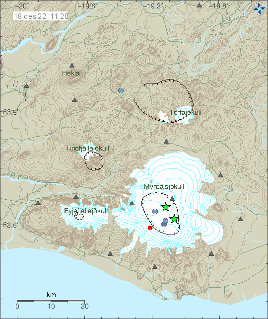
There has been some earthquake activity with minor earthquakes following this strong earthquake. But it has been minimal at the writing of this article.
Magnitude Mw3,1 earthquake in Katla volcano
Today (16. December 2022) at 21:44 UTC an earthquake with magnitude of Mw3,1 took place in Katla volcano. This seems to be a single earthquake at the writing of this article.
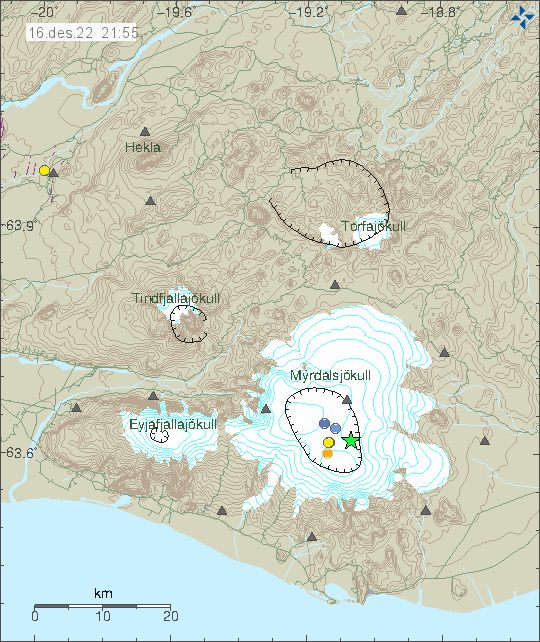
This earthquake activity seems to be normal and there is nothing to suggests that more is going to happen in Katla volcano at this time.
Earthquake swarm east of Iceland (45 km east of Fonti)
Today (15. December 2022) an earthquake swarm has been going around 45 km east of location known as Fonti in eastern Iceland. This location is out in the ocean and its unclear why this earthquake activity is happening. There are no volcanoes in this part of Iceland and no known fault areas. Since this is among the oldest parts of Iceland.
Largest earthquake in this swarm recorded so far, had the magnitude of M2,9. Distance from the SIL network prevents detection of smaller earthquakes in this area.
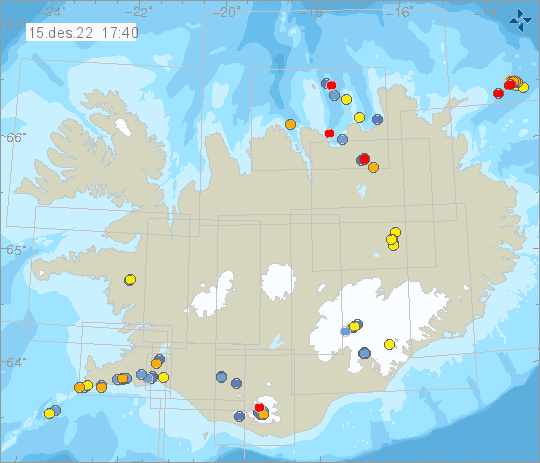
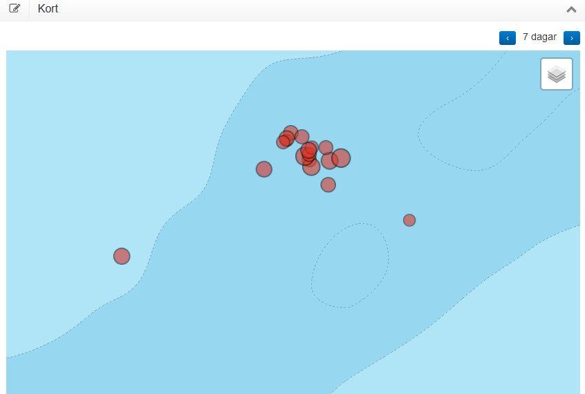
There is a risk of stronger earthquakes in this area. If this earthquakes are going to be felt in populated areas is unlikely unless this earthquake activity gets really big. Since this earthquake activity is far from the coastline and there’s almost no population in this parts of Iceland.
Earthquake swarm in Reykjanes volcano (3-December-2022)
Today (03-December-2022) at 12:49 UTC an earthquake with magnitude of Mw3,5 at 7,0 km depth. This was the largest earthquake in the swarm. Around of 40 earthquakes took place at the writing of this article. There are no reports about the largest earthquake was felt in nearby populated areas.
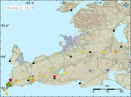
This earthquake activity suggest that a new inflation period is about to start in this part of the Reykjanes peninsula and Reykjanes ridge. There has been rather quiet time in Fagradalsfjall volcano and Reykjanes volcano since August when last eruption took place in Fagradalsfjall volcano. Reykjanes volcano has not erupted so far, but has continued activity of magma injection into the crust. When that is going to result in a eruption is impossible to know.
Magnitude Mw3,8 earthquake in Bárðarbunga volcano
Today (29-November-2022) at 01:09 UTC an earthquake with magnitude of Mw3,8 took place in Bárðarbunga volcano. This is a normal inflation earthquake in Bárðarbunga volcano and more earthquakes like this are going to happen in next few years.
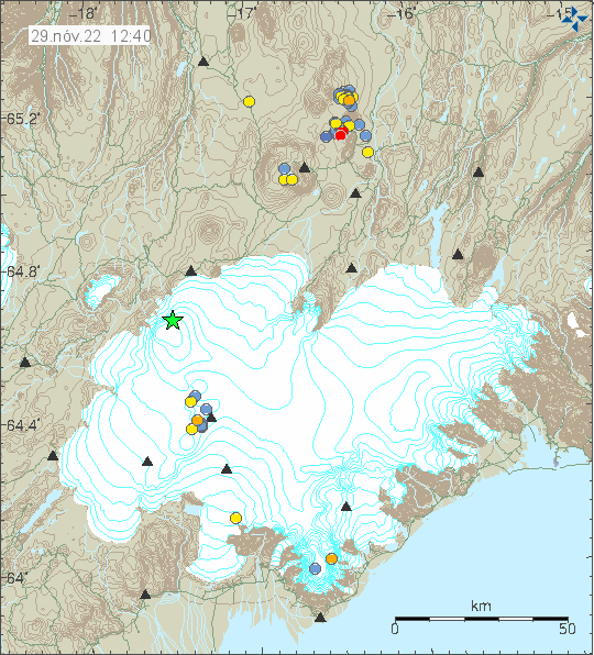
This is just regular earthquake activity in Bárðarbunga volcano. After the eruption in Bárðarbunga volcano in 2014 and until 2015 it is going to be a while until next eruption happens. Until then, earthquakes like this are going to happen.
Earthquake pulses in Katla volcano
Today (27-November-2022) two pulses of earthquake activity took place in Katla volcano. No eruption happened following this earthquake activity. This earthquake activity is interesting but it is unclear what is going on. This can be normal earthquake activity in Katla volcano, even if the earthquakes are larger than normal or this is a step that is going to result in an eruption happening in the future. At the moment, there’s no way to know what is the fact here. The earthquake pulses did come in two activity spikes, the first one started at 03:41 and lasted until 03:53 UTC. The second earthquake pulse did come at 11:48 and lasted until 12:12 UTC.
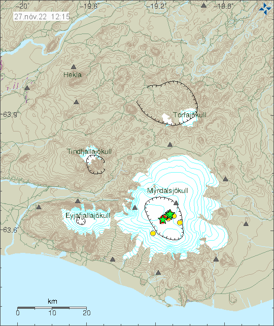
The largest earthquakes had a magnitude of Mw3,0 and Mw3,1 and Mw3,4. This is not a dyke intrusion of magma. Such activity behaves differently in a volcano than just surface level earthquake activity as took place in Katla volcano. Based on what I am seeing, it is possible that more earthquake pulses like this are going to happen in next few days or weeks.
