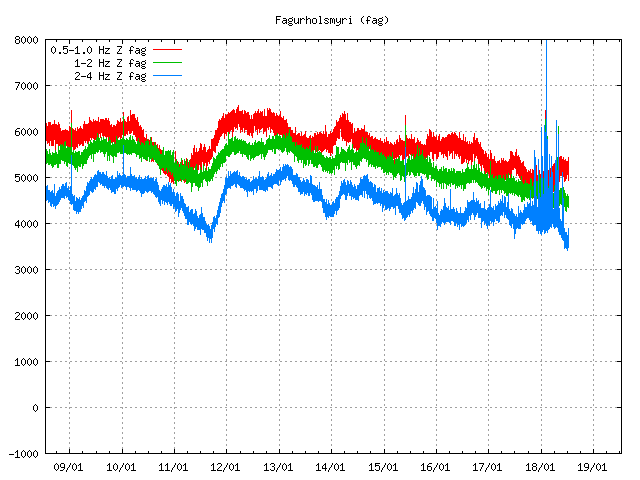
Yesterday (28-January-2018) a earthquake swarm started in Tjörnes Fracture Zone (TFZ). This earthquake swarm is ongoing and current numbers might change and magnitudes of earthquakes from what they currently are. At the moment largest earthquake that has been recorded happened yesterday and had a magnitude of 4,1 (at 07:49 UTC) and the second strongest earthquake so far had the magnitude of 3,4 (at 08:11 UTC). The stronger earthquake woke people up from their sleep and was felt over a wide area. That was not reported with the second earthquake.
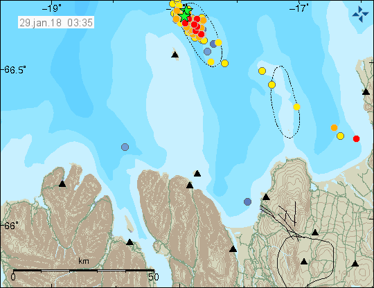
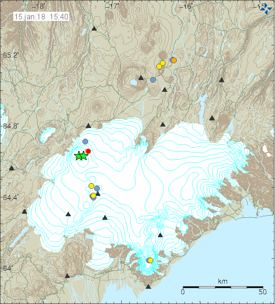
The earthquake swarm in TFZ. Strongest earthquakes are marked by green stars. Copyright of this image belongs to Icelandic Met Office.
All other earthquakes so far have been smaller than magnitude 3,0 at the moment. Over 130 earthquakes have happened so far. This earthquake swarm is currently ongoing. This earthquake swarm is only tectonic in nature and at the moment there is nothing suggesting that this activity is connected to magma movements.
Donations
Please remember to support my work with donations. Everything helps. Thanks for the support. 🙂