Earthquake swarm north of Grindavík town

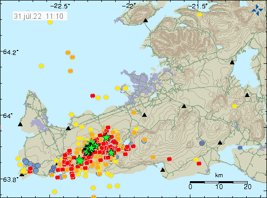
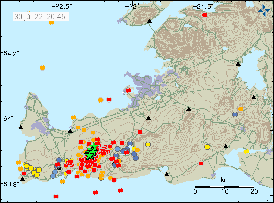
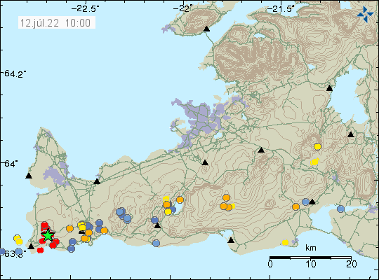
Around 14:00 UTC an earthquake swarm started north of Grindavík town. This look like a tension breaking earthquake swarm and that suggests an inflation is happening again in Fagradalsfjall volcano (mountain). Largest earthquake so far had a magnitude of Mw3,3 and second largest earthquake so far had a magnitude of Mw3,0.

Green star on the map north of Grindavík town shows the main earthquake swarm
Earthquake activity north of Grindavík town. Copyright of this image belongs to Icelandic Met Office.
Red dots north of Grindavík town showing the main area of earthquake activity
Area of earthquake activity. Copyright of this image belongs to Icelandic Met Office.

This earthquake swarm is ongoing, but like with all earthquakes swarms in this area it shows a sign of slowing down for few hours before continuing. There is a chance this earthquake swarm might be over. But I am not yet sure if that is the case.

Donations

Since I am broke in April. Please remember to support my work with donations if you can. Thanks for the support. 🙂

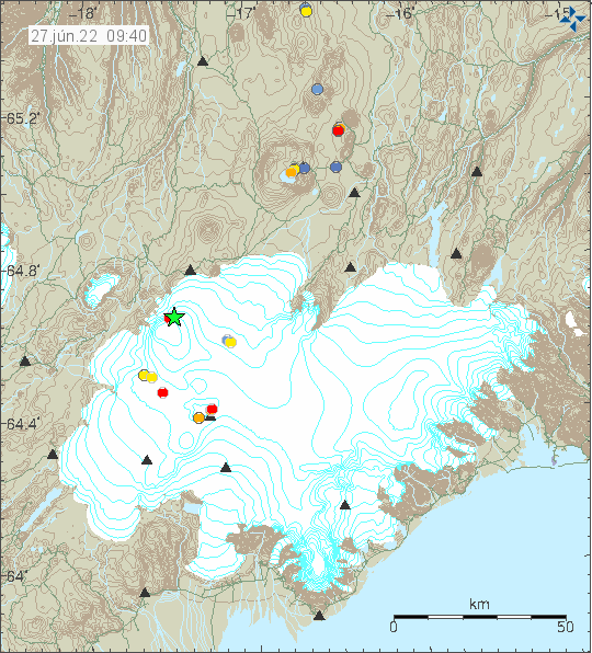
Earthquake activity in Bárðarbunga volcano

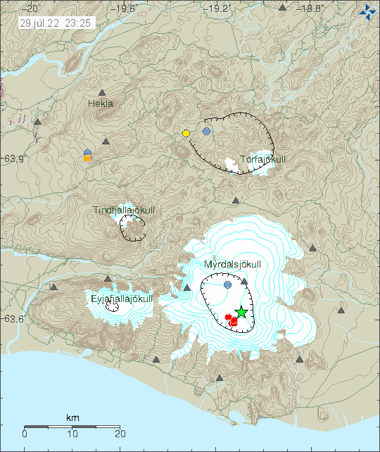
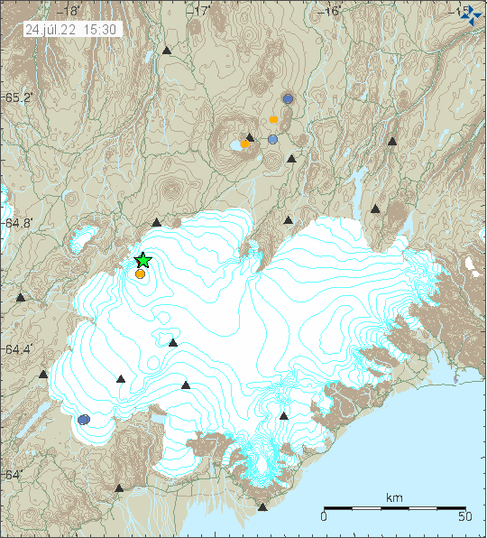
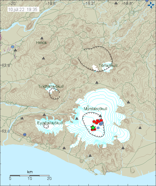
This morning an earthquake swarm took place in Bárðarbunga volcano. This earthquake activity is because of inflation of Bárðarbunga volcano. Largest earthquake had a magnitude of Mw4,1. Other earthquakes where smaller in magnitude.

Green star in eastern part of Bárðarbunga volcano showing the activity. Few red dots showing smaller earthquakes in western part of Bárðarbunga volcano.
Earthquake activity in Bárðarbunga volcano. Copyright of this image belongs to Icelandic Met Office.

This earthquake activity is normal since the end of the eruption in Bárðarbunga volcano in February 2015 it has been inflating. This earthquake activity is going to change and longer time is going to be between larger earthquakes. This type of earthquake activity is only going to go down to 1 to 2 earthquakes a year in next few years. Then down to one earthquake every few years.

Earthquake swarm in Krýsuvík-Trölladyngja volcano

This morning (17-March-2022) an earthquake swarm took place in Krýsuvík-Trölladyngja volcano.

Green star close to Kleifarvatn lake to the east. Green star shows the strongest earthquake in the area
Earthquake activity in Trölladyngja-Krýsuvík volcano. Copyright of this image belongs to Icelandic Met Office.

Largest earthquake had a magnitude of Mw3,0. Other earthquakes have been smaller in magnitude. Bad weather in last few weeks have prevented good detection of small earthquakes. More earthquake activity might have taken place than appears on Icelandic Met Office maps.

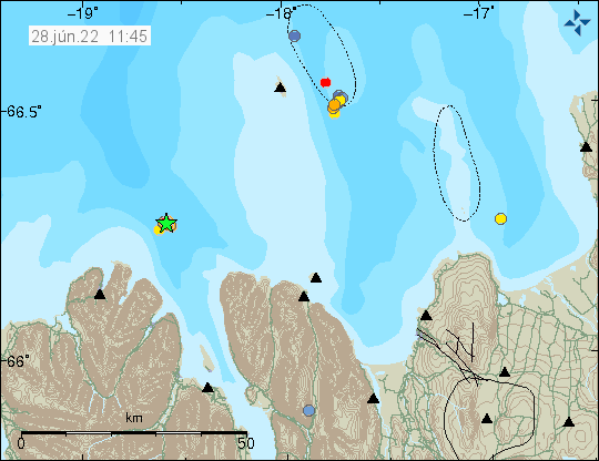
Earthquake swarm north of Kolbeinsey island

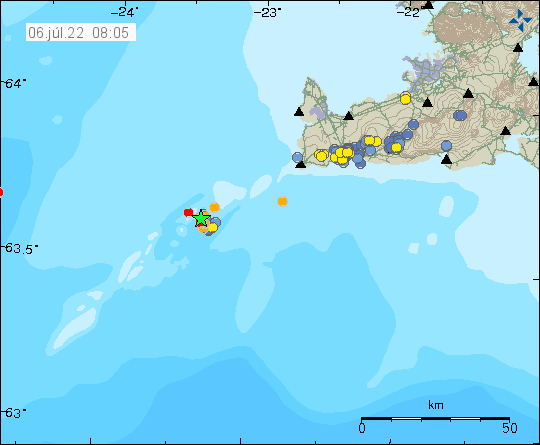
This morning (5-March-2022) an earthquake swarm started north of Kolbeinsey island. Three earthquakes with magnitude above Mw3,0 took place in this swarm and there where few smaller earthquakes recorded. Because of distance from the SIL network only the strongest earthquakes have been detected.

Green stars on the top of the map showing the location of the earthquake swarm. Few orange dots showing smaller earthquakes
Green starts show the location of the earthquake swarm in Kolbeinsey island. Copyright of this image belongs to Icelandic Met Office.

The strongest earthquakes with magnitude of Mw3,1 and Mw3,2. There is still a chance of stronger earthquakes in this area. It is unclear what is going on because this area is remote and under the ocean. If an eruption happens at this location there is a chance it won’t be noticed or just noticed on SIL seismometers.

Strong earthquake in Bárðarbunga volcano

At 10:11 UTC today (22-February-2022) an earthquake with magnitude of Mw4,8 (Icelandic Met Office) or Mw5,0 (EMSC) took place in Bárðarbunga volcano.

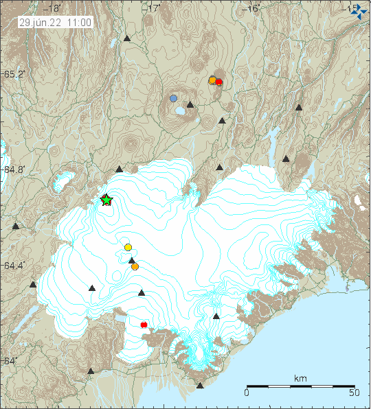
Two green stars in Bárðarbunga volcano showing the strong earthquake activity in the volcano. Two smaller dots show smaller earthquakes.
Earthquake activity in Bárðarbunga volcano. Copyright of this image belongs to Icelandic Met Office.

Yesterday (21-February-2022) at 14:08 UTC there had been a earthquake with magnitude of Mw3,0 in Bárðarbunga volcano, along with few smaller earthquakes. This earthquake activity shows that Bárðarbunga volcano continues to inflate after the eruption in the year 2014 to 2015. It is impossible to know when next eruption happens in Bárðarbunga volcano, it might be 10 years from now or 100 years from now. Last eruption in Bárðarbunga volcano before the 2014 eruption was in the year 1902.

Donations

Please remember to support my work with donations. They help me from not being broke. Thanks for the support. 🙂

Strong earthquake activity in Katla volcano

At 19:10 UTC today (02-February-2022) an strong earthquake swarm started in Katla volcano. Strongest earthquakes so far had a magnitude of Mw4,0 (19:10 UTC) and Mw3,4 (19:44 UTC).

Earthquake activity in Katla volcano. A lot of red dots with two green stars on the calder rim
Earthquake activity in Katla volcano. Copyright of this image belongs to Icelandic Met Office.

At the writing of this article it is unclear if this is going to result in an eruption. The chances are good, but this activity might still slow down and stop before any eruption, small or large happens in Katla volcano.

This article is going to be updated if needed or new article is going to be written if the situation changes enough from what it is now.

Strong earthquake close to Húsafell

Today (1-February-2022) at 00:05 UTC an earthquake with magnitude of Mw3,7 took place close to Húsafell. This earthquake was felt in Reykjavík. This earthquake swarm is ongoing, it is slow moving and often stops A second earthquake with magnitude Mw3,0 took place at 01:15 UTC. During the last 48 hours a total of 107 earthquakes have happened in Húsafell area.

Two green stars west of Langjökull glacier with smaller earthquakes in the same area
Earthquake activity in Húsafell. Copyright of this image belongs to Icelandic Met Office.

Largest known earthquake in this area has a magnitude of 5,5 in the year 1974. That is all I know about this earthquake, that earthquake was also slightly more north then current swarm. Why this earthquake activity is happening is unclear since there are not any known volcanoes in this area or earthquake faults. There is a low (as in degrees of hot water) hydrothermal area in this area and recent news articles have suggested that this earthquake activity might be connected to that area. That is at best speculation and nothing has been proved so far. The existence of this low hydrothermal area shows that magma is in the crust in this area at shallow depth and has been for a while. For hydrothermal area to form, both cracks in the crust needs to be open and magma needs to reach 1 to 2 km up in the crust to warm up ground water in the crust.