Activity remains low in Iceland. Eruption continues in El Hierro volcano

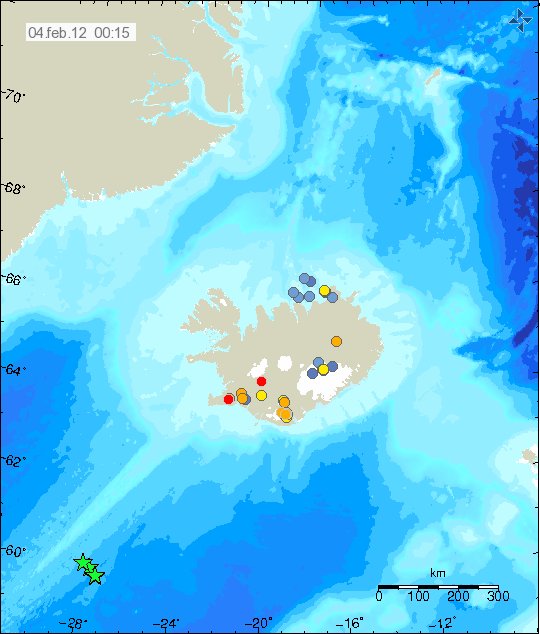
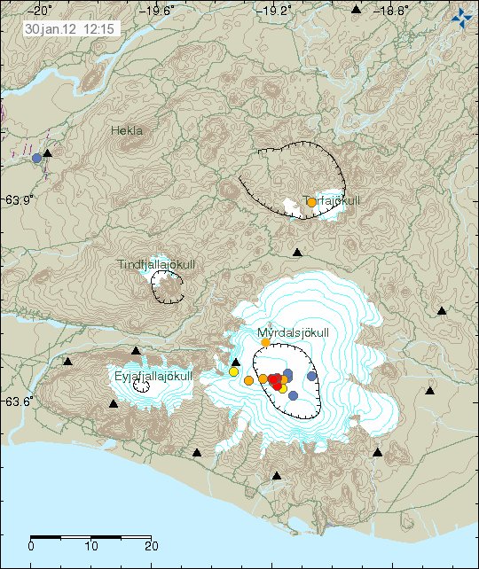
At the present time the earthquake activity remains low in Iceland. This goes for both Katla volcano and other areas of Iceland. This is the regular quiet time in Iceland, as it happens sometimes. For the next days, there is a risk of frost-quakes as the ground freezes over in a cold snap.

El Hierro volcano, Canary Islands

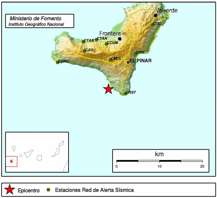
The eruption in El Hierro volcano continues as before. New eruption vents have been opening up at random in the south part of El Hierro volcano. Earthquake activity to the north has dropped. While at the same time, the earthquake activity seems to have increased slightly to the west part of El Hierro volcano. I am not sure why that is yet.

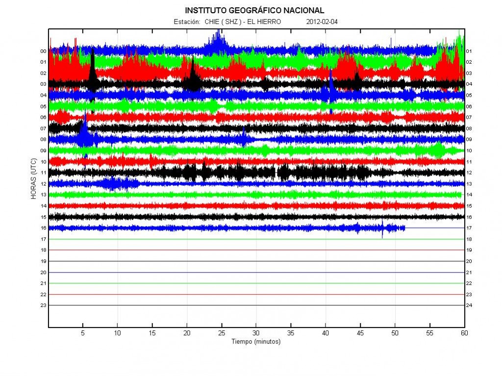
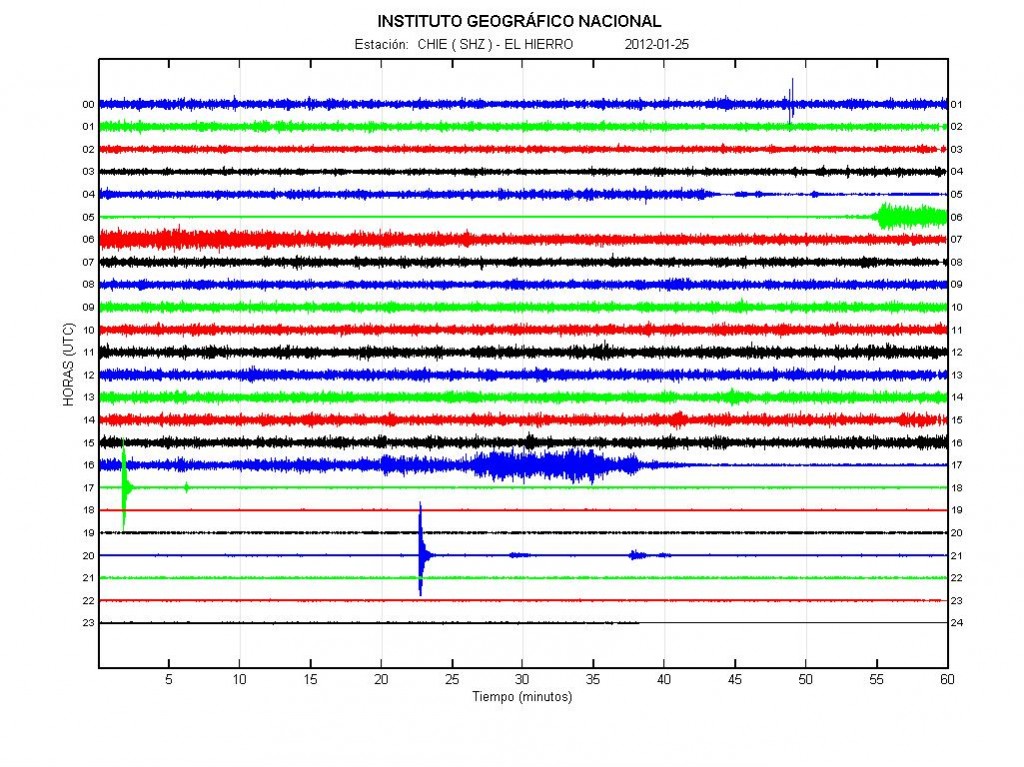
In the tremor data. I have been seeing several explosions taking place. But they create a spikes in the tremor plot, that is different then what happens when a earthquake takes place.


The current harmonic tremor from El Hierro volcano. Explosions are the spike activity (30 November, 2011). Some of this however might be sudden increase in eruption activity. Copyright of this picture belongs to IGN (Instituto Geográfico Nacional).

Other then that. The eruption in El Hierro volcano seems to be about the same for the moment as it has been for the past almost two months now. So far it is impossible to know when this eruptions ends. But eruption in La Palma volcano lasted about one month on average. Eruptions in Lanzarote volcano have lasted about three months (last eruption was in the year 1824). Based on this. This might be a eruption that lasts for about 3 to 5 months at the longest in my opinion. But what actually happens is just something that is a wait and see matter.

Earthquake swarm in Grímsey Island (TFZ)

Today there has been a earthquake swarm in Grímsey Island. But this tiny Island is off the north coast of Iceland. Around 100 people live on the Grímsey Island. This earthquake swarm is small. But its location makes sure that it is felt. But it is directly under the village on the Grímsey Island. So far the strongest earthquake recorded is a ML3.3 in size with the depth of 9.1 km.


The earthquake swarm in Grímsey Island. The Island is located where the earthquake swarm is on this map. Copyright of this picture belongs to Iceland Met Office.

The largest earthquake so far was recorded on my Hvammstangi geophone clearly.


The earthquake as recorded on my Hvammstangi geophone. This trace is filtered at 4Hz. This picture is released under Creative Commons licence. See top bar for more information.

The earthquake swarm appears to be ongoing. I am sure that this earthquake swarm is felt in the village because it is directly under it. But depth of the earthquakes might however play a role in it how well the earthquakes are felt in the village. So far there have not been any news reports on this earthquake swarm in Icelandic Media.

Blog post updated at 00:25 UTC on 25 November, 2011

Rare earthquake close to Hvammstangi geophone

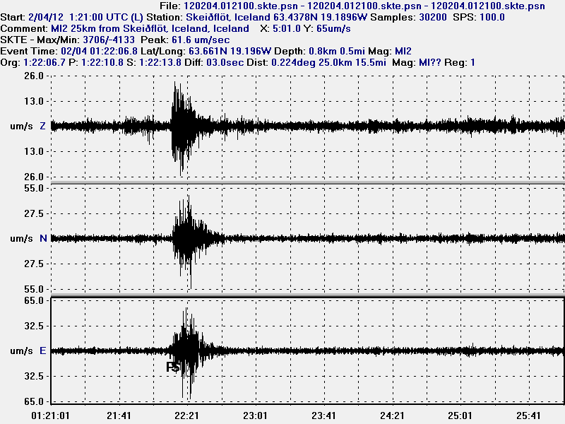
A rare earthquake took place yesterday close to my geophone in Hvammstangi village. But that village is located in north-west Iceland. This earthquake was small and I do not have location at moment, as I only have one geophone at this location for recording earthquakes.What I do know about this earthquake was around 25 km away from my geophone, with the default depth at 10 km. But this distance is a bit inaccurate due to default depth factors. So this is just a best effort guess. But what I do have is the wave form of this earthquake.


The vertical (Z) component of the earthquake. This picture is released under Creative Commons Licence. Please see the top bar for more information.


The North-South component of the earthquake. This picture is released under Creative Commons Licence. Please see the top bar for more information.


The East-West component of the earthquake. This picture is released under Creative Commons Licence. Please see the top bar for more information.

All the pictures here above show the 20 seconds wave form signal of the earthquake. I have marked the P and S wave of the earthquake in order to figure out the distance this earthquake took place from my geophone.

In this area I get around one to two earthquakes a year that are local and do not appear on the Iceland Met Office earthquake list. But that happens because there are few to none SIL seismometers in this area and IMO can only detect earthquakes that are larger then ML1.5 to 2.5 in size.

If I get a location on this earthquake, I am going to update this blog post.

Update for the eruption in El Hierro volcano

As the eruption in El Hierro volcano moves closer to the second month. Information on what has been going on has gone bit hard to come by (for me anyway). As people settle with there new reality (erupting volcano). But that does not stop me from reporting on it.

The current status of the eruption is that nothing much has changed since last blog post. But yesterday there where reports of new vents opening up off the south coast of El Hierro volcano. But this is the area where current eruption has been taking place the past month and a half. It remains to be seen if that is going to change or not. But earthquake activity has continued in north part of El Hierro volcano. This earthquake activity seems to be a mixed one. But that means there are both earthquakes due to dike intrusions and local tectonic earthquakes. I now think that this earthquake activity is going to continue all the eruption. I am not sure why a eruption has not started in north part of El Hierro volcano yet. But for the moment it is just earthquakes. The strongest earthquakes in this area can go up to Mb5.0 in size. But I base that on what type of rock makes up the area, along with the thickness of the crust. But that is from 10 km thick.


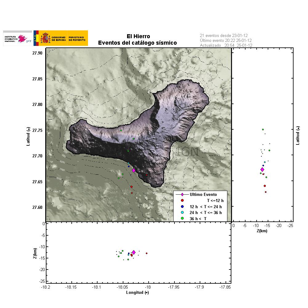
The earthquake activity for the past 48 hours in El Hierro volcano (picture from 22 November, 2011). Copyright of this picture belongs to IGN (Instituto Geográfico Nacional).


Earthquake activity in El Hierro volcano for the past 4 days. Copyright of this picture belongs to IGN (Instituto Geográfico Nacional).


The earthquake activity from July 2011. This earthquake activity maps out well where the magma lies in the El Hierro volcano. But as the magma expands in the crust, it creates earthquake activity. Copyright of this picture belongs to IGN (Instituto Geográfico Nacional).

The harmonic tremor tells me what is going on in the eruption, when I lack all other visual data on what exactly is going on. But the harmonic tremor increases or drops depending on the strength of the eruption. But that aspect of the eruption is based on how many and how large fissures are open at the time.


The harmonic tremor as it is today (22 November, 2011) at 21:11 UTC. The eruption as can be seen is around the same level as before. But this is not the strongest the harmonic tremor has been. Copyright of this picture belongs to IGN (Instituto Geográfico Nacional).


The harmonic tremor when the eruption was more active then today. This can clearly be seen by how the harmonic tremor is stronger then the scale of the harmonic tremor plot. This happens when a new fissure opens up and its eruption is at the strongest. Copyright of this picture belongs to IGN (Instituto Geográfico Nacional).

The IGN web site on El Hierro volcano eruption can be found here. But it is in Spanish.

I am continuing to monitor this eruption. Even if it is a long term eruption, but that are eruptions that are longer then 1 month. As the for the eruption as a whole, little change has taken place in terms of strenght and location of the eruption. But that might change without warning as before.

The weekend earthquake swarm deep out on the Reykjanes Ridge

During the weekend there was as earthquake swarm deep outside on the Reykjanes Ridge. It was about 700 km south of Reykjavík city. It was not felt on land and was only noticed on instruments. The last earthquake to be recorded was at 22:04 UTC, on 20 November 2011. It’s size was Mb4.4 according to EMSC. The largest earthquakes in this earthquake swarm had the size of Mb4.8, but there where several earthquakes recorded with this size.

Due to the location it is impossible to know if there was a eruption in this area or not. The ocean depth there is greater then 1 km (if my memory is correct). This means that if a eruption is taking place in this location. Nothing is going to appear on the surface of the ocean. So why this earthquakes are taking place are only speculation everything besides normal tectonic activity in this area. But the Reykjanes Ridge is a rift zone that often has earthquakes without any eruption taking place. There have however been several earthquake swarm during the year in this location. But what the actual reason remains a mystery due the location.

Other then this it is now quiet time in Iceland. This is the type of quiet time that I always worry about. But lets wait and see what is up with this lack of activity in Iceland.

Note: Update on the eruption in El Hierro volcano eruption is due tomorrow. This is now a long term eruption as explained few blog posts ago. So there are only updates on what is going on once in a while.

Possibility of a new fissure has opened up in El Hierro volcano eruption

It seems by the harmonic tremor data that a new erupting fissure has opened up somewhere in El Hierro volcano. But given lack of visual observation I do believe that this fissure is at really great depth, and is not leaving any signs on the surface that a new eruption is taking place. Where this new fissure might be is unknown to me at present time. But based on the harmonic tremor data this new eruption seems to be powerful one. It should be expected that new fissures opens up a random while El Hierro volcano is erupting. So far the fissures that have been opening up have been short and out in the ocean. It should also be expect that erupting fissures stop erupting for no reason and with no warning at all. This seems to have happened as I am writing down this blog post.


The harmonic tremor from the eruption in El Hierro volcano yesterday. It can be seen on this harmonic tremor chart that the eruption was powerful all yesterday. Copyright of this picture belongs to IGN (Instituto Geográfico Nacional).


The harmonic tremor around 22:07 UTC. At that time the eruption was in full power as can be seen. Copyright of this picture belongs to IGN (Instituto Geográfico Nacional).


The harmonic tremor at 22:46 UTC. Notice how the drop is sudden when the new eruption fissure stops erupting. What happens is that the magma source that fed the erupting fissure did dry up. Why and how that happens in unknown to me. Copyright of this picture belongs to IGN (Instituto Geográfico Nacional).

This might mean that a new fissure might open up in the next few hours to days. Where that might happen is impossible to know. But as the fissures have been open up so far, it is going to be in a North – south line (about) in El Hierro volcano. What has however become a problem in my opinion is that the magma might have “boiled” the rock and made it soft. So it might not make a earthquakes before a eruption starts in it. This might be the case if the magma has been in the crust for the past 5 weeks. But the only example of that type of event that I know of was in Eyjafjallajökull volcano last year (2010), when a new fissure did open up suddenly and without any earthquakes or warning after 4 weeks of eruption. The reason for that was the same one on what I think might be happening in El Hierro volcano.

From what I can tell, based on data and earthquakes it does not seems that the eruptions in El Hierro volcano are over. As new magma continues to flow in from depth (the mantle). Until that flow stops, El Hierro volcano is going to continue to erupt. However there might be breaks from few hours and up to several weeks between eruptions, in that case no eruption would be taking place. This has its origin in the fact that this is a fissure rift events of shorts, a similar eruption took place in Krafla volcano in Iceland for over a 10 year period. Movement and flash inflation and deflation are also to be expected during this period in El Hierro volcano eruption. As it has many similarities of the eruption in Krafla volcano in Iceland. But it is not exactly the same, just similar. As Krafla volcano is on the inter-plate rift zone. While El Hierro volcano is on a hot spot rift zone, far inside the Africa Plate.

Update on the forum: There have been some technical difficulties with the whois registration. How that works out is not yet clear. I am going to short that issue out before I set-up the forum on the domain. In the case I have to register a new domain name. What happens in this case should be come clear next week I hope.

Katla volcano newest earthquake swarm

During the night of the 16th of November, 2011 there was a new earthquake swarm in Katla volcano. This earthquake swarm is a part of ongoing pattern in Katla volcano. This pattern started after the small eruption that took place in Katla in July 2011. It was observed yesterday that there was a deep earthquake in Katla volcano, with the depth of 28 km. This earthquake did most likely did happen due to a dike intrusion deep inside Katla volcano, but it might well be that this was just a normal earthquake. It is hard to know that for sure. But deep dike intrusions are well known in Katla volcano. Sometimes they are followed by a harmonic tremor for few moments or minutes.


The earthquakes from Katla volcano can clearly be seen on this tremor plot from Iceland Met Office. But they make the spikes that are on it. Copyright of this picture belongs to Iceland Met Office.


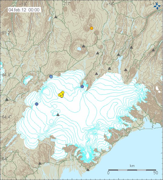
The location of last earthquake swarm in Katla volcano. Most of the earthquakes are inside the caldera of Katla volcano. Copyright of this picture belongs to Iceland Met Office.


The largest earthquake in this earthquake swarm. Its size was ML2.35 and it had the depth of 4 km. This picture is released under Creative Commons Licence. Please see the top bar (there is a link there) for more information on this.

This was a long period earthquake. But this is the only clue at the moment that Katla volcano is going to erupt soon. But when is still a unknown question at present time.


The frequency analysis of the ML2.35 earthquake. As can be seen here this earthquake has really low frequency component. But most of the energy goes into about 2Hz frequency. This picture is released under Creative Commons Licence. Please see the top bar (there is a link there) for more information on this.

It is impossible to know how many earthquake swarm Katla volcano is going to have before it erupts. But this is a one way street that Katla volcano is now on. For us humans, we just have to wait and see what happens next. Nothing else can be done when it comes to forces of nature. When the time comes, get out of the way of Katla volcano.

Analysis of the earthquake pattern in El Hierro volcan

Please note that this is not a professional analysis of the recent earthquakes in El Hierro volcano. So it might be wrong. It also might not hold any science value at all.

During the eruption of El Hierro volcano a earthquakes activity has been in the north part of El Hierro volcano. This earthquake activity is most likely created by dike intrusions into the bed rock. At this moment it is unclear if any of them are going to reach the surface. There also seems to be some minor connection between the earthquake swarms and how active the eruption is in the south part of El Hierro volcano is. But what and how that connection is and works is unknown to me at present time. The strongest earthquakes that have happened so far are up to Mb4.6 in size (I do not think that this earthquake size has been downgraded. But I might be wrong).

The current location of the earthquake swarm has not changed a lot during the past few weeks. So it is more or less in the same place. There are however reports that the earthquakes are getting shallower. But it is currently unknown if that is because of magma movements or because the crust is releasing stress because of the dike intrusions in El Hierro volcano. A full list of earthquakes larger then ML2.5 can be found here (EMSC).

The results of this dike intrusions are going to that in some areas of El Hierro Island a hot springs and other types of hydrothermal activity might show it self. Without warning. But that can result in this type of hot springs.


Picture is from Hveragerði, Iceland. Picture taken by me (Jón Frímann Jónsson). This picture is released under Creative Commons Licence. See Creative Commons Licence web page for more details (link in top bar).

This is also going to be the result for El Hierro volcano after the eruption end, if any magma remains shallow in the crust to cool down.


A 48 hour map of the earthquake activity in El Hierro volcano. Copyright of this picture belongs to IGN (Instituto Geográfico Nacional).

The earthquake are in almost N-S line, that is most likely the fault line that might erupt if it opens up. But as it stands now. Most of it would be out to the sea. But the exact length of a fissure is impossible to predict. What happens is only clear when it starts erupting.


The 4 day amount of earthquakes in El Hierro volcano. There are some earthquakes in south El Hierro volcano. But those earthquakes are fewer and smaller in size. Copyright of this picture belongs to IGN (Instituto Geográfico Nacional).


The total number of earthquakes in El Hierro volcano since the magma intrusion started in July 2011. As clearly can be seen on this picture, the new area with earthquakes makes a clear signal that it a magma injection into the rock. Rather then result of tectonic movements in the area due to the eruptions. Copyright of this picture belongs to IGN (Instituto Geográfico Nacional).

Update on the eruption it self: Explosions appears to be taking place in El Hierro volcano again. That suggests that the eruption is once again more powerful, after a few hours of lowered activity. It is not yet confirmed if any new vents have opened up closer to the shoreline. There are pictures that suggest it. But nothing is confirmed at this moment. But it cannot be ruled out that new fissure is going to open up closer to the coast. If that happens, it is going to be noticed if the depth is shallow enough.

As for the eruption in El Hierro volcano. I now classify it as long term eruption, as it has lasted for longer then 1 month. So rather then sharp blog posts about what is going on. I am going to post regular updates on what is happening in El Hierro volcano eruption. If there are any major changes. I am also going to cover that soon as possible. But I am not always in front of the computer, and El Hierro volcano is far away. But I am doing my best regarding this eruption.

Blog post updated at 12:25 UTC on 16 November, 2011

Quiet time in Iceland in earthquake and volcano activity

Currently there is a quiet time taking place in Iceland. This does happen often in Iceland. Sometimes the quiet days are due to bad weather. But now the quiet seems to be a ongoing and has been for past few weeks. The exeption from that is the earthquake activity in Katla volcano and the man made earthquake activity in Hengill volcano. But that activity has dropped down for some reason the past few weeks. I am not sure why that is.

I also want to point people to a new feature on Iceland Metrological Office web site, that seems to have gone up only few days ago. But this web site shows the drumplot (webicorders) from the SIL network. This is not far from what my geophone network shows. That web site can be viwed here.

Blog post updated at 16:43 UTC.

Sharp increase in eruption activity from El Hierro volcano

This is a short update on El Hierro volcano.

There has been a increase in harmonic tremor activity from El Hierro volcano. This suggest that new vent or vents might be opening up in El Hierro volcano. But this type of eruption pattern is to be expected from a fissure eruption. Like the one that is currently taking place in El Hierro volcano.


The harmonic tremor jump in El Hierro volcano at 16:06 UTC. Copyright of this picture belongs to IGN (Instituto Geográfico Nacional).

There are also some explosions that can be seen on this tremor chart. But they form spikes that can be spotted if looked closely. Is is now also possible to monitor the eruption via web cam located on El Hierro Island. That web cam can be found here.