This is a short update. Information here might go outdated quickly and without warning. This update is written on 11. November at 22:42 UTC.
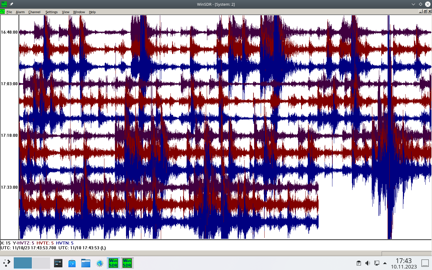
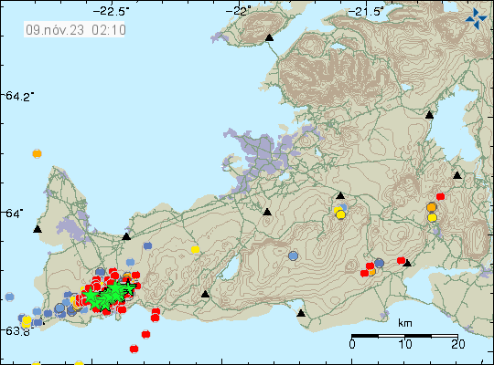
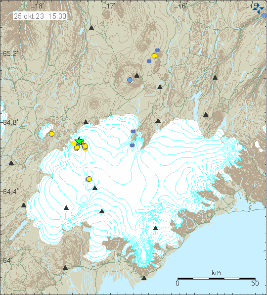
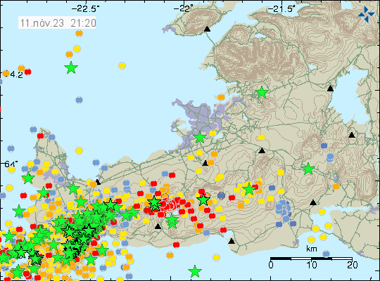
- The dyke is 15 km long at the writing of this article. It might be extending both north-east and south-west. Earthquake activity remains heavy but the magnitudes have dropped for now.
- The inflation in the area is around 120 cm or more since start of this yesterday (10. November 2023).
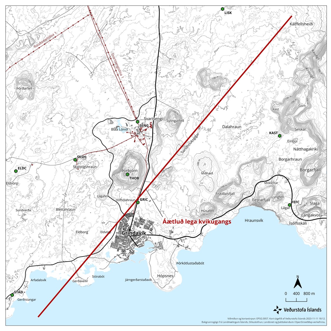
- The dyke now extends into the ocean and the part in the ocean is around 3 to 5 km. At shallow depth, this is going to result in explosive eruption for the first few hours to days.
- The magma is now at depth of 800 meters, where it is the most shallow. That might not result in a eruption at that location.
- Eruption is going to start without warning. Since Icelandic Met Office has issued that they can’t see the harmonic tremor start because of heavy earthquake activity in the dyke.
- There is now a major risk of large earthquakes both east and west of the dyke because of all the displacement resulting from him. Those might happen days or even weeks in the future.
- Icelandic Road Administration published pictures on Facebook here, showing the damage from the displacement and from the earthquakes. The ground is falling apart and opening up.
It is difficult to know what happens next and this eruption is not going to be small or tourist friendly.
I’ll post updates once I know more.