Increased conductivity in Múlakvísl glacier river

Donation notice: If you like my work. Please consider donating to help me continue my work. This site is now advertisement free as explained here. Donation button is going to be added soon. If you want to donate regularly, please use the Paypal button on the sidebar to do so. Information on how to donate to me with other ways can be found here. Thanks!

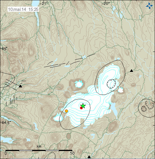
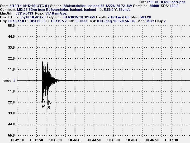
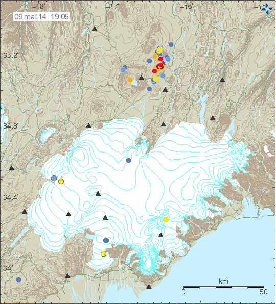
It has been reported in Icelandic media today that there is an increased conductivity in Múlakvísl glacier river that comes from Mýdalsjökull glacier. This increased conductivity started in Múlakvísl on 31-December-2013 and has lasted until today (it might last for few days longer).

Mýrdalsjökull glacier is on top of Katla volcano. There are no signs of increased activity following this and according to the news this is most likely a cauldron under the glacier empting it self of water melted by hydrothermal area under the glacier. So far there is no risk to this increased conductivity in Múlakvísl glacier river.

There are no signs of glacier flood is about to take place, at least it is not going to a large one if it happens. That is the current idea at the moment anyway. No earthquake activity or tremor activity has taken place following this changes in Múlakvísl glacier river.

Icelandic News about this

Aukin rafleiðni en ekki útlit fyrir hlaup (Rúv.is)
Fylgjast vel með Múlakvísl (mbl.is)
Vaxandi rafleiðni í Múlakvísl (Vísir.is)

Magnitude 3,5 earthquake on the Reykjanes peninsula

Donation notice: This site is now advertisement free as explained here. So that now I ask instead for donations to keep this site up and running. See here for details how to support my work. Thanks for the support.
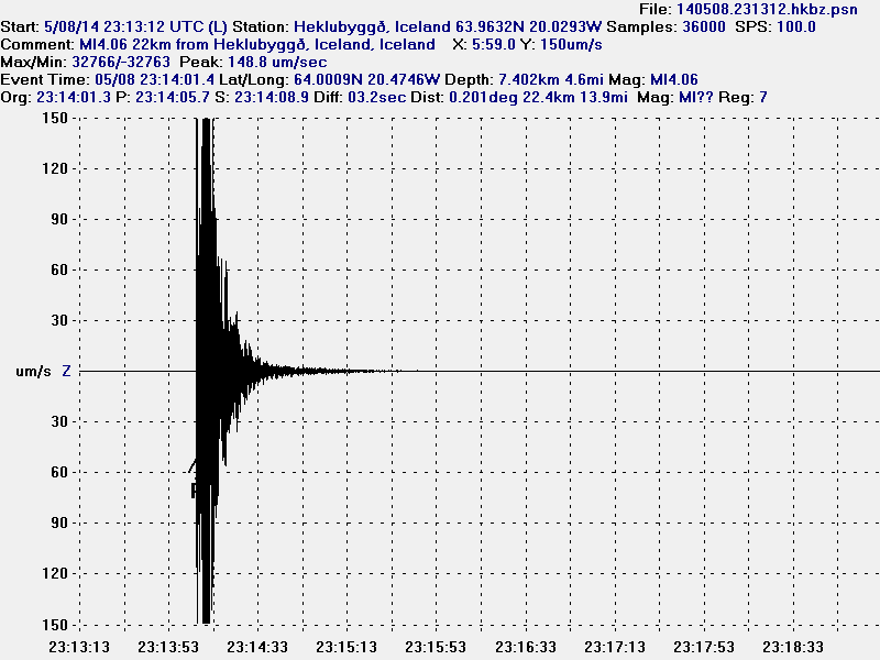
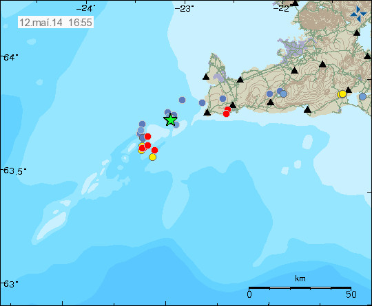
Today (7-January-2014) at 12:11 UTC an magnitude 3,5 earthquake took place on the Reykjanes Peninsula. This earthquake was part of an swarm that has been taking place in this area of Reykjanes peninsula for past two weeks.

140107_1335
The earthquake swarm on the Reykjanes peninsula. Copyright of this image belongs to Icelandic Meteorological Office.

I am not sure how this earthquake swarm is going to evolve, but there is a risk of more earthquakes in this area. But most of them are going to be minor, or less then 3,0 in magnitude.

Earthquake swarm in Hveravellir

During the night of 6-January-2014 an earthquake swarm started in Langjökull volcano, the northern one. The nearby area is known as Hveravellir geothermal area. So far this has just been a minor earthquake swarm. With largest earthquakes not exceeding magnitude 2,0 at the moment.

140106_2150
The earthquake swarm in Hveravellir geothermal area. Copyright of this image belongs to Icelandic Meteorological Office.

The tremor plot of nearby SIL station shows that more earthquake activity is taking place then appears on Icelandic Meteorological Office website. This are then earthquake that are too small to be detected by other nearby SIL stations.

hve.svd.06-Januar-2014.22.01.utc
The earthquake activity at Hveravellir SIL station. Copyright of this image belongs to Icelandic Meteorological Office.

I do expect this earthquake activity to continue for some time now. It is impossible to know for sure if this activity is going to increase or not.

Minor earthquake swarm on Reykjanes peninsula

Donations: This year (2014) is going to start in the same way as last year (2013) did end. I am broke this month. I am working on fixing this, but it takes time until it does. My social welfare income remains low, but the exchange rate of ISK to DKK have been improving for the past few days. I hope that they continue to do so. Information on how to support me with donations can be found here. Information on why I am always broke can be found here in past post on this subject.

Yesterday (31-December-2013) an earthquake swarm took place on Reykjanes peninsula. This was an minor earthquake swarm with largest earthquakes having the magnitude of 2,5. The depth of this earthquake swarm was around 5 km.

140101_1500
The earthquake swarm on the Reykjanes peninsula. Copyright of this image belongs to Icelandic Meteorological Office.

This earthquake swarm took place close to a mountain named Fagradalsfjall. I do not know (or remember) if this a cinder cone or some other type of volcano in this area. More details of this earthquake can be found here on Icelandic Meteorological Office website.

Earthquake activity in Esjufjöll and Kverkfjöll volcanoes

Earthquake activity started again in Esjufjöll volcano today (20-Desember-2013). The largest earthquake had the magnitude of 2,9 and had the depth of 5,0 km. So far only two earthquakes have been recorded, but it is not uncommon that earthquake activity in Esjufjöll volcano starts slow before it picks up. Earthquake activity remains low in Esjufjöll volcano, but there is now more earthquake activity in Esjufjöll volcano for the past few years then in past several decades (perhaps, recording is missing in the past)

Kverkfjöll volcano

Earthquake activity continued in Kverkfjöll volcano today. None of the earthquake did reach the magnitude of 3,0. The largest earthquake had the magnitude of 2,0 and the depth of 5,3 km.

131220_1910
Earthquake activity in Esjufjöll volcano and Kverkfjöll volcano. Copyright of this image belongs to Icelandic Meteorological Office.

I am expecting more earthquake activity in Kverkfjöll volcano. But I expect it to remain small as it currently is at least I do not expect any earthquake above the magnitude of 3,0 to take place as is.

Magnitude 3,1 earthquake in Kverkfjöll volcano

Today (19-Desember-2013) at 09:30 UTC a magnitude 3,1 earthquake took place in Kverkfjöll volcano. The depth of this earthquake was 5,0 km. No aftershocks have been recorded following this earthquake.

131219_1415
The magnitude 3,1 earthquake in Kverkfjöll volcano. Copyright of this image belongs to Icelandic Meteorological Office.

This is the first activity in Kverkfjöll volcano for some time now. But overall activity has been slowly increasing in Kverkfjöll volcano for the past few years. So far however there is nothing to suggest that volcano eruption is going to take place in near future.

Update 1: Three aftershocks took place in Kverkfjöllum volcano. The largest one had the magnitude of 1,7. The other two earthquakes had the magnitude of 1,3 and 1,5. With the depth of 6,5 km to 3,4 km.

131219_1615
The aftershocks in Kverkfjöll volcano. Copyright of this image belongs to Icelandic Meteorological Office.

It is possible that more aftershocks are going to take place in Kverkfjöll volcano in next few hours to days.

Blog post updated at 16:37 UTC.

Quiet period continues in Iceland

Donation note: Please donate to help me continue this website. Please check this site for details on how to donate. Thanks for the support. 🙂
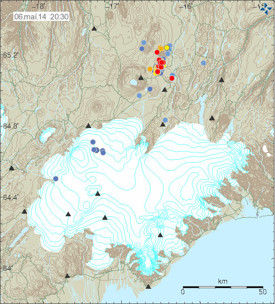
A new quiet period has started in Iceland, it is an extension of an quiet period that has been ongoing in Iceland for the past few months and is currently with no end in sight. I don’t know what is driving this quiet period at the moment, since quiet period are a bit of mystery and might always be that.

131218_1630
Quiet in Iceland. Copyright of this image belongs to Icelandic Meteorological Office.

For the past two weeks just around 120 earthquakes have been recording during each week (7 days) and for Iceland that is really low amount of earthquakes. This type of quiet period has been ongoing for most of the year 2013. I just hope that new year 2014 is not going to be quite so quiet as 2013 was.

Earthquake swarm in Hengill volcano

A earthquake swarm of minor earthquakes took place in Hengill volcano today. This earthquake swarm was due to Orkuveita Reykjavíkur was pumping down water in the area.

131214_1815
The earthquake swarm in Hengill volcano this evening. Copyright of this image belongs to Icelandic Meteorological Office.

The largest earthquake had the magnitude of 1,4. Other earthquakes were smaller.

Continued earthquake activity north of Kolbeinsey Island

During the week the earthquake activity continued north of Kolbeinsey Island. Two more earthquakes appeared, they had the magnitude of 3,0 and 3,1 according to EMSC. I do not have any image of that activity since I was travelling the days it was on Icelandic Meteorological Office website.

Webicorder images still do not update

Something failed in my hardware few days ago so no webicorder images are updating at the moment. I do not know what did go wrong or what did fail and it is going to be few weeks until I know why. According to electronic usage readings from my home something powered down or was powered down (I know what normal usage should be based on what electronics where turned on when I left). I am not sure what was turned off or did go offline and I won’t find out until I get back home. Until then my webicorder images are not going to be updated. International webicorders are updating (mostly) normal now and all large earthquake activity in the world is going to appear on that website. I do not run any of the images shown there so they are unaffected by this failure.

Donations

Like so many projects on the internet. I depend on donations to keep my working ongoing here. They allow me to work on this full time. Since I am not allowed to use the “Donate” button from Paypal. People have send me the donation directly via “Send Money” option on Paypal website. Thanks for the support.

Earthquake swarm activity north of Kolbeinsey island

Donation note: I want to thank people for the donations I have received over the year. But donations allow me to continue my work here and keep writing about volcano and earthquake activity in Iceland. If not for donations I would not be able to do anything. That includes writing on this website. So I am always thankful for donations. Since they allow me to continue my work here. Donations also allow me to maintain my geophone network in Iceland is expensive and last hardware updates was exactly that. So if you can donate, it is most welcomed. Information on how to donate can be found here. Thanks for the support.
During the night a magnitude 4,1 earthquake was recorded around 240 km north of Kolbeinsey island. This is automatic location and magnitude. So it is subject to change.

131210_0940
Earthquake activity north of Kolbeinsey island (green star). Copyright of this image belongs to Icelandic Meteorological Office.

I don’t know yet if I detected it on my Böðvarshólars geophone (website here). Since I have not had the change to review the data from that geophone yet. I am not sure what is taking place at that location. This might be earthquake swarm activity before and eruption starts there, but due to remote location and ocean depth it is currently impossible to know for sure at this point.

Minor earthquake swarm in Esjufjöll volcano

Today (27-November-2013) an minor earthquake swarm took place in Esjufjöll volcano. This earthquake swarm was just three earthquakes according to Icelandic Meteorological Office website. There is a chance of more earthquakes not being detected due to bad weather in this area at the moment.

131127_2225
The three earthquakes in Esjufjöll volcano. Copyright of this image belongs to Icelandic Meteorological Office.

The largest earthquake in this minor earthquake swarm had the magnitude of 1,8 and had the depth of 4,5 km. Last eruption in Esjufjöll volcano was possibly in the year 1927, but it is not confirmed according to Global Volcanism Program.